
Location: Map
Height: 45 meters
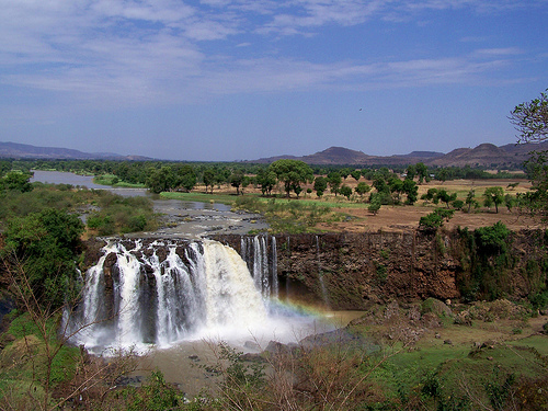
Blue Nile Falls is a natural formation situated on the Blue Nile
River in Northern Ethiopia. It flows 19 miles (30 km) down the
stream of Bahir Dar and lake Tana. Blue Nile Falls reach a height of
150 feet (45 meters). During the dry season it is barely trickling
while at the height of rainy season it swells to a width of 400
meters. About this time it also takes reddish color from the soil
that the water erode from the basin of the Nile River. It is locally
known as Tis Abay (in Amharic language) or "smoking water". You can
rent a boat to visit Blue Nile Falls from the river. Try to get here
around Sunday or local holiday.
Hydroelectric station was
constructed on the shores of the river and most of the water gets
diverted for its purposes (80% of total load). However during
weekends and holidays the plants shuts down and Blue Nile Falls get
all the water it naturally gets. If you do it you will pass first
stone bridge that was ever constructed in Ethiopia. It was built in
1626 on the orders of Emperor Susenyos and under supervision of
Afonso Mendes, the Catholic Patriarch of Ethiopia. Since he was from
Portugal the bridge is locally known as the Portuguese Bridge.<