Location: Map
Area: 50 mi² (130 km²)
Lake Baringo is a freshwater lake situated in a Rift Valley in Kenya. Lake Baringo covers an area of 50 mi² (130 km²).
The lake is located entirely in Baringo County in
the former province of the Rift Valley, about 285 km north-northwest
of the national capital Nairobi. The lake is part of the East
African Rift system. The Tugen Heights, a high fault block of
volcanic and metamorphic rocks, is located west of the lake and the
Laikipia escarpment is east. Water flows to the lake from the Mau
hills and the Tugen hills.
The lake has several small
islands, the largest being the island Kokwe Ol. Kokwe Ol, an extinct
volcanic center related to the Korosi volcano, located north of the
lake, has several hot springs and fumaroles, some with precipitated
sulfur deposits. There is a group of hot springs along the coast in
Soro, near the northeast corner of the island.
The main city
near the lake is Marigat, in addition to some smaller settlements
such as Kampi and Samaki and Loruk. The area is increasingly visited
by tourists and is located at the southern end of a Kenyan region
inhabited mainly by shepherds of ethnic groups such as il chamus,
rendille, turkana and kalenjin. Accommodation (hotels, cottages with
kitchen and camping), as well as boating services are available in,
and near, Kampi-Ya-Samaki, on the western shore, as well as on
several of the islands on the lake.
The evaporation rates of
the lake are 1,650 to 2,300 mm / year and the precipitation rates
are 450 to 900 mm / year, so, like all lakes in the East African
Rift, the hydrological balance is extremely negative. The
precipitation deficit, however, is similar to that of the Naivasha
basin, and is offset by the influx of water from the precipitation
of a large area of influence (6820 km²), with areas of rainfall
ranging from 1,100 to 2,700 mm / year. Thus, Lake Baringo, like Lake
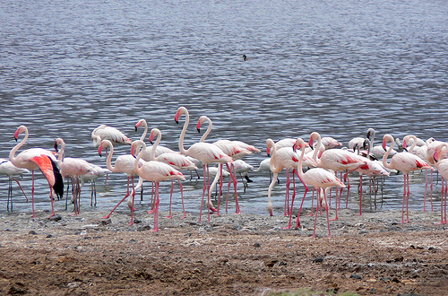
Naivasha, is a freshwater lake where many fish are produced that
serve as food for many birds.