Location: Arusha Region Map
Area: 137 km²
Arusha National Park is situated near Arusha region in North
eastern Tanzania. Arusha National Park covers an area of 137 km².
Arusha National Park is a protected biosphere reserve situated
between mountains of Kilimanjaro and Meru, just 25 kilometers East
of the regional center of Arusha. City of Moshi is the largest
settlement close to the Arusha National Park, while Kilimanjaro
International Airport is a popular hub for international visitors.
Arusha National Park was founded in 1960 and included Ngurdoto
Crater and lake Momella and originally it was called Ngurdoto Crater
National Park. In 1967 after it was increased in size and added area
around volcano Meru, it was renamed to Arusha National Park. This
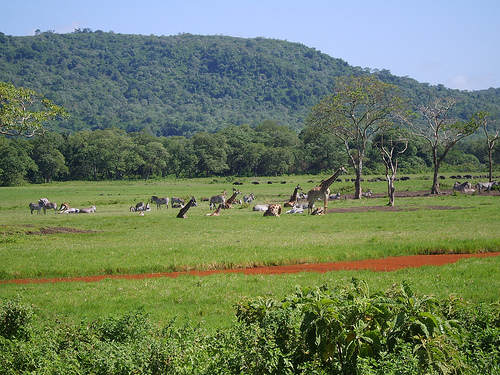
nature reserve can roughly be divided into three main zones: Mount
Meru, Momella lakes and Ngurdoto Crater. Mount Meru reaches an
elevation of 4565 meters. It is the fifth highest peak in Africa and
second in Tanzania. Momella Lakes are a group of shallow alkaline
lakes fed by underground springs. Ngurdoto Crater is strictly
protected by the authorities and no visitors are allowed within its
boundaries. You can observe animals in the crater from several
viewing platforms at the crater's edge, but no humans are allowed
inside.
History
The park was established as Ngurdoto Crater National Park
in 1960; Mount Meru became part of the park in 1967. The Hungarian Count
Teleki was the first European to visit the area of today's park in
1876. He also described a large number of hippos and rhinos.
Landscape
The Arusha National Park mainly includes the 4562 m high
Mount Meru, an extinct volcano, with the Small Mount Meru (3801 m) and
the Ash cone (cinder cone) as well as the Ngurdoto Crater with its wet,
partly swampy bottom and the small Serengeti . Between Mount Meru and
Ngurdoto Crater is the Momella Lakes area, which is characterized by
swamps, grasslands and montane forest. The mountain slopes are covered
with tropical (mountain) rain forest, cloud forest and cloud forest. The
park is 137 km² and is located at 36° 50' E and 03° 15' S. The altitude
varies from 1500 m at the entrance to 4562 m at the summit of Mount
Meru. The annual precipitation is 600 to 1300 mm in the lower regions
and up to 2400 mm in the higher regions.
Tourism
Arusha
National Park is subject to a fee and requires a permit, which can be
obtained at the entrances. The roads in the park are unpaved and only
accessible by off-road vehicles. There is a small museum near the
Ngurdoto Crater, which has stuffed birds on display, among other things.