Location: West Java Map
Area: 155 km2
Gunung Ciremai National Park, located in West Java, Indonesia, is a stunning conservation area centered around Mount Ciremai (also spelled Cereme or Ceremai), the highest volcano in West Java at 3,078 meters above sea level. Spanning approximately 15,859 hectares across the Kuningan and Majalengka regencies, the park is a biodiversity hotspot, a geological marvel, and a cultural treasure. Established as a national park in 2004, it protects the region’s unique ecosystems, serves as a critical watershed, and offers a range of recreational and adventure opportunities.
Gunung Ciremai National Park is situated about 50 km south of
Cirebon, in the East Parahyangan region of West Java, with Mount Ciremai
as its centerpiece. The park’s terrain is dominated by volcanic
landscapes, shaped by Ciremai’s status as an active stratovolcano, part
of the Pacific Ring of Fire.
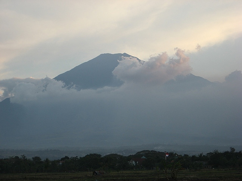
Mount Ciremai:
At 3,078 meters,
Ciremai is West Java’s highest peak, with a prominence of 2,792 meters,
making it a dominant feature visible from the Jakarta–Surabaya rail
corridor along Java’s north coast. Its name derives from the Sundanese
word for Otaheite gooseberry (Phyllanthus acidus), though it’s often
called Ciremai due to local linguistic conventions.
The volcano has a
double crater: a western crater (400-meter radius) intersected by a
larger eastern crater (600-meter radius). At around 2,900 meters on the
southern slope, Gowa Walet marks a former eruption point.
Ciremai’s
last recorded eruption was in 1937, with historical explosive activity
and lahars (mudflows). While eruptions are infrequent, the volcano is
monitored for activity, with recent reports (May 2025) indicating no
significant changes.
The park serves as the headwaters for major
river basins, including the Cimanuk and Cisanggarung, which flow into
the Java Sea, supporting regional agriculture and water supply.
Landscape:
The park encompasses diverse altitudes (737–3,078 meters),
creating varied ecosystems from lowland forests to subalpine zones. Its
slopes feature steep terrain, volcanic ridges, and fertile valleys used
for agriculture at lower elevations.
Notable features include
waterfalls (Curug Putri), hot springs (Sangkanhurip), and clear lakes
(Situ Cicerem and Situ Sangiang). The park’s isolation from other high
peaks enhances its scenic prominence.
The park’s varied elevations and climates foster a rich array of
flora and fauna, including endemic and endangered species. Its forests,
ranging from dense lowland to sparse subalpine vegetation, are critical
for conservation.
Flora:
Lowland and Montane Forests: Dominant
species include Sumatran pine (Pinus merkusii), Javan chestnut-oak
(Castanopsis javanica, locally Saninten), Lithocarpus sundaicus
(pasang), and Elaeocarpus stipularis. Fig trees (Ficus spp.), Macaranga
denticulata, and Fragraera blumii (randu tiang) are also common.
Higher Elevations: Subalpine zones feature smaller trees like Ardisia
cymosa and Platea latifolia, with grasses and shrubs dominating near the
summit, where forests thin out.
The park’s natural forests remain
dense at lower altitudes but sparse higher up, with pines and native
West Java trees prevalent past certain trail points (e.g., Post 3 on the
Apuy route).
Fauna:
Mammals: The park is home to the
critically endangered Javan leopard (Panthera pardus melas), Javan
muntjac deer (Muntiacus muntjak), Javan surili monkey (Presbytis comata,
endangered), and Javan gibbons. Sightings are rare due to habitat
density and human activity.
Birds: The endangered Javan hawk-eagle
(Nisaetus bartelsi) and other species thrive in the park’s forests.
Birdwatching is popular, especially in lower zones.
Reptiles and
Amphibians: Studies from 2008 identified diverse herpetofauna across six
habitat types, including pythons and various frogs, with community
structures varying by season (rainy vs. dry). The park’s streams and
forests support unique amphibians.
Aquatic Life: Ponds like Cigugur
and Cibulan host the sacred Kancra bodas fish, revered by locals.
Conservation Significance:
The park protects endangered species
and serves as a habitat for rare flora and fauna. Its biodiversity is
studied for ecological balance, with indices like Shannon Wiener used to
assess species diversity.
Restoration efforts target degraded areas
(e.g., Lambosir Block, affected by forest fires, and Karangsari Block,
cleared for agriculture) through natural regeneration and planting
initiatives.
Gunung Ciremai National Park is steeped in cultural and
historical importance, reflecting West Java’s Sundanese heritage and
Indonesia’s colonial and independence history.
Sundanese
Culture:
The park lies in a region with strong Sundanese
identity, evident in place names and local traditions. The
mountain’s name, linked to the cereme fruit, reflects linguistic
nuances, though “Ciremai” is a common hypercorrection due to the
“ci-” prefix in Sundanese toponyms.
Sacred sites, like Sumur
Tujuh Cikajayaan, a centuries-old well tied to Cirebon’s spiritual
history, attract pilgrims. The Kancra bodas fish in Cibulan ponds
are considered sacred, symbolizing local reverence for nature.
Historical Sites:
Linggajati Agreement Museum: Located on
Ciremai’s slopes, this museum commemorates the 1946 Linggajati
Agreement, a pivotal moment in Indonesia’s independence struggle
between Dutch and Indonesian negotiators. It draws weekend visitors
and history enthusiasts.
Gua Maria (Mary’s Cave): Near Cisantana
at the mountain’s base, this Christian pilgrimage site features a
statue of the Virgin Mary and a Stations of the Cross path. It hosts
liturgies in May and October, blending faith with the park’s natural
setting.
Local Communities:
Villages like Apuy,
Palutungan, and Linggarjati surround the park, with residents
engaged in agriculture (onions, potatoes) and tourism. Their
hospitality enhances the visitor experience, though economic
pressures contribute to deforestation.
The park offers diverse activities, from challenging hikes to serene
nature experiences, catering to adventurers, families, and cultural
explorers.
Hiking Mount Ciremai:
Routes: The park has four
main trails—Apuy (recommended for beginners, gentler slopes), Palutungan
(moderate, popular with novices), Linggarjati/Linggasana (steepest, most
challenging), and Padabeunghar. Apuy starts at 1,165 meters, Palutungan
at 1,100 meters, and Linggarjati at 650 meters, with ascents taking 5–7
hours.
Trail Details: The Apuy route begins with a cement track
through fields, transitions to pine forests, and becomes steeper past
Post 1. Water is available at Post 3, and Cigowong (Post 2) is a favored
camping spot with clear streams. The summit offers a 5 km-wide caldera
view, though clouds often obscure the Java Sea.
Challenges: Unstable
weather, steep inclines, and limited water sources (bring ample water)
make preparation crucial. The summit can be cold and windy, requiring
warm clothing. Total vertical gain from base to summit is ~1,600 meters.
Waterfalls and Hot Springs:
Curug Putri: A 20-meter waterfall,
ideal for nature lovers, with scenic trails.
Sangkanhurip Hot
Springs: Near Cilimus, these volcanic springs are popular for relaxation
and spas.
Cigugur and Cibulan Ponds: These clear pools, home to
sacred fish, offer swimming and cultural insights.
Lakes and
Scenic Spots:
Situ Cicerem (Lake Cermin): Known for its crystal-clear
water, this lake is easily accessible by vehicle and perfect for
picnics.
Situ Sangiang: Located near Talaga, this lake offers
beautiful scenery and tranquility.
Darma Reservoir: Near Kuningan, it
supports irrigation and adds to the park’s water-based attractions.
Camping and Other Activities:
Camping grounds like Cibunar,
Woodland Hulu Ciawi, Balong Dalem, Patulungan, and Cipanten are
well-maintained, offering starry nights in serene settings.
Birdwatching, fishing, and picnicking are popular in lower zones, with
families enjoying the park’s clean, safe environment.
Cultural
Exploration:
Visit the Linggajati Museum or Gua Maria for historical
and spiritual experiences. Local villages offer homestays and
interactions with Sundanese culture.
Access and Transportation:
From Cirebon: 50 km south, reachable by
car or bus to Majalengka or Kuningan, then motorbike taxis (ojek) to
basecamps like Apuy or Palutungan.
From Jakarta: Take a bus to
Kuningan (Cirendang for Palutungan) or Majalengka (Maja for Apuy).
Kertajati International Airport is the closest, with land transport to
basecamps.
Basecamps: Apuy, Palutungan, and Linggarjati have parking,
food stalls, and equipment rentals (tents, sleeping bags). Guides and
porters are available, especially in Apuy.
Permits and Costs:
Online registration is mandatory via the park’s website
(tngciremai.menlhk.go.id). Groups must have at least four people, and
health checks are required. Foreigners pay ~IDR 270,000 for entry.
Hikers must bring down all waste to receive an e-certificate, enforcing
eco-responsibility.
Best Time to Visit:
The dry season
(April–October) is ideal for hiking, with clearer skies and stable
trails. The rainy season (November–March) makes trails slippery and
risky, with potential for flash floods in gullies.
Avoid peak times
like Indonesian Independence Day (August), when trails are crowded.
Accommodation:
Guesthouses and homestays are available in Apuy,
Linggarjati, and Kuningan (e.g., Puri Elsas Hotel). Camping is popular
on trails, with Cigowong offering facilities like toilets and streams.
Kuningan and Cirebon offer hotels for those preferring urban bases.
Safety and Preparation:
Hiking: Trails are steep, and weather can
change rapidly. Bring warm clothing, ample water (no sources on most
routes), and navigation tools, as cell coverage is spotty. Guides are
recommended for Linggarjati due to its difficulty.
Volcanic Activity:
Check updates from the park’s website or MAGMA-VAR reports. As of May
2025, Ciremai shows low activity, but precautions are advised.
Wildlife: Javan leopards and snakes are present but rarely encountered.
Stay on marked trails to avoid disturbing wildlife.
Conservation
and Etiquette:
Respect sacred sites (e.g., Sumur Tujuh, Cibulan
ponds) and local customs. Dress modestly at cultural spots like Gua
Maria.
Avoid littering and support restoration by using eco-friendly
operators. Illegal logging and fires remain issues, so adhere to park
rules.
The park faces significant environmental pressures, despite its
protected status since 2004:
Deforestation: By 2012, ~4,000 of
15,000 hectares were deforested due to illegal logging, sand quarrying,
and forest fires. This causes siltation in rivers and flooding in
lowland areas.
Land Degradation: Agricultural encroachment and fires
(e.g., Lambosir Block) degrade ecosystems. Restoration trials by JICA
and partners focus on reforestation in areas like Seda (900–987 meters)
and Karangsari (1,100–1,175 meters).
Tourism Impact: Overcrowding
during holidays strains trails and facilities. Strict waste policies and
registration aim to mitigate this.
Conservation Efforts: Initiatives
include community-based restoration, with collaborations like JICA and
Yamaha Musik Indonesia targeting 60 hectares in Lambosir. The park
promotes sustainable tourism to involve locals.