Location: West Kalimantan Map
Area: 900 km² (350 mi²)
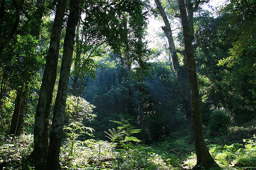
Gunung Palung National Park, located in the Ketapang and Kayong Utara regencies of West Kalimantan, Indonesia, is a biodiverse and ecologically significant protected area covering approximately 108,000 hectares. Established in 1990, the park is renowned for its pristine lowland and montane rainforests, which span a dramatic elevational gradient from sea level to the peaks of Mount Palung (1,116 meters) and Mount Panti (1,050 meters). It is one of Borneo’s most important conservation areas, serving as a critical habitat for the endangered Bornean orangutan and a hotspot for tropical biodiversity.
Gunung Palung National Park is situated along the
western coast of Borneo, bordered by the South China Sea to the west and
the Kapuas River basin to the east. Its topography is diverse,
encompassing coastal plains, lowland rainforests, peat swamps, and
rugged montane forests. The park’s climate is tropical, with high
humidity and annual rainfall ranging from 3,000 to 4,500 mm, peaking
during the wet season (October to April). The dry season (May to
September) is less pronounced but influences fruiting cycles critical
for wildlife.
The park hosts a remarkable range of ecosystems,
driven by its elevational and soil diversity:
Lowland Dipterocarp
Forests: Dominating the park’s lower elevations (0–300 meters), these
forests feature towering trees like Dipterocarpus and Shorea species,
forming a dense canopy up to 50 meters high.
Peat Swamp Forests:
Found in waterlogged coastal areas, these forests support species like
Shorea albida and are critical carbon sinks.
Heath Forests
(Kerangas): Occurring on nutrient-poor, sandy soils, these forests have
stunted trees, pitcher plants (Nepenthes spp.), and orchids.
Montane
Forests: At higher elevations (300–1,116 meters), cloud forests with
moss-covered trees and epiphytes thrive in cooler, mist-shrouded
conditions.
Alluvial Forests: Found along rivers, these fertile areas
support diverse understory plants and wildlife.
Coastal and Mangrove
Forests: Small patches along the coast include mangroves (Rhizophora
spp.) and Nypa palms, protecting against erosion.
Gunung Palung is a global biodiversity hotspot, with
its varied habitats supporting an extraordinary array of flora and
fauna. Its forests are among the most intact in Borneo, making it a
critical refuge for endangered and endemic species.
Flora
The
park is estimated to contain over 2,000 plant species, reflecting its
ecological diversity:
Dipterocarps: Dominant canopy trees like
Shorea and Dipterocarpus species, valued for timber and as keystone
species for wildlife.
Fruit Trees: Figs (Ficus spp.) and Durio
(durian) are critical food sources for orangutans and other frugivores.
Orchids and Epiphytes: Hundreds of orchid species, ferns, and pitcher
plants thrive in montane and heath forests.
Medicinal Plants: Local
communities use plants like Eurycoma longifolia (tongkat ali) for
traditional medicine.
Peat Swamp Species: Gonystylus bancanus (ramin)
and other water-tolerant trees are unique to swamp areas.
Fauna
The park’s wildlife is exceptionally diverse, with a focus on primates,
large mammals, and forest-dependent species:
Mammals:
Bornean
Orangutan (Pongo pygmaeus), a flagship species, with an estimated
2,000–2,500 individuals, one of the largest populations in Borneo. The
park’s diverse forests provide year-round food sources.
Gibbons
(Hylobates muelleri), including the Bornean white-bearded gibbon, known
for their distinctive calls.
Clouded Leopard (Neofelis nebulosa), a
rare and elusive predator.
Sun Bear (Helarctos malayanus), the
smallest bear species, foraging in lowland forests.
Other mammals
include Banteng (Bos javanicus), Sambar Deer (Rusa unicolor), Pangolin
(Manis javanica), and numerous bat species.
Birds: Over 350 bird
species, including eight of Borneo’s nine hornbill species, such as the
Rhinoceros Hornbill (Buceros rhinoceros) and Helmeted Hornbill
(Rhinoplax vigil), both critically endangered. Other notables include
the Bornean Peacock-Pheasant (Polyplectron schleiermacheri) and Argus
Pheasant (Argusianus argus).
Reptiles and Amphibians: The Bornean
Keeled Pit Viper (Tropidolaemus subannulatus), monitor lizards, and a
variety of frogs, including the endemic Bornean Horned Frog (Megophrys
nasuta).
Invertebrates: Thousands of insect species, including
endemic butterflies, beetles, and the giant Trilobite Beetle (Duliticola
spp.). The park’s rivers support freshwater crabs and shrimp.
Gunung Palung is surrounded by Dayak, Malay, and Chinese
communities, with approximately 60,000 people living in villages
near the park. These communities rely on the park’s resources and
have deep cultural ties to the land:
Traditional Practices:
The Dayak (e.g., Iban and Kantu subgroups) practice shifting
cultivation, growing rice and fruit crops, and use forest products
like rattan, honey, and medicinal plants.
Fishing and Hunting:
Rivers and forests provide fish, wild boar, and deer, though
overhunting is a concern.
Cultural Beliefs: The forests are
considered sacred by some Dayak groups, with rituals performed to
honor spirits associated with Mount Palung and rivers.
Economic
Activities: Small-scale logging, rubber tapping, and oil palm
plantations occur in buffer zones, often leading to conflicts with
conservation goals.
The park also hosts the Cabang Panti Research
Station, established in 1986, which has been a hub for studying
orangutan behavior, forest ecology, and climate change.
Community-based ecotourism and conservation programs, such as the
Gunung Palung Orangutan Conservation Program (GPOCP), engage locals
in sustainable practices.
Gunung Palung is less accessible than other Indonesian national
parks, making it a destination for intrepid ecotourists and researchers.
Its remote nature preserves its pristine ecosystems but limits mass
tourism. Key activities include:
Orangutan Trekking: Guided treks
to observe wild orangutans in lowland and peat swamp forests, often
starting from Cabang Panti or Matan River.
Jungle Trekking: Trails
through diverse ecosystems, ranging from short hikes to multi-day
expeditions to Mount Palung or Mount Panti, offering views of
waterfalls, rivers, and wildlife.
Birdwatching: The park’s hornbills,
pheasants, and other rare birds attract birders, with guided tours
targeting specific species.
River Exploration: Canoeing or boating
along the Matan and Panti Rivers to explore swamp forests and spot
proboscis monkeys or crocodiles.
Cultural Experiences: Visits to
Dayak villages for cultural performances, handicraft workshops, or
homestays.
Research Tourism: Visitors can engage with scientists at
Cabang Panti, learning about orangutan behavior and forest ecology.
Managed by Indonesia’s Ministry of Environment and Forestry, Gunung
Palung is a priority for conserving Borneo’s lowland rainforests and
orangutan populations. Conservation efforts include:
Orangutan
Protection: Anti-poaching patrols, habitat restoration, and community
education to reduce human-wildlife conflict.
Reforestation:
Replanting degraded areas, particularly in buffer zones affected by
logging.
Sustainable Livelihoods: Programs like GPOCP promote
ecotourism, agroforestry, and alternative incomes to reduce dependence
on forest resources.
Research: Long-term studies at Cabang Panti
inform conservation strategies, focusing on orangutan ecology, forest
dynamics, and carbon sequestration.
Major challenges include:
Illegal Logging: Despite protections, illegal timber extraction
threatens lowland forests, driven by high demand for dipterocarp wood.
Oil Palm Expansion: Encroachment from plantations in buffer zones
fragments habitats and increases human-wildlife conflict.
Poaching
and Hunting: Orangutans, hornbills, and other species are targeted for
the illegal wildlife trade or bushmeat.
Mining: Small-scale gold and
bauxite mining in surrounding areas pollute rivers and degrade
ecosystems.
Climate Change: Altered rainfall patterns and rising
temperatures affect fruit availability, impacting orangutans and other
frugivores.
Gunung Palung is remote, with access primarily through Ketapang, West
Kalimantan’s coastal city (about 100 km away). The journey involves:
A 3–4 hour drive from Ketapang to the park’s edge, followed by boat
or foot travel to interior sites like Cabang Panti.
Flights to
Ketapang’s Rahadi Osman Airport from Pontianak or Jakarta, followed by
ground transport. Roads are often unpaved and impassable during the wet
season, requiring four-wheel-drive vehicles or boats. Infrastructure is
limited:
Basic guesthouses and homestays in villages like Sukadana or
Matan.
The Cabang Panti Research Station, primarily for researchers
but open to guided visitors.
Local guides, often coordinated through
conservation NGOs or park authorities.