Language: Nepali
Currency: Rupee (NPR)
Calling Code: 977
Nepal, whose official name is the Democratic
Federal Republic of Nepal, is a landlocked country in South Asia.
Geographically it is located in the Himalayas, surrounded on the
north by the People's Republic of China and on the south by India.
It is separated from Bhutan by the Hindu state of Sikkim, by the
so-called Siliguri Corridor. It is a country of mountainous nature
in whose territory there are, totally or partially, some of the
highest peaks of the Earth, highlighting Mount Everest (8848 meters
above sea level), as well as seven other so-called
eight-thousanders.
The modern Nepalese nation is configured as such since the
unification of the regions under the direction and influence of the
Gurkha king Prithvi Narayan, on September 25, 1768. Until 2006 Nepal
was the only state in the world with Hinduism as the official
religion . Since the decline of the monarchy, the country has been
transformed into a secular state. Its recent history has been marked
by a bloody civil war that ended with the triumph of the Maoist
rebels of the PCN-M, the establishment of a government of national
unity and the convening of a Constituent Assembly. This last body
proclaimed on May 28, 2008 the establishment of a democratic federal
republic, which ended more than 240 years of monarchy.
Nepal is considered a multicultural, multilingual and secular state.
Despite being a small state, compared to its huge neighbors, the
country has a wide and diverse variety of territories, ranging from
the humid wooded plains of the Terai, to the highest and iciest
peaks of the earth. The Nepalese people are mainly Hindu, despite
having an ancient and deep Buddhist tradition, centered in the town
of Lumbini, birthplace of Siddharta Gautama. Much of the population
is concentrated in the valley and the city of Kathmandu, which is
the capital of the State. The official language is Nepalese, the
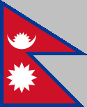
official currency is the Nepalese rupee, and the flag has the
peculiarity of being the only one of a State that has no rectangle
or square shape.
Chitwan National Park is a nature reserve situated in a Chitean District of Nepal. It covers a total area of 932 sq km.
Mount Everest or Qomolangma (Holy Mother) is situated in Solukhumbu District. It is the tallest peak in the World reaching an elevation of 8,848 m.
Royal Bardia National Park is a nature reserve in Bardia District of Nepal.
Shivapuri National Park is a nature preserve in the districts of Nuwakot and Sindhupalchowk in Nepal.
Entry requirements
To enter the country, foreign nationals (except
Indians) need a passport that is still valid for six months and a visa,
which can be obtained on arrival at the border crossing points in Nepal
or at Kathmandu Airport. The fees are graduated depending on the length
of stay:
15 days: US$25
30 days: US$40
90 days: US$100
The visa can also be applied for at the Nepalese embassy in Berlin or
the Nepalese honorary consulates (there +5 € extra) in Frankfurt,
Hamburg, Cologne, Munich and Stuttgart. Here the fees are about the same
as at the airport (25/40/100€ for 15/30/90 days).
Children up to
the age of 16 need a children's passport with a photo.
Entry must
be with a passport that is valid upon entry (a temporary document is
also possible).
Visas can be extended up to 150 days. If you
exceed the specified length of stay, you will be charged USD 2 per day
if you exceed 30 days, USD 3 per day if you exceed 90 days, and USD 5
per day if you exceed 90 days. In addition, a fine may be due.
More information is available from the Nepalese Department of
Immigration.
By plane
Kathmandu internet wikipediacommons
Airport (IATA: KTM) in Nepal is served by Turkish Airlines, Qatar
Airways, Thai Airways, Korean Air, Singapore Airlines and Air Arabia,
among others. There are currently no direct flights from Germany. It is
also possible to fly to Delhi and travel from there to Kathmandu by bus
or flight. Note that Kathmandu Airport does not allow instrument
flights. Due to poor visibility, there are sometimes considerable
delays.
The second international airport, Gautam Buddha
International Airport formerly Bhairahawa, is near Lumbini but has few
international connections.
By train
The only existing rail
connection to India runs from Khajuri in Nepal to Jaynagar in the Indian
state of Bihar. This line is operated by the Nepal State Railways. There
are no border controls, i. H. Third-country nationals are not allowed to
cross the border by train.
By bus
It is possible to arrive by
bus from India. Some services are offered from Delhi.
A border
crossing is in the far west at Kakarbhitta. Buses from Kathmandu take
12-16 hours.
car / motorcycle / bicycle
Entry by car or
motorbike is possible. Note that the driving behavior in Nepal takes
more than getting used to. A Carnet de Passage (available from the
automobile clubs in D/A/CH) is required. An international driver's
license is also recommended.
Mobility is always a problem. In the Kathmandu valley, traffic has
increased enormously in the last ten years, so that one often gets stuck
in traffic. It doesn't really matter whether you're traveling by
tuk-tuk, bus or taxi, depending on your wallet and the desired proximity
to other people.
From time to time, overland roads are closed for
a while due to protests by the Maoists (so-called "Bandhs"). The
vehicles of tour operators (cars and buses) marked as "tourist" or the
tourist buses can usually pass. It is possible to get on by domestic
flight, which is quite fast, but also significantly more expensive than
by bus. It is best to clarify the current political situation on site.
Military checks are to be expected on overland trips, especially in the
west of the country but also before Kathmandu or Pokhare. However, the
tourist vehicles can pass through them.
There are no railways.
Travel within Nepal is almost always done by bus. Since only very narrow
roads across high mountains connect the towns and villages, enormous
delays must always be expected. Bridges and paths are often partially
damaged by falling rocks and can only be used in one lane.
In
addition to public buses, tourist buses operate on the main routes. In
addition to a seat (in the bus and not on the roof, since they only take
as many passengers as there are seats), the tourist buses offer greater
safety and better comfort. The vehicles are in good condition and
drivers are encouraged to drive passively, i.e. safely.
The official language is Nepali, but there is an unmanageable variety of
other languages and dialects in the multi-ethnic state of Nepal.
Especially when trekking, you should make sure that your guide speaks
the language(s) spoken in the respective region.
As a tourist,
you can usually get around the country easily with English, most Nepali
know at least a few words to negotiate prices or to offer goods.
The electricity network is now well developed in the tourist centers - if there is electricity. You have to be prepared for hours of power outages in all areas of Nepal at all hours of the day and night. Higher-class hotels usually have their own generator, otherwise it makes sense to carry flashlights. Charge your batteries (photo, mobile phone) whenever possible.
"The kitchen" in Nepal does not exist. The food is Tibetan in the
mountain regions, international in Kathmandu + Pokara and Indian in the
south. On the famous trekking paths you will always find something
delicious to eat in the lodges, whereby the regional and vegetarian
cuisine (Dahl Bhat) is recommended with a view to hygiene and
environmental protection. Otherwise, the food should always be cooked,
fried or peeled. We do not recommend eating salads, as they are washed
with tap water and can therefore contain germs.
The national dish
is daal baat (daal = lentils; baat = rice). In Nepal there are usually
two meals; in the morning (around 9-10 h) Daal Baat and in the evening
Daal Baat. In Tibetan and Newari cuisine, momo are offered. Momo are
dumplings filled with vegetables or meat (chicken, buffalo) and served
steamed or fried.
Breakfast in the European sense is not known in
Nepal. The hotels and inns offer an "American" breakfast of eggs
(scrambled or omelets), toast, jam, cereal, and buffalo cheese.
Thanks to tourism, almost every dish is now available in the larger
cities, pizza, burgers ... Despite everything, the Nepalese stick to the
Daal Baat.
The main drink is milk tea / black tea or water. Water
should always be bought in capped and sealed bottles! Fruit juices and
lassis (yoghurt drinks) are generally discouraged because they are mixed
with water.
To avoid misunderstandings: Daal Baat is Dahl Bhat
(whereby the spelling follows the German pronunciation). There is more
to a good daal baat than just lentils and rice, namely vegetable curry,
potato curry, different types of meat, pickles (chutneys), yoghurt. Each
is individually seasoned and the Nepalese spice blends are delicious.
The rice is unseasoned, so it's not salted either, so you can eat it
with all the other things. There is a lot of rice with the meal, much
more than we are used to as a side dish.
The milk tea is also
seasoned, i. H. Milk and black tea, possibly fresh ginger slices and
cardamom are boiled together and finally sugar is added.
Most restaurants have knives and forks, or at least spoons. In less
touristy places people still eat by hand. Make sure you only use your
"right" hand. The left hand is considered unclean and is only used for
going to the toilet. Only pass food on with your right hand!
For
Hindus, an object touched with the lips (glasses, bottles) is unclean.
Nepal stands for a fascinating juxtaposition of neighboring cultures
from India and Tibet, e.g. T. also for their merger. In the southern
lowlands, in the Terai, you almost feel like you are in India, which is
only evident from the place names that sound Indian (such as Biratnagar
or Janakpur). Many Terai residents speak the same language as across the
border and resemble their Indian neighbors in appearance and dress. The
religious sites, which are predominantly Hindu, also show Indian
architectural influences.
In the sparsely populated mountainous
region, on the other hand, the majority of people live who are close to
the Tibetans in terms of language, religion, architecture or cuisine.
Thus, most of the people living there speak Sino-Tibetan languages and
adhere to Buddhism.
In the Kathmandu valley, on the other hand, a
fusion of cultures can be observed, for example in relation to
architecture and religion: the famous temples of Kathmandu and Lalitpur,
although Hindu, have architectural elements that can also be found in
Tibet, in addition to Hindu deities.
In Kathmandu there are some bars and restaurants that are open until late in the evening. The main nightlife area is Thamel, which has numerous pubs, restaurants and also many backpacker accommodations in its winding streets.
There is something for all budgets and desires in the larger cities.
When trekking rather simple accommodation. One should be careful in
cities, rather to sleep in the direction of the inner courtyard, as loud
barking dogs often disturb the night's sleep on the streets at night.
Incidentally, many monasteries also offer overnight accommodation.
Hotel Siddhartha, Surkhet Road, Karkandho, Nepalgunj. Price: From
US$33.
In Nepal, the most common calendar is the Bikram Sambat. It has 12
months, the length of which varies between 29 and 32 days, and the year
has 365 days. The Nepalese celebrate their New Year mainly on Nawa
Barsa, the 1st Baishak. According to this calendar, December 25, 2010 is
the 10th Poush 2067. Some people groups have a different New Year's date
and a different count of the years. The religious holidays are based on
the lunar calendar and are postponed in a similar way to our Easter
festival.
Dashain, the most important festival for the Hindus, is
towards the end of September/beginning of October. It lasts about seven
days and is roughly equivalent to a harvest festival.
Diwali is
another important festival of the Hindus, the festival of lights has a
similar status as our Christmas.
Teej is a three-day festival that
women celebrate with fasting and prayer
In addition to the Hindu
holidays, there are also Buddhist holidays that are celebrated in the
same way, such as Buddha Jayanti, the anniversary of Buddha's birth,
which is celebrated on the full moon of May/June.
The political situation in Nepal has eased, but travel to Nepal is still subject to particular imponderables. In particular, the conflict with the Maoists has not yet come to an end, despite an agreement. The Federal Foreign Office provides up-to-date information.
Groceries
In a country where sewage treatment plants are special,
more attention should be paid to hygiene. Everything that can be eaten
should be boiled or peeled beforehand. (Cook it, peel it or leave it!)
With the exception of the tourist strongholds of Kathmandu and Pokhara,
where it is safe to feast, in the remote villages a certain amount of
care is recommended when choosing food and dining place.
Another
problem is the catastrophically bad air in Kathmandu (Bangkok is nothing
short of a climatic health resort!). Here it often helps to live on the
edge of the valley (e.g. in Boudha) or even to move to the adjacent
mountains. Measures to improve the air quality are always on the
political agenda, but little has really been done in recent years.
altitude sickness
Drink a lot (2 liters + 1 liter per 1,000m
altitude), slowly gain altitude (preferably no more than 400 meters in
altitude per day from an altitude of around 3,000m) and, if in doubt,
come down again(!). A lot has already been done with that.
There are Internet cafes in all larger villages and tourist areas, some of which have very good speeds. In Kathmandu in particular, many Internet cafes have broadband connections and it is also possible to make phone calls over the Internet. Cell phone reception is only available in larger cities.
There are several versions of the origin of the toponym "Nepal". According to one of them, the toponym comes from the Sanskrit bases -nipa (“at the foot of the mountains”) and -alai (“dwelling”, “inhabited place”), that is, “dwelling at the foot of the mountain”, which corresponds to the geographical conditions of the country. According to another version, the word "Nepal" comes from the Tibetan "niampal" ("holy land"), which may be due to the fact that Siddhartha Gautama, who became known as the Buddha, was born in Nepal more than 2500 years ago.
Nepal is located in South Asia and extends approximately from latitude
26 to 30 north and longitude 80 to 88 east. Nepal covers an area of
147,516 square kilometers, of which approximately 143,000 square
kilometers are land and the remaining 4,000 square kilometers are inland
waters. The east-west extent is 885 kilometers and the maximum
north-south extent, which is reached in western Nepal, is around 241
kilometers. Nepal lies between the Tibet region in the north and India
in the south. Nepal borders (from west to east) the Indian states of
Uttarakhand, Uttar Pradesh, Bihar, West Bengal and the former Kingdom of
Sikkim, which joined the Indian Union.
In the north and east lies
a large part of the Himalayas, including Mount Everest, whose summit at
8,848 meters is the highest point on earth. Seven of the other ten
highest mountains in the world are also in Nepal. The deepest point,
however, is 70 meters near Kencha Kalan (Kechana Kawal in Jhapa
district) in the extreme southeast of Nepal. Over 40 percent of the
country's surface is above 3,000 meters. This makes Nepal the highest
average state in the world, while the Tibetan plateau reaches an average
altitude of 4,500 meters.
In terms of geological history, the Himalayas are a relatively young
folded mountain range at around 45 million years old, so they are less
rounded and smoothed by erosion than other mountains. The rivers do not
all flow into the Ganges, but the largest arise north of the main
Himalayan range and have carved out through valleys during the mountain
uplift. At around 6,000 meters - measured against the eight-thousanders
Dhaulagiri (8,167 m) and Annapurna (8,091 m) that face each other - the
Kali Gandaki is the deepest valley on earth.
This entire area is
sparsely populated and is a popular destination for trekkers and
mountaineers. From 1950 to 2005, 832 mountaineers had fatal accidents in
the Nepalese Himalayas, around one in every hundred expedition
participants on mountains above 6,000 meters high.
Structure of
the country
In terms of natural space, Nepal can be divided into
three main regions, the southern Terai, the central plateau and the high
mountain region. Socioeconomic, cultural and ethnic aspects are also
associated with this structure.
The Terai
The Terai forms the
Nepalese part of the Ganges Plain. Over the past 50 years it has
developed into an important economic and settlement area. Although the
Terai only accounts for 14% of the country's area, 47% of the population
lives there. Fertile soils with little risk of erosion and a frost-free
climate all year round as well as good irrigation options make the Terai
the most agriculturally valuable region.
Almost all industrial
settlements outside the Kathmandu Valley are also located in this plain.
The Mahendra Highway runs through the Terai as the only road that
enables an east-west connection. Nine domestic airports are located in
the Terai and offer direct flight connections with Kathmandu.
The
Mittelland
The Siwaliks and the Mahabharata Range form the transition
from the Terai to the midland, which reaches heights of up to around
3000 meters. The Mittelland has a very strongly structured relief.
Factors such as microclimate, soils and geomorphology vary over a small
area in the Central Plateau, meaning that the conditions for settlement
and agriculture also vary greatly. Nevertheless, the Central Plateau
represents the long-populated heartland of Nepal. 45% of the population
live in the Central Plateau, covering 30% of the country's area.
Due to the high relief energy, the Mittelland is highly inhospitable to
traffic. For a long time only the Kathmandu and Pokhara valleys had road
connections, with Kathmandu only receiving road connections in the 1950s
and Pokhara in the 1970s, Tribhuvan Rajmarg and Prithvi Rajmar g. The
Mahendra Rajmarg, the first national longitudinal connection from
Mechinagar to Bhim Datta, was built gradually in the Terai from the
1960s and was only completed in 1996 over a length of over 1000 km.
Other parts of the country's central plateau were accessed from this
road via cul-de-sacs, of which the Mechi Rajmarg (Ilam), the
Dharan-Dhankuta-Rajmarg, the Ratna Rajmarg (Birendranagar) and the
Mahakali Rajmarg (Amargadhi) are the most important. Numerous other
cul-de-sacs followed and the existing ones are constantly being extended
to the north at high speed. A longitudinal connection is currently being
built through the Mittelland, which has been completed in numerous
sections, but not yet throughout.
For a long time, Kathmandu had
the country's only international airport, Tribhuvan International
Airport. Two more, the Gautam Buddha International Airport in
Siddharthanagar and the Pokhara International Airport, opened in 2022
and 2023.
Almost all settlements in the high mountain region are concentrated in
the valley areas. Summer settlements with pasture farming reach up to
5000 meters. The extremely high relief energy and high monsoon rainfall
(over 5000 millimeters) on the southern slopes contribute to soil
erosion and make agriculture difficult.
The northern sides of the
main chain, which are in the rain shadow, receive very little rainfall
(less than 200 millimeters), so agriculture is hardly possible. Forestry
and forestry are important pillars of rural subsistence farming in the
mountains. Overall, the high mountain region is a food deficit area. The
most important external source of income is tourism. So far there is
only one cul-de-sac from the south, namely to Jomsom and Muktinath,
although it has not yet been developed. The only road that crosses the
high mountains in Nepal and therefore the only land connection from
Nepal to China is the Arniko Rajmarg from Kathmandu to Tibet; However,
it has been difficult to pass for years due to numerous landslides on
the Tibetan side. The numerous airstrips and airfields spread across the
region represent an important transport connection with the rest of the
country; the most important of these are Jomsom, Jimikot, Dolpa and
Lukla.
As a result, walking is still an important form of
transport, as it is in the Central Plateau. The high mountain regions
tend to be less developed than the rest of the country. Particularly in
the western parts of the high mountain regions, the human development
index is significantly lower than the national average. It deviates from
average by 15%.
Nepal mainly belongs to three catchment areas of approximately equal size, namely the Karnali (upper reaches of the Ghaghara in India), the Narayani and the Koshi. The Karnali drains most of western Nepal, the Narayani the central part of Nepal and the Koshi the east of the country. The only one not included in these catchment areas is the Mahakali, the border river in the west, which largely drains the Mahakali zone. All major rivers in the country flow directly or indirectly into one of the first three rivers: Seti, Bheri, western Rapti, Tila, Thuli Bheri, Humla Karnali, Mugu Karnali into the Karnali, Kali Gandaki, Seti Gandaki, Madi Khola, Marsyangdi, Budhigandaki, Trishuli, Bagmati and Eastern Rapti in the Narayani and Indrawati, Sunkoshi, Tamakoshi, Likhu Khola, Dudh Koshi, Arun and Tamor in the Koshi.
To this day, the population of Nepal is largely rural and agricultural.
In 2021, 21 percent of Nepal's residents lived in cities,[11] making the
country a very low proportion of urban residents compared to the rest of
the world. However, urbanization has increased sharply in recent years,
with growth rates in this area at 3.5% per year and higher.
Until
the early 1990s, Nepal was centrally governed down to the local level.
As part of democratization and decentralization, municipalities were
given independence in several waves. The “city rights” titled
“Nagarpalika”, “Up-Maha-Nagarpalika” and “Maha-Nagarpalika” are thus
granted by the government.
With the exception of Kathmandu, all
cities lack resources to a greater or lesser extent and self-government
is therefore difficult to implement. In addition, there are still strong
centralistic structures in the state administration that contradict the
desired local self-government.
Depending on the size and
financial strength of the municipality, there are three different levels
of self-government. The Maha-Nagarpalika receives the most competences;
there is only one city in this category in Nepal: Kathmandu. The next
stage is the Up-Maha-Nagarpalika, such as Lalitpur or Pokhara; There are
four of them in total. The lowest of the three stages is the
Nagarpalika.
In many cases, other conditions for independence,
such as certain infrastructural facilities or road connections, are not
met, at least all year round. There are regional planning and political
reasons why these municipalities were granted independence. Viewed in
this light, Nepal's statistical urban population can safely be reduced
by about half a million to get an idea of the country's true level of
urbanization.
The three largest cities are in the mountains, but
the majority of municipalities are in the Terai. The other
municipalities in the mountains are often the smallest mountain towns,
which, through the addition of surrounding villages, have a population
of almost 20,000. The fact that a number of them are not urban centers
is also shown by their comparatively low growth rate.
In addition
to the high rural exodus rate, Nepal is experiencing a shift in
population focus from the mountains to the Terai. More than half of the
country's population already lives in this lowland strip along the
border with India, and this is where most of the new cities are
currently being built.
The largest population center was and
still is the Kathmandu Valley with the twin city of Kathmandu/Lalitpur
(Patan), the smaller neighboring city of Bhaktapur and a few small towns
such as Madhyapur Thimi and Kirtipur. This metropolitan area also
includes a few smaller towns near the valley, namely Banepa, Dhulikhel
and Panauti. The Kathmandu Valley is largely urban sprawl and complete,
almost always unplanned, absorption as settlement area is foreseeable.
The area around Kathmandu today has a population of just over 1.5
million.
The second major population center in the mountains,
which also has above-average growth rates, is the Pokhara Valley with
the cities of Pokhara and Lekhnath, whose population has already
exceeded 200,000 inhabitants. Otherwise there are only a few smaller
towns worth mentioning scattered throughout the mountainous regions
(from east to west):
Ilam
Dhankuta
Bhimeshwar
Gorkha
(formerly Prithvinarayan)
Tansen
Putalibazar
Ghorahi (formerly
Tribhuvannagar)
Tulsipur
Birendranagar
Dipayal Silgadhi
In addition, the rest of the country's major cities are located in the
Terai (from east to west):
Mechinagar
Biratnagar
Dharan
Itahari
Rajbiraj
Triyuga
Janakpur
Birgunj
Hetauda
Bharatpur
Ramgram
Butwal
Siddhartha Nagar
Nepalganj
Gulariya
Tikapur
Dhangadhi
Bhim Datta (formerly Mahendranagar)
The recent name changes of some cities are due to the local
authority receiving a new name upon incorporation. Prominent examples of
this are the better-known town of Gorkha; the commune was officially
called Prithivinarayan until 2009, but was then renamed after the core
town of Gorkha. The old royal city of Patan near Kathmandu is now
officially called Lalitpur. However, the old names are still in use.
The territory of
Nepal, according to its natural and geographical features, is divided
into altitudinal belts, stretching from west to east along the
Himalayas.
Southern tropical belt up to 1900 m above sea level
(Terai, Sivalik and the lower slopes of the Mahabharata). The average
temperature in July is +27…+30°C, in January +15…+17°C. In summer -
frequent floods, in winter - droughts. The Terai used to be covered with
tropical jungle, but today many of the forests have been reduced to
nothing, replaced by cultivated fields. The jungle has been preserved at
the foot and on the slopes of Sivalik, especially in its eastern part.
Subtropical mountain belt (1200-1900 m). It is covered with broad-leaved
forests (oak, chestnut, maple, hornbeam, elm, as well as magnolias,
rhododendrons, camphor and laurel trees, banyan, mountain bamboo,
orchids).
Mountain temperate belt (1900-2800 m). Deciduous forests.
Moderately cold belt (3000-4000 m). Deciduous trees are gradually being
replaced by conifers (silver spruce, blue pine, larch, juniper tree,
Himalayan cedar, fir above).
Alpine meadows (4000-5200 m).
Ice
zone (above 5200 m).
Sagarmatha National Park is located in the northeast of the capital
Kathmandu. The status of the National Park was granted in July 1976. The
territory covers 1148 km² of the ecological zone of the Himalayas. The
park is UNESCO World Heritage Site No. 120. Sagarmatha is the local name
for Mount Everest, which lies on the northern border of the national
park. The easiest way to get to the park is by flying from Kathmandu to
Lukla. To stay in the park, you must pay a fee of $10. From the top of
Kalapatar, a panorama of Everest opens up.
Annapurna National Park is
located in the central part of Nepal, 180 km west of Kathmandu. On the
territory of the park are the highest peaks - Annapurna and Dhaulagiri,
separated by the deepest Kali Gandaki valley on the planet. The valley
itself is geologically older than the Himalayas, and shellfish fossils
can be found at its bottom. In the Kali Gandaki valley, Jomsom apples
are grown, highly valued for their taste. These apples are exported to
England for the Queen.
The Royal Chitwan National Park is located 200
km from the capital Kathmandu. The park, UNESCO World Heritage Site No.
284, was the hunting grounds of kings until the 1970s and was carefully
guarded, and therefore avoided the destruction of the fauna by poachers.
The park is interesting because Asian rhinos (almost completely
exterminated in neighboring India), Bengal tigers, crocodiles (mashmaga
is the local name for a crocodile), caimans and other interesting
animals live on its territory. An elephant safari is organized in
Chitwan (this word today in Nepal means not hunting, but just a trip) on
elephants. This makes it possible to enter the impenetrable jungle and
approach the rhinos at a distance of less than 10 m.
Population statistics from 1911 to 2020
Population - 30,430,267
people (2014 estimate)
Annual increase - 1.4% (fertility - 2.5 births
per woman)
Average life expectancy - 64.6 years for men, 67 years for
women
HIV infection - 0.5% (2007 estimate)
Urban population - 17%
Literacy - 62.7% of men, 34.9% of women (according to the 2001 census)
In cultural and ethnic terms, Nepal is a mixture of about a hundred
nationalities and castes. Caste boundaries, as a rule, are transparent,
and belonging to one or another caste also depends on the accepted
tradition of the observer. The people of Nepal speak seventy different
languages and dialects.
Nepalese, Nepali:
the name of all
citizens of Nepal.
self-name spread among the peoples of Nepal
Ethnography
The peoples of Nepal are predominantly speakers of
the languages of the Sino-Tibetan (Tibeto-Burmese group) and
Indo-European language families.
Many nationalities are refugees,
conquerors or settlers. Thus, the Bahuna people fled to Nepal from the
south from the Muslim invasion around 1300, and the Sherpa people fled
from the north from the Mongols about 500 years ago.
The origin
of some ethnic groups is unclear, such as the Newari or the Tharu.
In addition, mention should be made of such nationalities as the
Gurungs, Sherpas, Limbu and Rai.
For 49% of the population
(according to the 2001 census), their mother tongue is Nepali. Other
spoken languages: Maithili (12.4%), Bhojpuri (7.6%), Tharu (5.9%),
Tamang (5.2%), Newari (3.6%) and Magars (3.4%).
According to official figures, 80.6% of the population professes
Hinduism. According to independent estimates, the actual number of
adherents of Hinduism is only 70%, or even less. This discrepancy is due
to the fact that there are many peoples who, although formally declare
their belonging to Hinduism, in reality practice animism or Buddhism. It
is often difficult to draw a clear boundary, so it is impossible to
speak about the accuracy of estimates. But anyway, Hinduism is the
dominant religion in Nepal.
Approximately 10.7% of the population
identify themselves as Buddhists, especially in the Kingdom of Mustang.
There are also minorities who practice Islam, Kirant Kirant (mandham -
an ancient belief of the Kirat people) and Dainism and belong to
separate animistic beliefs.
The Nepalese caste system
developed in parallel with the Indian one. It is known that the
historical Buddha Gautama Siddharta (born 563 BC) belonged to the
Kshatriya varna, the warrior varna. Indian influence especially
increased in Nepal during the Gupta dynasty (320-500); Nepal then had
the status of a "neighboring kingdom", but subordinate to Samudragupta.
Later, from the 10th century, many Hindus (as well as numerous
Brahmins) migrated from India to Nepal, mainly to escape the Arab
invasion and the introduction of Islam, especially from northeastern
India. At the same time, the refugees sought to preserve the original
culture and rituals.
To understand Nepalese caste relations, let
us consider schematically the various caste systems.
ancient period
Once the valley of Kathmandu lay at the bottom of a
huge mountain lake. After the earthquake, the water of the lake came
down (according to the legend, the Bodhisattva Manjushri cut the water
with a magic sword, according to another legend, it was Krishna, who,
with the help of a staff, formed the Chobar Gorge, through which the
water left), and the valley was inhabited by numerous people from the
surrounding regions, who formed the Newari people. The valley was
distinguished by high fertility, and the population - by great talents
in art and crafts, and became famous throughout East Asia.
Nepal
has gone through periods of prosperity and decline. Even before our era,
Buddhism came to Nepal, and Nepal was a stronghold of Buddhism
throughout the Himalayan region, as well as an important transit point
on trade routes between India, Tibet and China.
Kingdom of Nepal
The heyday of Nepal occurred during the Newar Malla dynasty in the
13th-17th centuries, which left the most noticeable mark on the history
of Nepal with an abundance of magnificent architectural monuments that
have survived to this day, which largely shaped the face of the country
in the eyes of the rest of the world. It is not for nothing that the era
of Mull's reign is called the "Golden Era".
In 1768, King Prithvi
Narayan Shah of Gorkha conquered the Kathmandu valley and moved his
capital to the city of Kathmandu. Thus was the beginning of the reign of
the Shah dynasty in Nepal. Although in the traditional Russian
translation the title of the rulers of Nepal has always been translated
as “king”, in the original it sounds like “shah-in-shah” (a shah among
shahs) - similarly to the traditional title of the rulers of Iran and
other countries of the East.
1814-1816 - Anglo-Nepalese war. The
peace treaty basically defined the modern borders of Nepal, and made the
state dependent on the British crown.
On September 15, 1846,
conspirators led by Jang Bahadur, a young, ambitious and cruel
aristocrat from the Chhetri caste in western Nepal, carried out a bloody
palace coup, called the “Kot Massacre”.
For more than a century,
the Rana dynasty of prime ministers ruled the country, and although this
time is characterized by the isolation of the country and stagnation in
almost all areas of life, Nepal managed to maintain its independence,
falling into the position of a semi-colony of the British Empire. On
January 1, 1923, a treaty of "friendship" was concluded with Great
Britain, the country received formal independence.
At the end of
1950, King Tribhuvan left his palace, taking refuge in the Indian
Embassy, from where he then fled to India. At this time, supporters of
the newly created political party, the Nepalese National Congress (NNC),
seized power in most of the Terai and formed an Interim Government in
the Indian border town of Birganj. In Nepal, clashes began between the
supporters of the NNK and the Rana dynasty, during which not a single
force achieved a decisive advantage. Then India intervened, and the
proposed settlement plan was accepted by both sides. In accordance with
this plan, King Tribhuvan returned to the capital in 1951 and formed a
new government, including both Ran supporters and representatives of the
NNC. The centuries-old isolation of the country was over: Nepal
established relations with many states of the world.
In 1955,
King Tribhuvan died (in particular, the capital's airport is named after
him), and his son Mahendra took the throne. He proclaimed a new
constitution that established a parliamentary system in Nepal in 1959.
However, 3 years later, in 1962, King Mahendra recognized this
"experiment" as a failure and dissolved the parliament. On May 16, 1962,
a new constitution appeared, according to which Nepal again passed to an
absolute monarchy. As a result, the prime minister and members of
parliament were arrested and subjected to repression, and absolute
monarchy was maintained in Nepal for the next 18 years.
In 1972,
King Mahendra died, and his son Birendra succeeded to the throne, having
received an excellent education at Eton and Harvard. Pro-democracy
movements among the students pushed the new king to decide to hold a
referendum in May 1980, which would ask about the nature of the future
Nepalese government. The Nepalese were offered 2 options: the
preservation of the absolute monarchy while carrying out democratic
reforms and the transition to a multi-party system. Then the monarchy
won the referendum, but the advantage was small.
At the same
time, the population, which for the most part expected an immediate
improvement in life after the introduction of democracy, quickly became
disillusioned with the ruling party, riots began again in the country,
and the government was forced to call early elections in 1994. This
election was won by the United Communist Party (Marxist-Leninist) under
the leadership of Man Mohan Adhikari. A unique political situation was
created: a government formed by the communists under a theocratic
monarchy (Nepal is one of the few countries in which Hinduism is
proclaimed the state religion). However, this situation did not last
long: already in September 1995, the communist government received a
vote of no confidence and was forced to resign, and a three-party
coalition of the NNC, the right-wing Rastriya Prajatantra party and the
pro-Indian Nepal Sabdhavana party came to power.
Fall of the
monarchy
On February 13, 1996, the "People's Nepalese Army" (in fact,
extremely few and poorly armed guerrillas), the armed wing of the
Communist Party of Nepal (Maoists), launched the so-called "prolonged
People's War" (a specific Maoist term). However, the Maoists received
the support of local peasants, who began to join the partisan
detachments by the hundreds. The rebel movement expanded, capturing more
and more territories.
Political instability in the country has
especially intensified since June 2001, when Crown Prince Dipendra shot
his entire family and shot himself, killing King Birendra and almost all
members of the royal family. The reason for the tragedy was that
Dipendra had been in a love affair with Devyani Rana since 1990, whom he
met while studying in London. Traditionally, the family of Nepalese
aristocrats, Rana, until 1951 gave hereditary prime ministers of the
country and was a rival of the royal family for power in Nepal, and the
royal family was categorically against this marriage. The brother of the
murdered king Gyanendra, who was very unpopular in the country, took the
throne. Rumors spread throughout the country that it was he who
allegedly was involved in the tragedy. Immediately after the change of
power, mass riots began in the country, exacerbating an already
difficult situation.
In an attempt to stabilize it, Gyanendra
resorted to a series of unpopular measures, including the banning of
political parties and the dissolution of the government, interspersing
active military action against the Maoists with negotiations. Meanwhile,
the Maoists took control of a significant part of the territory of
Nepal, while government troops firmly held the Kathmandu valley, the
outskirts of Pokhara, the most populated part of the Terai and areas of
the main tourist routes in the vicinity of Everest and Annapurna.
In 2005, the king effectively dissolved parliament.
In
connection with the intensification of hostilities, the tourist flow
began to decline and by 2005 it had fallen five times, which hit the
economy of Nepal. At the same time, the Maoists emphasized that they
were not waging war against tourists. For all the time of hostilities,
not a single foreign tourist was killed. Moreover, the Maoists
encouraged foreign tourism in the territories they controlled. At the
entrance, tourists paid a "revolutionary tax", approximately two dollars
a day per person, they were given a receipt. In the event of a hike
delay when leaving the territory, they paid the difference for
additional days in excess of the dates noted on the receipt.
Opposing the king's authoritarian measures, the leading political
parties formed an alliance with Nepal's Maoists.
In April 2006, a
general strike began in the country.
On July 11, 2006, the
Nepalese parliament stripped King Gyanendra of his right to veto laws
and bills. A month before, the deputies unanimously took away the post
of supreme commander of the army from the king, deprived him of immunity
(it became possible to put him on trial), and also ordered him to pay
taxes. Thus, the parliament completely excluded him from the political
system of the country. In addition, the deputies decided from now on to
consider Nepal a secular state, thus taking away the title of "the
incarnation of the god Vishnu" from Gyanendra. A coalition government
was formed.
On November 21, 2006, the seven-party government made
peace with the Maoists, announcing the end of the civil war. Under the
terms of this deal, the Maoists agreed to lay down their arms in
exchange for their integration into the ranks of the regular army and
government administration. For this, Prime Minister Girija Prasad
Koirala, who became the main figure in the country in May 2006, promised
to give the Maoists 73 out of 330 seats in the new parliament.
Republic period
On January 14, 2007, the parliament adopted an
interim constitution, according to which the king lost his head of state
status and power functions were transferred to the prime minister. At
the same time, the Maoists achieved an increase in representation in
parliament to 83 seats, became the largest opposition party and received
seats in the cabinet. The Nepalese National Congress, led by the Prime
Minister, won 85 seats.
Elections to the Constitutional Assembly were scheduled for June 20,
2007 in the country. The Nepalese Congress Party - supporters of Prime
Minister Koirala - believed that Nepal should be a constitutional
monarchy, and the king should be placed under indefinite house arrest
for suppressing popular demonstrations. At the same time, in the north
of Nepal, the armed groups of the Maoists handed over their weapons to
special storage facilities, which were controlled by international
observers. The acceptance of weapons was carried out by a special
commission, which is made up of UN employees and veterans of the British
special forces from the Gurkhas.
The elections were rescheduled
for November 22, 2007. At the first meeting, the deputies of the
Constitutional Assembly would have to decide the fate of the monarchy in
Nepal. Although an amendment was adopted in the interim constitution in
April 2007, allowing it to be done directly by parliament before the
elections to the Constituent Assembly, in case the king interferes with
their holding. After that, the deputies of the Constitutional Assembly
had to develop the text of the new fundamental law of the country. The
Maoists insisted on the final transformation of Nepal into a
parliamentary republic. In September, the Maoists put forward a demand
for the proclamation of a republic and the replacement of the mixed
voting system with a proportional one at an extraordinary session of the
interim parliament on October 11, 2007. On October 5, elections to the
Constitutional Assembly were once again postponed for an indefinite
period. Voting on the issue of declaring a republic and replacing the
electoral system due to the intervention of pro-monarchist forces (the
Nepalese Congress, the United Marxist-Leninist Communist Party of Nepal)
was postponed three times: first to October 14, then to October 16 and
the last time to October 29, 2007. On November 4, the extraordinary
session ended. By a majority vote, it was decided to instruct the
government to develop a draft amendment to the constitution that would
allow proclaiming Nepal a republic, as well as change the electoral
system from a mixed (50% + 50%) to a proportional one, for consideration
at the regular session of parliament, which opened on November 19, 2007,
but through 11 minutes after the opening, the next meeting was adjourned
until 29 November.
Despite the adoption at the congress on
September 22-23, 2007 by the Nepalese Congress party of the decision to
vote in the Constitutional Assembly for the establishment of a republic,
this party, led by Prime Minister Girija Koirala, was an obstacle to the
establishment of a republican system in the country. Some members of the
party have openly stated that they will ignore the decisions of the
November 4, 2007 extraordinary session of parliament on the development
of legislation to proclaim a republic in the current session of
parliament. The Maoists, on the other hand, put the issue of a republic
and a proportional electoral system at the forefront - as long as the
"Nepalese Congress" will prevent the proclamation of a republic and
change the electoral system, the Maoists will prevent the issue of
calling elections to the Constituent Assembly.
On December 28,
2007, the interim parliament proclaimed Nepal a democratic federal
republic. The decision was subject to approval by the Constitutional
Assembly. Until then, the king of Nepal, Gyanendra Bir Bikram Shah Dev,
deprived of real power, continued to live in the royal palace.
On
April 10, 2008, elections were held to the Constituent Assembly, which,
being a provisional body of power (parliament), was supposed to prepare
a Constitution in two years, on the basis of which it was planned to
hold subsequent elections. The Communist Party of Nepal (Maoist) won 220
out of 601 seats, and its leader Pushpa Kamal Dahala (better known as
"Comrade Prachanda") led a government that included the Maoist Communist
Party, the Communist Party (United Marxist-Leninist) and deputies from "
Madhesi Jana Adhikar Forum".
On May 28, 2008 at 23:26 local time,
the Constituent Assembly of Nepal by 560 votes to 4 (members of the
monarchical Rashtriya Prajantra Party) proclaimed Nepal a federal
democratic republic. It was established that the prime minister would
head the executive branch. The former royal palace is now a museum.
Soon, Pushpa Kamal Dahal resigned, the reason for which was the
violation of the peace agreements by the commander-in-chief of the
Nepalese armed forces, General Rukmangud Katawala - he refused to
integrate the former Maoist guerrillas into the army.
The new
coalition government was formed by the Communist Party of Nepal (United
Marxist-Leninist), which had the third largest faction in Parliament
(103 seats out of 601), and it, in turn, resigned in June 2010. However,
for a long time, the parliament failed to elect a new prime minister,
and the government continued to function as "acting". On February 10,
2014, Sushil Koirala was elected as the new Prime Minister.
In May 2010, a 2-year period expired, for which it was planned to
prepare the Constitution, which was not done. Therefore, the term of
office of the Constitutional Assembly was extended. In June 2015,
political leaders reached an agreement on a new constitution for Nepal.
Distribution of seats in Parliament (Constituent
Assembly/Constitutional Assembly) as of 2013.
In 2015, an
earthquake occurred in the country, which caused numerous destructions.
In the fall of 2015, representatives of the Communist Party of Nepal
(United Marxist-Leninist) took over the key posts of President and Prime
Minister. In August 2016, the Chairman of the Communist Party of Nepal
(Maoist Centre), Pushpa Kamal Dahal, took over the government.
In
the parliamentary elections in November-December 2017 to the House of
Representatives and February 2018 to the National Assembly, the
Communist Party of Nepal (United Marxist-Leninist) won. After the
February 15 elections, the Chairman of the Communist Party of Nepal
(United Marxist-Leninist) Khadga Prasad Sharma Oli led the government.
On July 14, 2021, Sher Bahadur Deuba, chairman of the Nepalese
Congress, took over the government.
According to the interim constitution of 2007, Nepal is a parliamentary
republic.
According to the Constitution of 2015, Nepal is
proclaimed a state focused on the construction of socialism.
According to the Economist Intelligence Unit, the country in 2018 was
classified on the Democracy Index as a hybrid regime.
Legislature
House of Representatives
Nepalese Communist Party -ML 95
Nepalese
Congress 63
Nepalese Communist Party -MC 49
Nepalese Communist
Party -O 25
People's Socialist Party 21
LSPN 13
Independent 5
National Assembly
Nepalese Communist Party -ML 18
Nepalese
Congress 10
Nepalese Communist Party -MC 16
Nepalese Communist
Party -O 9
RSPN 3
RDM 1
LSPN 1
Independent 5
Executive branch (as of 2015)
President and Vice President
The
head of state is the president. The current president, Bidhya Devi
Bhandari, who served as vice chairman of the ruling Communist Party, was
elected in October 2015 by the Nepalese parliament with 327 votes, her
rival Kul Bahadur Gurung received 214 votes.
Under the Fifth
Amendment to the Constitution, the President, Vice President, Prime
Minister, Chairman of the Constituent Assembly, and Vice Chairman are
elected on the basis of "political understanding". During the 2008
presidential election, the parties failed to agree on candidates for the
position of vice president, but the elections were declared valid.
Parmanand Jha of the Madhesi Jana Adhikar Forum was elected Vice
President with the support of the Nepalese Congress and the Communist
Party of Nepal (United Marxist-Leninist).
Government
The head
of government is the prime minister. On February 10, 2014, Sushil
Koirala was elected as the new Prime Minister. The election of Koirala
became possible as a result of an agreement reached between the Nepalese
Congress and the Communist Party of Nepal (United Marxist-Leninist),
which agreed to support the candidacy of the leader of the centrists. As
Koirala said, “Nepal's main task now is to adopt a constitution. We will
try to complete it within a year." Koirala's candidacy was approved by
405 out of 575 deputies of the 2nd Constituent Assembly. Since February
15, 2018, the new Prime Minister Oli, Khadga Prasad Sharma. The
government includes representatives of communists and socialists.
Judicial branch
In accordance with Article 101 of the Interim
Constitution of Nepal, the following courts operate in the country:
Supreme Court;
appellate courts;
district courts.
In
addition to the above, special courts, judicial institutions or
tribunals may also be established to deal with special categories of
cases, but no court, judicial institution or tribunal shall be
established to deal with specific cases.
The highest judicial
body in Nepal is the Supreme Court, headed by the Chief Justice. The
Chief Justice of the Supreme Court is appointed by the President of the
country on the recommendation of the Constitutional Council. The Chief
Justice, in turn, on the recommendation of the Judicial Council,
appoints other judges of the Supreme Court, which cannot be more than
14. If this number of judges is not enough, ad hoc judges may be
appointed for a certain period.
Nepal is landlocked and lies between its two major neighbors, the People's Republic of China and India. In the north of the country, the Himalayas form a natural and almost impassable border with China. In the south, east and west, Nepal is surrounded by India. Having no access to the sea, Nepal became dependent on India due to the transit of goods through its territory. During the existence of British India (1858-1947), Nepal followed a policy of isolationism. Such a policy was formed due to the fact that the country partially avoided colonization expansions and retained its independence. Since the middle of the 19th century, when the British Empire finally conquered India, and the Qing dynasty (1644-1911) in China was in decline, Nepal managed to conclude contractual relations with London on the best terms for itself. By maintaining autonomy in domestic politics, Nepal received a guarantee that the British Empire would protect it in the event of external aggression. In return, London received units of Gurkha soldiers from Nepal, who came to play a vital role in maintaining order in British India.
Nepal is one of the poorest and least developed countries in the world.
GDP per capita (in 2009) - 1.2 thousand dollars (159th place in the
world according to the IMF). The unemployment rate is 46% (in 2008).
The main branch of the economy is agriculture (76% of employees, 35%
of GDP) - rice, corn, cereals, sugar cane, jute, root crops. Meat and
dairy farming - buffaloes.
Industry (6% of employees, 16% of GDP)
- processing of agricultural products (jute, sugar, tobacco, grain),
carpet production, brick production.
Service sector - 18% of
employees, 49% of GDP.
The main source of foreign exchange
earnings is foreign tourism.
International trade
Foreign trade
is almost completely focused on India, and Kathmandu's dependence on New
Delhi only grew in the 2000s: if in 2005 India accounted for 53.7% of
Nepal's exports and 47.7% of the imports of the Himalayan country, then
in 2011 these the figures were 66.4% and 65.2%, respectively. Export -
804 million dollars (in 2017) - textile and weaving goods, including
clothes - 317 million dollars, food products, including fruit juices -
138 million dollars, agricultural raw materials (tea, nuts, spices,
etc.) .) - 95 million dollars, metal products - approx. $70 million
The main buyers are India (54%), USA (11%), Turkey (6.7%), Germany
(4.1%).
Imports - $9.56 billion (2017) - petroleum products,
manufactured goods, machinery and equipment, vehicles, semi-finished
metal products, gold, electronics, medicines.
The main suppliers
are India (63%), China (12%), Germany (2%).
Nepal remains quite isolated from the world's main transport routes. At
the same time, air communication within the country is quite developed:
there are 47 airports, 11 of which are concrete-paved, the frequency of
flights corresponds to the needs. The northern two-thirds of the country
is mountainous, making road construction and maintenance difficult and
costly. In 2007, the length of asphalt roads was 10142 km, unpaved roads
- 7140 km. In 2018, there were two railway lines in the south of the
country with a total length of 34 km.
More than a third of
Nepal's population lives within two hours' walk of any all-weather road.
Only recently roads connected all the administrative centers with the
capital Kathmandu. In 2009, about 60% of the roads were country roads
and impassable during the rainy season. Maritime communication with
Kathmandu is carried out through the port of Indian Calcutta. Due to the
poor condition of the roads, Nepaleses have difficulty accessing
markets, schools and hospitals.
The state television company, Nepal Television, includes the TV channel of the same name, the state radio company Radio Nepal includes the radio station of the same name.