Nantes is the prefecture (administrative seat) of
both the Loire-Atlantique department (44) and the higher-level Pays
de la Loire region. With just over 300,000 inhabitants (as of 2015),
Nantes is the sixth largest city in France. The population of the
agglomeration is over 900,000.
At Nantes, the Erdre and the
Sèvre flow into the Loire, which widens west of the city to form an
estuary before it flows about 55 kilometers downstream into the
Atlantic. Nantes is mostly on the north bank of the Loire.
The climatic conditions are determined by the proximity to the
Atlantic: the winters are mild and humid, the summers are warm and
not too dry. The mean annual temperature is 11.9 °C. The geographic
center of the land hemisphere of the globe is located near the city.
Nantes belonged to the province of Brittany until 1790, and the
Breton dukes even had one of their residences here. When the French
administrative regions were introduced in 1955, the department of
Loire-Atlantique was assigned to the Pays de la Loire - more for
economic reasons. This decision is still controversial to this day.
Therefore, to avoid misunderstandings, Brittany is sometimes spoken
of in the historical and cultural sense (which includes Nantes) and
Brittany in the administrative sense (excluding Nantes).
Nantes tourism (Nantes metropolis tourist office) 9 rue des Etats , +33 892 464044 (premium rate number) , email: info@nantes-tourisme.com Mon - Sat : 10 am - 6 pm Sun : 10 am - 5 pm.
1 Nantes Cathedral (cathédrale
Saint-Pierre-et-Saint-Paul) . 15th century late Gothic cathedral
(Flamboyant style). Its vault is more than 38 meters high, making it one
of the highest in the country. In the southern aisle, the tomb of Duke
Francis II of Brittany and his wife Margarethe von Foix, made of black
and white marble and decorated in a Renaissance style, is remarkable.
There was a fire on 07/18/2020, closed until further notice.
2
Basilica of Saint Nicolas . Neo-Gothic church built in 1844-69.
3
Église Notre-Dame-de-Bon-Port (Église Notre-Dame de Bon-Port, also
called Église Saint-Louis) . 1852-59 built church in Neo-Baroque style.
The most striking element is the 60 meter high (with peak and cross)
black and white striped dome, the shape of which is based on the dome of
Les Invalides in Paris.
4 Eglise Sainte Croix . Baroque-classical
church from the second half of the 17th century. In 1860, an unusual
bell tower was added, which is intended to commemorate the Bouffay
belfry, which was demolished in 1848.
5 Église Sainte-Thérèse (called
«église rouge»), place Alexandre-Vincent (Breil-Barberie district, 2.5
km northwest of the city center; tram 3 "Alexandre
Vincent/Sainte-Thérèse"). 1935-59 built red brick church in a
Romanesque-Byzantine style mix.
6 Eglise Saint Luc
1 Castle of the Dukes of Brittany. Features: No smoking, no drinking.
Musée d'Histoire de Nantes (in the Château des ducs de
Bretagne).
2 Musée d'arts de Nantes (formerly Musée des beaux-arts),
10 rue Georges-Clemenceau. Tel: +33 (0)2 51 17 45 00 .
3 Musée Jules
Verne (musée Jules Verne), 3, rue de l'Hermitage (in the Sainte-Anne
district, above the Quai Marquis d'Aiguillon on the Loire, diagonally
opposite the planetarium) .
4 Planétarium, 8 Rue des Acadiens
(diagonally opposite Musée Jules Verne). One of the largest and most
modern planetariums in France.
5 Musée départemental Thomas-Dobrée
(Musée Dobrée for short), 18, rue Voltaire. Works of art from the Middle
Ages to the 20th century as well as archaeological finds. Not only the
exhibition is worth seeing, but also the museum building, a Renaissance
mansion from the 15th century and the historicist palace of Thomas
Dobrée from the 19th century, the scion of a very wealthy family of
shipowners and merchants who dedicated himself to collecting art . The
most important and valuable object in the collection is the golden
reliquary for the heart of Duchess Anne de Bretagne. The renovation and
reconstruction of the museum began in 2011, but further construction was
prohibited by an administrative court. Since then, only part of the
exhibition has been open to the public.
6 Musée de l'Imprimerie, 24
quai de la Fosse. Tel.: +33 (0)2 40 73 26 55, Email:
info@musee-imprimerie.com . Museum of Printing Technology and Printing
Art. Printing has a long tradition in Nantes, dating back to 1493.
7
Muséum d'Histoire naturelle (Muséum de Nantes) . Natural History Museum.
Feature: wardrobe.
Museum of Companions of Devoir. The museum is
dedicated to traditional craft training in France, which also includes
years of travel, similar to the waltz in German-speaking countries.
Musée de la Machine a Coudre. Sewing Machine Museum.
Musee de la
Poste. Postal Museum.
Maille Brezé Naval Museum. Naval Museum.
8
Musée des Sapeurs-Pompiers de Loire-Atlantique, 37, rue Maréchal-Joffre.
Tel: +33 (0)9 52 94 00 71, email: contact@museepompiers44.org wikipedia.
Departmental fire department museum. Price: 3€.
Garden of plants . Merkmal: 2 öffentliche Toiletten.
Japanese Garden on the Island of Versailles
Proce Park
Gaudinière
Park. Merkmal: 2 öffentliche Toiletten.
Parc de la Beaujoire (floral
park of Beaujoire)
Garden of the 5 Senses
Meadow to the Dukes
Grand Blottereau Park
Erdre Valley
By plane
Nantes Atlantique Airport (IATA: NTE)
is located in Bouguenais, around twelve kilometers southwest of the
city. In 1997 it was the first airport with quality certification
(ISO 9001) in Europe. Since then, the certification has been
constantly renewed and expanded. It's open 24 hours a day. Between
2008 and 2017, passenger numbers doubled to over 5 million. Nantes
is one of the ten largest airports in France and has a large number
of national and international scheduled flight connections.
From the German-speaking area, the airport is served by easyJet
(EuroAirport Basel), HOP! (Düsseldorf and Hamburg), Lufthansa
(Munich), Transavia (Berlin) and Volotea (Vienna) (as of summer
2018). There are other connections with a change in Paris (either
Charles-de-Gaulle or Orly). If you arrive in Paris-Charles de
Gaulle, instead of a connecting flight, you can also take the TGV
twice a day directly from the airport train station to Nantes (just
under 3 hours).
There are shuttle buses from Nantes airport
to the city center (main train station). They run every 20 minutes
Monday to Friday from 5.30 a.m. to 11 p.m., and every half hour on
Sundays and public holidays from 6.15 a.m. to 11 p.m. The journey
takes 20 minutes and the ticket costs €8.
By train
The
train station (Gare SNCF) is located east of the city center, a few
steps from the Jardin des Plantes. Long-distance and regional trains
as well as tram line 1, city bus lines C2, C3 and C5, shuttle buses
to/from the airport and various intercity buses stop here. The tram
takes you from the train station to the city center in just a few
minutes.
With the French high-speed train TGV, you can get to
Nantes from Gare Montparnasse in Paris in about 2 hours every hour.
Some of the TGV stops en route in Le Mans, from there the journey
time is about 1 hour 20 minutes.
Regional express trains
(TER) run from Angers to Nantes every hour, and even every half hour
during peak periods. The journey takes about 45 minutes (the TGV
only saves a few minutes on this route). TGV and TER are also
available between Saint-Nazaire and Nantes (at least one train per
hour), the journey takes 35-50 minutes.
A TGV runs four times
a day from Lyon directly to Nantes. The journey takes about 4½
hours. These trains also stop at Saint-Pierre-des-Corps, a suburb of
Tours, from where the journey takes 1½ hours.
From the south
there is an IC connection three times a day from Bordeaux (just
under 5 hours) via La Rochelle (a good 2½ hours) and almost every
hour TER from La Roche-sur-Yon (journey time approx. 50 minutes).
From the Breton capital of Rennes, you can get to Nantes seven
times a day with the TER in about 1 hour 20 minutes. From the south
coast of Brittany, there are only two TER direct trains to Nantes in
the morning (journey time from Lorient approx. 1:50 hours, from
Quimper 2½ hours), otherwise you have to change trains in Redon.
Coming from German-speaking countries, you usually have to
change trains in Paris and also change the train station (from Gare
de l'Est or Nord to Gare Montparnasse). Overall you are z. B. from
Basel 6:15 hours, from Cologne over 6½ hours, from Frankfurt a. M.
or Stuttgart around 7 hours on the way.
By bus
Ouibus
offers four daily bus connections from Paris-Bercy to Nantes. The
journey takes 5:15 to six hours and costs €12, savings from €9.
A regional bus runs twice daily from Poitiers to Nantes via
Parthenay, Bressuire and Cholet. Travel time: 3:15 hours
With
Eurolines you can travel from various German cities to Nantes with
one change in Paris. From Cologne/Bonn, for example, you need 13:45
hours and pay €75, from Stuttgart a good 16 hours (€75), from Munich
20 hours (€90). Promotional prices can be significantly cheaper.
By bicycle
The Vélodyssée, which runs from Roscoff in
Brittany along the Atlantic coast to the Franco-Spanish coast (via
La Rochelle, Royan and Biarritz), passes through Nantes. It is part
of the European long-distance cycle route Eurovelo 1 (Atlantic
coast). GPS track in the bike travel wiki.
Nantes is also
close to the start or finish point of Eurovelo 6 (Atlantic - Black
Sea). You can cycle here from Ulm or Basel. It coincides with the
Loire Cycle Route on this western section, passing the famous Loire
Castles and through the cities of Orléans, Tours and Angers.
Public transport in Greater Nantes is operated by tan (transports en
commun de l'agglomération nantaise). Nantes has a tram network with
three lines and a total of 44 km of route network, partly with its own
track bed (i.e. independent of car traffic), on which modern low-floor
trams are used. The central stop where all three lines meet is Commerce.
There are also seven Chronobus lines (C1 to C7) and the Busway line
4, which are characterized by a high frequency and their own bus lanes.
There are also around 50 regular bus lines and two water bus lines
(Navibus) on the Loire and Erdre rivers.
Nantes is the center of the region and offers numerous opportunities,
especially for shopping. In large pedestrian zone areas, there is almost
everything your heart desires.
Passage Pommeraye. This shopping
arcade - built in the years 1841-1843 - is worth a visit because of its
fantastic interior.
Middle
.et la fourmi, 2 Rue Gretry, 44000 Nantes. Tel:
(0)2.40.79.72.82. Small, nicely furnished restaurant with international
cuisine.
Tourist Information, 9 rue des États, 44000 Nantes. Tel.: +33 (0)272 640479, email: info@levoyageanantes.fr . Open: Mon-Sat 10am-6pm, Sun 10am-5pm.
The city of Nantes, about 55 km east of the Atlantic and about 385 km
(driving distance) southwest of Paris, lies in the formerly navigable
area of the Loire estuary; nearby the Erdre and the Sèvre flow into the
Loire. The city is located about 55 km east of the Atlantic and lies
mostly north of the Loire. The geographic center of the land hemisphere
of the globe is located near the city.
The climatic conditions of
Nantes are determined by its proximity to the Atlantic: winters are mild
and humid, summers are warm and not too dry. The annual mean temperature
is around 12 °C; Rain (approx. 700 to 800 mm/year) falls mainly in the
winter months.
The importance of Nantes as a seaport continued to decrease as ships
grew in size. The port is of little importance today; the large
freighters unload their goods 50 kilometers west of Nantes in St.
Nazaire. In the 19th century, the navigable Canal de Nantes à Brest was
built, which is now mainly used for tourism by sports boats and
houseboats. The transporter bridge over the Loire was closed in 1955.
Important branches of industry are the steel, glass, textile, sugar
and food industries, for example Saupiquet was founded here in 1891.
Numerous pastry companies of international renown have been founded in
Nantes: BN (Biscuiterie nantaise) and LU (Lefèvre-Utile) are two
well-known examples. There is an Airbus plant on the southern outskirts
of Nantes.
Greater Nantes has a well-developed local transport
network. It is operated by the Semitan (Société d'économie mixte des
transports en commun de l'agglomération nantaise). Main means of
transport are:
3 diameter tram lines (total length 40 km; opening of
the first line in 1985)
70 bus routes
Nantes has had a tram
since 1885, the vehicles of which were initially operated with
compressed air. The lines were electrified in 1913. Operations ceased in
1958, as most trams in France were shut down in the post-war period. In
1985 a new tram network was opened, the first in France.
Since
November 2006, the city has had a "busway" with line 4 from Foch
Cathedral and the castle in a southeasterly direction to Porte de
Vertou. This bus line, a Bus Rapid Transit System, is consistently run
on its own lanes and has absolute priority at the intersections.
Nantes Atlantique Airport in the southwest of the city is busy. In
January 2018, after protests, it was decided not to pursue plans for a
new building.
The city is a railway junction, it is on the
railway line Tours -Saint-Nazaire; Nantes station is the starting point
of the main line towards Saintes-Bordeaux, as well as several regional
lines. Nantes can be reached from Paris by TGV in just over two hours.
Between 900 and 600 BC The remains of settlements on the banks of the Loire have already been proven. Around 500 BC Celts settled in the region around today's Nantes. As a result, the place became the capital of the Celtic tribe of the Namnetes. During the Gallic Wars, the area was conquered in 56 BC. subject to Roman rule under Caesar. In the year 50 BC The Roman port city of Portus Namnetus was founded in the area of today's city of Nantes. In the 3rd century the residents converted to Christianity. Around the year 285, the Saxons invaded the region. Nantes has been the seat of a bishopric since the 4th century.
Bretons are said to have arrived from the British
Isles in the 5th and 6th centuries, but written and archaeological
evidence of such settlements is scant. Charlemagne subdued Brittany, but
it revolted under his successors. For the year 843 the first arson by
the Loire Normans has been handed down. Nominoë, who ruled over Brittany
at the time, conquered the city in 850 and had its walls razed because
the city had allied itself with Charles the Bald. In 919 Nantes fell to
the Normans, who were expelled again 17 years later. It was around this
time that the rivalry between the Counts of Nantes and the Counts of
Rennes for supremacy over Brittany began.
In 1154, Nantes was
given to Henry II, who ascended to the English throne that year. Almost
50 years later, the County of Nantes, which had existed since the 5th or
6th century, came to an end. Peter Mauclerc was made Duke of Brittany by
the French King Philip II Augustus in 1213 and made Nantes his capital.
He surrounded Nantes with fortifications and defended the city against
the English king John the Landless. The city, which remained the capital
of Brittany until 1689, also developed into its important seaport from
the 14th century. During the War of the Breton Succession (1341-1364),
the town first sided with John of Montfort, but surrendered to Charles
of Blois in November 1341. Ultimately, however, the Montforts triumphed,
becoming Breton dukes in 1364 and choosing Nantes as their main
residence. In 1460, the university was founded in Nantes by Duke Francis
II of Brittany and confirmed by Pope Pius II. After the death of the
last Duchess Anne de Bretagne (reigned 1489–1514), who had married two
French kings, Brittany was annexed to the French crown domain. In the
course of the 15th and 16th centuries, Nantes suffered from repeated
epidemics.
In 1560, King
Francis II granted Nantes a municipal constitution. During the Huguenot
Wars (1562-98), the city, hostile to Protestantism, joined the Catholic
League and surrendered to King Henry IV only in 1598. With the Edict of
Nantes (Edict of Tolerance), by Henry IV on 13 April Passed in 1598,
decades of oppression and persecution of the Huguenots by the Catholic
Church and the French state came to an end. This had its climax in 1572
in the so-called Bartholomäusnacht. However, the Edict of Nantes, which
granted the French Calvinists freedom of religion, was revoked by Louis
XIV in 1685 (Edict of Fontainebleau).
In 1626, Henri de
Talleyrand-Périgord, Count of Chalais, was executed in Nantes for
conspiring against Cardinal Richelieu. Nicolas Fouquet was also arrested
here in 1661 at the instigation of Louis XIV. In 1718, the regent Philip
of Orléans had some Cellamare conspirators executed in Nantes. Due to
its favorable location on the Loire estuary, the city experienced an
economic boom in the 18th century and became the most important port
city in France. She owed this to the Asian trade, but above all to the
flourishing slave and sugar trade with the Caribbean. Around half of all
French slave ships left Nantes. A memorial to the abolition of slavery
was inaugurated in 2012 at the Quai de la Fosse, where the slave ships
docked. From 1661, naval ships were used to protect the slave
transporters.
The area of the Vendée uprising, which turned
against the increasingly radical measures of the French revolutionary
government, also included the area around Nantes. During the Reign of
Terror, the Vendée uprising was bloodily crushed by the troops of the
National Convention. Even after the uprising had been crushed, the
Parisian government had the country plundered and burned by the
so-called “Columns of Hell” (French: colonnes infernales) in order to
systematically devastate it and take revenge on the civilian population.
Carrier, the envoy of the Parisian revolutionary government, allegedly
had 16,000 "opponents of the revolution" executed in and around Nantes
in the early years of the French Revolution, mainly through the mass
drownings in the Loire known as Noyades or "Baptisms of Nantes".
In 1826, the world's first public bus line was inaugurated in Nantes. In
1832, the Duchess of Berry was arrested in Nantes after attempting to
incite a revolt against King Louis-Philippe in the Vendée. In 1903, the
Nantes Transporter Bridge, the world's fifth known such ferries, was
opened; it was demolished in 1958.
Nantes was the destination of
the outward journey in the world's first motorcycle race. On September
20, 1896, eight participants took part in a competition that went from
Paris to Nantes and back again. M. Chevalier won on a Michelin Dion.
In June 1940, as part of the western
campaign, the city was occupied by German troops. On October 20, 1941,
the German city commander, Lieutenant Colonel Karl Hotz, was killed by
the Resistance; in revenge, 48 hostages were executed (the main
thoroughfare Cours des 50 Otages commemorates this tragedy).
From
1943 the Navy maintained a naval hospital in the city. Between September
16 and 23, 1943, Nantes was hit hard by Allied air raids. 1,467 people
died and around 2,500 were injured. The city suffered severe
destruction. After the Allied landings in Normandy in early June 1944,
the city was evacuated by the German occupying forces on August 12,
1944.
When the Vichy government created the regions of France in
June 1941, the department of Loire-Atlantique and with it Nantes, the
former capital of Brittany, was allocated to the Pays de la Loire region
and thereby separated from the new region of Brittany.
After the Second World War, the northernmost arm of the Loire was filled
in and the railway to Saint-Nazaire was rerouted underground. This
enabled a redesign of the city center.
In 1962 the University of
Nantes was reopened. The decline of the shipyard industry at the end of
the 1980s plunged Nantes into a deep crisis. In 1989 the last shipyard
was closed. The consequences were high unemployment and social and
cultural decay (highest alcoholic rate in France). The TGV connection
with Paris and a strong outsourcing of national administration from
Paris to the provinces marked the beginning of Nantes' resurgence. The
reintroduction of the streetcar (tram) and the organization of numerous
cultural festivals (Rendez-vous de l'Erdre, Royal de Luxe) also
contributed to the renewed rise of the Atlantic metropolis. Nantes has
left its competitors Rennes and Angers far behind, and Bordeaux is now
the new benchmark. There are moves to reshape and unify the region to
bring greater light to the cultural commonalities. The last unofficial
referendum in 2003 clearly pointed in this direction.
From 1989
to 2012, Jean-Marc Ayrault was mayor of Nantes and at the same time a
member of the National Assembly. He resigned as mayor just over a month
after being appointed prime minister and was succeeded by Patrick
Rimbert (PS). Johanna Rolland (PS) has been Nantes' first female mayor
since 2014.
Nantes is located near the Atlantic Ocean, in France, at the
beginning of the Loire estuary and at the confluence of the Erdre and
the Loire.
On a planetary scale, the American geographer Samuel
W. Boggs located the pole of the continental hemisphere in the vicinity
of Nantes in 1945. More prosaically, Nantes is located in Europe.
Nationally, Nantes is 342 km southwest of Paris, 340 km north of
Bordeaux, 100 km south of Rennes, 214 km west of Tours, 255 km
south-east of Brest (great circle distance).
Regionally, Nantes
is 157 km south-west of Le Mans, 111 km south-west of Laval, 80 km west
of Angers, 61 km north of La Roche-sur-Yon.
At the departmental
level, Nantes is 51 km east of Saint-Nazaire, 33 km west of Ancenis, 57
km south of Châteaubriant.
According to the classifications
established by INSEE, on geographical and economic criteria, Nantes is
the central municipality of the urban unit of Nantes (commonly: Nantes
agglomeration) whose suburbs include 21 municipalities; it is also the
center of the Nantes attraction area (116 municipalities). It is also
part of the Nantes - Saint-Nazaire metropolitan center (61
municipalities).
Nantes Métropole comprises 24 municipalities for
a territory of 523 km2 (52,336 hectares).
The municipalities bordering Nantes are: Basse-Goulaine, Bouguenais, Carquefou, La Chapelle-sur-Erdre, Orvault, Rezé, Saint-Herblain, Saint-Sébastien-sur-Loire, Sainte-Luce-sur-Loire, Treillières and Vertou. Of all these municipalities, Treillières is the only rural municipality and the only one not to be part of Nantes Métropole.
Nantes is located at the point of convergence of the Erdre, the Sèvre
and the Loire in a place where the valley of the latter narrows due to
the outcrop of the Sillon de Bretagne, a granite axis extending over a
large part of the Armorican Massif. The city is therefore based on a
crystalline base whose Hercynian fractures (330 to 240 million years
before the present time) favor the flow of rivers whose bed is strongly
incised at the level of the confluences.
The rivers divide the
plateau to the north of the town into three sectors which converge
towards the historic centre. The bottom of the valleys is marshy and
hides a backfilling of mud connected to the Flanders plain of the Loire
by masking a layer 25 to 27 m thick composed of fine sand, mud and peat.
The interfluves are flat, the grain size of their soil is very fine. The
more airy soil on the slopes of watercourses favors the variety of
vegetation.
The basement of the historic center has the
characteristic of parts filled in to create pits protecting the walls,
to reclaim land on the beds of watercourses or to divert rivers. For
example, the basement of the Place du Commerce is made up of 10 m thick
earth moved and compacted in the 14th century as part of the creation of
the quays of the port. Nantes is also located about 30 km from the coal
basin of Basse Loire and less than 20 km from the coal basin of
Grand-Lieu.
The Nantes hydrographic network underwent many spectacular
transformations in the 19th and especially in the 20th centuries.
Because of its position at the confluence with the many islands and
canals found there (Beaulieu Island, Sainte-Anne Island, Feydeau Island,
Gloriette Island, etc.), Nantes has long been nicknamed "the Venice of
the 'West ". Most of the canals and rivers on the north bank were filled
in or covered up at the beginning of the 20th century, the most
important operations being, from 1929, the filling in of the northern
arms of the Loire.
the arm of the Stock Exchange which gives place to
the current Franklin-Roosevelt price;
part of the arm of the
hospital, covered by the current cours John-Kennedy and cours
Commandant-d'Estienne-d'Orves;
the confluence zone of the Erdre is
filled in (it is the current course of the 50-Otages) and its course was
diverted in a navigable underground canal towards the remaining portion
of the arm of the Hospital, called the Saint-Félix canal.
The Loire now crosses the Nantes conurbation by two arms which
enclose the island of Nantes: the arm of “la Madeleine” (to the north)
and that of “Pirmil” (to the south).
The city is also watered by
two major rivers: the Erdre to the north and the Sèvre Nantaise to the
south, and by three small rivers: the Chézine, flowing into the Loire,
the Cens and the Gesvres flowing into the Erdre, all three to the north.
There are also several streams, generally channeled and underground, but
some of which have been redeveloped as part of the development of
numerous parks, such as the Gohards stream in the Bottière-Chénaie
district.
Control of the river upstream makes flooding rare. Winter high water
can cover islands located just upstream of Nantes, in
Saint-Sébastien-sur-Loire, which are floodable and not buildable, as
well as the eastern end of the island of Nantes. The last major flood
was in January 1995.
The Loire is subject to the influence of the
tides throughout the estuary and even beyond, as far as Oudon, not far
from Ancenis. The tidal phenomenon is therefore still very sensitive in
Nantes, with the ebb currents causing notable muddy foreshores to appear
in certain places (at the Loire-Sèvre confluence for example).
The Sèvre Nantaise and the Erdre are each protected from the tides by a
dam and a lock.
Nantes is located south of the Armorican Massif, and extends on both banks of the Loire, mainly on the right bank (north) as well as on the island of Nantes. The main road accesses are radial (connections to other major cities) and concentric (belt of boulevards, ring road) to and around the historic center of Nantes.
The Erdre crosses the city from north to south to flow into the Loire by an underground canal, the Saint-Félix tunnel, pierced and replacing since the 1930s the natural course of the river which was the route of the current course of the 50-Hostages. The historic center developed at the confluence of the Erdre and the Loire, first on the left bank of the Erdre, Bouffay district, cathedral hill, then on the right bank at Place Royale, at level of the river and the hill of Place Graslin. There remains an island on the course of the Erdre: the island of Versailles. The width of the Erdre is 300 m north of the Beaujoire bridge, this body of water is used for nautical activities and still 125 m wide at the level of Houssinière.
The Sillon de Bretagne, a north-west/south-east oriented geological
fracture line, is to the west of the Erdre. The Loire Valley cuts it at
the level of the "butte Sainte-Anne", at the very marked steep (altitude
38 m against 16 m place Général-Mellinet), at a distance of 2 km from
the former confluence of the 'Erder. The altitude of the furrow rises to
the northwest: 55 m at Hauts Moulins, 3.5 km from the Sainte-Anne hill.
La Chézine, a small tributary of the Loire coming from
Saint-Herblain, flows to the north and below the Sillon de Bretagne, in
the open air up to rue de Gigant, then underground, flowing into the
Loire at the west end of Quai de la Fosse. Its valley is marked by a
green flow, in particular with the park of Procé.
The Cens, a
tributary of the right bank (west) of the Erdre coming from Orvault,
flows parallel 2.5 km further north. Its valley is sometimes very deep,
especially at the level of the road to Rennes (district of Pont du Cens,
on the edge of Orvault). It then passes south of the Petit Port
racecourse and flows into the Erdre between the hills of Tertre
(faculties of letters and law) and Houssinière (rectorate), opposite
Port-Boyer. The Cens valley is also a green corridor (with here the
Gaudinière park).
1.5 km north of the Cens, the Gesvres, another
tributary of the right bank of the Erdre, roughly marks the boundary
with La Chapelle-sur-Erdre. The confluence is to the north of the
Jonelière district, slightly downstream from the Jonelière bridge.
This vast complex therefore presents undulations linked to the joint
presence of the furrow of Brittany and the waterways that dug it, it is
the most hilly part of Nantes.
To the east of the Erdre (routes to Sainte-Luce, Paris, Saint-Joseph), the terrain is less hilly than to the west. The only watercourse is the Aubinière stream, a tributary of the Loire coming from Sainte-Luce-sur-Loire, emerging 6 km east of the confluence of the Erdre (a little downstream from the bridges of Nice view).
The island of Nantes, with an area of 337 hectares, is connected to
the north and south shores by ten road bridges (six on the north side
and four on the south side). There is also a pedestrian bridge (to the
north) and two railway lines spanning the island. It is planned to build
an additional bridge to the west of the island of Nantes by 2025 or a
tunnel.
The island of Nantes results from the progressive
unification of several islands previously separated by branches of the
Loire: Beaulieu island, islands of the Prairie au Duc, of Grande Biesse,
of Petite Biesse and Vertais (which once carried the Prairie upstream
and the Prairie downstream). The relief is flat. Several of the former
islands were attached to the north shore during the fillings: near the
center, Île Feydeau, Île de la Madeleine and Île Gloriette; a little to
the east, the Mauves meadow (Orléans and Malakoff station districts).
To the south of the Loire, the municipal territory of Nantes is
roughly bounded to the west by the Sèvre Nantaise. Between the Sèvre and
the Loire, is the Nantes-Sud district, made up of four old districts of
Nantes: Dos-d'Âne (or Pirmil), Saint-Jacques, Grèneraie and Sèvres.
The Dos-d'Âne district corresponds to the Sèvre-Loire confluence and
the relief is flat.
The Saint-Jacques (with Clos-Toreau) and
Grèneraie districts, on the other hand, are located at the end of the
Nantes vineyard plateau, at a slightly higher altitude. The difference
in level is noticeable on rue Saint-Jacques, route de Saint-Sébastien
and rue de la Fonderie, the three streets that lead to the Loire. The
hillside is more marked beyond the Georges-Clemenceau bridge, along the
Saint-Sébastien coast.
These two districts are separated by the
Douet stream, which has its source in San Sebastian. It flows in a
fairly marked undulation in an underground channel. It is only visible
in Saint-Sébastien, in a masonry trench, from the end of rue de
Bonne-Garde to rue de la Grèneraie; it then continues under the
Saint-Jacques hospital.
The Sèvres district (with those of
Gilarderie and Bourdonnières) is located a little to the south near the
Sèvre (bridge of the Morinière).
Close to the Atlantic Ocean, the climate of Nantes, and more
generally of Loire-Atlantique, is of the temperate oceanic type (Cfb
according to the Köppen classification). The influence of this climate
is largely facilitated by the Loire estuary and the absence of notable
relief. Winters are mild (5°C on average) and rainy. Although relatively
beautiful and also mild (min 17°C / max 35°C), summers each year
experience at least one heatwave episode lasting a few days accompanied
by drought. Throughout the year, the rains are frequent but not very
intense. Annual rainfall is around 820 mm and can vary greatly from year
to year. Like most of the French Atlantic border, Nantes experiences
many windy episodes, without these being particularly violent. Snowfall
is rare here.
This climate is very favorable to vegetation, as
evidenced by the many parks and gardens in Nantes. Nantes is under the
prevailing westerly winds linked to the cyclonal depressions of the
Atlantic. Their direction is generally north, northwest and west.
Southwest and northeast winds are rather rare. In addition, we note the
presence of morning mists in the bottom of the valleys.
An arc formed by large boulevards defined the limits of the most urbanized areas of the city for a long time, before certain surrounding municipalities (such as Chantenay and Doulon in 1903) were attached to it. In terms of historical strata, a few typical ensembles can be distinguished.
The first urban developments still visible today date back to
medieval times, the constructions dating from the High Roman Empire
having been covered by later developments. The fortified medieval town
of yesteryear corresponds to the Bouffay district. There also remains
the Porte Saint-Pierre, the castle of the Dukes of Brittany, as well as
a few half-timbered houses and mansions dating mainly from the 15th
century.
In 1998, work on the tramway brought to light the
remains of a fortified gate from the middle of the 15th century, the
"Porte Sauvetout", at the intersection of rue de la Boucherie, rue de
Beaurepaire and rue de Cacault. Part of the masonry of the Haut-le-Pied
tower was still preserved in elevation and has been integrated into the
new urban development.
This part has suffered from upheavals from
the 18th century to the present day, but also from the bombardments of
1943 which particularly affected the city. Rue de la Juiverie, Rue
Sainte-Croix and Rue de la Bâclerie are among the best-preserved
examples and there are also a few models of exposed half-timbered
architecture on Rue de Verdun, Rue Bossuet and Place du Change. The
castle of the Dukes of Brittany and its immediate perimeter form the
most characteristic ensemble of this period.
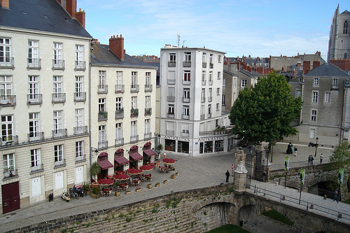
The first major expansion of the city took place in the 18th century. It was at this time that the Feydeau Island was subdivided, then that the architects Jean-Baptiste Ceineray then Mathurin Crucy traced the quays (Brancas, Flesselles, Tremperie, Port-Maillard, the Saint-Pierre and Saint-André courtyards ( characteristic residential complex of the time), the Places Royale, Graslin and the Cours Cambronne, where the theater and the Stock Exchange were built. The current center is articulated around a spinal column which is the east-west axis: from the cathedral, crossing rue de Verdun, rue de la Marne, rue d'Orléans, rue Crébillon and ending on place Graslin.The 18th century marked the triumph of the neoclassical style in the city.
Large rectilinear arteries lined with buildings appear with in particular the rue de Strasbourg: a “Haussmannian” breakthrough. Apart from this case, the center expanded concentrically in the 19th century. Around the Jardin des Plantes and the Museum of Fine Arts to the east is the Saint-Clément/Dalby/Saint-Donatien complex, around the old courthouse to the north are the Hauts-pavés/Viarme districts /Saint-Félix, for the sector of the Dobrée museum and the Notre-Dame-de-Bon-Port church to the west, these are the Canclaux and Mellinet districts in particular, as for the Quai de la Fosse, it stretches towards the butte Sainte-Anne and the village of Chantenay. The Madeleine district, landlocked to the fill-ups of the Loire in the 1930s, has kept its “faubourg” aspect.
The historic center is dotted with modern buildings built under the
supervision of the architect Michel Roux-Spitz in charge of the
reconstruction of the city. They took the place of buildings demolished
by Anglo-American bombings in World War II. Rue du Calvaire was widened
and rebuilt according to modern post-war canons: with Place des
Volontaires-de-la-Défense-Passive, it is an interesting example of 1950s
town center planning. To the north of this street, the old Faubourg du
Marchix has been razed to make way for a new district around Place de
Bretagne. These two examples being the work of Michel Roux-Spitz and his
assistant Yves Liberge.
In Nantes, it is therefore not uncommon
to see very old buildings alongside others with typical architecture
from the reconstruction period: for example the Hôtel-Dieu, an imposing
concrete building, faces Feydeau Island.
Beyond the large boulevards surrounding the center are popular and
historically working-class neighborhoods such as Chantenay or Doulon and
other more upscale areas such as the banks of the Erdre, Canclaux or
Mellinet.
Approaching the ring road, we find, among other things,
the HLM districts of the 1950s and 1970s. Twelve priority neighborhoods
have been defined in the municipality of Nantes. Among the most
important are the large group of collectives of Bellevue (shared with
Saint-Herblain), Les Dervallières and Breil to the west; Chêne des
Anglais, Port-Boyer, Bout des Pavés and Boissière to the north;
Bottière, Pin-Sec and Malakoff on the banks of the Loire to the east;
from Clos Toreau to the south.
Bourgeois Nantes stretches out
like a fan from the city center between Erdre and Chézine (apart from
the northern sensitive area) while the working-class districts are
mainly to the south of the Loire and to the west.
The urban
sprawl of Nantes is quite significant, and is characterized as elsewhere
by the development on the outskirts of residential districts with
relatively low buildings but also many shopping centers, tertiary
districts and green spaces. Despite a low density, the city is dominated
by a few high-rise buildings such as the 144 m high Bretagne Tower in
the city center, which is the third tallest office tower in the
province.
One of the biggest urban planning projects the city has
seen was the creation of the Beaulieu district in the 1970s. Only part
of the initial project was carried out, making the district a mainly
residential area. The Tripode, one of the large office buildings in the
district, was destroyed on February 27, 2005, in particular because of
the high rate of asbestos present in its structure.