Location: Hamburg Map
Area: 13,750 ha
Tel. +49 40 428403392
The Lower Saxony Wadden Sea National Park has existed since 1986 and encloses the East Frisian Islands, mudflats and sea marshes between Dollart on the border with the Netherlands in the west and Cuxhaven to the outer Elbe shipping channel in the east. The national park is about 345,800 ha. The national park administration is located in Wilhelmshaven. The Lower Saxony Wadden Sea National Park is part of the UNESCO World Heritage Site together with the Schleswig-Holstein Wadden Sea National Park, the Hamburg Wadden Sea National Park, the Danish Vadehavet National Park and the Dutch Wadden Sea.
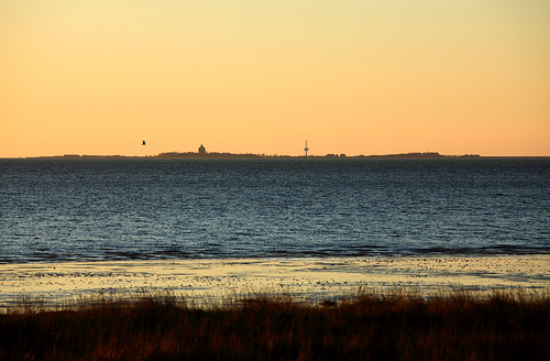
The journey to Neuwerk inevitably always leads via
Cuxhaven (for details see there), from there on
By boat
The shipping company Cassen Eils is the only shipping company from
Cuxhaven to the Neuwerk ferry terminal (one-way trip approx. 1½
hours). Booking, especially for the return trip to the mainland, is
mandatory.
By watt wagon
With the Wattwagen (horse-drawn
carriage) from Cuxhaven-Duhnen and from Cuxhaven-Sahlenburg (shorter
route) you can get to the island comfortably and traditionally in
just over an hour. The horses pull the wagons through knee-deep
channels and over muddy mud.
Providers:
- Werner Stelling
wagon rides.
- Volker Griebel wagon rides
- Hans-Werner Fock
wagon rides
- Wattenpost Jan Brütt
On foot (mudflat hike)
Individual mudflat hike
It is not recommended to hike to Neuwerk
and back to the mainland during a period of low water, as the
walking time is 2½ - 3 hours one way (10-12 km one way depending on
the route). So you either have to take the ferry at least one way,
spend the night on the island or you look for one of the few
suitable days on which you can hike to the island in the morning and
back again in the evening. Within Cuxhaven there are bus connections
between the jetty at Alten Liebe and Duhnen or Sahlenburg, the
starting points of the two mudflat routes.
- To the tide
calendar: In addition to the normal tides, mainly inform about the
weather (risk of thunderstorms; risk of fog). Plan the tour in time
so that you have reached your destination at low tide if possible.
- Attention: The normal tides can be influenced by special
circumstances (e.g. strong wind towards land). The water level
forecast for the Elbe area of the BSH provides information about
this (with data for Cuxhaven and Neuwerk).
- Good to know: There
is a foot washing point on Neuwerk at the entrance to the National
Park House.
- If careless hikers should be surprised by the tide,
they will find protection in three lifebuoys along the mudflat path.
At the top of these beacons, a space designed as a "Faraday cage"
offers protection even during thunderstorms.
Guided mudflat
walks
There are also guided mudflat hikes in groups on the
Cuxhaven - Neuwerk route (for those who do not trust themselves to
plan an individual hike). Advantage of the tour (in addition to the
care of the guide): On the tour you learn a lot of interesting facts
about the mudflat habitat.
Habitats to be protected in this national park include the mudflats,
sandbanks, salt marshes, beaches, dunes and estuaries into the North
Sea. Particular attention is paid to the fauna and flora typical of the
Wadden Sea.
The North Sea coast is unusually flat. The sea floor
sometimes drops only a few centimeters per kilometer. Twice a day the
tide carries sand, clay and silt into the Wadden Sea area. Dunes
characterize the coast, which the wind builds up from the fine grains of
sand from the exposed mudflats.
The Wadden Sea is the second most
productive ecosystem after the tropical rainforest - only this surpasses
the Wadden Sea in terms of living biomass. Life forms found in the
Wadden Sea include diatoms, snails, worms, mussels and shrimp. A typical
inhabitant of the sand flats is the lugworm, which lives in a U-shaped
tube under the flat surface.
Up to 4000 animal and plant species
are specialized in the Wadden Sea habitat, which is unusually rich in
food. For example, shelducks live off the mudflat snails, which can be
found in their hundreds of thousands on the surface of the mudflats. The
north-west European shelduck population, which numbers around 180,000
birds, also spends its moulting period between July and September in the
Wadden Sea. About 200,000 eider ducks also spend their moulting time
here; about 1000 pairs of eider ducks use the mudflats of the North Sea
as breeding grounds. Most of them breed on the island of Amrum.
At the same time, the Wadden Sea is a resting area for breeding birds
from Nordic countries, which eat up the fat reserves they need for
successful breeding. Around 10-12 million waders, geese, ducks and gulls
can be found in the entire Wadden Sea.
Seals can be observed on
the sandbanks in the Wadden Sea and salt marshes, sandy beaches and
dunes border the Wadden Sea. On the salt marshes, which serve as
breeding grounds for avocets and terns, sea holly and sea lavender bloom
in summer. The most typical plant in the dunes is the beach grass, which
strengthens the dunes with its extensive root system.
Since the Ramsar Convention of 1971, today's national park areas and
the Dollart have been protected as wetlands of international importance.
In 1979, Hans-Joachim Augst and Holger Wesemüller presented an
expert opinion that developed a zoning model based on the differences in
importance of various areas of the Wadden Sea that were worthy of
protection. The Lower Saxony regional planning program of 1982 then
specified the development of a nature park "East Frisian Islands and
Coast" as a state planning goal. This idea was taken up in 1983, and
planning for a comprehensive national park began. At the beginning of
1984, the cabinet decision was made to fundamentally agree to a national
park, and on January 1, 1986, the national park ordinance came into
force.
According to the UNESCO program "man and biosphere", the
entire national park was recognized as a biosphere reserve in 1992, see
Lower Saxony Wadden Sea Biosphere Reserve.
The national park has
been a registered fauna-flora-habitat area since 1997 with Zones I and
II according to the European Habitats Directive. Since 2000 it has also
been a registered bird sanctuary under the European Birds Directive. The
national park is therefore part of the Natura 2000 network and
protection regime.
Initially, the national park was protected by
an ordinance that came into force in 1986, which was replaced by a state
law in 1999. On July 11, 2001, the law on the Lower Saxony Wadden Sea
National Park (NWattNPG) was promulgated: Numerous areas for tourism
were removed from the scope of the national park or downgraded in the
zoning. For this purpose, a purely marine area off the islands of Borkum
and Baltrum and the former nature reserve in the eastern part of the
Dollard were included in the national park. This increased the protected
area from 240,000 hectares to almost 280,000 hectares.
In January
2002, the East Frisian nature conservation group Wattenrat Ost-Friesland
lodged a complaint with the EU Commission in Brussels against the
removal or downgrading of more than 80 sub-areas for tourism, mainly on
the East Frisian islands. The complaint was incorporated by the
Commission into ongoing infringement proceedings against Germany
(complaint number 2002/4099, file no.: ENV A2/MD/avdm D(2005)6096).
After more than four years, in a letter dated October 25, 2006, the EU
Commission informed the Wattenrat-Ostfriesland that the complaints
procedure had been closed "since the Federal Republic of Germany has
meanwhile designated sufficient areas as FFH proposal areas" (Ref.: ENV
A.2/MD/pd D 2006 21119).
In July 2006, the twentieth anniversary
of the Lower Saxony Wadden Sea National Park was celebrated on the beach
in Neßmersiel on the initiative of the state of Lower Saxony. The nature
conservation associations in Lower Saxony, under the leadership of the
WWF, accompanied the 20th anniversary with a critical "National Park
Balance Sheet", which shows in detail the many conflicts of use.
This national park is listed by the IUCN in “Category II, National
Parks”. However, it should be noted that the World Database on Protected
Areas (WDPA) is based on the reports from the individual countries and
there is currently no independent verification of the assigned
categories, which can lead to errors in the listing. It is also
important to know that categories I through VI reflect the goals of
protected area management, but are not an indicator of quality, or
success or failure. However, the "European Environment Agency" (EAP)
lists the Lower Saxony Wadden Sea National Park in "Category V,
Protected Landscape", i.e. roughly a landscape protection area (written
information from the UNEP World Conservation Monitoring Center
(UNEP-WCMC) in Cambridge from 23 October 2008).
In 2008 the
Wadden Sea in Lower Saxony and Schleswig-Holstein was proposed to UNESCO
for nomination as a UNESCO World Heritage Site. The President of the
German UNESCO Commission from 2003 to 2014 was Walter Hirche (FDP), who
was Economics Minister in Lower Saxony from 2003 to 2009.
In the
run-up to the nomination of the Wadden Sea as a UNESCO World Heritage
site, a senior officer from the Switzerland-based International Union
for Conservation of Nature (IUCN) and representatives of the tourism
industry in and around the Wadden Sea made an expert visit in the summer
of 2008. From newspaper reports that appeared at the same time and
later, however, it emerged that the UNESCO nomination should primarily
serve as an "internationally effective marketing instrument for the
tourism industry" and that additional restrictions due to nature
conservation measures were not associated with it.
"We have to
make the UNESCO World Natural Heritage known at home and abroad and
point out its importance as a unique ecosystem with special
biodiversity," says Friesland's District Administrator Sven Ambrosy. So
far, the Lower Saxony Wadden Sea National Park has had a comparatively
low level of awareness despite its age.[...] Only if a region is proud
of itself and loves it can it market itself."
“In the opinion of
the IHK, this international award also offers great opportunities for
tourism. "The region can and must grow with the pound," explained the
head of the Chamber of Industry and Commerce. Should the Wadden Sea
actually be awarded this title, the entire North Sea coast would receive
a new trademark. Kolck emphasized that the recognition as a natural
world heritage site does not entail any change in the current legal
situation.”
On June 26, 2009, the Lower Saxony Wadden Sea
National Park, together with the Dutch Wadden Sea and the
Schleswig-Holstein Wadden Sea National Park in Seville, received
recognition as a UNESCO World Heritage Site. The Hamburg Wadden Sea was
recognized as a UNESCO World Heritage Site on June 27, 2011. Denmark has
so far refused to nominate its tidal flats.
On February 19, 2010,
the law on the Lower Saxony Wadden Sea National Park was amended again
and adapted to the Federal Nature Conservation Act. As a result of the
amendment, the national park was enlarged by approx. 670 km², mainly in
the Cuxhaven area and in the Elbe-Weser estuary. The total area grew to
almost 3500 km².
On June 10, 2021, the Lower Saxony state
parliament changed the law again and added regulations on the status of
the national park as a UNESCO biosphere reserve and as part of the
UNESCO World Natural Heritage.
In the past, nature conservation associations and groups have
critically monitored the development of the national park in five-year
reports. At that time, the associations worked together in the "AG
National Park" under the leadership of the WWF.
On the occasion
of the 25th anniversary of the Lower Saxony Wadden Sea National Park in
2011, NABU criticized the fact that parts of the area were not
effectively protected despite being designated as a national park and
world heritage site, and called for clearer protection for all three
Wadden Sea National Parks. In the past 25 years, despite formal
protection, 19 out of 33 bird species have become rarer, including
oystercatchers and shelducks. The national park lacks a professional
ranger system to look after the protected areas. A North German concept
for connecting offshore wind farms to the grid, littered beaches and the
planned deepening of the larger rivers Ems, Weser and Elbe are also
problematic.
Fishing in the national park is unrestricted, even
in the strictest protection zones. The Pacific oyster released by
fishermen is spreading in the park. For the catch of one kilo of North
Sea shrimp, seven kilos of bycatch in the form of small fish, starfish
and other sea creatures are brought on board the cutter. This by-catch
is dumped dead or injured back into the sea and only serves as food for
seagulls. Despite the ban, fireworks are started every year without
sanctions. On the islands in the park, stray house cats kill many birds,
including rare species such as black-tailed godwit and Kentish plover.
Wind turbines were built close to the border of the national park. As on
all sea coasts in Central Europe, large amounts of plastic waste are
washed ashore and the eutrophication caused by the nutrient load of the
North Sea also affects the park. Ducks and geese may still be killed
when hunting migratory birds. 21 kite spots for kitesurfers have been
designated in the national park, which leads to the disturbance of the
resting birds. In the salt marshes there are drainage ditches every ten
meters, which led to a massive decline in the typical salt marsh plants
and the former bird and insect diversity there.
The national park is divided into three zones with different
protection statuses.
Zone I: The most strictly protected quiet
zone makes up around 68.5 percent of the area and may only be entered in
a few areas all year round, for example on marked paths or as part of
guided mudflat hikes.
Zone II: The intermediate zone makes up 31.0
percent of the area and, with the exception of designated bird
sanctuaries, may be entered all year round on designated paths. During
the main breeding, feeding and resting season of the birds in the course
of the year from April 1st to July 31st, these areas may only be entered
on marked paths.
Zone III: The recreation zone makes up the smallest
area at 0.5 percent and is mainly used for people to relax.
Due to the occurrence of numerous rare and endangered species, the
Lower Saxony Wadden Sea National Park is subject to area protection.
Fauna Flora Habitat Area
The FFH area National Park Lower Saxony
Wadden Sea with the area number 2306-301 has an area of 276,956.22 ha
and is described as a coastal area of the North Sea with salt marshes,
tidal flats, sandbanks, shallow bays and dune islands. Geest cliff
overlaid with shifting sand with coastal heaths, grasslands and dune
forests. Parts of the Ems and Weser estuaries with brackish mud flats.
The recreation zone of the national park (approx. 2000 ha) is not part
of the area registration.
The following habitat types are
protected:
Sandbanks with only a weak constant overflow from sea
water
estuaries
Vegetation-free mud, sand and mixed mudflats
Coastal lagoons (shore lakes)
Flat large sea inlets and bays (shallow
water zones and seagrass meadows)
reefs
Pioneer vegetation with
Salicornia and other annual species on mud and sand (Saphirewatt)
mudgrass stocks (Spartinion maritimae)
Atlantic salt marsh
(Glauco-Puccinellietalia maritimae)
primary dunes
White dunes with
beach grass Ammophila arenaria
Fixed coastal dunes with herbaceous
vegetation (grey dunes)
Decalcified dunes with Empetrum nigrum
Fixed decalcified dunes of the Atlantic zone (Calluno-Ulicetea)
Dunes
with Hippophaë rhamnoides
Dunes with Salix repens ssp. argentea
(Salicion arenariae)
Forested dunes of the Atlantic, Continental and
Boreal regions
Humid dune valleys
Degraded raised bogs that can
still be renatured
Peat bog slugs (Rhynchosporion)
Appendix II
species are protected: twait shad, river lamprey, sea lamprey, gray
seal, harbor porpoise, harbor seal, narrow whorl snail, marsh glossweed
The Annex IV species are protected: Natterjack toad
The bird sanctuary Lower Saxony Wadden Sea and adjacent coastal sea with the area number 2210-401 has an area of 354,882 ha and is described as a coastal area of the North Sea with salt marshes, tidal flats, sandbanks, shallow bays and dune islands as well as parts of the Ems estuary with brackish water tidal flats and part Dollart. Water areas bordering the open sea with a depth of 10-12 m in the 12 nautical mile zone. It is a wetland of international importance for bird protection, an outstanding Lower Saxony breeding and resting area for over 30 species listed in Appendix I of the EU Birds Directive and numerous other water and wading bird species.
The national park also includes the areas of the islands of Borkum,
Lütje Hörn, Memmert, Juist, Norderney, Baltrum, Langeoog, Spiekeroog,
Wangerooge, Minsener Oog and Mellum (from west to east).
Large
parts of the islands belong to protection zones I+II, the uninhabited
islands (Lütje Hörn, Memmert, Minsener Oog and Mellum) may not be
entered without permission all year round (protection zone I).
Only the actual settlement and infrastructure areas on the inhabited
islands are completely exempt from national park protection. Within the
scope of protection zone III, there is also relatively little protection
for certain island areas that are primarily used for recreation (e.g.
designated bathing beach sections).