Location: Lower Saxony Map
Area: 247 km²
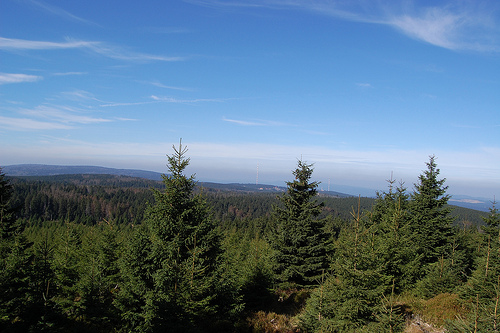
Harz National Park (Nationalpark Harz) is a protected natural area located in the Lower Saxony region in Germany. Harz National Park covers an area of 247 km². Unlike many other nature reserves these lands are virtually uninhabited by men other than several dozens of park rangers.
The Harz National Park is
located in the western part of the Harz (see Upper Harz) and extends
from Wernigerode and Ilsenburg in the north to Herzberg and Bad
Lauterberg in the south. In its peripheral areas, the park is
located at heights of 230 m in the north to 270 m in the south and
rises to 1141.2 m above sea level. NHN at the summit of the Brocken.
The headwaters of several rivers such as the Bode, the Oder or
the Ilse are located in the area of the national park. The Oder
flows through the Oderteich and feeds the Oder dam located on the
southeastern border of the park. Other dams and standing waters
within or on the edge of the national park include the
Eckertalsperre and the Silver Pond. The highest peaks are the
Brocken, the Bruchberg and the Achtermann.
Today's
cross-border Harz National Park was created on January 1st 2006
through the merger of the Harz National Park in Lower Saxony and the
Hochharz National Park in Saxony-Anhalt. Since the merger, Andreas
Pusch has been the head of the large conservation area.
The
Hochharz National Park was set up on October 1, 1990 two days before
German reunification on the basis of a Council of Ministers
resolution of the GDR government on the national park program. The
park encompassed the eastern high Harz around the Brocken between
Eckertalsperre, Hohnekamm and Schierke, later extended to Ilsenburg.
The region is characterized by little-touched flora and fauna, which
is mainly due to the so-called "Brocken Urwald" forest, which has
not been used for forestry for centuries, and the location directly
on the former German-German border. In the GDR era, the Brocken was
accessible with an easy-to-obtain pass until 1961. From August 13,
1961, it became a restricted area, so it was no longer used for
tourism. Since the 1970s, forest problems such as bark beetles or
fungal infestation have also appeared in the Harz. In the course of
the spirit of optimism at the time of reunification, they were also
the ones who initiated the establishment of the national park. On
January 1, 1991, the national park administration in Wernigerode
began its service under the direction of Hubertus Hlawatsch. Peter
Gaffert acted as Hubertus Hlawatsch's successor from 1995 until the
merger with the western Harz National Park (2006).
The Lower
Saxony part of the park was launched on January 1, 1994 after four
years of preparation. Wolf-Eberhard Barth was the founding director.
Although the two countries have been talking about a joint national
park project since the fall of the Wall, it took another twelve
years to implement.
The Harz National Park belongs to the
European umbrella organization EUROPARC Federation, a network of
national parks, biosphere reserves and nature parks. Among other
things, he deals with the exchange of information, training, public
relations and lobbying. The German section EUROPARC Deutschland e.
V. of this umbrella organization has also organized the network of
many large protected areas in Germany.
In 2005 the national
park was included in the European Charter for Sustainable Tourism in
Protected Areas.
The national park currently employs 160
people who work in the national park administration offices in
Wernigerode (headquarters), the branch in Sankt Andreasberg OT
Oderhaus and in the area. The head office is home to the following
departments: general administration, nature conservation, research
and documentation and public relations. The forest treatment and
game population regulation department is located in Sankt
Andreasberg. The employees of the national park guard, who are also
known as rangers, give tours and take on tasks in public relations
and environmental education, right through to looking after
information points and national park houses.
In addition, the
National Park Education Center is located in the National Park House
in Sankt Andreasberg. The education center and the rangers work
closely together. The main task of the education center is to create
wilderness areas.
Brocken
At 1142m, it is the highest mountain in the
Harz Mountains and is very popular.
Turf house
Location:
Torfhaus is centrally located on the B4 in the national park. The
highest settlement in the Harz Mountains (located at 811m) is the
starting point for the popular hike to the Brocken via the Goetheweg.
From here you also have a beautiful view of the highest mountain in the
Harz Mountains.
National Park House - Collection of the natural and
animal world of the national park
Aft man height
Viewpoint:
The 926m high cliff is a beautiful viewpoint, which is about 5km
north-east of Braunlage. The approximately 15 - 20m high, treeless crest
rises ruggedly above the forest. It offers a beautiful view over the
forests of the Harz National Park. Brocken, Bruchberg and Wurmberg can
also be seen.
Access: car parking spaces on the B4 near Oderbrück or
Königskrug; hiking trails lead from here to the granite peak (approx. 2
km one way); From Königskrug, cyclists can ride on roads just below the
crest.
Wolf station at Bruchberg
The cliffs of the Wolfswarte
are about 3km west of Torfhaus. From a height of 918m you have a
beautiful view over large parts of the western and high Harz Mountains,
you can also see the Brocken. Except at the Wolfswarte, the mountain is
not accessible to hikers. When there is a lot of snow, the Wolfswarte is
only accessible with cross-country skis, as the hiking trails are not
cleared or used as cross-country ski trails. Directly on the cliffs
there is no protection from the weather. If there is a risk of
thunderstorms, you should refrain from hiking to the fairly exposed
Wolfswarte.
The stamp office no. 135 ("Wolfswarte") of the "Harz
Hiking Needle" is not directly on the cliffs. The stamp box is at the
Butterstieg/Oberer Bruchbergweg junction, about 250m north-west below
the rocks. A few meters further you will also find a pretty, fairly new
mountain hut ("Altenauer Hütte").
Access ways:
From Torfhaus
you can get to the cliff if you follow the path with the "red bar"
(entrance on the road to Altenau (about 3 km easy from Torfhaus with
about 150 meters in altitude, walking time: 40 - 60 min, bumpy in parts,
Sturdy shoes are therefore best.) From Torfhaus, the hike along the
fairytale trail between Torfhaus and Oderteich see Oderteich with a
visit to the wolf watchtower is also attractive.
From Altenau it is
almost 6km up to the Wolfswarte via the path on the Dammgraben and the
Butterstieg. Depending on where you start in Altenau, the climb is
around 400 to 450 meters in altitude. The steep Buttersteig in the last
part of the ascent is particularly attractive. Sturdy shoes are required
for the bumpy, partly rocky mountain path.
In winter, the fairly
demanding, moderately difficult Altenau-Torfhaus trail leads past the
Wolfswarte. However, the Wolfswarte itself has to be climbed via deep
hiking trails, as the trail does not lead directly past the cliff.
However, a real pioneering spirit is guaranteed to arise when you fight
your way uphill on a beautiful winter day after lots of fresh snow over
the possibly even untrodden snowdrifts on the hiking trails. You will be
rewarded with a great panoramic view. However, if you are the first to
reach the top, there is a good chance that the loneliness will soon be
over. The vantage point is clearly visible from the cross-country ski
trail, so that latecomers are of course happy to use the freshly laid
track. Alternatively, you can reach the Wolfswarte by ski from the
Stieglitzecke.
Oder pond
The reservoir, which is rather small
by Harz standards, is located at over 700m altitude on the
Harzhochstraße (B 242) in the area of the B 4. Swimming is permitted at
your own risk (no lifeguards) in the southern area of the body of water,
but the water is quite fresh. There is a parking lot for hikers in the
area of the dam wall on the B 4. You can also get to the Oderteich with
regular buses that run on the B 4 or Harzhochstraße (B 242).
History - The Oderteich is the largest reservoir in the Upper Harz water
system and was once created to supply water to the water-driven conveyor
systems in the pits of St. Andreasberg. This historic facility still
functions today. However, the water is no longer used to drive the art
of running, but is converted underground into electrical energy with the
help of turbines and generators. If you want to follow the course of the
water, you can walk or cycle along the Rehberger Grabenweg in the
direction of St. Andreasberg. Here, in the Samson pit, a giant water
wheel with running art can be viewed on a guided tour.
Circular
path around the Oderteich - A 4 km long hiking trail circles the
reservoir (walking time around 1.5 hours). For a detailed description of
the route with background information, see the National Park leaflet on
the circular route.
Hike on the fairy tale trail between Torfhaus
and Oderteich - An attractive hiking route is the fairy tale trail to
the Torfhaus settlement. The rustic route leads slightly uphill north of
the Seerundweg through the wild forest landscape of the Hochharz. The
path runs over small bridges and footbridges through partly boggy
terrain. In Torfhaus you can then visit the National Park House, stop
off and enjoy the view of the Brocken on a clear day. If you feel like
it, you can also make a short detour (just under 1km) via the Goetheweg
to the Moorsteg on the Großer Torfmoor, which is well worth seeing. At
the Oderteich it is a good idea to visit one lake shore on the way there
and back. In this way, you get to know the circular route around the
lake completely.
Distance there and back around 12 km (including
detour to the Moorsteg in Torfhaus and completely around the Oderteich).
If you feel like it, you can still visit the Wolfswarte. Then around
16km, which are a bit hilly though). Waterproof, sturdy shoes are best,
as the paths are bumpy and wet after rain.
Upper Oder Valley
The
deeply cut upper Oder valley lies between Braunlage and St. Andreasberg.
The valley can be explored on hiking trails (roadways). The 2 Hahnensee
cliffs with a beautiful view of the wooded valley are particularly worth
seeing. The vantage point can be hiked from Braunlage (about 3km easy
with about 200 meters in altitude).
A beautiful hiking
destination is also idyllically situated on a forest clearing in the
valley floor
Forest restaurant Rinderstall
Hanskuehnenburg
Hanskuehnenburg. Tel.: (0)170 8 64 03 48, email:
info@hanskuehnenburg-im-harz.de. The forest restaurant ("Baude")
Hanskuehnenburg is located on the Hanskuehnenburg summit on the ridge
"Auf dem Acker" in the western part of the national park. The mountain
hut is 811m above sea level. NN is the highest of all Harz huts and
offers a wide view of the surrounding mountain towns and the peaks of
the western and upper Harz mountains, such as e.g. B. the Brocken and
the Big Tubers. 300m northeast of the restaurant on the so-called
Reitstieg you will also find the "Hanskuehnenburg-Klippe", which is well
worth seeing. The Hanskuehnenburg is only accessible on foot or by
bicycle. In the mountain restaurant you can get some small hot and cold
dishes, drinks and coffee and cake. Sunny terraces outside and the
fireplace inside make the cottage a good resting place in any weather.
Open: daily 9am-5pm, Nov-Mar until 4pm. Thursday rest day (except public
holidays).
From the Stieglitzecke car park (B242)
From the
Stieglitzecke car park on the B242 between Clausthal-Zellerfeld and
Sonnenberg, the best-known and least steep path leads to the
Hanskuehnenburg. The route is easy to manage, as the parking lot is
already at an altitude of about 800m. There is also a bus stop here. It
is a total of 7km one way to the mountain hut, back a little over 14km.
If there is a risk of thunderstorms, you should not tackle the hike, as
you will be crossing a partly forest-free area.
From the
Stieglitzecke there are two paths that lead to the Hanskuehnenburg:
The Reitstieg along the north-western side of the ridge is swampy and
bumpy in large sections. After long periods of rain, many sections of
the path can be really difficult, especially due to the very muddy
ground. It should only be walked on with ankle-high hiking boots. This
trail is not suitable for prams or people with mobility impairments. Due
to the cliffs and the views towards Clausthal-Zellerfeld, this is the
nicer section, but you should plan a much longer time for the way than
on the Ackerstraße.
The Ackerstraße runs south-east of the ridge and
is almost entirely a wide, finely graveled forest road that is very easy
to walk on and almost without gradients. Only the last 500m lead up very
steeply in a few turns to the Hanskuehnenburg. At the beginning, the
European long-distance hiking trail E6 runs along this route, but leaves
the Akerstraße about halfway and leads down into the valley to Sieber.
The path on the forest road leads through spruce forest and is therefore
more monotonous than the Reitstieg, but much easier to manage.
If you
want, you can of course also do a circular hike, which is a little over
14km in total.
In winter, with good snow conditions, you can also
reach the mountain hut via the 16 km long farm track, which also starts
at the Stieglitzecke car park.
From Lonau
From Lonau, a district
of Herzberg am Harz, two 7.5 km long, relatively easy hiking routes lead
to the Hanskuehnenburg.
Kirchtal Lonau car park Through the
Kirchtal: Asphalted forest road with a constant incline. Groomed trail
in winter.
Mariental Lonau car park Through the Mariental:
relatively easy ascent to the Hanskuehnenburg on a wide forest road. In
winter, the route is partly a toboggan run.
From Sieber
Coming
from Sieber, you have to climb up to the Hanskuehnenburg on the direct
route of a little more than 5km, 600 meters in altitude. However, there
are numerous ways to climb up from the Siebertal to the ridge. It is
somewhat detoured via the European long-distance hiking trail E6, from
which you turn left when you arrive on the Ackerstraße and follow the
forest path to the last climb to the Hanskuehnenburg (about 8 km one
way, 700 m altitude difference).
Other ways to Hanskuehnenburg
From Riefensbeek-Kamschlacken there is an approx. 5.5 km long path from
the parking lot on the B498 and a very steep, approx. 3.5 km long path
directly from the town center to the Hanskuehnenburg (the shortest way
up).
From the Sösetalsperre you get from the parking lot at the
Vorsperre in about 5.5km to the hill, first relatively lax at the
Riefensbeeker Schacht, along a torrent, then later steeper uphill. From
the Sösestaudamm (car park) it is about 8km on the Harzer Baudensteig.
At 11km, the longest path leads from Osterode to the Hanskuehnenburg,
past the Seiler cliffs and later also on the Harzer Baudensteig
Rabenklippe with lynx enclosure
The Rabenklippe is about 550m above
the Eckertal and is an attractive hiking destination from Bad Harzburg.
There is a restaurant on the cliff. The granite rock of the Rabenklippe
is partly accessible. From the cliff you have a view over the Ecklertal,
which on a clear day extends to the Brocken.
Forest restaurant
Rabenklippe
In the area of the Rabenklippe there is a luch
enclosure of the Harz National Park. Here the shy animals u. viewed from
a covered observation deck.
Access: From Bad Harzburg-Stadtmitte
it is a one-way walk of around 5 km with around 300 meters in altitude.
If you use the cable car on the Burgberg uphill, you can comfortably
cover 186 meters in altitude in the historic cable car from 1929:
Edit Burgbergbahn info
If you are arriving by car, you will find
a parking lot directly at the valley station of the cable car. A
national park bus line also runs directly to Rabenklippe.
Ilsetal
The lively Ilse mountain stream flows through the romantic forest
valley. In the middle of the Ilsetal, the torrent plunges into the
cascading Ilse Falls. Access to the valley is from Ilsenburg on hiking
trails. For pedestrians there is a near-natural hiking trail, mostly
directly on the torrent. Part of this path is anchored in the slope with
bridges. There is also a gravel road for cyclists. The Ilsenburger
Chaussee, built between 1830 and 1838, leads over the Gelben Brink to
the Brocken bed on the Brockenstraße, the Chaussee is closed to motor
vehicle traffic. At the top of the Brocken bed at an altitude of 900m,
the approximately 300m long jungle climb opens up the jungle and the
headwaters of the Ilse. A popular hiking route to the Brocken also leads
through the Ilsetal.
Wilder Harz: Rocky cliffs in the
Renneckenberg and Hohnekamm area
In its east slope, the
"Brockengebirge" shows its particularly wild side. There are numerous
rocky cliffs in the Renneckenberg and Hohnekamm mountain ranges. Some of
the cliffs are in the sensitive core zone of the national park and
therefore cannot be climbed. However, the most attractive rocks are
accessible by paths. Well-known hiking destinations here include the
Obere Zeterklippe, the Leistenklippe and the imposing Ottofelsen.
In the Renneckenberg area
Obere Zeterklippen (930 m), also called
"Große Zeterklippe", is the most famous vantage point in the
Renneckenberg area. Anyone who has conquered the staircase on the rock
formation opens up an almost unobstructed panoramic view of the
wilderness of the Hochharz. To the west, the view goes over to the
nearby Brocken. In the north-west the Scharfenstein can be seen, in the
north the Harz foreland and others. with Wernigerode. To the southeast
you can see over to the Hohnekamm with the border and ledge cliffs. At
the entrance to the rock there is also the stamping point no. 10 "upper
Zeterklippe" of the "Harz hiking needle".
Access: The cliff is
only accessible via hiking trails, which are also marked as MTB routes.
From the track on the Yellow Brink, it's 1.2km easy (connect touring
bikes to the gravel road). The stony mountain hiking trails are not
suitable for prams. There is also a short wooden walkway in a swampy
area.
Lower Crying Cliffs. (about 830 m) – These cliffs are located
on the Zeterklippenweg north of the Upper Zeterklippe. location of a
shelter. Also noteworthy view across to the Brocken.
sun cliffs. 749m
- Beautiful western view of the Brocken and the upper and lower
Zeterklippe. The rocks are largely off the beaten track. According to
internet sources, climbing the cliff is not without danger.
Access:
According to OpenStreetMap, a 400m long hiking trail leads from the road
to the east as a dead end to the cliffs.
Brocken children. To be
found near the Brockenstraße at the Brocken bed. This nice, smaller rock
formation lies overgrown in the high forest. So there is no prospect.
chapel cliff. According to the National Park trail plan, the rocks near
the Glashüttenweg are accessible via an unsigned hiking trail.
Hohnekamm
groin cliff. (901 m) Attractive, very popular summit point
for hikers in the Hohnekamm. The cliff, which is equipped with a
staircase, is relatively well known. From up here you have an attractive
panoramic view over the wilderness of the Hochharz. You can see, among
other things, Wernigerode, the Wurmberg and of course the Brocken.
Stamping point no. 15 of the "Harz hiking needle" is located on the
approach to the cliff.
Access: Access is only possible via hiking
trails that are not suitable for pushchairs.
Grenzklippe and
Bärenklippe - both cliffs are not accessible because they are in the
core zone of the national park. The "Hohnekamm-Gratweg" in the direction
of Landmannklippe passes quite close by.
Hell Cliff - The rock is in
the core zone of the national park and cannot be hiked.
Trudenstein.
Located directly on the busy Glashüttenweg. The rock can be easily
climbed via a steel staircase. Beautiful view over the vast forests of
the eastern Harz and also across to the Wurmberg.
farmer's cliff.
Rock cliff off the tourist trail at the northern end of the Hohekamm.
The rock has no stairs and is probably only safe for climbers who are
more experienced. A summit book awaits you at the top. Nice view u. a.
to Renneckenberg and the Brocken. Access is probably possible via the
Hölle-Lehmann path from Schierke. Alternatively, you can probably also
reach the cliff via the "Hohnekamm-Gratweg" from the Leistenklippe. From
the north-west from the Weringerode area, the stairway leads relatively
close to the rock.
Access: The small dead-end path to the
Landmannklippe branches off from the stairs (at the sign with a dead-end
sign "Landmannklippe"). There are probably red arrows to point you to
the rock. Branch path is included in the national park plan and may be
used with it.
Otto Rock
The much-visited Ottofelsen
wikipediacommons is already to the east outside the borders of the
national park. Due to its prominent position among the rocky cliffs of
the Harz Mountains, it should nevertheless be briefly introduced here.
On a hike from Wernigerode in the rock world of the national park you
can still visit the Ottofelsen well. The 36m high rock has had a secured
steel staircase since 1896. The staircase was renewed in 1990. The
striking cliff with its characteristic wool sack weathering is very
popular. The rock also attracts climbers.
more destinations
Geopark Harz - Braunschweiger Land - East Westphalia. The Geopark
includes nature parks and other protected areas under nature
conservation law in the Harz Mountains, in the Braunschweiger Land and
Ostfalen with Elm and Drömling in an area of about 100 × 120 kilometers.
Hiking - on the Brocken. Most of the ascents to the Brocken run in
the National Park (for detailed information, see the Brocken article).
See also sections above for hiking suggestions to sights.
Cycling and
mountain biking - is only allowed on the paved paths. Some hiking
trails, such. For example, the New Goetheweg on the Brockenbahn is
closed to bicycles. Please be considerate of hikers. It's best to ring
the bell early.
Cross-country skiing in winter - see topic article
"Winter sports in the Harz Mountains"
Bathing in the Oder pond
A nostalgic way of getting here is to take the
Harzquer / Brocken Railway from Wernigerode or Nordhausen, for
detailed information, see the Brocken article.
Suitable
places for arrival and, if necessary, accommodation are in Lower
Saxony: Bad Harzburg, Altenau, St. Andreasberg, Herzberg and
Braunlage, in Saxony-Anhalt Ilsenburg and Wernigerode. Specific
travel information can be found in the local articles.
Cyclists on the Weser-Harz-Heide-Radweg pass the national park area
on the section from Herzberg to Riefensbeek-Kamschlacken.
The best way to explore the national park is on foot. In winter,
cross-country skis are also a popular means of transport due to the
attractive network of trails. In many places there are parking
spaces for hikers from which you can take day trips. The park can
also be easily reached by environmentally friendly local public
transport. The extensive network of hiking trails in the area of
the national park is well marked. Nevertheless, it makes sense to
use a hiking map so that you can orientate yourself better.
There are no trails in the national park. In order to protect
nature, entering the forest or park away from designated paths /
trails is not permitted. Instructions from rangers in the area must
be followed in this regard. In the park live z. Sometimes very shy
wild animals such as the lynx and the wild cat, which need
appropriate retreats. Wild animals, which are often "frightened" in
winter, use an unnecessarily large amount of energy to escape from
humans in deep snow. If this happens more often, such "overactive"
escape behavior can lead to death, especially in severe winters.
Even supposedly rare individual disturbances on disused, closed
hiking routes therefore add up.
Notes on Openstreetmap in
this regard: In the free wiki world map, some paths are shown in the
park area that have been closed due to the nature conservation
reasons mentioned above. For "normal users" of Openstreetmap,
however, these routes may not be immediately recognizable as blocked
routes on the map. The symbol for "blocked route" in
Openstreetmap-Mapnik is an overlaid, wider red dashed line. This
applies for the quiet zones on the much-visited Brocken. These
routes are usually no longer included in regular hiking maps.
There are a few inns and excursion restaurants that are located
directly in the park area and are good destinations for excursions.
These include:
On the Brocken:
Brockenwirt, Brocken plateau,
38879 Schierke. Tel.: + 49 3 94 55 120, fax: +49 3 94 55 12 100, e-mail:
info@brockenwirt.de.
Waldgaststätte Rinderstall, Rinderstall 1, 37444
St. Andreasberg (in the valley floor of the Oder valley). Phone: +49 55
82 740, fax: +49 55 82 80 99 19, email:
waldgaststaette-rinderstall@t-online.de. Open: public holidays;Nov-Apr.
10:30 a.m. - 5:00 p.m., summer time 10:30 a.m. - 5:30 p.m., closed on
Wed.
Gastronomy within closed locations, see the relevant local
article.
The guest beds in Torfhaus are centrally located in the park.
However, there is hardly any other infrastructure here, (kiosk,
globetrotter store available) for example shopping.
Places in or
on the edge of the national park:
Altenau
Bad Harzburg
Braunlage
Herzberg am Harz
Ilsenburg
St Andreasberg
Schierke
Wernigerode
Entering the primeval forest areas in the park is to be avoided
during a storm, as there is a risk of death from felling. In general,
there is always a higher risk of branch breakage in natural forests than
in commercial forests due to the high proportion of deadwood. It is also
important to note that no campfires may be lit in the national park!
Attention: Simple, wooden shelters without an iron air-termination
rod on the roof, lightning conductors and ring anchors in the foundation
do not offer sufficient protection against thunderstorms. On the
contrary: Exposed huts can develop into deadly traps during
thunderstorms. In this regard, unfortunately, tragic accidents have
already been recorded in other regions.
During a tour of the
Brocken in March 2012, there were unfortunately no lightning protection
systems in the park area, even at the exposed shelters.
Unfortunately, as of February 2013, the subject of "shelters and
lightning protection" is not discussed on the Harz National Park
website. In addition to the hut on the triangular post, the Altenauer
Hütte, which is in much more exposed terrain below the Wolfswarte, also
has no lightning protection. The hut seems to be an almost identical,
newer model of the hut on the triangle pole. In March 2012, no lightning
conductor could be seen at the small pointed gabled hut in the
Brockenstrasse break-bone curve. The same was true for the small pointed
gable hut Eiserner Tisch on the quite high and exposed Hirtenstieg north
of the small Brocken. With regard to the lack of lightning protection
systems at shelters, the Harz National Park is no exception in Germany.
There are no lightning protection systems on almost all wooden shelters
in the low mountain ranges, but also on cycle routes in the valley.
Alpine bivouac boxes, on the other hand, are usually made of metal
from the outset (Faraday cage protection principle).
The numerous nature park centers and ranger stations in the national
park area offer information and places to rest. Some of them can be
approached by car - like the houses in Torfhaus and Sankt Andreasberg,
others you have to hike up or you can take the Brockenbahn there, like
to the Brockenhaus:
1 ranger station at Scharfenstein. Tel.: +49 160
71 48 827. Also rest area with sale of refreshments. Open: Open daily
from 10 a.m. to 4 p.m. Price: Admission free.
2 Ilsetal National Park
House, Ilsetal 5, 38871 Ilsenburg. Tel.: +49 39 452 89 494. Open:
Tues-Sun 8.30 a.m.-4.30 p.m., closed on Mondays (except on public
holidays). Price: Admission free.
3 Brockenhaus. Open: Daily from
9.30am - 5.00pm, 365 days a year. Price: adults €4, children 2€.
4
Torfhaus National Park Visitor Center, Torfhaus 38 B, 38667 Torfhaus.
Phone: +49 53 20 33 17 90, fax: +49 53 20 33 17 919, e-mail:
post@torfhaus.info. Open: April-Oct. daily 9 a.m. - 5 p.m. Nov.-March
Tue-Sun 10 a.m. - 4 p.m., also open on Mondays during school holidays
and public holidays.
5 HohneHof Nature Experience Center, Drei Annen
Hohne 100, 38879 Schierke. Tel.: +49 39 455 86 40. 15-minute walk from
the Drei Annen Hohne car park. Open: Open daily from 10am to 4.30pm.
Price: Admission free.
6 Sankt Andreasberg National Park House, Erz
Wäsche 1, 37444 Sankt Andreasberg. Tel.: +49 (0) 5582 9230 74. Open: Apr
- Oct Mon-Fri 10am-6pm, Sat, Sun, public holidays 10am-5pm. March
Tue-Sun 10am-5pm. Price: Free entry.
7 Schierke National Park House,
Brockenstraße, 38879 Schierke. Tel.: +49 39 45 54 77. Open: Open daily
from 8.30 a.m. to 4.30 p.m. Price: Admission free.
8 House of Nature,
Nordhäuser Str. 1c, 38667 Bad Harzburg. Phone: +49 53 22 78 43 37,
email: info@haus-der-natur-harz.de. Open: Tue-Sun 10 a.m.-5 p.m., closed
on Mondays (except public holidays). Price: adults €3, children 1€.
Hiking maps
The following maps together cover the entire national
park:
Map set "Harz 1:50,000" of the administrations for state
surveying of Lower Saxony and Saxony-Anhalt. Two topographical leisure
maps and a supplement show the entire mountain range as a large area.
The map set is the official map series of the Harz Club; ISBN
978-3-89761-111-5 (2009 edition); €12.90
Compass hiking and biking
map West Harz 1:50,000 - with Brocken; ISBN 978-3-85491-134-0 €6.95; The
"small" hiking trails can be easily found on the map, since the route
signature was drawn parallel to the roadways. If only a red line is
drawn on the map, it is usually a hiking trail. - Compass publisher
Compass hiking and biking map East Harz 1:50,000 with Brocken; ISBN
978-3-85491-632-1; Map image as above - Kompass Verlag
For winter
sports, see the topic article "Winter sports in the Harz Mountains".
The Harz National Park is recognized by the IUCN as a national park
(category II protected area according to the IUCN system). According to
the guidelines, at least 75 percent of the area must be designated as a
natural dynamic zone (core zone). In this zone, nature is completely
left to itself. If this area is not reached, the areas can be classified
as so-called national development parks if they meet these requirements
within 30 years.
The Harz National Park is considered a
development national park. Currently, 60 percent of the area of the
national park is designated as a natural dynamic zone.
39 percent
of the national park area is currently still a nature development zone.
Measures are carried out here in accordance with the forest development
concept. The aim is to transfer as large a part of this natural
development zone as possible to the natural dynamics zone.
One
percent of the area is considered a usage zone. These include areas that
are important for tourism or cultural history, such as the Brockenkuppe,
mountain meadows and heavy metal lawns or the areas of the Upper Harz
water management system. Maintenance measures will also take place here
in the future.
Furthermore, within a 500 m wide zone around the
national park, forest protection measures are carried out to protect the
adjacent forest areas.
There are special climatic conditions on the Brocken that are
comparable to those in Iceland. In the rough climate of the Harz
Mountains, the natural tree line is 1100 m high, so the summit of the
Brocken with its 1141.2 m is treeless. A tundra-like heather vegetation
grows between the lichen-covered rock heaps of the Harz Mountains, which
has adapted to the frequent fog, low temperatures and 300 days of rain
and snow. Due to the large amount of precipitation in the mountainous
areas, the Harz is one of the most water-rich regions in Germany.
On foggy days, in addition to halos, the "Brocken ghost" can also be
observed extremely rarely on the Brocken. The latter is an optical
effect in which objects are projected oversized onto the fog.
The natural forests of the High Harz consist mainly of Norway spruce
(Picea abies) and mountain ash (Sorbus aucuparia), deciduous trees only
dominate the forest below 600 m altitude. Since the Harz was partially
deforested by ore mining in the 18th century, the Count's chief
forester, Hans Dietrich von Zanthier, developed the concept of
reforesting with fast-growing spruces. This resulted in the spruce
monoculture that is widespread today. Unlike the "Harz spruce", however,
the spruce trees planted in other regions are less able to cope with the
snow and ice loads in the Harz Mountains and are therefore more
susceptible to bark beetle infestation.
Currently, 82 percent of
the forests consist of spruce stands. Only 12 percent of the trees are
beeches. The remaining 6 percent of the trees are species such as oak,
mountain ash or birch. (as of December 2007)
There are different
levels of vegetation in the Harz National Park. In the subalpine area
above 1050 m is the "fighting zone" of the spruce. Here the trees are
often more than 250 years old and twisted into bizarre shapes by the
wind. Various dwarf shrub heaths and raised bogs are mainly found here.
Between 750 m and 1050 m altitude you are in the high montane vegetation
level. Here the spruce dominates. These areas can be found in the area
around Schierke and Torfhaus. Beech forests only predominate in the
montane area between 450 m and 750 m altitude and in the submontane
vegetation level. Today's beech stands grow on predominantly acidic
soil. The predominantly encountered forest community is the
Hainsimsen-Buchenwald. Normally, in the areas above 700 m, the
spruce-beech mixed forest joins. But this area has shrunk to a few
remaining stands in the national park and has been replaced by spruce
trees. In the Ilsenburg region, the spruce monoculture even goes down to
a height of 230 m. Spruce is not native to these zones, as a result of
climate change there has been increased damage from bark beetle
infestation. The national park administration is currently planting
there in order to reintroduce the beech and sycamore maple, which are
appropriate to the location and originally dominated here.
The
Harz is home to the Brocken anemone (Pulsatilla alpina subsp. alba),
which in Germany only grows on the Brocken plateau. Their stocks were
particularly endangered by the mass tourism that began after
reunification, but have stabilized again. The Brocken Garden, a
botanical garden on the Brocken summit, focuses on species protection
and the renaturation of the mountain top.
The high moors are
particularly valuable for nature conservation - the renaturation of
former moor areas has been initiated. The conditions for this are
favorable, since the raised bogs in the national park are less affected
by human use than the bogs in the Lower Saxony lowlands. When wood
became scarce in the Harz Mountains, attempts were made to use the peat
from the moors. This turned out to be unprofitable due to the low
calorific value of the peat and the weather conditions in the Hochharz.
The moors in the Harz are of international importance due to their
characteristics and flora.
The European lynx lives again in the Harz Mountains. This was
considered extinct in this area since the early 19th century. A last
report of a successful lynx hunt in the Harz Mountains dates back to
1818. In an eleven-day hunt in which almost 200 people took part, a male
lynx was killed near Lautenthal. The so-called lynx stone is still a
reminder of this hunting success today. The specimen killed was
preserved and exhibited in a diorama at the Natural History Museum in
Braunschweig. In 1999 it was decided to reintroduce the lynx. Between
2000 and 2007, 24 captive-bred lynxes were released into the wild.
Before being released, the animals are prepared for freedom in a large
acclimatization enclosure. In addition, there is a show enclosure at the
Rabenklippe National Park forest restaurant where the shy cats can also
be observed by National Park visitors. Since 2002 there has been
numerous evidence of young animals born in the wild. Some lynxes
received a GPS transmitter. This way you can get more detailed
information about the home range of the animals.
Another project
to reintroduce the capercaillie, which died out in the Harz Mountains
between 1920 and 1930. Release began in 1978. Over time, around 1000
animals have been raised and released. Despite the animals still being
present, the stock is not assessed as secure. The project was
discontinued in 2003 due to a lack of prospects of success.
Today, the wildcat has one of its most important German occurrences in
the Harz Mountains. It is classified as critically endangered in the
Federal Republic of Germany. It can be assumed that the wild cat has a
stable population in the Harz Mountains. It is widespread throughout the
area and prefers warmer, more structurally rich and better-supplied
locations (deeper deciduous forest regions with greater food supply).
In addition to lynx and wildcat, there are u. a. Red and roe deer
are important animal species in the Harz National Park.
The
raccoon or occasionally the raccoon dog are often found as neozoa. The
European mouflon, which was settled in various areas of the Harz
Mountains for hunting reasons in the 1930s, also occurs in the national
park.
Ecological problems
In addition to acid rain and other
ecological problems, the Harz National Park has recently had
difficulties with bark beetle mass proliferation. The bark beetles are
also on the rise here due to global warming. Since 2006 there have been
increased bark beetle gradations. In addition, Hurricane Kyrill in 2007
caused severe damage in the region. Tree stands, especially spruce,
partially collapsed over long stretches. The administration of the
national park came under criticism in neighboring communities as a
result of the bark beetle control measures that subsequently became
necessary. The national park municipality of Ilsenburg (Harz) in
particular criticized the use of technology (e.g. harvesters). Due to
the inaccessibility of the terrain, however, it was hardly possible to
get the trunks that had been thrown over by the wind from the affected
areas.
In the so-called natural development zone of the Harz
National Park, which surrounds the core zone, bark beetles are
controlled where necessary and plantings are also carried out locally to
promote natural forest development. To protect these beech and oak
plantations, wildlife management appropriate to the national park is
also required. Allegations that there had been private or government
hunts in the national park turned out to be unfounded.