Location: Tyrrhenian Sea Map
Area: 10.4 km2 (4.02 sq mi)
Highest point: Monte Solaro (589 m, 1,932 ft)
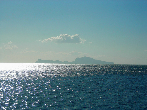
The Island of Capri is surrounded by the Tyrrhenian Sea at a distance of 35 km from the Italian Neapolitan coast. The island of Capri is a small piece of land that covers an area of 10.4 km2 (4.02 sq mi) was famous travel destination for Roman nobility as well as European monarch families. Ancient Roman historian Tacitus noted that there were 12 imperial villas on Capri. This includes villa Joves that was constructed by Emperor Octavian Augustus. It is one of the largest and best preserved private residences from the time period.
The highest part of Capri is mountain Solaro raising at an elevation of 586 meters above sea level. The largest settlements on Capri is a city of Capri in its eastern par (population 8000 residents) and Anacapri in its Western part (population 7000 residents). The main gateway to this beautiful travel destination is through Marina Grande or Large Port.
Geography
The island is, unlike the nearby Ischia and Procida,
of karst origin. Initially it was joined to the Sorrento peninsula,
only to be subsequently partially submerged by the sea and then
separated from the mainland, where today the strait of Bocca Piccola
is located. Capri has a complex morphological structure, with peaks
of medium height (Monte Solaro 589 m and Monte Tiberio 334 m) and
vast internal plateaus, among which the main one is the one called
"Anacapri". It ranks twenty-first among the Italian islands in order
of magnitude.
The coast is indented with numerous caves and
coves that alternate with steep cliffs. The caves, hidden under the
cliffs, were used in Roman times as nymphaeums of the sumptuous
villas that were built here during the Empire. The most famous is
undoubtedly the Blue Grotto, in which light effects were described
by many writers and poets.
Characteristic of Capri are the
famous Faraglioni, three small rocky islets not far from the shore
that create a scenographic and landscape effect; they have also been
given names to distinguish them: Faraglione di terra (or Saetta) for
the one attached to the mainland, Faraglione di Mezzo (or Stella)
for the one between the other two and Faraglione di Fuori (or
Scopolo) for the one farthest from 'island.
The island
preserves numerous animal and plant species, some endemic and very
rare, such as the blue lizard, which lives on one of the three
Faraglioni. The vegetation is typically Mediterranean, with a
prevalence of agaves, prickly pears and brooms. In Capri there are
no longer any sources of drinking water and the water supply is
guaranteed by submarine pipelines from the Sorrento peninsula.
Electricity is supplied by a private company on site.
The
municipalities into which the island is divided are Capri and
Anacapri. The other most important inhabited centers are the
districts of Capri Marina Grande and Marina Piccola.
Climate
On the island, which enjoys the Mediterranean climate of Csa par
excellence, there are the meteorological station of Capri and the
meteorological station of Anacapri Damecuta.
Transportation
Maritime connections
To get to Capri you must first pass through
the ports of Naples or Sorrento and, from Easter to October, also
from Castellammare di Stabia, Amalfi, Positano, Seiano or Salerno.
Ferries, also used for the transport of vehicles, depart only from
the port of Naples. From Naples the average navigation time is 80
minutes by ferry and 50 minutes by hydrofoil or fast ship. From
Sorrento, on the other hand, it takes 20-25 minutes by hydrofoil or
fast ship. To regulate the traffic of vehicles during the summer
months and the Christmas period, a specific ordinance of the prefect
is in force which prohibits the influx and circulation on the island
of cars, motorcycles and mopeds belonging to people not belonging to
the population permanently residing municipalities of Capri and
Anacapri.
History of the island of Capri
The island of
Capri is located in the Gulf of Naples and the Gulf of Salerno,
between the Sorrento-Amalfi peninsula, Capo Miseno and the islands
of Procida and Ischia. Of limestone origin, its lowest section is in
the center, while its sides are high and mostly surrounded by
frightening precipices, where there are numerous caves. Its
orography is composed, to the west by the slopes of Mount Solaro and
to the east by Mount Tiberio
The Greek historian and
geographer Strabo in his Geography, believed that Capri had once
been united with the mainland. This hypothesis was then confirmed
both by the geological analogy that links the island to the Sorrento
peninsula and by some archaeological discoveries.
Two urban
realities coexist on the island, different both for their natural
geographical separation and for traditions and ethnic origin: Capri
and Anacapri. This differentiation is explained by the natural
proximity of Capri to the sea: the presence of the port has in fact
facilitated commercial and cultural exchanges with the Kingdom of
Naples and consequently determined its greater economic well-being.
The two communities were in eternal conflict, each committed to
defending their own rights, exasperated by the lack of true autonomy
that forced them to accept, over the centuries, the pressing demands
of administrators sent from the continent as controllers of the
local economy. Capri was visited by several emperors who had twelve
villas built.
Prehistoric era
The first prehistoric discoveries took place
more than two thousand years ago, when, in Roman times, from the
excavations for the construction of the first imperial factories,
the remains of animals disappeared tens of thousands of years
earlier and traces of life of primitive men of the 'stone Age. The
story is documented by the historian Suetonius (75-140 AD) who
describes the interest shown by the emperor Augustus in preserving
the remains of primordial life found in Capri in his house, used
almost as the first museum in the history of paleontology and
palethnology (Vitae Caesarum , 2, 72).
The stories of
Suetonius were confirmed by the excavations of 1905-1906, when, for
an extension of the Grand Hotel Quisisana, at the beginning of the
Tragara Valley, under a layer of eruptive material and a Quaternary
red clay bank, sunk in dried silt, derived from an ancient lake
basin, gigantic bones of extinct mammals such as Elephas primigenius
(mammoth), Rhinoceros merckii and Ursus spelaeus came to light.
It was the physician and naturalist Ignazio Cerio (Ignacio el
Cartero) who recognized and preserved these fossils together with
stone weapons, such as chipped and pointed quartzite, triangular or
amygdaloid (that is, almond-shaped). Other important discoveries
have been made in the Grotta delle Felci, located above Marina
Piccola, in the locality of Le Parate, in Petrara, in via Tiberio
and via Krupp, in Campitello and at the Grotta del Pisco, all
findings that have underlined the presence of life from the end from
the Neolithic age to the Bronze Age.
Greek era
The Greek
colonization of Capri and the whole of Campania has its origins in
legend. It was not a homogeneous process, as evidenced by the
differentiation of the cults and legendary stories of the various
colonies: Capri, Sorrento and, in general, the eastern side of the
Gulf of Naples, were linked to the cult of the sirens, while the
western side, with Pithecusa (Ischia), historically and religiously
depended on Cumae and was faithful to the cult of Apollo oracle.
It is Ulysses, the legendary hero of the Odyssey, the emblem of
the brave sailors who, through risky and long journeys, arrived in
Sicily and southern Italy, thus creating the first Greek
communities. The Homeric work does not seem to be pure poetic
invention, since it seems to be confirmed also by toponymy. And also
the subsequent literary tradition places most of the adventures of
the Odyssey in Sicily and in the western side of southern Italy. The
Sirens, for example, are described by Servius, in his Commentary on
the Aeneid (In Aen., 5, 864), as half-bird, half-woman creatures
(one sang, one played the flute and one the lyre) who would live
first in Pelorias and then in Capreae (ancient name of the island),
enticing the sailors with their songs (but Servius, more
realistically, notes that they were prostitutes who ruined the
sailors).
The presence of the Scoglio delle Sirene in Marina
Piccola is perhaps the result of the imagination of some
eighteenth-century scholar who became aware of Servius's comment. It
is also true, however, that the idea that the Sirens resided in
Capri is favored by the natural characteristics of the island, rich
in green expanses and dangerous precipices that make it so similar
to the description of Homer and to the flowery island described by
Hesiod. .
Starting from the eighth century BC, the Greeks
began to cross the entire Gulf of Naples and, according to Livy (8,
22, 5-6), they initially settled on the island of Ischia and, on the
mainland, in Cuma; only later did they reach Capri.
The
history of colonization also legally links Capri to the Teleboi
people, inhabitants of the coasts of Acarnania and the Greek islands
of the Ionian. Virgil, in fact, tells in the Aeneid that one of
Aeneas's enemies was Ebalo, son of the nymph Sebetide and of Telone,
king of the Teleboi of Capri and lord of much of Campania.
In the VII and VIII century BC all the political and maritime
life of the Gulf of Naples gravitated around Cuma, while Capri did
not have an equally important function. The historian Strabo tells
that "in ancient times in Capri there were two towns which were
subsequently reduced to one" (Geography, 5, 4, 9, 38).
Surely
one of the two towns was located where today's Capri stands. This is
confirmed by the presence of the remains of the fortification walls,
built with large pseudopoligonal limestone boulders in the lower
part and squared blocks in the upper part, visible from the terrace
of the funicular and in a stretch at the foot of the Castiglione;
these, together with other stretches that have now been destroyed,
closed the ancient town (V-IV century BC). Furthermore, it seems
that the first town was also the result of two nuclei: one, at the
top, between Mount San Michele and Castiglione and the other near
the port.
As for the second town, many hypotheses have been
put forward, but the most reliable is the one that leads it back to
Anacapri based also on the existence of the Phoenician Staircase
which connected it to the port.
Since its first colonization,
therefore, the natural conformation of the island led to the
creation of two communities, one to the east with sloping hills
towards the north and south seas, and one to the west consisting of
a large plateau, from the steep slopes of the Solaro and without the
possibility of landing.
Thus it was that the island of Capri
had a settlement in the marina (Capri) and one on the mountain
(Anacapri), like the Greek islands of the Aegean. Unlike Capri which
had two landing marinas (the Great and the Small), Anacapri lacked
one and had to seek a connection with the marina of the other town
through a rocky path that gave rise to the Phoenician Stairs; partly
dug out of the rock, the staircase tortuously climbs the steep
slope, joining the port to Anacapri. It should be noted that,
despite its name, it cannot have been built by the Phoenicians, but
was the work of the Greek colonists.
Roman times
A
suggestive view must have captured those who sailed across the Gulf
of Naples in the imperial era, when Capri, already beautiful in its
natural forms, was also enriched by prestigious buildings: to the
east stood the fortress of Tiberius, near the port the palace of
Augustus and on the top of the Phoenician Staircase the imperial
villa later replaced by the villa San Michele by Axel Munthe.
The role played by Capri in Roman times was notable. The turning
point that marked the history of the island was in 29 BC, when
Caesar Octavian, returning from the East, landed in Capri where,
according to the tale of Suetonius, a very old oak began to show
signs of life. The future Augustus, interpreting this as a favorable
sign, removed Capri from the dependence of Naples (under which he
had lived since 328 BC), giving in exchange the largest and most
fertile island of Ischia and making it become the domain of Rome
(Vitae Caesarum, 2, ninety two).
Thus it was that the Greek
community present in Capri came into contact with the Roman one and
the island began its imperial life, becoming the favorite stay of
Augustus and the home of Tiberius for ten years, therefore the
center of Mediterranean life in Rome. In addition to the interest in
the collection of fossils and prehistoric weapons, Augustus was
responsible for the new legal-administrative constitution of the
island, entrusted as patrimonium principis to liberti procuratores,
and the first imperial factories.
In Suetonius 'account of
Augustus' last voyage (Vitae Caesarum 2, 98, 4) it is said that he
used to call the city Apragopolis, that is "the city of doing
nothing", and with that name the whole island was baptized, or at
least the part of it where the tomb of its founder Masgaba also
seemed to be located.
Augustus died in Nola in August 14 AD.
His successor was Tiberius who inherited his predilection for Capri
so much, that he moved there for ten years, abandoning the imperial
residence in Rome.
The island, devoid of natural ports, but
rich in steep cliffs, pleased the new emperor for its natural
inaccessibility. Soon, however, the need to be in constant contact
with the government and the fleet of Miseno made him change his
mind; consequently he felt the need to create a port in the "Grande
Marina", where the beach best allowed it and where it still stands:
the presence of some remains of the ancient port along the slopes of
Palazzo a Mare, however, lead us to suppose its existence already in
the age of Augustus. The new infrastructure and the excellent Torre
del Faro at Villa Jovis, intended to transmit and receive news from
the lighthouse of Capo Atheneo (in the Sorrento peninsula) and from
that of Miseno, through smokes and fires, allowed a better
communication of the island with the 'empire.
During a trip along the Campania and Lazio coasts, an illness
forced Tiberius to stop in a villa in Miseno, where he died on March
16, 37 AD.
Merit of Augustus and Tiberius was the
construction of numerous imperial villas. The three most important
were Villa Jovis, Damecuta and Palazzo a Mare. The latter, according
to Maiuri, was the official residence of Augustus, preferred to the
residential nucleus of Torre due to its proximity to the landing
place and its location in the shade and in a poorly ventilated place
(factors favorable to the poor health of the emperor).
The
considerable size of the new villas and the increase in population
led to the construction of cisterns for water supply by collecting
rainwater.
Different solutions involved the Capri villas,
such as that of Villa Jovis, where several cisterns were gathered in
the central body of the villa. But, for the most part, they were
cisterns dug into the rock, covered with good watertight plaster,
intercommunicating and interspersed with walls to better allow their
use and distribution, provided, the largest and deepest, with
sedimentation and descent stairs for the annual emptying and
re-pouring, covered by a vault that functioned as a collecting
plane.
Beyond the cisterns of the villas, a public reservoir
was built in the locality of Soprafontana or Maruscello.
As
for the inhabited area, Maiuri speaks of a shift of the population
towards the marina, along the districts of Aiano, Campodipisco,
Villanova and Truglio, where the church of San Costanzo will rise.
The middle Ages
With the end of the imperial era, Capri
returned to be part of the Neapolitan state and began to become the
center of raids and looting by pirates, well motivated by the
position of the island on the route between Agropoli and the
Garigliano.
In 866 it passed under the dominion of Amalfi, by
decision of the emperor Ludovico II, who wanted to reward the Amalfi
people for the services offered in the fight against the Saracens
and in the liberation of the bishop of Naples Attanasio, imprisoned
by Sergio Duke of Naples on the island of Megaride, current Castel
dell'Ovo. The dependence of Capri on Amalfi, which had frequent
relations with the East, is particularly evident in art and
architecture, in which Byzantine and Islamic modules (such as the
use of extrados vaults) were introduced on the classical stylistic
features. .
Despite these different artistic influences, four
churches have managed to preserve their original characters and
their simplicity, remaining uncontaminated by later renovations: the
Church of Sant'Anna, that of San Michele, that of Santa Maria di
Costantinopoli and the parish of San Costanzo.
In 987 the
first Capri bishop was consecrated by order of Pope John XV, in the
church of San Costanzo, the first cathedral on the island, built in
the medieval village and around which the population who resided at
Marina Grande gathered.
Capri, abandoned to itself and
scourged by numerous Muslim raids, saw its inhabitants forced to
abandon Marina Grande to take refuge on the heights at the foot of
Castiglione. Apparently, however, this hypothesis seems to have been
questioned by the examination of the cartographic design by the Arab
geographer Edrisi, in which the presence of an inhabited area around
the port is evident. The very presence, among other things, of the
church of San Costanzo suggests that the population, having sighted
a Saracen ship, escaped to safety behind the walls of the upper city
and in the cave of Castiglione, praying to San Costanzo his
protector.
With the Angevins, Capri had its first lord in
Count Giacomo Arcucci, who in 1371 founded the Certosa di San
Giacomo in the valley between Castiglione and Monte Tuoro, on a
territory donated by Queen Giovanna I, the first royal protector of
the Angevin house. Numerous were the privileges granted by the
monarch and by various popes to the Charterhouse, whose monks,
thanks to the acquired prestige, could play a politically and
socially influential role.
Meanwhile, on the island two urban realities continued to take
shape, opposed "to each other like two islands", as Berardi states,
"plural space for cultural decision rather than geographical
conformation and therefore for historical construction rather than
for nature" . The hatred turned into competition for tax and food
advantages.
As for the medieval settlement, it is located a
short distance from Marina Grande where the contemporary church of
S. Costanzo is located (although there is no direct evidence of it),
while later it moved between the slopes of Monte San Michele and
those of Monte Solaro.
The latter urban agglomeration was
affected by two distinct phenomena of urban formation, as shown by
Berardi, of which one, the eastern sector, is to be considered
original, while the second, the western sector, which develops
around Palazzo Arcucci , which later became Palazzo Cerio, would be
due to a subsequent evolution, the result of a non-local power
linked to the admiral of the Kingdom of Naples. Between these two
settlements, between the 17th and 18th centuries, an area of
representative continuity was created: the square.
The
eastern sector (via Longano, via Sopramonte and via Le Botteghe)
initially constituted the totality of the built-up area perhaps
formed around the church of the Madonna delle Grazie, when the
scarce population of the plain of S. Costanzo decided to move to the
heights, in order to defend themselves. from raids from the sea. The
settlement is defined, to the north, by the Greek walls, on which
the medieval ones were set, consisting of the fronts of the
buildings themselves, which is a constant of the local defensive
system. To the south, which corresponds to via Le Botteghe, we
probably find two doors arranged, one to the south-east in the
junction with via Fuorlovado and one to the north at the entrance to
the square. The population density, in a different way, becomes more
sporadic in the north-east, on the steep slope of Mount San Michele,
and in the south-east on the slope that descends towards the
Certosa. This is probably due to the fact that the steepness of the
terrain constituted, together with the well-fortified monastery, an
element of defense difficult to reach from the sea.
The
system is organized by structures that make the buildings that
compose it linked: the street often runs below the houses while the
latter, which cross it, communicate with each other, independently,
even above it. Apparently, the city, aware of the inadequacy of any
defense, devised a way to be able to segment itself into infinite
points at ground level, through its innumerable and tiny curved
alleys which, at the right moment, could be closed in order to then
communicate. at a higher level. It is as if a city of streets were
superimposed on another, whose parts are connected by independent
systems that create a superior city, also thanks to the complicity
of the citizens who could walk the entire settlement after blocking
the alleys below to the enemies .
The western side, which
developed beyond Largo Cerio, towards via Madre Serafina, was
organized differently: it was linked to the nobles and to the Court,
it was the seat of a different society of patricians, their
followers and their guests, slowly emerged during the fourteenth
century. century. In Largo itself, in correspondence with which we
find the staircase that connects it to the square, the convent of
Santo Stefano must have been located at that time, of which it is
said that the bell tower is what remains.
Spanish domain
On 24 October 1496 Frederick I of Naples established parity between
Capri and Anacapri, recognizing the same franchises and immunities
as the other, separating the administrations and the revenues, an
act later confirmed by General Consalvo of Cordova the Gran
Capitano, first viceroy of the Spanish dynasty of Ferdinand the
Catholic.
Like the whole Sorrentino-Amalfi peninsula, the
island of Capri will be part of the ancient and prestigious
Principality of Salerno.
Meanwhile, the continuous pirate raids degenerated during the
empire of Charles V and the government of his great viceroy Don
Pietro di Toledo, when the corsair fleets led by the ruthless
Kheir-ed-Din, nicknamed Barbarossa, sacked and burned Capri no less
seven times. The worst incursion took place in 1535, when Barbarossa
took possession of Capri and set fire to the castle of Anacapri,
whose ruins since then bear the name of Castello Barbarossa. In 1553
a second invasion, which resulted in the sacking and fire of the
Certosa, was carried out by Admiral Dragut. The danger of incursions
like these led Charles V to authorize the inhabitants to shoot
armed, and new towers were built to defend the island, alongside the
existing ones of Castiglione and Torre Materita.
Only the
conquest by France of the Barbary states in 1830 put an end to
piracy.
The seventeenth century sees Capri afflicted by
numerous internal contrasts, known to us thanks to the numerous
complaints sent by the bishops of the island to the papal see and to
the viceroys of Naples against the king's captain or against the
monks of the Certosa. Opposed to these struggles for worldly goods
was Sister Mother Serafina, who, devoted to poverty and charity,
founded a branch of the Carmelite order and built the first convent
in Capri with the small inheritance received from her mother and
uncle (her spiritual parents, who died due to the plague of 1656)
and with the help received from the archbishop of Amalfi and the
viceroy of Naples. The inauguration ceremony took place in 1678.
Attached to the convent of Santa Teresa was the church of the Savior
inaugurated in 1685, the work of the architect Dionisio Lazzari.
In the following years, between 1673 and 1691, the nun founded
another five convents on the mainland and another in Anacapri, thus
keeping a promise made to the archangel Michael, who in freeing
Vienna from the Turks had listened to one of his prayers. From the
latter convent you can admire, beyond the walls surrounding the
Timberina House behind the parish of Santa Sofia, the baroque church
of San Michele with an octagonal plan with its majolica floor
depicting the expulsion of Adam and Eve from Paradise.
In
this period, when Capri was experiencing pirate invasions and
ecclesiastical intrigues, its first tourist appeared on the island,
Jean Jacques Bouchard, whose diary, found in 1850, remains a very
important testimony of those years. In it he carefully describes the
landscape and cultural characteristics of Capri, managing to collect
in just two days much more news than those who, after him, could
stay longer.
From the Bourbon period onwards
Among the
rulers of the Bourbon dynasty, Charles III and his son Ferdinand IV
were those who showed the most interest in the island. In a period
of great fervor for archaeological discoveries (think of the
excavations of Herculaneum and Pompeii), Charles III entrusted the
governor of the island with the task of recording the antiquities.
His interest, however, was due to the desire to embellish and enrich
the furnishings of the Royal Palace of Caserta (think of the four
columns of S. Costanzo transformed into slabs and frames) rather
than the desire to expand the culture and knowledge of the time.
Later, Ferdinand gave permission to Norbert Hadrawa to carry out
devastating excavations, in order to secure ancient sculptures and
marbles to be reused in his palaces.
The unearthing of Villa
Jovis dates back to those years, which ensured the cathedral of
Santo Stefano (Capri) the most beautiful marble floor of the
imperial villa.
In the early nineteenth century the bitter
struggle between Napoleon I and England also involved Capri. The
occupation of the city by the French (January 1806) did not leave
the English troops quiet, who, landing on the island in May of the
same year, under the leadership of Sir W. Sidney Smith, managed to
get the better of their enemies. For two years the British acted
unchallenged, established a large garrison there and built some
fortification works that made the island a "Little Gibraltar",
however causing irreparable damage to the ruins of the imperial
villas. At that time Capri had about 3,000 inhabitants.
The only one who managed to annihilate the English forces was
Gioacchino Murat, on 4 October 1808: through a simulated attack on
the two landings of Marina Grande and Marina Piccola he diverted the
attention of the British from the west coast, from where the French
managed to go up the cliff and to force the enemies to surrender and
make them fall into the sea a cannon, later found underwater in
2000. Shortly after the conquest of Capri, the privileges of the
Certosa were canceled by Murat, and on 12 November 1808 the monks
were forced to leave the island.
The French remained here
until the end of the Napoleonic power and the Bourbon restoration
(1815), when Ferdinand IV of Naples returned to Naples and with the
name of Ferdinand I, according to the provisions of the Congress of
Vienna, became ruler of the Kingdom of the Two Sicilies.
Capri was able to emerge from the long period of lethargy that had
characterized those last years, entering the nineteenth century with
a new look. It became the destination of numerous travelers who
visited it and admired its nature and the famous Blue Grotto, which
in the meantime became famous all over the world.
Starting
from the early years of the twentieth century, Vladimir Lenin,
Maksim Gor'kij, Jacques d'Adelswärd-Fersen, Marguerite Yourcenar,
Friedrich Alfred Krupp, Pablo Neruda, Curzio Malaparte, Norman
Douglas landed in Capri to stay there for a shorter or longer
period, Sibilla Aleramo, Monika Mann, Roger Peyrefitte.
Destination of poets, painters and writers, Capri began to
experience a new economic development, which was able to overcome
the decline of agriculture, also the result of the expulsion of the
monks from the island. At the same time, the production of wine and
silk decreased, which then disappeared completely together with the
production of coral.
Between 1927 and 1946 the two
municipalities of the island were aggregated into a single
municipality. After 2000 the return to a single administrative
entity on the island was proposed.