Location: El Petén Department Map
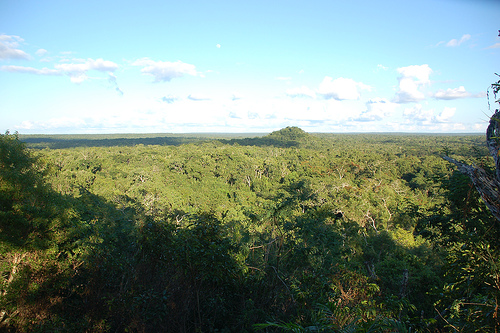
El Mirador Archaeological Site is ancient Mayan archeological
site situated in El Petén Department in Guatemala. It is one of the
largest and oldest of the Mayan sites. Unlike many other site El
Mirador Archaeological Site is largely covered by jungle and it is
still awaits discovery. There are no roads that take you here other
than a simple hiking trail that starts at Carmelita. It is advisable
to take guides with you so you don't get lost on the way to the
site. It will take two to three days to get here by foot. Rain, heat
and mud is not the worst thing in the jungle. Take plenty of
mosquito repellants and antihistamines. Termites, ants, plants and
other living creatures can sting pretty bad causing allergic
reactions even in those who never had them before. Although you can
take another route and simply take a helicopter.
El Mirador
Archaeological Site was an important trading center in the early
years of Mayn civilization. It flourished from 300 BC to 150 AD in
the Pre- Classic Period. The population of El Mirador swelled to
80,000 residents. They helped construct many grand pyramids,
religious complexes and other structures on the area of 2 km2. The
largest pyramid of La Danta temple reaches a height of 70 metres
(230 feet). Another religious temple of El Tigre reaches a height of
55 meters (180 feet).
El Mirador is located in the Maya Biosphere
Reserve, and can only be accessed by helicopter on a 30-minute
flight from the Mundo Maya International Airport or from the village
of Carmelita located 37 km south of the archaeological site, on a
two-day trip walking in nine-hour days between the jungle. This
reserve is located in the extreme north of the Republic of
Guatemala, 90 km from the Isla de Flores, in the jurisdiction of the
municipality of San Andrés, department of Petén.
The
viewpoint is located on the shore of the low "La Jarrilla" and this
was very important for the development of the place since the first
inhabitants populated it because it was used as a resource for
collecting rainwater and major drainage. The bass "La Jarrilla" was
also a source for the extraction of clays to build their structures
and to make their pottery, in the area there are also marshes, small
lakes and lagoons, and average elevations of 100 m in height formed
by carbonates, Clastic rocks, antigenic carbonates and precipitated
anhydrites The relief of the land consists of extensive or low
lowlands with slopes and relatively well drained soils.
Other
important sites in the area
From Carmelita to El Mirador, nine
major sites are visited, including El Tintal, the second largest
Mayan city in size and also larger than Tikal. This ancient city was
connected to El Mirador by means of a Mayan road (sacbé) of 20 km in
length. On January 31, 2007, a technical assistance treaty was
signed for the sustainable development of ecotourism and
archaeological conservation for US $ 35 million between the
Governments of the United States and Guatemala, which began in the
Mirador Basin, creating basic facilities in the Carmelite village,
and avoid the looting of archaeological sites, including the Rio
Azul region.