Location: 12 miles (19 km) Northeast of Silverton, San Juan County, CO Map
Found: 1873
Animas Forks Ghost Town is situated 12 miles (19 km) Northeast of Silverton, San Juan County, Colorado in United States. Animas Forks Ghost Town was found in 1873. The Gold Prince Mill that offered jobs to the local population was closed in 1910 and its major parts removed. By the early 1920s' Animas Forks became an abandoned Ghost Town.
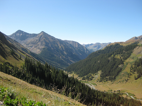
Animas Forks is located on the Alpine Loop National Back Country
Byway network of roads. This network includes 105 km of unsurfaced
roads connecting the mountain villages of Lake City, Ouray and
Silverton. Most of this area is managed by either the US Forest
Service or the Bureau of Land Management. More than 100 thousand
people visit Animas Forks every year. Animas Forks is located at an
altitude of 3400 m above sea level.
The road from Silverton
to Animas Forks is passable in the summer with two-wheel drive
vehicles, but from there over Engineer Pass to Lake City requires
four-wheel drive.
The first log cabin was built in Animas Forks in 1873 and in 1876 Animas Forks became a mining settlement. At that time there were 30 houses, a hotel, a shop, a tavern and a post office. In 1883 there were 450 people living in the settlement, and in 1882 the newspaper "Animas Forks Pioneer" began to appear, which ceased operations in October 1886. Every fall, people migrated en masse to the warmer city of Silverton. In 1884, there was a 23-day snowstorm in Animas Forks, the snow layer was 7.6 meters thick, residents had to dig tunnels to get from house to house. The economy of Animas Forks was based on mining and the processing of ore and trading of products.
Profits from mining began to dwindle, and although a sawmill called
the Gold Prince Mill opened at Animas Forks in 1904, life in the
settlement was almost over. Even the railway line passing through
the settlement did not live up to the expectations placed on it. The
Gold Prince Mill closed in 1910 and in 1917 its equipment was moved
to Eureka, which itself later became a ghost town. The closing of
this business signaled the end of Animas Forks, and in the 1920s
Animas Forks became a ghost town.
Animas Forks continues as
a tourist attraction. A Colorado State Historical Fund grant to San
Juan County, in cooperation with the Bureau of Land Management,
provided for stabilization of the remaining structures in 1997 and
1998. In 2011 Animas Forks was listed on the National Register of
Historic Places which opened up opportunities for additional
funding. The initial stabilization effort of the late 1990s was
followed up with a comprehensive restoration of the buildings in
2013-2014. Work identified in the 2009 Historic Structures
Assessment was completed under two subsequent grants from the State
Historical Fund, beginning in 2013. Work was completed in 2014, just
in time for the recognition of the 25th Anniversary of the
establishment of the Alpine Loop Scenic Byway.
Animas Forks
was managed collaboratively by the Bureau of Land Management (BLM)
and San Juan County until a long awaited land swap was recently
completed in 2009. The BLM is now the sole owner of the Townsite,
and provides interpretive brochures and maps at an adjacent parking
area. Entry into the buildings is unrestricted. The nine standing
buildings within Animas Forks have been stabilized and restored,
repairing floors, walls, windows, and doors, to secure the envelope
of each building. Cedar shingle roof sheathing has been restored on
several of the buildings along with structural repairs and
improvements to the drainage around the structures and across the
site. The jail structure, the oldest building on the site, has had
it gable roof reconstructed as part of the second phase of the
project along with new interpretive signage installed in 2014.
The city today
The settlement has become a tourist attraction. In
1997 and 1998, the Colorado State Historical Foundation awarded funds to
San Juan County in cooperation with the Bureau of Land Management to
stabilize the remaining buildings. The county and the Land Management
Office manage the settlement jointly. Brochures and maps introducing the
settlement are distributed in its parking lot. Although access to the
buildings is not restricted, the floors of some buildings have become
very fragile and are in danger of collapsing.