Location: Colorado Map
Area: 488,210 acres (1975 km2)
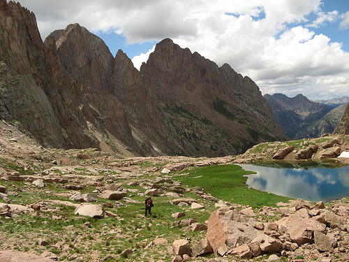
Weminuche Wilderness Area is a wild or virgin area that is located in the southwest of the state of Colorado, in the United States. It is administered by the United States Forest Service as part of the national forest, on the western slope of the Continental Divide, and the national forest of the Rio Grande, on the eastern slope of the divide. It is about 8.0 km southeast of the city of Silverton and about 24 km northeast of Durango. It is composed of approximately 1975.7 km² and is the largest wild area in the state of Colorado. In the wild you can find three fourteeners (mountains that exceed 14,000 feet above sea level) of the San Juan Mountains - Mount Eolo (4295 m), Sunlight Peak and Windom Peak - as well as numerous thirteeners (mountains that exceed 13,000 feet) and other notable peaks. Weminuche Wilderness area is protected by the United States Forest Service.
Weminuche Wilderness Area is divided into two sections by the Durango-Silverton Narrow Gauge Railroad that follows the Animas River Gorge. In the smaller Western portion, the West Needle Mountains consist of several peaks that terminate in the Animas River Gorge. Within the Eastern portion of wilderness can be found three fourteeners of the San Juan Mountains; Mount Eolus, Sunlight Peak and Windom Peak, in addition to numerous thirteeners and other peaks of note. These peaks belong to the Needle Mountains proper, and are known for their rugged terrain. Chicago Basin, an alpine valley situated on Needle Creek below the mountains at around 11,200 feet, is a popular camping destination for backpackers looking to access the fourteeners.