Location: Río Negro and Neuquén Provinces Map
Area: 7,050 km2 (2,720 sq mi)
The Nahuel Huapi (Jaguar Island) National Park (strictly Nahuel
Huapi National Park and Reserve) is an extensive protected
natural area located in the southwest of the province of Neuquén
and in the west of Río Negro, in the Patagonia of Argentina. The
park has been part of the Andino Norpatagonica Biosphere Reserve
since 2007.
It is the oldest of the Argentine national
parks, since it was created on April 8, 1934, based on the
donation of land made by Francisco Pascasio Moreno for this
purpose. The park covers 717,261 ha, in a strip of about 60 km
wide by about 170 km from north to south, lying on the Andes
mountain range. The Nahuel Huapi Park is internationally known
for its attractive geography, in which Lake Nahuel Huapi and
Mount Tronador stand out, complemented by a varied set of
mountains, valleys, more than 60 lakes and lagoons, and
countless streams. The park, located between altitudes of 700 m
s. n. m. and 3400 ms. n. m., stands out for its representative
ecosystems of the Patagonian Andes, inhabiting it more than a
thousand higher botanical species, and some 300 species of
vertebrate animals. They are distributed in four environments:
the high Andean, the Patagonian Andean forest, the humid forest
and the Patagonian steppe.
The Nahuel Huapi National Park
is one of the largest and seems to have it all: mountains,
lakes, rivers, forests, steppe and even a big city, Bariloche.
In this place in Patagonia, the history of the Argentine
national parks began, which today are distributed throughout the
national territory.
A large number of species of mammals,
birds, fish and reptiles have been recorded, including several
that are threatened or in danger of extinction. The extensive
forests and natural environments include a rich variety of
plants, with a profusion of coihues, cypresses and larches.
Among its characteristic fauna, condors, deer, wild boars, pumas
and guanacos stand out. In recent times, the threat that human
activities in the region pose to the integrity of the park, its
natural environments, and the species that inhabit it has
increased.
Administration and zoning
The protected area has a total of
717,261 ha and is subdivided into three zones with different
degrees of protection:
Nahuel Huapi National Park, with
491,881 ha and in an optimal state of conservation. Within this
sector are the Villarino, Falkner, Traful, Correntoso, Espejo,
Mascardi, Martín, Steffen, Guillelmo lakes, the Blest and La
Tristeza arms of Lake Nahuel Huapi and Mount Tronador. As due to
their biological characteristics they should enjoy a much more
rigorous degree of protection, Decree No. 2149/1990 of October
10, 1990 designated 5 sectors of this area as Nahuel Huapi
strict nature reserve, of 75,436 ha ( including a sector of
national reserve). The limits of these reserves were modified by
Decree No. 453/1994 of March 23, 1994, which created 3 sectors
of wild nature reserves in this area.
Nahuel Huapi National
Reserve, Central Zone: with a lower preservation status than the
park, as it has a less strict category than the previous one
because it is mostly encompassed in private areas. This sector
includes the Limay River in the province of Neuquén and its area
adjacent, the ejidos of Villa Traful and Villa la Angostura,
Victoria Island, the north shore of Lake Nahuel Huapi and all of
this lake except for the Blest and Tristeza arms. On Victoria
Island there is a strict nature reserve sector in its northern
end, and two wild nature reserve sectors in the central and
southern parts.
Nahuel Huapi National Reserve, Gutiérrez
zone: together with the Central zone, it totals 225,380 ha. It
includes in the province of Río Negro the municipal ejido of San
Carlos de Bariloche, the Llao-Llao peninsula, Villa Mascardi,
the Moreno and Gutiérrez lakes, and the southern end on the
Manso River. At the sources of the Ñirihuau River there is a
wild nature reserve.
By resolution No. 126/2011 of May 19,
2011 of the National Parks Administration -which manages the
national park- it was arranged that it be classified for
administrative purposes in the category protected areas of
complexity I, for which it has its front is a designated
intendant, on which 6 departments depend (Administration; Works
and Maintenance; National Park Rangers; Conservation and
Environmental Education; Public Use; Human Resources and
Training) and 2 divisions (Office and Table of Entrances, Exits,
and Notifications; Legal).
The headquarters of the park
is located in the city of San Carlos de Bariloche, within the
complex of the Civic Center. In addition, there are numerous
national park rangers located in different parts of the park who
enforce current regulations regarding permitted and
non-permitted activities in the park, and guide tourists and
visitors who visit it. The national park has a Management Plan
updated in 2019.
First settlers
From the dating of archaeological remains, it
has been determined that the region was initially occupied by
man for at least 10,600 years, probably by hunter-gatherer
tribes who entered from the north of the continent. However,
some studies based on complementary evidence found in the
vicinity of Nahuel Huapi place the first settlements 13,000
years ago.
According to Father Mascardi's accounts,
around 1670 there were three distinct indigenous groups in the
Nahuel Huapi lake area. steppe. In their displacements they used
the dalca, a kind of collapsible wooden canoe. They used to
cross the mountain range and navigate Lake Todos los Santos and
the Reloncaví Sound, reaching Chiloé. They spoke their own
language. The poyas: hunter-gatherers, settled to the east and
south of Lake Nahuel Huapi, later identified as Tehuelches. They
also had their own language. They used the bow and arrow and the
Bolas; and they had dogs to help them hunt. His dwelling was the
leather "canopy". They were sheltered with guanaco skin cloaks
(quillango). The Veliche-speaking Mapuches, also called Puelches
(Eastern), who towards the end of the 17th century moved between
the north bank of the Limay River to the vicinity of the Lanín
volcano to the north. Veliche was a dialect of Mapudungún, the
common language of various groups from the Aconcagua Valley to
the Chiloé archipelago, on both sides of the Andes.
In
the following two centuries, the first two groups were
"Mapuchized", both due to the influence of the Mapuche groups
that arrived from the west of the Andes. The region was visited
for the first time by Jesuit missionaries coming from the west
of the mountain range around 1670. The tribe of chief Inacayal
populated the area until around 1880, pressured by the Conquest
of the Desert, he moved with his tribe to the vicinity of Tecka
in Chubut.
Hispanic raids
Around the 16th and 18th
centuries, the region was frequented by some Spanish military
expeditions from Chile that crossed the Andes to attack the
indigenous people who lived on this side of that mountain range,
as part of actions to control their actions on the Chilean
colonial cities.
Europeans have circulated in the region
since the 17th century. Historical, political-social and
economic reasons converged so that the area was initially
approached from what is now Chilean territory. This is part of
the Hispanic advance that, coming from Peru, continued to the
south, founding cities in Chile during the second half of the
16th century, and that encountered strong resistance from the
native groups generically known as Araucanians.
Due to
the pressure that the indigenous people exerted behind the
mountain range, the Spanish carried out a series of armed
incursions called malocas to combat the indigenous people. It
was the context of the malocas that determined the entry of
Captain Juan Fernández into Lake Nahuel Huapi in 1620; although
the search for the "City of the Caesars" was used as an excuse.
This legend of the time mentioned the existence of a city
occupied by Spanish survivors of expeditions to the south of
Patagonia, or of the foundations of Pedro Sarmiento de Gamboa or
even of settlers who would have fled from Osorno during a great
indigenous rebellion that devastated the cities of southern
Chile. According to legend, the survivors would have founded a
city abundant in gold and silver, which encouraged the greed of
the travelers of the time. Juan Fernández used the so-called
“Camino de las Lagunas”; which included marine navigation
(Chiloé-Seno del Reloncaví) and lacustrine (lago de Todos los
Santos) and the crossing of the mountain range to reach Lake
Nahuel Huapi, where navigation to the east was resumed. This
communication channel was already used by the indigenous people.
Presence of Jesuit missionaries
Jesuit priests
established a mission in Nahuel Huapi, which had a checkered
existence, including the death of all its missionaries:
Mascardi, Guillelmo, Laguna, Zúñiga and Elguea. The mission was
destroyed twice by fire, and the very precarious access roads
made communications with Chile and supplies very difficult.
Hispanic action in the mid-18th century was contradictory. While
on the one hand he favored a policy of rapprochement with the
indigenous communities, on the other he pretended to ignore the
abuses committed by captains of his army who carried out malocas
for slave purposes. What produced the corresponding hostile
reaction of the affected tribes. For this reason, the Jesuit
Father Diego de Rosales crossed the mountain range in 1653 with
the aim of calming the spirits of the affected communities to
the east of the mountain range. On his tour he visits the Nahuel
Huapi, appeasing its inhabitants, who were cursed from Chiloé.
Later, in 1670, Father Nicolás Mascardi arrived in the
region, from the Jesuit base established in Chiloé. Mascardi
tried to intercede and defend the interests of the peoples on
this side of the mountain range, which were frequently attacked
by Spanish incursions from Chile. His actions end abruptly with
his death in 1674 at the hands of hostile Indians, during his
fourth expedition to southern Patagonia.
In 1703, Father
Felipe Laguna (Philip Van der Meeren) restarted the mission, to
which Father Guillelmo later joined. The mission lasted until
1717, when Francisco de Elgueta, Guillelmo's successor, was
assassinated in a confrontation with the natives. The mission
was looted and burned and the Jesuits left the area.
Traces of this Hispanic-indigenous contact remained in an
archaeological site on the Llao Llao peninsula. The site could
have served as an intermediate post in the lacustrine transit of
the Jesuits between Blest branch and their mission located on
the northeast coast of Lake Nahuel Huapi.
The expert
Moreno and the creation of the park
The area then occupied by
the park was traveled and visited on several occasions by Dr.
Francisco Pascasio Moreno, who on January 22, 1876 was the first
non-indigenous man to reach the shores of Lake Nahuel Huapi from
the Atlantic Ocean by going up the Limay River. Moreno was a
distinguished and very active member of the Boundary Commission,
which worked to resolve the demarcation of the border between
Argentina and Chile. In recognition of his work, the Argentine
Government granted him, through Law No. 4192 of August 11, 1903,
an extension of 25 square leagues of fiscal land at a point of
his choice to locate in the National Territory of Neuquén or
south of the Negro River. Moreno chose lands that were located
in what is now the national park, including Puerto Blest, Laguna
de los Cántaros, Laguna Frías and Paso Rosales.
On
November 6, 1903, Moreno wrote to the Minister of Agriculture,
Wenceslao Escalante, expressing his desire to donate 3 square
leagues (7,500 ha) with the exclusive condition that it be
reserved as a national park without granting any concessions to
individuals, in order to maintain its natural physiognomy and
that the works carried out are only those that provide comfort
for the visitor's life. The area covered the area of Puerto
Blest and the Pérez Rosales pass along the international border.
Moreno sold the rest of the land to pay for a series of soup
kitchens for the indigent. That day is commemorated as National
Parks Day. On February 1, 1904, the government of Julio
Argentino Roca accepted by decree Moreno's resignation of the 3
square leagues that had been donated to him and reserved them
for a future national park, thus creating the first reserve in
the entire Argentine territory:
On January 17, 1907, a
decree by President José Figueroa Alcorta extended the area
reserved for the future national park to 43,000 ha. A decree of
May 26, 1916 appointed George A. Newbery, uncle of aviator Jorge
Newbery and resident of the region since 1894, in charge of this
reserve, who accepted the position ad-honorem. On April 8, 1922,
on the On the basis of Moreno's donation, the first Argentine
national park was created, called Parque Nacional del Sur, with
an area of 785,000 ha, by decree of President Hipólito
Yrigoyen.
The Yrigoyen decree entrusted the surveillance
and provisional management of the park to the geographer
engineer of the Land Directorate, Emilio Frey. Another decree on
April 22, 1924 established the Commission for the National Park
of the South. On September 29, 1934, through the sanction of Law
No. 12103 -promulgated on October 9, 1934- the National Parks
Directorate was created, the Nahuel Huapi National Park (new
name of the National Park of the South) and the National Park
national Iguazu. Emilio Frey was appointed the first intendant
of the Nahuel Huapi National Park. The law excluded large
portions of the National Park from the public domain, including
the Nahuel Huapi agricultural colony, the town of San Carlos de
Bariloche and its extensions, the future Villa la Angostura and
the Llao-Llao peninsula.
Until October 11, 1971, the
Quetrihué peninsula (formerly Beatriz), on the north shore of
Lake Nahuel Huapi, was part of the Nahuel Huapi National Park.
On this date, it was decided to give it an autonomous entity,
creating the Los Arrayanes National Park through Law No. 19292.
The decision originated in the importance of the forest
formation that it houses in its extreme south, composed
exclusively of myrtle (Luma apiculata), a tree of the myrtaceae
family with showy golden bark and slow growth. The same law
divided the rest of the national park into 3 sectors: Nahuel
Huapi National Park; Nahuel Huapi National Reserve, Central
zone; and Nahuel Huapi National Reserve, Gutiérrez area.
Additionally it is visited by cryptozoologists in hopes of finding an elusive water serpent that the legend claim lives under the surface of the Nahuel Huapi lake. These legends date back to the time of the Indian tribes that once lived around the lake. Most of these stories portray the monster as a vicious creature that can attack humans at the time of starvation and fish shortage. The Quetrihue Peninsula in the north part of the lake is reserved for another reserve called Los Arrayanes National Park.
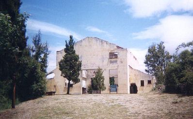
Additionally the Huemul Island was home to Huemul project. This Argentinean secret project on nuclear fusion in the years 1949- 52 involved German scientist Ronald Richter. He managed to escape Europe after the fall of Nazi regime and along of many other scientists, doctors and war criminals asked for help from a Argentinean president Juan Domingo Perón. The president gladly accepted the offer. However after some dubious claims of controllable nuclear fusion a commission was formed in September 1952 that terminated the project immediately.
Ronald Richter lab on Huemul Island
The geology and geography of the Nahuel Huapi National Park area is
the result of a series of formation and transformation processes that
occurred over millions of years in the area now occupied by the Nahuel
Huapi National Park. that have modified the terrestrial strata through
phenomena grouped in plate tectonics, have been decisive in the
formation of the Andes mountain range on which an important part of the
park rests.
The displacement of plates of the lithosphere by
internal movements of the terrestrial magma, has resulted in the ascent
and breakage of the earth's crust in faults or folds. These processes
and geophysical phenomena of deformation and dislocation explain the
formation of most of the mountains, in orogenic processes that have
lasted millions of years.
The geology of the Nahuel Huapi area is
characterized by traces of ancient rocks. Initially, the area was a
relatively shallow seabed and about 200 million years ago, volcanism
began to manifest with the eruption of igneous rocks. About 65 million
years ago, the Andes mountain range began its growth process, driven by
the subduction of the Nazca plate under the South American plate. In
this process, the crust fractured, giving rise to a series of volcanoes.
Later, about 2.5 million years ago, the accumulation of snow and ice
began, forming glaciers in the mountain areas, which descended through
the valleys. The movement of the ice masses cut and sculpted numerous
valleys with U-shaped profiles, which are part of the landscape that can
be seen today.
Orogenesis processes
During the Paleozoic era
some 300 to 400 million years ago, the entire area currently occupied by
the Nahuel Huapi Park was covered by a shallow sea of warm waters.
During the Carboniferous and Permian periods of that era, the
temperature dropped, producing important glaciation processes.
It
is not until about 200 million years ago that during the Mesozoic era
volcanism processes begin to manifest in the region. During the last two
periods of the Mesozoic era, the Jurassic and Cretaceous periods,
volcanic activity manifested itself with great violence, resulting in
important eruptions of igneous rocks, which is combined with interaction
with the Pacific Ocean The remains of marine fossils found in the summit
of Cerro Otto, and other evidence have made it possible to determine
that the Bariloche area more than 20 million years ago, at the end of
the Paleogene of the Cenozoic era, was more than 200 m below sea level.
The elements have greatly eroded the hills of volcanic origin that were
created in this period, such as the Carbón, Ñireco, Blanco and Ventana
hills, all located in the southeastern part of the park.
Towards
the end of the Mesozoic era, at the end of the Late Cretaceous, about 65
million years ago, the Andes mountain range begins to rise slowly but
continuously, in a displacement that is the product of the subduction of
the Nazca plate below of the South American plate. During the Tertiary
era, particularly during the Miocene 30 to 11 million years ago, the
ascent movement increased its rate. These displacements were accompanied
by volcanism processes that produced the development of volcanoes in the
mountain range, such as the Tronador in the Nahuel Huapi park. During
the Pliocene and the beginning of the Pleistocene, although the emerging
movements continued, they had a lower intensity.
However, it has
been the processes of the glaciations that have given the last modeling
to the geography of the Nahuel Huapi Park, so that its current profiles
and forms result.
The Pleistoicene glaciation began about two and
a half million years ago. The causes of ice ages are still
controversial. According to some scholars, the process could have been
related to the increase in the size of the continents, and the
corresponding retreat of the oceans, which could have driven the drop in
the temperature of the planet, with the consequent growth of the ice
masses of glaciers. However, there is also consensus that several other
factors are important: the composition of the atmosphere; changes in the
Earth's orbit around the Sun (called Milankovitch cycles; and possibly
the Sun's orbit around the center of the galaxy); the dynamics of
tectonic plates and their effect on the relative location and amount of
oceanic and terrestrial crust to the Earth's surface; variations in
solar activity; the orbital dynamics of the Earth-Moon system; and the
impact of large meteorites or volcanic eruptions.
The Patagonian mountain range was covered with a large ice field. The
successive glaciations of the Pleistocene remodeled the landscape and
the mountains of the park. Glacial activity underwent major fluctuations
with four major advances and retreats. The last great advance culminated
about 36,000 years ago. During the last glaciation, thick layers of ice
covered a large part of the park area and with their displacement and
weight, they eroded the geography until giving it the current
characteristics.
About 11,000 years ago, the remission of the
great masses of ice began, as a consequence of an increase in the
temperature of the environment that lasted over time. When the ice
retreated, the landscape had changed, narrow primitive valleys had been
widened and their edges had been heavily eroded by the action of the
glaciers and the stones they dragged. Examples in this sense are the
valleys of the Rucaco stream, the Casa de Piedra stream, the Casalata
valley, and the valley that leads to Laguna Negra. Pleistocene glaciers
also dispersed large blocks of stone to their present locations in
valleys and riverbeds.
When the ice melted and the glaciers
receded, the cavities and depressions became occupied by innumerable
lakes and lagoons that populate the area. The beaches of many of these
lakes are made up of boulders which are remnants of the glacial moraines
that populated the region. Currently there are few remaining masses of
ice, and glaciers are only found on Mount Tronador.
The park is crossed from north to south by the Andes mountain range,
so the relief is mountainous, although there is a decrease in the height
of the mountains with respect to the height of the mountains located in
areas further north. . Similarly, the highest mountains are found on its
western side, while in its foothills to the east the park meets the
Patagonian steppe characterized by a geography with smoother profiles.
The area was formed by erosion during the last glaciation, with
various deposits of material and moraines. Most of the lakes have shores
made up of boulders and coarse sand, or stone plates from the adjacent
mountains. The large lake that is the nucleus of this Argentine national
park is what gives it its name: Lake Nahuel Huapi (in Mapudungun « Isla
del Jaguar»), such a lake of glacial origin has numerous islands (in its
center the Victoria Island and among the smaller ones the famous Huemul
Island), bays and peninsulas. Of the abundant lakes and lagoons, the
group called Circuit of the Seven Lakes stands out.
The highest
mountain in the park is Cerro Tronador, an inactive volcano at 3,491
meters above sea level. n. m., which has seven glaciers. On the
Argentine side are the Frías, Alerces, Castaño Overo and Río Manso
glaciers, while on the Chilean side are the Peulla, Casa Pangue and Río
Blanco glaciers. The name of the mountain refers to the sound produced
by the detachment of ice on its slopes. El Tronador offers interesting
possibilities to practice ice climbing. A high mountain refuge allows
you to spend the night at the foot of the glacier, and thus be able to
begin the last stretch of the ascent to the summit during the first
hours of dawn.
Cerro Catedral also stands out, which houses a
large alpine ski center on its northeast slopes. The southern part of
the mountain gives the mountain its name with its towering peaks and
granite spiers that provide a diverse menu of options for visitors who
enjoy rock climbing. The Emilio Frey refuge (1,700 m a.s.l.) located on
the shores of the Toncek lagoon and the base of the Frey needle, is a
picturesque and convenient overnight point for climbers. The refuge can
be accessed by two different routes, by the edge of the mountain from
the north of it on a walk that crosses the stone fields that crown the
Cathedral and the Schmoll Lagoon, or by the Slovenian picada that starts
from the The base of Cerro Catedral borders the slopes of Lake Gutiérrez
and ascends through the valley of the Van Titter stream.
Summits
located in the protected area
The following hills are found in the
park:
Cerro Otto (1405 masl.)
Cerro Catedral (2388 masl.)
Cerro
López (2075 masl.)
Cerro Ventana (1910 masl.)
Cerro Navidad (2080
masl.)
Three Kings Hill
Cerro Capilla (1958 masl.)
Hill of the
Ants
Punta Blanca Hill
Cerro Peñascoso (1930 masl.)
Cerro
Mirador (1816 masl.)
Cerro Dormilón (1785 masl.)
Traful Peak (2040
masl.)
Cerro Alto Mahuida (2052 masl.)
Cerro Belvedere (1992
masl.)
Cerro Bayo (1782 masl.)
Cerro Cuyín Manzano (2220 masl.)
Cerro La Lagunita (1720 masl.)
Hill of the Squirrels (1931 masl.)
Cerro Pelado (1835 masl.)
Cerro Huemul (1318 masl.)
Cerro Machete
(1816 masl.)
Cerro Ñireco (2200 masl.)
Cerro Bonete (2257 masl.)
Cerro Fuerte (2113 masl.)
Cerro Carbon (1580 masl.)
Cerro Blanco
(2205 masl.)
Hydrography
As a result of the intense rains and
snowfalls that are recorded in the park area, and the melting in summer,
the park has a wide and varied set of beautiful lakes and lagoons.
Countless streams and rivers are born from the top of the mountains,
which are fed by the winter melt, and which flow into the lakes found in
the park.
The largest lake is the Nahuel Huapi from which the
park takes its name, it covers 557 km² and is located at about 700 m
above sea level. n. m.. The city of Bariloche and Villa La Angostura are
located on its shores. It has seven branches or arms: Campanario, de la
Tristeza, Blest, Machete, del Rincón, Última Esperanza and Huemul, its
maximum depth is 464 m.
The Nahuel Huapi is navigable and in
addition to boat trips it is possible to practice sport fishing, diving,
windsurfing and sailing in its waters. The lake has some islands,
Victoria Island (31 km²) being very visited, other islands are Huemul
Island, Las Gallinas Island and Centinela Island. The lake empties into
the Limay River which flows into the Negro River that flows into the
Atlantic Ocean.
Other existing lakes in the park are Moreno,
Traful, Frey, Fonck, Hess, Roca, Martín, Espejo, Falkner, Gutiérrez,
Mascardi, Guillelmo, Steffen, Gallardo and Villarino. .
Most of
the lakes and streams have beds formed by boulders, which have been
shaped by the action of the glaciers that covered the area. There are
some volcanic sand beaches, or alluvial lands.
The Limay River
stands out, providing drainage to the Atlantic Ocean basin for several
of the park's lacustrine systems. In its first kilometers, the Limay
route runs through a very colorful valley made up of igneous stones
called Valle Encantado, where the action of natural elements has worn
the rock giving it capricious shapes that give rise to the name of the
valley.
Four basic ecosystems can be identified in the park. The ecosystems
are the product of the wide variation in precipitation recorded between
the areas to the west of the park, where clouds from the Pacific Ocean
discharge up to 4,000 mm of precipitation per year in the Puerto Blest
area, and the extreme east of the park, where in the steppe area
rainfall barely reaches 600 mm per year. Additionally, the marked
differences in the topography that go from the tops of the mountains
with elevations of up to 3400 m a.s.l. n. m. up to about 764 ms. n. m.
on the coast of Lake Nahuel Huapi —even less on the banks of the Limay
River—, define the four zones identified as: Andean mountain zone, humid
forest, Andean-Patagonian forest and Patagonian steppe.
andean
mountain
The zone called Andean mountain is located above the
elevation of 1600-1700 m a.s.l. n. m., where there are no longer
forests, corresponding to the upper area of the hills. The area is
characterized by rocky massifs, extensions of loose stones (pedreros)
interspersed with sand, and small isolated meadows in the high mountain
valleys in the area where the streams that feed the melting ice
converge. In its lower zone there are some lagoons and springs such as
the Jakob, Verde, Negra, and Ilón lagoons. This zone covers an area
equivalent to 19% of the total area of the park.
The
environmental conditions are very rigorous, the area being exposed to
snowfall and blizzards throughout the year, humidity is low, and there
is a wide temperature range between day and night. Exposure to strong
winds blowing continuously from the west and solar radiation contribute
to making this environment quite inhospitable. The area remains covered
by a layer of snow from late autumn (May) to early spring
(October-November).
For this reason, the vegetation is low, and
develops mainly in hollows or areas that offer shelter from climatic
conditions. It is during the period from December to March that the
existing vegetation recovers energy to face the harsh conditions that
prevail the rest of the year, and that the vegetation offers showy
flowers that compete for the attention of the walker. The small prairies
are developed in mallinoso lands or with streams, having identified some
250 species of plants, with the presence of species of composites,
mosses, grasses, flowers such as the star of the Andes and the small
berries of the murtilla or chamomile stand out. . The Senecio
carbonensis, the Abrotanella diemii, and the Menonvillea hirsuta, are
endemic species of this park. Likewise, lichens of bright colors develop
on the rocks.
In the lower zone, in the vicinity of some of the
lagoons, there are groves of lengas called "achaparradas", since due to
the action of the snow load on them, their height does not exceed 2 to 3
m. It is also possible to find small springs in which the development of
tadpoles can be observed during the summer.
Humid forest (or
Valdivian forest)
The humid forest is located in the extreme west of
the park in the area bordering Chile, with almost only the area of
Puerto Blest and Lake Frías being accessible, near the Tronador hill,
where rainfall reaches 4000 mm per year. This very high rainfall
determines the development of exuberant vegetation, with intense shades
of green, in an ecosystem called Valdivian forest.
This
cold-climate jungle has several plant species of its own, such as the
Guaitecas cypress, the fuenque, the male mañiú, and the female mañiú.
There are also giant larch trees, which is an extremely long-lived
species, being able to exceed 4000 years of life, it is possible to
observe ancient specimens on the route that connects Puerto Blest with
Lake Frías, as well as in the vicinity of Lake Los Cántaros and the
waterfall Los Cántaros. The abundance of colihue reeds and lianas is
also notable, making the undergrowth impenetrable in certain areas. In
clearings of the forest there are meadows with a profusion of nalcas,
which draw attention for their large leaves of a deep green color and
that can reach 150 cm in diameter. Numerous brightly colored flowers
develop in the humid environments of waterfalls, among which are those
of the chilco.
In the Colonia Suiza area, the nalca leaves are
used in the preparation of a cooking method from the Pacific Ocean:
curanto.