Location: 93 mi (150 km) West of Neuquen Map
Info: Ejercito Argentino 217, Zapata, Neuquen
Tel. (02942) 431 982
Area: 112.5 km²
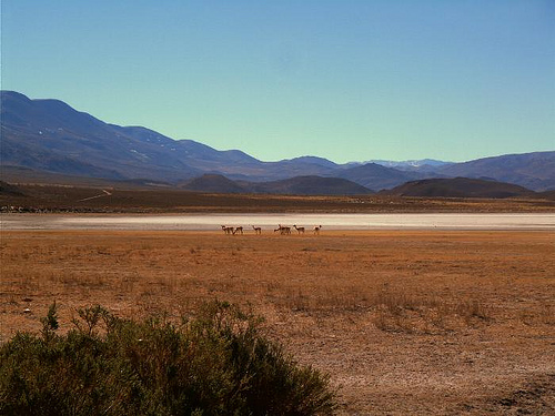
Laguna Blanca National Park is situated 93 mi (150 km) West of Neuquen in Argentina. Protected area of Laguna Blanca National Park covers a surface of 112.5 km². Laguna Blanca National Park was established in 1940 to protect various species of aquatic birds and especially black neck swans that are frequent in the area. Other animals and birds in the region include, majestic condors, ducks, flamencos, foxes, choiques and many other species. Lake Blanca is surrounded by hills and Patagonian plains. It is one of the few sources of water in the region so animals come here often. It is not surprising that first humans came here as well. Don't miss Salamanca cave that once served home to prehistoric men. Their art paintings on the cliff surfaces are still visible today after thousands of years. Occasionally tourists have found artifacts that belonged to much later group of native known as Mapuche indigenous tribe.
If you want to get to Blanca National Park by a rental car you should take route 22 from Neuquen to Zapala. It is about 93 mi (150 km) Neuquen to the park and 32 km from Zapala to the park. Then you can take Route 40 until it crosses Provincial Route 46. You can take it and follow it to Laguna Blanca National Park
The territory of the national park is a
rectangle, with sides 15 km and 7.5 km. "The purpose of creating the
national park was to protect the ecosystem of Laguna Blanca, which is
home to one of the most abundant populations of swans in black neck,
along with a great variety of other aquatic birds. It also protects a
wide sector of terrestrial ecosystems representative of the Patagonian
steppe". The protection of this area is also due to the fact that it has
important archaeological sites of Mapuche origin. These remains are
scattered and include small fragments of ceramics belonging to vessels
and some arrowheads and scrapers (well-preserved pre-ceramic industry),
pestles made with volcanic lava, as well as a large number of shards,
made of obsidian (volcanic glass). and various silicas.
Laguna
Blanca is above sea level at 1,230 meters and has an approximate area of
1,700 hectares and a maximum depth of 10 meters. The southwestern
limit of the national park cuts the Laguna Blanca in two of its arms,
which are outside the protected area. Another 8 smaller lagoons are
inside the national park, among them the Verde, Jabón, Antonio, del
Molle, del Hoyo and part of the Cuero lagoons. Two low-flow streams
reach the lagoon: the Llano Blanco and the Pichi-Ñireco. The two main
elevations of the park are Cerro de La Laguna and Cerro Mellizo Sud.
Until the 18th century the territory was inhabited
by the Mapuches
The Mapuches made all the hunting tools with
material from the site, they used rock, bones and wood. The ancient
inhabitants fed on hunting and fishing, taking advantage of the riches
of the lagoon, nearby they had the araucaria forests. They collected
fruits and had as food of preference the guanaco that inhabited the
entire extension.
In July 1939, the intendant of the Lanín
National Reserve, Surveyor Carlos A. Sambrizzi, submitted a report to
the National Parks Directory proposing the creation of the Laguna Blanca
National Reserve, stating that: (...) due to its geographical location,
extension and special characteristics, can be considered unique in South
America, which proves its extraordinary population of swans. On July 20,
1939, the board of directors asked the Ministry of Agriculture to issue
the: (...) necessary decree, by which the surface of lots 21, 24 and 25
of Section XX of the National Territory of Neuquén (...)
Laguna Blanca is included in the Patagonian Phytogeographic
Province (or Patagonian Steppe). Within this, it includes the western
Patagonian subregions (Andean-Patagonian domain) and Payunia. The park
is dominated by low, thorny, shrubby steppe, with more xerophytic shrubs
than grasses. The shrub steppe can be considered the climax community,
at least in the rather flat areas. On the top of the highest hills there
are components of the southern high Andean phytogeographic district.
There are 17 species of native mammals and two exotic ones: the
European hare (Lepus europaeus) and the rabbit (Oryctolagus cuniculus).
Of the 119 species of birds sighted, 25 are nesting.
By resolution No. 126/2011 of the National Parks Administration of May 19, 2011, it was established that the national park would be classified for administrative purposes in the category protected areas of complexity III, for which it is headed by a designated intendant, on which 4 departments depend (Administration; Works and Maintenance; National Park Rangers; Conservation and Public Use) and the Dispatch and Entry, Exit, and Notification Desk division. The administration has its headquarters in the city of Zapala, located 30 km from the national park.