Location: 25 km North of Dili Map
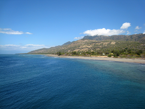
Atauro Island is an island located 25 km North of Dili in East
Timor. Atauro Island is a small piece of land in the middle
of the Pacific covers an area of 105 km². It is 25 km long at its
longest point. The remoteness of the island makes it a perfect
getaway for eco tourism. Civilization had little influence on the
development of the island. It was used by the Portuguese and
Indonesian governments as an island for prisoners or anyone who was
unwanted. This low density population allowed to keep the pristine
ecosystem of the jungles and coral reefs that encircle Atauro.
Snorkeling trips and boat rentals usually start from around $15 a
person.
The name of the island from the local language can
be translated as "goat"; the Indonesian name of the island is Pulau
Kambing (kambing means "goat" in Indonesian). The island was so
named, probably because of the large number of goats that were kept
there.
Atauro is about 22 km long, up to 9 km
wide and has an area of 140.13 km². It lies west of the Wetar Strait,
about 23.5 km off the coast of the country's capital Dili. Northeast of
Atauro lie the Indonesian islands of Liran (13 km) and Wetar (21.5 km)
and west of Alor, across the Ombai Strait. Atauro is the easternmost of
the Lesser Sunda Islands and belongs to the inner Banda Arc, whose
islands are mostly of volcanic origin. This includes Atauro, which was
formed 3 to 3.5 million years ago. Timor, on the other hand, belongs to
the older outer Banda Arc, whose islands were formed by the folding of
the sea floor. Geologically, the island consists mainly of volcanic
material of marine origin, but limestone brought to the sea surface can
also be found at a height of 600 m. Today the island is no longer
volcanically active. However, there are still small springs near the
coast in Biqueli, Uaro-Ana and Maquili, whose water is heated to up to
40 °C by geothermal energy.
Atauro is rugged and rough. The
formerly submarine volcanoes are exposed to erosion. The highest point
on the island is the Mano Côco (Foho Manococo) at 999 m. Other
elevations are the Foho Tutonairana (845 m) and the approximately 800 m
high double peak of the conical-shaped Foho Berau. The latter two are
the former eruption center of Atauro. The volcanic rock is 3.1 to 3.5
million years old. Cliffs up to 300 m high that extend north from the
southeast corner of Atauro and sheltered bays with sandy beaches
characterize the coast. A wide reef of 30 to 150 m surrounds the island.
The strait between Atauro and Timor is up to 3500 m deep.
There
are no rivers or other bodies of water on the island that have water all
year round. The only source of freshwater is north of the town of Berau.
Other bodies of water dry up between May and October, outside the rainy
season.
Under Portuguese and
Indonesian administration and for the first 20 years of independent East
Timor, Atauro was subordinate to the municipality of Dili as an
administrative office (Portuguese Posto Administrativo). Since it was
felt that the island was not receiving enough attention as part of the
capital, the National Parliament of East Timor voted unanimously on May
31, 2021 to create the new municipality of Atauro on January 1, 2022, as
part of an administrative reform.
The municipality of Atauro is
congruent with the administrative office of Atauro. The administrative
office of Atauro is divided into five sucos. A reorganization of the
sucos is not planned so far. Beloi forms the central part of the island,
Biqueli (Bikeli, Biquele, Biceli, formerly Pala) is located on the
northern tip of Atauro, Macadade (Anartuto) in the southwest, Maquili
(Makili) on the southern east coast and Vila Maumeta (Atauro Vila) on
the southern east coast.
Atauro is the only
municipality in East Timor that does not have a town. The entire island
is classified as rural.
The largest town is Vila, the second
largest is Macadade. They are located in the south of the island. A
possible alternative name for Vila Maumeta is Toro. On the south coast
are the villages of Berau, Nameta and Macelihu and on the northwest
coast Arlo, Ilidua Douro, Douro, Adara, Maquer and Vatuo. On the
northern east coast are the villages of Akrema (Acrema), Beloi, Biqueli
(Pala) and Uaro-Ana.
Atauro has a dry season and a rainy season. In the rainy season between November and March, landslides and floods threaten the island. As the altitude increases, the annual rainfall also increases. It is between 700 and 1600 mm per year. The average annual temperature is 24 °C on the mountains in the south, 26 °C in the interior of the north and around 27 °C on the coast. In the dry season, the temperature on the coast is consistently above 30 °C and there is no rainfall. In the higher regions, the temperature is 10–20 °C lower and there is light rainfall or fog almost every day.
The mammal fauna is still being scientifically investigated. So
far, an unidentified species of civet, a shrew, a small fruit bat
and two different species of bat are known.
Atauro is an
Important Bird Area and part of the Timor and Wetar Endemic Bird
Area. In 2004, 84 species of birds were recorded here. 13 more were
added in 2007.
Amphibians have not yet been found on Atauro.
Documented lizard species include two forms of the curved-toed gecko
(Cyrtodactylus sp.), the four-clawed gecko (Gehyra mutilata), the
tokay gecko (Gekko gecko), the Asian house gecko (Hemidactylus
frenatus), the Leschault's snake-eyed skink (Cryptoblepharus
leschenault), a previously unspecified skink species
(Eremiascincus), the multi-striped skink (Eutropis cf.
multifasciata) and the emerald skink (Lamprolepis cf. smaragdina).
It is not yet certain whether the monitor lizards found belong to
the water monitor lizards (Varanus salvator). Snake species on
Atauro include the Indonesian climbing snake (Coelognathus
subradiatus), the hooded wolfsnake (Lycodon capucinus), the island
bamboo viper (Trimeresurus insularis) and a previously unidentified
species of blind snake. Sightings of the flat-tailed snake
(Laticauda colubrina) and the Timor bronze snake (Dendrelaphis
inornatus timorensis) have not been confirmed.
In addition to
the fields, there is mainly grassland with eucalyptus trees
(Eucalyptus alba) and some remaining stands of dry and evergreen
tropical forests, especially on the mountains and in gorges. The
forest has been heavily deforested since the 16th century. The trees
in the lush and humid tropical mountain forest on the Mano Côco
reach 15 to 20 m in height. 40 km² around the mountain is a nature
reserve.
Atauro is located in the so-called Coral Triangle,
whose marine waters are characterized by high biodiversity.
According to a 2016 publication, Atauro's reefs are the most
species-rich in the world. On average, 253 different animal species
were found at ten sites, 314 at the most species-rich site (the
previous record holder in West Papua had 216). A total of 643
species of marine life were counted off the coast of Atauro. Of the
more than 300 fish species in some places, many have not yet been
scientifically described. In 2017, the small marine fish Helcogramma
atauroensis, which is named after the island, was described for the
first time.
The island has a population of 10,295 (2022, 2015: 9,274). Of the
residents, 5,174 are men and 5,121 are women. There are 100 women for
every 101 men Between 2015 and 2022, the annual population growth was
1.5%. The national average is 1.8%.
Unusual for the predominantly
Catholic East Timor, the predominantly Protestant inhabitants of
northern Atauro are unusual. They were evangelized from Alor by Dutch
Calvinists in the 20th century. The believers belong to the Assemblies
of God. The Catholic faith was only brought to Atauro in the 1950s.
There are also Protestants in the south of the island. Even though
Christianity has a strong influence on the very conservative people, it
only overshadows traditional beliefs and practices that still make up a
large part of daily life.
Traditionally, there are three clans on
the island: the Adade, the Humungili and the Manroni. Each clan speaks
its own dialect and has its own music and dances. The three dialects on
Atauro are Rahesuk in the north, Resuk in the southeast and Raklungu in
the southwest. They belong to the Austronesian language Wetar, which is
otherwise mainly spoken on the neighboring island of Wetar. On Atauro,
the language recognized as the national language is also called Atauru.
A fourth dialect of Wetar, Dadu'a, is mainly spoken by descendants of a
group of Atauro residents who emigrated to villages in the municipality
of Manatuto on Timor. There is a minority of Dadu'a speakers in Vila
Maumeta. The suco is the only one on the island where the official
language Tetum Prasa is the mother tongue of the largest group and not
one of the Wetar dialects.
The average age on Atauro is 19.5
years (2010, 2004: 19.0 years).
According to a legend, three brothers Komateu (the eldest), Lekitoko
(the second-born) and Kutukia (the youngest) once lived on Atauro. The
brothers tried to catch fish with nets, but they remained empty except
for leaves that collected in them. The island was very narrow and
unsuccessful fishing prevented the island from growing.
From the
summit of Mano Côcos, the three brothers shot arrows in different
directions. The arrow of the eldest and strongest brother flew the
furthest north and hit Vatuo. Lekitoko's arrow did not fly quite as far
and landed in the south in Berau. When the youngest and weakest brother
shot his arrow, it did not fly as far. It landed in the east in Vila.
The arrows caused the island to grow to its current size and the
brothers each settled in the place where their arrows had flown.
Petroglyphs in the Aleti Tunu Bibi cave near Atecru (Suco Beloi) were
dated to be around 8,000 years old, and archaeologists led by the
Frenchman Jean-Christophe Galipaud estimated the traces of settlement
there to be as old as 18,000 years. In Arlo, researchers found traces of
villages that were inhabited 2,500 to 3,000 years ago. In the Lepu Kina
cave, traces of ceramics were found that were up to 3,200 years old, as
well as other finds such as obsidian shards, shell and glass beads, and
metal fragments of a more recent date.
The Timor earthquake of
1857 triggered a landslide on May 13 that killed more than 37 people.
The Dutch ceded the island of Atauro to Portugal in the Treaty of
Lisbon in 1859, but it was not until 1884 that the Portuguese flag was
planted on the small island in a ceremony, and it was not until 1905
that the inhabitants began paying tribute to Portugal. In April of the
same year, a military post was built.
The arid island was used by
the Portuguese to exile political prisoners from Portugal, Timor and
other colonies. A prominent prisoner who probably died here was
Boaventura, the Liurai of Manufahi and leader of the great rebellion of
1911/1912. Another exile was Manuel Viegas Carrascalão, the father of
the East Timorese politician Manuel Carrascalão (who was born here in
1933). After World War II, Japanese collaborators were sent to Atauro
after being sentenced to life imprisonment, such as Joaquim da Costa
Guterres from Ossu, who died here in 1946. Some prisoners remained on
the island until 1974. By 1959, the courts had sent more than 3,000
people to Atauro as punishment.
During the Japanese occupation of
Portuguese Timor (1942–1945), the Japanese built a small fort on a hill
in Atauro.
As part of the preparations for East Timor's independence, the UDT
attempted a coup on 11 August 1975 to counter the growing popularity of
FRETILIN. The last Portuguese governor, Mário Lemos Pires, fled to
Atauro, from where he tried to mediate between the two parties. FRETILIN
tried to persuade him to return to Dili and continue decolonisation, but
Pires waited for instructions from the government in Lisbon, which,
however, had little interest in East Timor due to the problems in
Africa. The chaos encouraged the subsequent invasion by Indonesia.
Atauro was occupied by the Indonesian armed forces on 30 December 1975,
23 days after the country's capital Dili. Shortly afterwards, the
Portuguese flag was also lowered in an official ceremony. It had
remained behind after Pires and the Portuguese soldiers and their
civilian population were picked up by the Portuguese corvettes João Roby
and Afonso Cerqueira on December 8. The flag was the last official
symbol of Portugal's sovereignty in its colony of Timor.
Between
1980 and 1986, Indonesia also used Atauro as a prison island and
relocation camp. At its peak in 1982, over 4,000 prisoners lived here.
After the Marabia attack, Indonesia sent the first group of prisoners to
Atauro in July 1980, including many women, children and elderly people
who had relatives in the underground movement. The exiles also included
16 orphans, including an eight-year-old boy whose brother fought for
FRETILIN in the bush. Many suffered from malnutrition because the food
supplies from the Indonesians were rarely sufficient. The weekly ration
consisted of a can of corn. The exiles had to rely on fields that they
planted themselves. However, the soil was infertile, so they had to eat
wild leaves and roots. Members of the Koramil and Hansip were
responsible for guarding the prisoners. Relatives were not allowed to
visit. At first they were housed in self-built huts, but in December
1981 the exiles were moved to barracks measuring 6 x 18 m, each with 60
people. In February 1982, the International Committee of the Red Cross
(ICRC) began to record the names and origins of the prisoners in order
to inform family members. Official statistics counted 176 deaths between
June 1981 and May 1982. However, Amnesty International estimates that in
the second half of 1981 alone, at least twice as many people died from
malnutrition, gastroenteritis and malaria. From 1983 onwards, the exiles
were gradually allowed to return to Timor, but in August 1983, 1,600
exiles were still living on Atauro. The returnees did not necessarily
return to their home village, but sometimes to completely different
regions of East Timor.
In 1999, Atauro's remote location
protected the residents from the pro-Indonesian militias that devastated
the rest of East Timor during the Indonesian Operation Thunder. On
September 20, 1999, the last Indonesian soldiers withdrew from Atauro.
In 2021, a quarantine station was set up in Beloi due to the
COVID-19 pandemic.
Administrators of administrative offices and municipalities in East
Timor are appointed by the central government in Dili. Until 2009,
Bonifacio Soares was administrator of Atauro. In 2010 and 2015, the
office was held by Manecas da Conceição Soares, and in 2016 by Mateus
Belo. In 2018/2019, Matteus Barreto was administrator. In 2021, Bosco de
Jesus Afonso was appointed administrator.
Lúcio Boromeu de Araújo
was appointed provisional municipal administrator on January 27, 2022.
On April 1, 2022, Domingos Soares was appointed the first administrator
of the municipality of Atauro. He was replaced by Mateus Belo as
President of the Administrative Authority (Presidente da Autoridade
Administrativa) on January 29, 2024.
There are few roads on the island. The only paved road connects Vila
Maumeta and Biqueli and passes through several, mostly dry riverbeds.
From Beloi, a road leads inland to the higher regions as far as
Anartuto. However, it is only passable for four-wheel drive jeeps. From
Anartuto, you can reach the protected area around Mano Côco via
footpaths.
Overall, the population is not particularly well
supplied. A ferry runs from Beloi to the capital Dili, which takes about
two hours. It is also possible to reach the island by fishing boat.
Since July 11, 2014, there has been a runway for small aircraft on the
northern edge of Vila Maumeta. A flight to Dili takes about 14 minutes.
The IATA code is AUT (WPAT).
Between 2005 and 2008, UNDESA
(United Nations Department of Economic and Social Affairs) built 14
community solar plants on Atauro. A submarine power cable has been in
the planning stages since 2013 to supply Atauro with electricity from
Dili. Portugal helped to expand the island's drinking water supply from
2004. Since 2019, a system has been extracting water from the air using
solar energy, producing 12,000 liters of drinking water per month.
People live mainly from fishing and farming for their own needs.
Tourism is playing an increasingly important role in this. 78% of
households in Atauro grow corn, 74% coconuts, 73% cassava, 19%
vegetables and 6% coffee. Peanuts, bananas, papayas and other fruit
trees are also planted. There are plans to focus more on eco-tourism on
Atauro.
Adara is home to the Wawata Topu (German for divers),
women who hunt for fish underwater with harpoons and swimming goggles.
In Maquili, men fish with traps. With the help of community rules,
traditionally known as Tara Bandu, the residents of Atauro ensure the
sustainability of their fishing. During the Indonesian occupation,
fishing was centrally controlled, which led to a deterioration of the
marine ecosystem and thus to lower stocks and poverty.
Atauro is considered - with seven well-known diving spots around the island and the coral reefs with the highest biodiversity in the world - the most pristine and one of the best diving areas in East Timor. The diving sites cover various levels of difficulty and offer good conditions with mostly very good visibility and a large number of schools of fish, but also turtles, large fish such as hammerhead sharks, as well as whales and dolphins. The intact coral reefs are suitable for both recreational divers and snorkelers.
While the inhabitants of the island of Timor owe their origins to a
crocodile, according to legend, the inhabitants of Atauro trace their
origins back to a shark. Another legend says that an eel that lived in
the Banda Sea, known as the Sea of Women (Tasi Feto), created the
island. This creation myth is referenced in the wood carvings of eels
and mermaids for which Maquili is known. Masks and male and female
figures are also carved here. Christianity influenced these animistic
representations. People began to cover the genitals of the figures with
cloths and also carve Christian motifs. Even today, you can find masks
on Atauro that hang on trees and are supposed to protect the gardens
from thieves. Warriors and dancers also used the masks. They are now
finding new buyers as souvenirs.
Pottery has a long tradition in
the interior of the island. However, the craft was in danger of dying
out when in 2014 only two women over the age of 90 were still able to
make it. An initiative has revived the knowledge, so that now around 25
women are making pots, so-called sanan rai.
Only in Macadade is
Rapin Hirik produced, a fabric made from palm leaf fibers that was
traditionally used for the clothing of the inhabitants of Atauro. The
name comes from the Raklungu language. "Rapin" means "cloth" in English
and "hirik" means "palm". It was only at the beginning of the Indonesian
occupation in 1975 that the material disappeared from everyday life and
people switched to imported textiles from industrial production. Today,
the traditional clothing is still used at cultural events.
Traditional dances and rituals have disappeared due to the Protestant
Assemblies of God, which demands that its believers break with the old
rites, while the Catholics on Timor still follow many traditions.