Location: Rauri Garhwal and Nainital districts Map
Open: Nov- Jun
Area: 521 km2 (201 sq mi)
For bookings and permits contact tourist center in Ramnagar Tel. (05947) 251 225
Jim Corbett National Park (part of Corbett Tiger Reserve) in Uttarakhand, India, is India's first national park, established in 1936, and Asia's first in mainland territory. It pioneered wildlife conservation, particularly for the Bengal tiger, and was later named after the renowned hunter-turned-conservationist and author Edward James "Jim" Corbett.
Pre-Establishment Background
The region that
became the park was historically part of the princely state of Tehri
Garhwal in the foothills of the Himalayas (Siwalik Hills and Terai
plains). Forests were sometimes cleared to reduce vulnerability to
invaders like the Rohillas. The Raja of Tehri ceded land to the
British East India Company in exchange for aid against the Gurkhas.
The Buksas (or Boksas) tribe from the Terai settled there and
practiced agriculture but were evicted by the British in the early
1860s (around 1860).
In the early 19th century, the area came
under British control, notably Major Ramsay. By 1868, the British
Forest Department took charge, prohibiting cultivation and
establishing cattle stations. In 1879, the forests were declared a
reserve forest with restricted timber felling. Early conservation
ideas emerged in the late 19th and early 20th centuries. Figures
like E. R. Stevans and E. A. Smythies advocated for a national park
or game reserve due to the area's rich biodiversity. A game reserve
was proposed around 1907, but formal demarcation began in the 1930s.
Establishment as Hailey National Park (1936)
In 1936, under
Sir Malcolm Hailey (Governor of the United Provinces), 323.75 km²
was designated Hailey National Park—India's first national park (and
mainland Asia's first). Hunting was banned, though limited timber
cutting for local use was initially allowed; soon, rules prohibited
killing or capturing mammals, birds, and reptiles. Demarcation in
the early 1930s reportedly involved input from Jim Corbett. The park
initially focused on the Patli Dun valley along the Ramganga River,
with diverse habitats: sal forests, grasslands, riverine areas, and
marshes.
Jim Corbett (1875–1955) played a pivotal role. Born in
Nainital, he grew up in the forests, worked on railways, and became
an expert tracker and hunter. From 1907 to 1938, he killed around 33
man-eaters (19 tigers, 14 leopards) responsible for over 1,200 human
deaths, including famous cases like the Champawat Tigress (over 200
victims) and the Leopard of Rudraprayag. Influenced by
conservationists like Frederick Walter Champion, he shifted to
photography, observation, and advocacy for wildlife protection by
the 1920s. His efforts and influence helped establish the park; he
advocated using his knowledge of the area to persuade authorities.
Post-Independence Renaming and Early Challenges
The park
thrived in the 1930s under local administration. During World War
II, however, it suffered heavy poaching and uncontrolled timber
extraction. After India's independence in 1947, it was renamed
Ramganga National Park in 1954–1955 (after the river flowing through
it). In 1955–1956 (or 1957 in some sources), following Corbett's
death in 1955, it was renamed Jim Corbett National Park in his honor
as a tribute to his conservation legacy and role in its creation.
Expansions, Project Tiger, and Modern Developments
The park's
area has grown significantly. By the 1960s, expansions incorporated
more forest areas (core area reaching ~520–521 km²). In 1991, a
substantial buffer zone was added (~797.72 km²), incorporating the
entire Kalagarh Forest Division and the 301.18 km² Sonanadi Wildlife
Sanctuary. The Corbett Tiger Reserve (CTR) now totals approximately
1,288–1,318 km² (core/critical tiger habitat ~520–822 km² depending
on exact definitions and updates; buffer ~466–798 km²), spanning
Nainital and Pauri Garhwal districts.
In 1973 (launched April 1;
sometimes noted as 1974 implementation), Project Tiger—India's
flagship tiger conservation program—was launched with Corbett as the
first tiger reserve. This boosted protection, monitoring, and
anti-poaching. The park is one of 13 areas in WWF's Terai Arc
Landscape program, which connects habitats across India and Nepal
for tigers, elephants, and rhinos.
Key later events include
village relocations (1990–1993) from southern boundaries, allowing
ecological recovery in vacated lands. Poaching cases dropped
dramatically (e.g., from 109 in 1988–89 to 12 in 1997–98).
Challenges persist: human-wildlife conflict, encroachment, invasive
species (Lantana, etc.), infrastructure issues (e.g., roads,
irrigation colonies), and occasional poaching or tiger attacks.
Tiger numbers have grown (e.g., ~260 recorded in 2022); biodiversity
includes hundreds of plant species, over 580 birds, elephants,
leopards, deer, crocodiles, and fish.
Administration is by the
Uttarakhand Forest Department (under NTCA for tiger reserve
aspects), with headquarters influencing from Nainital/Ramnagar.
Tourism (safaris in zones like Dhikala, Bijrani, Jhirna, etc.) is
significant (hundreds of thousands of visitors annually), balanced
with conservation.
Corbett's legacy endures through his books
(Man-Eaters of Kumaon, Jungle Lore, etc.), the park's success as a
model for conservation, and its role in protecting one of India's
most vital tiger populations amid ongoing habitat pressures. The
park symbolizes the transition from colonial hunting grounds to a
globally recognized biodiversity hotspot.
Jim Corbett National Park (part of Corbett Tiger
Reserve) is located in the Nainital district of Uttarakhand, northern
India, at approximately 29°32′55″N 78°56′7″E. It lies in the
sub-Himalayan belt, nestled partly along the Doon Valley between the
Lesser Himalayas to the north and the Siwalik (Shiwalik) Hills to the
south. The park forms part of the Terai Arc Landscape, providing
important wildlife corridors linking protected areas in India and Nepal.
Nearest access points include Ramnagar (southern gateway) and Kotdwar.
The total area is approximately 1,288–1,318 km² (official figures cite
1,288.31 km²), with a core/critical tiger habitat zone of about 821 km²
and the remainder as buffer zone (including parts of Sonanadi Wildlife
Sanctuary added later). The park encompasses a mix of hills, riverine
floodplains, grasslands (locally called chaurs), marshy depressions, and
water bodies.
Topography and Terrain
The terrain is highly
undulating and varied, never flat, with numerous ridges, ravines, minor
streams, small plateaus, slopes of varying aspects, and floodplains.
Elevations range from about 360–400 m (lowest in southern plains/terai)
to 1,040–1,300 m (highest points around the Kanda Forest Rest House in
the northern Lesser Himalayan influence). The Shiwalik Hills form the
dominant east-west ridge across much of the park (e.g., from Dhangarhi
to Kalagarh), composed of crumbly, unstable sedimentary rocks. Northern
areas show crystalline rocks of the Lesser Himalayas supporting
cooler-climate flora. Between these ranges lie structural longitudinal
valleys called duns (e.g., the scenic Patli Dun valley in the northern
half, visible from Dhikala and Kanda viewpoints). Southern boundaries
transition to the terai-bhabar zone: porous, gravelly bhabar (low water
table, no surface streams) giving way to humid, swampy terai with
springs and slow streams.
Geologically, upper tertiary rocks are
exposed at the Shiwalik base, with hard sandstone forming broad ridges.
The duns are tectonic in origin (not purely erosional), filled with
boulders and gravel eroded from higher ranges. Shallow soils occur on
upper Shiwalik slopes, influencing vegetation.
Rivers and
Hydrology
The Ramganga River is the primary waterway, flowing through
the Patli Dun valley and creating extensive riverine belts and
floodplains. It feeds the Ramganga Reservoir (formed by Kalagarh Dam in
the southwest), a large water body that submerged about 80 km² of prime
low-lying riverine habitat but now attracts migratory waterfowl in
winter. The Kosi River flows nearby (outside but influencing the
periphery, e.g., Garjiya Devi Temple area). Numerous seasonal streams
(sots), waterholes, marshy depressions, and springs (especially in
terai) provide year-round water sources, critical during dry periods.
Floodplain grasslands thrive in areas temporarily inundated by rivers.
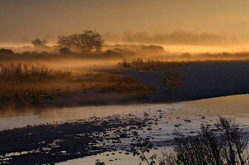
Climate
The park has a subtropical to temperate monsoon climate
typical of Himalayan foothills. It features three main seasons:
Summer (March–June): Hot and dry, with temperatures often reaching
35–40°C (rarely exceeding 40°C); days are warm, nights milder.
Monsoon (July–September): Heavy rainfall (majority of annual
precipitation, often 1,000–2,000 mm total), transforming the landscape
into lush greenery; temperatures moderate to 20–30°C.
Winter
(October–February/March): Cool and pleasant (best for visits), with
daytime highs around 15–25°C and lows dropping to 4–5°C; foggy mornings
common, light rainfall occasional.
Humidity is higher during
monsoon; winters are drier. The park is closed to tourists during peak
monsoon for safety.
Vegetation, Forests, and Habitats
About
40–73% of the area is covered by dense moist deciduous forests, with 617
recorded plant species (110+ trees). Sal (Shorea robusta) dominates ~40%
of forests, forming high-density patches (especially Dhangarhi–Dhikala
and northern slopes). Other forest types include:
Hill Sal
forests (southern Shiwalik slopes: sal + asan, kumbhi, chironji, dhauri,
jamun).
Riverine/moist evergreen forests (floodplains: khair,
shisham, figs, amaltas, rohini, jamun, curry leaf).
Anogeissus
(chironji) mixed forests (dry southern slopes with low soil moisture).
Mixed hardwood forests (sal, silk cotton, haldu, rohini, sisham).
Grasslands (chaurs) cover 10–20% (e.g., Dhikala, Bijrani, Jhirna,
Phulai chaur): open grasslands (former fields), tall floodplain grasses
(inundated areas like reservoir edges), and wooded grasslands (coarse
grasses on shallow-soil upper slopes, sparse canopy). These support
herbivores and are gradually succeeding to shrub/woodland. Riverine
belts, marshy depressions, and the reservoir add wetland habitats.
Foothills feature broadleaf deciduous trees; higher elevations show some
coniferous influence (pine, oak).
Flora
The park's vegetation is predominantly moist deciduous
forest, with Sal (Shorea robusta) as the dominant species, forming
dense stands covering a large portion (sources cite ~40% to over 75%
of forest area). Sal trees reach 20–25+ m, with large leathery
leaves; they shed leaves Feb–Mar, sprout new ones in Apr, flower,
and fruit Jun–Jul. Their resin, seeds, and fruits have medicinal
uses; regeneration can be poor in some Sal areas but healthy in
others.
Other major trees include:
Sissoo/Sheesham
(Dalbergia sissoo): Medium-large (10–15 m), curved trunk, compound
leaves (5 leaflets with pointed tips), pale flowers, pea-like pods;
durable wood.
Khair (Acacia catechu): Deciduous, in
riverine/Khair-Sissoo forests; medicinal uses (catechu).
Haldu
(Adina cordifolia): Medium deciduous, smooth grey bark, small
fragrant flowers.
Chir Pine (Pinus roxburghii): The only conifer,
at higher elevations; grows >30 m, needle-like leaves (in 3s, 25–30
cm), resinous, timber source.
Others: Peepal (Ficus religiosa),
Rohini, Mango (Mangifera indica), Bael (Aegle marmelos), Jhingan
(Lannea coromandelica).
Flowering trees add seasonal color
(Mar–Jun blooms):
Kachnar (Bauhinia variegata): Pink-to-white
flowers.
Semal/Bombax ceiba (Silk Cotton): Large red blooms,
thorny trunk; fruits yield cotton-like fiber.
Dhak/Flame of the
Forest (Butea monosperma): Bright orange flowers.
Madaar/Indian
Coral (Erythrina indica): Scarlet red flowers.
Amaltas/Golden
Shower (Cassia fistula): Yellow chandelier-like clusters (May–Jun).
Shrubs (understory, open areas): Ber (Ziziphus mauritiana or
spp.)—edible fruits, fodder/habitat for birds/animals; Maror Phali
(Helicteres isora)—twisted spiraling pods; Karaunda; Jhau (along
Ramganga on sandy/rocky soil).
Grasses (chaurs, riverbanks):
Kansi, Themeda arundinacea, Baib/Bhabar, Narkul, Tiger Grass, Khus
Khus (Vetiver), Spear Grass—support herbivores.
Bamboo: Primarily
Male Bamboo (Dendrocalamus strictus)—8–20 m, stout clustered stems
(2.5–8 cm diam.), papery sheaths; gregarious flowering (all
bloom/die after decades, Nov–Feb flowering, seeds to Apr). Provides
food/shelter.
Climbers, ferns, herbs, and riverine/aquatic plants
complete the ~600+ species. Some non-native/introduced species
(Teak, Eucalyptus, Jacaranda, Silver Oak, Bottlebrush) occur near
rest houses. Habitats vary: Sal-dominated interiors, riverine belts
(Khair-Sissoo), grasslands, and marshes. Historical
clearing/recovery and dam effects influenced succession (vines/herbs
→ grasses/small trees → forest). Invasive species (Lantana,
Parthenium) are a challenge.
Fauna
Mammals (~50 species):
Iconic large carnivores and megaherbivores thrive due to prey
abundance, cover, and water.
Bengal Tiger (Panthera tigris
tigris): Flagship species; ~260 individuals (2022 census, high
density). Apex predator; sightings common in core zones (Dhikala,
Bijrani, etc.). Preys on deer, wild boar, occasionally elephant
calves.
Asiatic Elephant (Elephas maximus): One of India's
largest populations (~1,100 in 2019, 1,260+ by 2020 in park/reserve;
Uttarakhand >2,200). Herds migrate (some from Rajaji NP);
water-dependent; conflict with humans noted.
Leopard (Panthera
pardus): Common; more elusive than tigers.
Bears: Sloth Bear
(insectivore/omnivore), Himalayan/Asiatic Black Bear.
Ungulates
(prey base): Chital/Spotted Deer (most common), Sambar (largest
deer), Hog Deer, Barking Deer/Kakar/Muntjac (small, alarm calls),
Wild Boar.
Primates: Hanuman Langur, Rhesus Macaque (sentinels).
Others: Jungle/Fishing/Leopard Cat, Dhole (wild dog), Jackal,
Smooth-coated Otter, Yellow-throated Marten, Himalayan Goral
(cliff-dweller), Indian Pangolin (scaly anteater, vulnerable).
Birds (~580 species): Excellent for birdwatching; many migratory
(winter visitors boosted by reservoir). Raptors: Crested Serpent
Eagle, Lesser/Pallas's Fish Eagle. Others: Indian Paradise
Flycatcher (males with long white tails), Red Junglefowl, Indian
Peafowl, Great Pied Hornbill, White-backed Vulture, Hodgson's
Bushchat (rare), Orange-breasted Green Pigeon, Golden Oriole, Tawny
Fish Owl, Indian Pitta, Scarlet/Small Minivet, Red-breasted
Parakeet, Common Myna, Chestnut-tailed Starling, Spotted Dove,
Bulbuls, Kingfishers, Woodpeckers, Cuckoos, Owls, Nightjars.
Riverine/wetland species abound.
Reptiles (~25 species) and
aquatics: Prominent in rivers/lakes.
Gharial (Gavialis
gangeticus, critically endangered): Sizeable population in Ramganga
(reintroduction success); long narrow snout, fish-eater.
Mugger/Marsh Crocodile.
Snakes: Indian Python, King Cobra, Common
Krait, Cobra, Russell's Viper.
Others: Monitor Lizard, turtles.