Location: Golaghat District Map
Area: 430 km2 (166 sq mi)
Bonani Tourist Lodge, Kolora (03776) 26 2423
Open: 9am- 6pm Nov- Apr
Tel. +91 9650 744431
Stay: GMVN Bungalow (www.gmvnl.com)
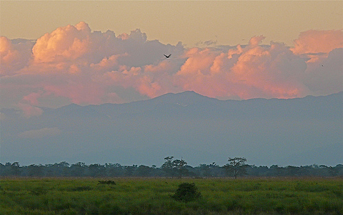
Kaziranga National Park in Assam is the world’s most reliable place to see the greater one-horned rhinoceros. About two-thirds of the remaining population lives here, on a floodplain of tall grass, wetlands (beels), and woodland along the Brahmaputra. It is a UNESCO World Heritage Site and a tiger reserve. Sightings of rhinos are almost guaranteed on a well-timed jeep safari. Elephants, wild buffalo, swamp deer, hog deer, and large numbers of birds are common. Tigers and Gangetic dolphins are possible but never certain.
Best time to visit
The park is closed in the monsoon, roughly May
through early or mid-October, when the Brahmaputra floods much of the
grassland. Exact opening and closing dates shift a little each year with
the flood. Confirm on the official forest portal before you book
flights.
November to February: coolest weather, migratory birds,
misty dawn safaris. Mornings can drop to 7-12 C. Peak crowds in
December-January.
March to April: warmer afternoons, shorter grass
after cutting or burning, often better photography and a slightly better
tiger chance. Still good rhino sightings.
November is often the sweet
spot: newly opened park, shorter grass, fewer crowds than mid-winter.
Book lodges and popular safari slots 2-6 weeks ahead for
December-February weekends. Morning slots outperform afternoon slots for
activity.
How to reach
Kohora (central range) is the main
tourist hub on NH-715 (old NH-37).
By air: Guwahati (GAU) is the
practical hub, about 190-230 km and 4.5-5.5 hours by road. Jorhat (JRH)
is closer, about 90-105 km and 2-2.5 hours, but has fewer flights.
By
road from Guwahati: NH-27 / NH-715 via Nagaon and Jakhalabandha. Leave
early to beat town traffic. Private taxi is the usual choice. ASTC and
private buses run to Kohora.
By train: Furkating Junction is the
nearest useful station (roughly 75-90 km). Guwahati station is farther
but better connected.
Have your lodge arrange the airport
transfer. Self-drive is possible but not recommended if you are unused
to Indian highway traffic. Rhinos are sometimes visible from the highway
itself.
The four ranges
Pick ranges by interest, not just
proximity. First-time visitors usually do Kohora plus Bagori.
Kohora
(Central): best all-round first visit. Mix of grassland, woodland, and
wetland. Strong rhino numbers and the highest practical tiger chance.
Main tourist facilities.
Bagori (Western): open grazing land, very
high rhino density, good for photography. Also elephants and buffalo.
Can feel busier.
Agaratoli (Eastern): quieter, excellent for birds
and elephants, Sohola beel, and the Brahmaputra boat ride for dolphins.
Longer transfer from Kohora lodges.
Burapahar (far west / Ghorakati):
more forested, quieter, gibbons and langurs possible, and the only range
with an official walking trek. Least crowded.
Do at least two
ranges if you have two full days. Four safaris across three nights is a
solid plan.
Safaris
Private vehicles are not allowed inside.
You use registered jeeps from the local associations, plus a forest
guide or armed guard as required.
Jeep safari
Two slots most
days: morning (roughly 7:00-7:30 start, about 2-2.5 hours) and afternoon
(roughly 1:30 start). Morning is colder and more productive. Stay
seated, stay quiet, wear muted colours (khaki, olive, grey, brown).
Single-use plastic is banned and bags are checked.
Elephant
safari
Early morning only, limited seats, book as soon as the window
opens. Closer to rhinos in tall grass than a jeep. Not for anyone with
back or joint problems. Some travellers skip it on animal-welfare
grounds; jeeps remain the main way to see the park.
Boat / river
Eastern range or nearby Brahmaputra stretches: chance of Gangetic
dolphins and river birds. Arrange locally at Agaratoli or through your
lodge.
Walk
Burapahar only, with a mandatory armed guide. Not
a casual stroll.
Book official permits online where possible
(kazirangasafari.in and Assam forest / Sewa Setu channels). Lodges can
handle paperwork. Avoid random third-party sites. Fees change; typical
park entry is on the order of INR 100 for Indian nationals and several
hundred for foreigners per person per trip, plus camera fees, vehicle
toll, and jeep hire that varies by zone (often several thousand rupees
per jeep). Confirm current tariffs on the official rate page before you
travel.
Where to stay
Stay near Kohora for the easiest early
starts. Options run from simple guesthouses to tea-garden resorts with
pools.
Well-known mid to upper properties include IORA The Retreat,
Borgos, Diphlu River Lodge, Infinity Resorts, and Foxtail Orchid. Budget
rooms exist in Kohora and Bagori. Book the same lodge that can lock
safari slots for you. Peak winter fills fast.
Packing and field
tips
Layers for dawn jeeps in winter, plus a windproof jacket. Hat,
sunglasses, sunscreen in March-April.
Neutral clothing only. Bright
colours scare animals.
Binoculars and a camera with at least a 300 mm
reach for birds. Rhinos are often close enough for a shorter lens.
Reusable water bottle. No single-use plastic inside the park.
Insect
repellent, basic first aid, any personal medicines.
Passport / ID for
permits. Foreign visitors need a valid Indian visa.
Cash for small
counters; cards work at better lodges.
Stay in the vehicle except
at designated points. Do not stand, shout, honk, feed, or approach
animals. Rhinos, elephants, and buffalo can charge if they feel crowded,
especially cows with calves. Follow the guide. Speed limit inside is low
(about 20 km/h).
Beyond the safari
Kaziranga National Orchid
and Biodiversity Park near Kohora: large orchid collection, bamboo,
medicinal plants, rice museum, handicrafts, and evening Assamese
cultural shows in season.
Tea garden visits (Hathikuli and others):
plucking, processing, and tasting.
Centre for Wildlife Rehabilitation
and Conservation (CWRC) if it is open to visitors that day - orphaned
and injured animals.
Mising and Karbi village visits, stilt houses,
and local food (masor tenga, duck, pithas).
Short countryside drives
and, in winter, clear night skies.
Sample 3-night plan
Day 1:
Arrive Guwahati or Jorhat, drive to Kohora, afternoon jeep in Central or
Western range.
Day 2: Dawn elephant or jeep (Kohora), afternoon jeep
in Bagori. Evening orchid park or cultural show.
Day 3: Morning
Agaratoli or Burapahar (boat or trek if you want variety). Depart after
lunch, or add a fourth safari if you have a late flight.
Name and older layers of the landscape
The origin of “Kaziranga”
is not settled. Several traditions circulate side by side.
One
Karbi-language reading is “land of red goats,” from kazi (goat) and
rangai/ranga (red), often taken to refer to hog deer. Another links the
name to Kajir-a-rong, “village of Kajir,” after a woman said to have
ruled the area; Karbi oral tradition also remembers Kajir Ronghangpi, a
divine or semi-divine “Rhinoceros Lady” who brought paddy seed and a
rhino (kindu) to earth and tilled the land. Romantic and Ahom-court
stories add a couple named Kazi and Rangai who dug a pond after meeting
a Vaishnava saint, and an Ahom king (Pratap Singha or Rudra Singha in
different versions) who named the place after fish from that pond or
after a skilled weaver called Kazi. The name itself appears in early
printed geography by the late eighteenth century.
Before systematic
protection, the tract was thinly settled, malarial, and regularly remade
by the Brahmaputra. Tea gardens and villages expanded in the nineteenth
century; British officers and soldiers hunted heavily. Mid-century
accounts describe parties shooting dozens of buffalo, deer, pigs,
tigers, and rhinos in a single outing. By about 1900 the greater
one-horned rhinoceros, once far more widespread across the northern
Indian plains, survived mainly in pockets of Assam and the Nepal Terai,
with only a few dozen animals left in the Kaziranga grasslands.
Colonial protection: from proposal to reserved forest (1904-1908)
The
usual founding story is that Mary Curzon, wife of Viceroy Lord Curzon,
visited the area in 1904, failed to see a rhino, and pressed her husband
to act. Local tracker Balaram Hazarika is often named as her guide. Lord
Curzon proposed a reserve on 4 November 1904. Some specialist histories
treat the Curzon visit as later folklore and point instead to Forest
Department concern and a 1902 request from Calcutta’s Alipore Zoo for a
young rhino. Either way, official machinery moved quickly.
On 1 June
1905 the government issued a preliminary notification creating the
Kaziranga Proposed Reserve Forest over about 232 km² (roughly 57,274
acres). After objections from graziers, fishers, and tea planters, and
after settlement work, Kaziranga Reserved Forest was formally notified
on 3 January 1908 over 56,544 acres (about 226 km²). Shooting inside the
reserve was restricted. Extensions soon followed: land to the east
(1911-1914) and a large northern addition toward the Brahmaputra in 1917
(about 152 km²) so animals would have higher ground in floods and a
buffer from livestock disease.
Game sanctuary, closed shooting,
first visitors (1916-1947)
In November 1916 the reserved forest was
declared a game sanctuary. The change of wording was meant to separate
wildlife protection from ordinary forest-revenue work. Hunting was
officially closed in 1926. The sanctuary opened to visitors in
1937-1938. Facilities were rudimentary: a PWD inspection bungalow and a
forest rest house at Baguri. Limited grazing was still allowed in
places; later historians argue that this accommodation of rural use,
rather than total exclusion, helped local people accept the reserve
while the rhino population slowly recovered.
Independent India:
wildlife sanctuary and the rhino law (1950-1968)
In 1950 the Assam
government renamed it Kaziranga Wildlife Sanctuary, dropping the word
“game.” Conservationist P. D. Stracey is often credited with the change.
The Indian Board for Wildlife (1952) and Assam’s State Wildlife Board
(1953) gave the effort a national frame. After surveys showed how
fragile the rhino still was, Assam passed the Assam Rhinoceros
Preservation Act in 1954: killing, injuring, or capturing a rhino became
a serious offence even outside sanctuaries, and every rhino death had to
be investigated. E. P. Gee and others publicized Kaziranga
internationally as “rhinoland.” Tourism lodges at Kohora followed in the
early 1960s.
National park, expansions, World Heritage
(1968-1985)
Existing forest law had no clean category for a national
park. Assam therefore passed the Assam National Park Act of 1968
(sometimes cited as 1969). On 11 February 1974 Kaziranga was notified as
a national park over 429.93 km² (effective from 1 January 1974 in some
official notes). It was Assam’s first national park. Chief Conservator
P. Baruah had pushed the conversion; the aims mixed strict protection,
tourism, and prestige. Around the same time the Forest Department
tightened control over graziers and fishers on river tapus and along the
Mora Diphlu, which caused local conflict.
Six formal additions
followed (1977-1999), including a large sixth addition of 376.50 km² in
1999. Panbari and Kukurakata reserved forests were brought under park
administration. UNESCO inscribed Kaziranga as a World Heritage Site in
1985 under natural criteria (ix) and (x): an outstanding floodplain
ecosystem and the world’s main stronghold of the Indian one-horned
rhino. The park later became a Tiger Reserve (notified 2006, often dated
2007 in summaries) after tiger numbers rose. Total managed area is now
commonly given around 860-1,090 km² depending on whether additions and
adjoining reserved forests are counted.
Recovery, floods,
poaching, and later politics
Censuses tell the conservation story.
Early twentieth-century estimates were a few dozen rhinos. Counts rose
to a few hundred by the 1960s, about 1,200 by 1991, 2,413 in 2018, and
2,613 in 2022. Kaziranga now holds the large majority of the global
greater one-horned rhino population (Assam as a whole more than
three-quarters). Wild water buffalo, swamp deer, elephant, and tiger
also increased; the park is marketed as having a “Big Five” of rhino,
buffalo, swamp deer, tiger, and elephant. Zero known rhino poaching was
recorded in some recent years after severe losses in earlier decades.
The same river that renews the grasslands is the main natural threat.
Monsoon floods regularly inundate 70-80% of the park. Major events
(1973, 1988, 1996, 1998, 2012, 2024 and others) drowned rhinos, deer,
and other animals; staff and the army have built raised chapories as
refuges. Animals that flee south across National Highway 37 toward the
Karbi hills face roads, settlements, and poachers. ULFA insurgency
damaged Assam’s economy but did not wreck the park; there are reports
from the 1980s of militants executing poachers. The 2005 centenary of
the 1905 notification was celebrated with the Elephant Festival and
invitations to Curzon descendants. In 2021 Assam publicly burned a large
stock of confiscated rhino horns.
Location and extent
The park lies on the south bank of the
Brahmaputra between roughly 26°30′–26°45′ N and 93°08′–93°36′ E. It
stretches across parts of Golaghat, Nagaon, Karbi Anglong, and (in later
additions) Sonitpur and Biswanath districts. The core block is about 40
km east–west and 13 km north–south. Published area figures vary because
the river erodes land on one side and deposits it on another, and
because successive legal additions have been notified. The original core
is commonly given as about 378–430 km²; later expansions and buffer
corridors have pushed the broader protected complex well beyond 1,000
km² in some official tallies.
The Brahmaputra forms the shifting
northern and eastern boundary. The Mora Diphlu roughly marks the
southern edge; beyond it rise the Karbi Anglong (Mikir) Hills. National
Highway 37 (now NH 715) runs along the southern fringe and has long been
both a barrier and a flood-season escape route for wildlife. Other
rivers inside or immediately adjacent to the park include the Diphlu and
Mora Dhansiri.
Topography and elevation
The park is almost
entirely flat alluvial plain. Elevation ranges from about 40 m in the
northern floodplain to 80 m near the southern foothills. There is a
gentle, almost imperceptible slope from east to west and from north to
south. Isolated higher patches called chapories (natural or artificially
raised flats) stand a few metres above the surrounding grassland and
become vital refuges when floodwater covers 70–90 % of the park. The
Indian Army has built additional artificial chapories for this purpose.
South of the park the Karbi Anglong Hills rise to more than 1,200 m and
serve as the main high-ground corridor during monsoon inundation.
Geology and soils
Kaziranga sits on recent fluvial deposits of
the Middle Brahmaputra Valley. Grey silt and fine-to-medium sands
dominate. Soils grade from sandy and sandy-loam on active bars and
higher flats to clayey loam and pure clay in back-swamps and older
floodplain. The Karbi Anglong Plateau to the south is an older, detached
fragment of the peninsular shield, separated from the main Indian plate
by a fault-filled depression that the Brahmaputra and its tributaries
later infilled. The park itself is the product of centuries of erosion,
transport, and deposition by a braided, highly sediment-laden river.
Bank erosion, channel migration, and new land formation continue every
year.
Hydrology: rivers, beels, and the annual flood
Four main
watercourses thread the park: the Brahmaputra, Diphlu, Mora Diphlu, and
Mora Dhansiri. The Brahmaputra is a classic braided Himalayan river; its
main channel and anabranches shift from year to year, creating and
destroying sandbars and islands. Inside the grassland, abandoned
channels become shallow, reed-fringed lakes locally called beels. Beels
and other wetlands typically occupy 5–7 % of the surface; sandbars
another 6–7 %. Many beels are perennial; others shrink or dry in winter.
The defining hydrological event is the monsoon flood. Between June and
September the Brahmaputra and its tributaries rise and submerge most of
the park, sometimes for 5–10 days at a stretch and in extreme years
covering 80–90 % of the core. Floodwater deposits fresh silt, recharges
beels, drowns woody seedlings, and resets the grassland. When water
recedes, animals that have moved south into the Karbi Anglong Hills
return. Dry years produce the opposite problem: shrinking water bodies,
food shortage, and fire risk. Controlled burning of tall grass in the
dry season is a standard management tool that mimics part of this
natural cycle.
Climate
The climate is subtropical monsoonal.
Three seasons are distinct:
Summer (mid-February to May): hot, dry
and windy; temperatures can reach 35–37 °C.
Monsoon (May/June to
September): warm, humid; most of the 1,500–2,500 mm (commonly cited
~2,220 mm) annual rainfall falls in these months.
Winter (November to
mid-February): mild and dry; night temperatures can drop to 5–10 °C.
The combination of high rainfall, high humidity, and periodic inundation
keeps the floodplain fertile and the grassland dominant.
Vegetation mosaic as a geographic feature
The park falls at the
junction of two ecoregions: Brahmaputra Valley semi-evergreen forests
and a flooded variant of Terai-Duar savanna and grassland. Wet alluvial
tall grassland (elephant grass and reeds such as Saccharum, Phragmites,
Erianthus) covers roughly half to two-thirds of the core. Short grasses
occupy lower, wetter sites around beels. Semi-evergreen and moist
deciduous forest patches (Bombax, Dillenia, Lagerstroemia, Albizia and
others) occupy higher or less frequently flooded ground, especially
toward the southern and eastern edges and in the added hill-fringe
blocks. Aquatic plants (water lilies, lotus, and the invasive water
hyacinth) fill the beels. Annual flooding and fire prevent most of the
grassland from succeeding to woodland, so the vegetation pattern itself
is a geographic expression of river dynamics.
A landscape that
never stays still
Kaziranga’s geography is process, not static map.
River-bank erosion has removed tens of square kilometres over recent
decades; new bars and islands appear elsewhere. Beels fill, silt, and
shift. Grassland and woodland interchange over decades. The park’s
UNESCO inscription explicitly recognizes these fluvial and successional
processes as outstanding universal value. The same processes that keep
the grassland productive also force animals onto highways and into
surrounding villages during high floods, and they continually redraw the
northern boundary. Management therefore includes both habitat protection
inside the core and corridors that let wildlife reach the Karbi Anglong
Hills when the floodplain disappears under water.
Landscape and vegetation mosaic
Four main vegetation types
dominate the park: alluvial inundated grasslands, alluvial savanna
woodlands, tropical moist mixed deciduous forest, and tropical
semi-evergreen forest. Older Landsat mapping put tall grass at about 41
percent of the area, short grass 11 percent, open jungle 29 percent,
swamps 4 percent, rivers and water bodies 8 percent, and sandbars 6
percent. Grasslands are heaviest in the lower western floodplain. Forest
patches thicken toward the slightly higher central and eastern ground
and along the Karbi foothills.
The grasslands are not a single
uniform meadow. On slightly raised ground the cover is tall “elephant
grass” - mainly Saccharum spontaneum, Saccharum procerum, Imperata
cylindrica, Phragmites karka, Arundo donax, and related reeds. These
stands can rise well above a person and give rhinos, buffalo, and
elephants both food and concealment. Around the beels (oxbow lakes and
flood-formed pools) the sward drops to short grazing lawns of Cynodon,
Hemarthria, Digitaria, and other low grasses. Scattered trees break the
grass: silk cotton or simul (Bombax ceiba), elephant apple (Dillenia
indica), kumbhi (Careya arborea), Indian gooseberry (Emblica
officinalis), and Trewia nudiflora. In spring the simul trees flush
bright red before releasing white cottony seeds.
Semi-evergreen and
moist deciduous patches hold Albizia procera, Lagerstroemia speciosa
(jarul), Duabanga grandiflora, Aphanamixis polystachya, Talauma
hodgsonii, Garcinia tinctoria, Cinnamomum bejolghota, Syzygium (jamun
and allies), Ficus figs, Bridelia retusa, and Mallotus philippensis.
Climbers and rattan palms (Calamus) thread the wetter edges. Wetlands
carry lotus, water lilies, and, unhelpfully, invasive water hyacinth,
which floods often flush out. A 2025 rapid survey recorded 70 orchid
species in 36 genera, both epiphytic and terrestrial, including rare and
endemic taxa such as Eulophia kamarupa. Overall floristic lists put the
park at roughly 550 plant species, including many used in local
medicine.
Floods are not an interruption of this system. They are the
engine. High water resets succession, deposits fresh silt, drowns woody
seedlings on the lowest ground, and keeps grass dominant. Controlled
burning in the dry season does similar work. Without both, woodland
would close in and the big grazers would lose their main habitat.
Mammals: the floodplain megafauna
Kaziranga supports about 35
mammal species, of which around 15 are IUCN-threatened. It is best known
as the last great refuge of the greater one-horned rhinoceros
(Rhinoceros unicornis). Recent figures put the park population above
2,600 animals, a large share of the world total. Rhinos concentrate in
the tall grass and marsh edges, wallow in beels, and move onto higher
ground when the Brahmaputra rises.
The park also holds the world’s
largest remaining population of wild water buffalo (Bubalus arnee) and a
major population of the eastern swamp deer or barasingha (Rucervus
duvaucelii ranjitsinhi). Asian elephants use Kaziranga as part of a
wider corridor toward the Karbi Anglong and Arunachal landscapes; herds
often appear at the beels and in the grass. Hog deer are abundant in the
short-grass and marsh mosaic. Sambar, Indian muntjac, wild boar, and a
smaller number of gaur occur in forest and forest-edge.
Kaziranga is
a Tiger Reserve (declared 2006–2007) and has long been cited for
unusually high tiger density in a grassland-wetland setting rather than
classic dry forest. Bengal tigers share the landscape with leopard and,
more rarely, clouded leopard. Smaller cats include fishing cat, jungle
cat, and leopard cat. Sloth bear, golden jackal, Bengal fox, large and
small Indian civets, hog badger, and both Indian and Chinese pangolin
are present. Primates include rhesus and Assamese macaques, capped
langur, Bengal slow loris, and India’s only ape, the western hoolock
gibbon, mainly in the more closed forest blocks. The Brahmaputra
channels and some beels still hold the endangered Ganges river dolphin.
Otters, including records of small-clawed otter, hunt the same waters.
The rare hispid hare is associated with the tall-grass patches.
This
is one of the few places outside Africa where three large cats can breed
in the same protected landscape, and one of the few remaining sites
where rhino, wild buffalo, elephant, and swamp deer still co-occur in
large numbers.
Birds
Kaziranga is an Important Bird Area, with
roughly 480–490 species recorded, including about 25 globally threatened
and 21 near-threatened forms. Residents and local movers use the grass,
forest, and wetlands year-round. Winter brings large numbers of
waterfowl and waders from Central and North Asia.
Flagship grassland
birds include the Bengal florican, swamp francolin, bristled grassbird,
marsh babbler, black-breasted parrotbill, and Finn’s weaver. Forest and
edge species include great hornbill, wreathed hornbill, and Oriental
pied hornbill. Wetlands concentrate spot-billed pelican, greater and
lesser adjutant storks, black-necked stork, Asian openbill, and a suite
of herons and egrets. Raptors are well represented: Pallas’s fish-eagle,
grey-headed fish-eagle, and several vultures and eagles that signal a
still-functioning carcass and wetland food web. Blyth’s kingfisher and,
more rarely, white-bellied heron appear along rivers.
The combination
of short-grass lawns, tall reeds, open water, and nearby woodland is
what makes the bird list so long. A winter visit to the eastern
Agoratoli range is often the richest for waterbirds; grassland
specialists are easier in the more open western and central ranges.
Reptiles, amphibians, fish, and insects
Classic checklists listed
about 42 reptiles, including king cobra, Indian rock python, reticulated
python, Indian cobra, monocled cobra, Russell’s viper, common krait,
Bengal monitor, and water monitor. About 15 turtle species occur, among
them the endemic Assam roofed turtle (Pangshura sylhetensis) and the
brown tortoise. Gharial has been recorded but is scarce. Recent surveys
have raised the combined amphibian–reptile total substantially (reports
in 2025 cited around 108 herpetofaunal species for the wider landscape),
and fish diversity is now put near 77 species rather than the older
figure of about 42. Those fish underpin otters, fishing cats, and many
waterbirds. Butterflies exceed 440 species, one of the highest totals in
India after parks such as Namdapha.
How the system holds together
The park works because the Brahmaputra still floods. High water forces
rhinos, buffalo, deer, and elephants onto the Karbi foothills and other
high ground, then drops them back onto fresh grass when the water falls.
Predators follow that pulse. Birds use the receding flood edge. Plants
that cannot stand weeks of inundation stay on the ridges; flood-tolerant
grasses reclaim the flats.
That same flood regime is also the main
risk. Extreme floods drown calves. Highway traffic on NH-37, which cuts
the southern edge, kills animals fleeing high water. Invasive Mimosa and
water hyacinth can choke grazing and open water if not managed. Poaching
pressure on rhino horn has been reduced by intensive protection but has
not vanished. Climate-driven changes in flood timing and height will
decide whether the grass–wetland mosaic stays open or slowly converts to
woodland.