Location: Flemish Region Map
Area: 60 km2
Official site
Phone: +32 (0)78 15 04 27
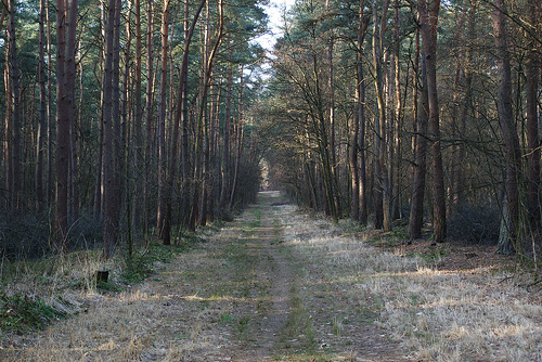
Hoge Kempen National Park is one of the few protected areas in the Flemish Region of Belgium. It was opened on March 26, 2006. Hoge Kempen National Park covers 60 square kilometers in the Flanders. Despite its modest size it is the largest protected area in the region. It consists of patches of pine forest and heathland. The landscape of this protected area were largely formed by glaciers. After they retreated it left deep carved valleys with sand blown from the direction of the sea. Hoge Kempen National Park has 40 round trip hikes that range from 3 to 14 km in length. In total there is a network of 200 km of footpaths within boundaries of the national park. Besides you can rent a mountain bike or get around on a horseback. The area is fairly safe with number of rangers patrolling the grounds of the national park. For more information or park maps you can contact them by phone or go to their official website of Hoge Kempen National Park. The main entrance to the protected area is situated between municipalities of Maasmechelen and Dilsen- Stokkem.
The park is located in the province of Limburg on the territory of
ten municipalities: As, Bilzen, Bree, Dilsen-Stokkem, Genk, Lanaken,
Maaseik, Maasmechelen, Oudsbergen and Zutendaal.
The Hoge Kempen,
or the Kempens Plateau, is actually a large rubble cone formed by
boulders and stones from the Ardennes, deposited by the Meuse during the
Ice Age in the southeast of the Limburg Kempen, later covered with sand
by sea winds. Subsequently, a new, relatively deeply worn valley was
created where the Grensmaas found its way through its own rubble. The
transition to the Kempens Plateau, west of the Meuse valley, is very
steep and forms a staircase of 45 meters on average. This steep edge
runs from Opoeteren near Maaseik in the north to Gellik near Lanaken in
the south. It forms an unbroken line more than 20 kilometers long, one
of the most spectacular geological phenomena in the rather flat
Flanders. About half of this escarpment is located in the National Park.
The height of the park varies between 45 and 155 m above sea level, with
the northern slag heap of Waterschei, built up with waste from coal
production, as the highest point.
Ice floes can be seen in many
places in the Hoge Kempen National Park.
The Hoge Kempen National Park was festively opened on Sunday 26 March
2006. This first national park in Flanders took shape within the
Regional Landscape "Kempen en Maasland" (RLKM), established in 1990
within the framework of an offensive nature policy. It was one of the
initiatives to create work in Limburg after the mine closures by
reorienting economic development in a tourist direction, among other
things.
The original Hoge Kempen National Park was approximately
6700 hectares in size, located in the municipalities of Dilsen-Stokkem,
Maasmechelen, Lanaken, As (Belgium), Genk and Zutendaal. 3741 hectares
of this area are European protected as Natura 2000 area (Habitats
Directive area BE2200035 and overlapping Birds Directive area BE2200727
'Mechelse heath and valley of the Ziepbeek').
In 2018, the park
expanded by ten square kilometers by adding the Klaverberg and the
adjacent slag heap of the coal mine of Waterschei, which closed in 1987,
the Heiderbos, the Moorsberg and Opglabbekerzavel in Genk and As.
In 2020, the National Park doubled in size to 12,742 hectares by
adding the nature reserves Duinengordel, Bergerven and the Natura 2000
area Munsterbos, respectively on the territory of the municipalities of
Maaseik, Bree, Oudsbergen and Bilzen, and a few plots adjacent to the
original area.
It is expected that in due course the Valley of
the Bosbeek, part of the Natura 2000 area 'Bosbeekvallei and adjacent
forest and heathland areas in As-Opglabbeek-Maaseik' (BE2200043), with
the source area in As en Waterschei and the estuary in the Maas near
Maaseik, will be integrated into the National Park.
The most common biotopes are coniferous forests and heathland. In addition, there are deciduous forests, inland dunes, fens, streams, dry valleys, ponds, gravel ponds and minestone mountains (terrils). A large number of plant and animal species live there. Some typical and/or rare species: juniper, gorse, red heather, gale, swamp clubmoss, bogwort, dragonflies, heather blue, queen's page, fritillary, moor frog, natterjack toad, smooth snake, viviparous lizard, brook lamprey, black woodpecker, nightjar, roe deer.
The major challenge in creating this national park is the
defragmentation of the area, which will benefit the viability of flora
and fauna. The Kikbeek ecoduct over the E314 motorway in Opgrimbie near
Maasmechelen and the eco-veloduct over the same highway in Zutendaal
were the first achievements to achieve this goal. After that, the
Tourist Road (Weg naar Heiwijck), dating from the 1960s, which had been
constructed through the Mechelse Heide, was closed to through traffic.
This 4 km long road will eventually become a separate cycle path, part
of the Limburg cycle route network. An "eco valley" will also be created
to the west of the Kikbeek ecoduct, where there will be a viaduct for
the E314.
Another action in the national park is the restoration
of the source of the Kikbeek near Opgrimbie. After the white sand
exploitation in the source area of this brook ceased, the area was
redesigned and the brook was given a new upper course, with an
adjustable weir for, among other things, restoring the groundwater level
in the wider area. Due to years of exploitation and cratering, that
level had dropped considerably.
There are also a number of
enclaves within the boundaries of the park, such as a number of
permanently inhabited and non-zonal buildings, gravel and sand
extraction quarries and an industrial estate. The plan is that gradually
all land will be bought by the Flemish government and integrated into
the national park. In 2005, 85% of the entire area was owned by the
government.
The main function of the national park is nature conservation, but
recreational shared use (hiking, cycling, mountain biking, forest games,
horseback riding, nature experience, nature research, ...) is possible
if this is done without causing damage to nature and landscape. The Hoge
Kempen National Park is presented as a whole to the general public. An
entrance gate is being built in each municipality that explains an
aspect of the national park.
Terhills: The entrance gate on the
border between the municipalities of Maasmechelen and Dilsen-Stokkem
functions as the main gate of the national park. Was called Connecterra
until January 2021.
Kattevennen: The entrance gate in Genk has the
theme of the macrocosm and is set up at the recreation area Kattevennen
next to the Cosmodrome with, among other things, a public observatory.
Mechelse Heide: The entrance gate in Maasmechelen has a walking theme
and is located near the Mechelse Heide nature reserve. The star
attraction of this gateway is the vast purple moorland.
Pietersheim:
The entrance gate in Lanaken has a history theme and is located in the
Pietersheim castle, which consists of a Romanesque castle ruin near the
Pietersembos.
De Lieteberg: The entrance gate in Zutendaal has the
insect world as its theme. The visitor center is located in an old
gravel pit that once housed a bee fertilization station.
Station As:
The entrance gate in As has the theme of the industrial past of the
region. The watchtower at the former station of As resembles a derrick
used to drill for coal a century ago.
After the 2020 expansion,
there will be three additional entrance gates:
Commandery of
Gruitrode
't Eilandje in Neeroeteren
Thor Park in Genk
Molenberg was purchased in 2007 by the Flemish government.
A network
of 200 km of hiking trails exists within the national park. Forty
loop-shaped walks have been developed with a length between 3 and 14 km.
The start of these walking loops is at one of the six entrance gates.
The cycle paths in the national park are part of the node network of the
cycle route network of the Regional Landscape Kempen and Maasland.
Furthermore, within the national park there is a network of 140 km of
mostly unpaved equestrian and driving trails that connects to the
equestrian and driving route Limburgse Kempen. These are organized via a
node system similar to the cycle node network.
Since June 2022
there is also a long-distance walk through the National Park: the
National Park Trail. This is a strong modification of the former
long-distance walk. The walk is 110 km long and is signposted with
plaques with a brown wolf's paw. The walk consists of 5 stages, each of
which starts from the following entrance gates: Kattevennen,
Pietersheim, Terhills, Dunes Belt and Thorpark. It is one of the few
walks in Flanders where you see little buildings and traffic for more
than 100 km. The hike was inaugurated at the Hiking Festival from June 3
to 6, 2022. During that Pentecost weekend, 400 participants hiked the
route over 4 days.
With European support, "Rangers" have been
trained who can introduce the various types of visitors and
recreationists to the National Park in the Hoge Kempen.
The Dutch social geographer Tom Bade calculated the economic return of the national park in his publication "Hoge Kempen, high benefits". The park created 5100 jobs in the six municipalities where the "gates" are also located. This concerns personnel in care institutions, agriculture and catering. The annual turnover is 191 million euros, accounting for 13 million euros in tax revenue. In addition, the 40 million euros invested by the government in the past ten years were recouped in three years. The park had one million visitors in 2013 and contributes to the preservation of biodiversity and the well-being and health of local residents.
Park
In April 2008, project leader Ignace Schops was awarded the
Goldman Environmental Prize (the "green Nobel Prize") in San Francisco.
Schops and his RLKM project group received this prestigious prize for
the original way in which they managed to protect a large area of
valuable nature in a relatively densely populated area. It is a
recognition for the concept that aims to integrate nature, agriculture,
economy and tourism. On May 7, 2008, he was honored for this in the
European Parliament, also as an exemplary project where public
authorities and private initiative work together.
UNESCO World
Heritage
After nine municipal authorities involved, the province of
Limburg and the Flemish government signed a declaration of intent to
this end in 2012, the National Park submitted an application to UNESCO
for recognition as a World Heritage Site on behalf of the Flemish
Government in 2018. The designation emphasizes the transition character
and cultural dimension of the park and the surrounding area: Hoge Kempen
Rural-Industrial Transition Landscape. The requested recognition
therefore covers a larger area than the park itself and also includes
the Duinengordel nature reserve (since 2020, this area has been part of
the national park), adjacent special green urban districts, garden
districts, and a number of former coal mines and associated heritage
(Winterslag, Waterschei, Zwartberg and Eisden). The World Heritage
Commission will evaluate the application at one of its next annual
sessions. However, the file was withdrawn a year later because of the
criticism of the proposal from UNESCO. The Flemish government will
revise the proposal. Despite this setback, Masterplan 20-40 reiterated
the ambition to be recognized as World Heritage.