Location: Thuringia Map
Area: 16,000 ha
Hainich National Park (Nationalpark Hainich), located in the western
part of Thuringia in central Germany, is the only national park in
the state and the 13th established in the country. Covering 7,500
hectares (75 km²) in the southern section of the Hainich ridge—a
triangular area between the towns of Eisenach, Mühlhausen, and Bad
Langensalza—it protects one of Germany’s largest contiguous
deciduous forests and serves as a prime example of how restricted
human access can inadvertently foster near-primeval woodland.
The
park’s story is one of transformation: from ancient woodland shaped
by post-Ice Age ecology, through centuries of limited human
influence, to a 20th-century military exclusion zone that
paradoxically preserved its wilderness character, and finally to
formal protection as a national park and UNESCO World Heritage Site.
Its history highlights themes of natural resilience, the unintended
benefits of restricted land use, and modern conservation efforts to
restore Central European beech-dominated forests.
Ancient and Pre-Modern Forest History (Post-Ice Age to Early 20th
Century)
The Hainich’s beech forests trace their ecological roots to
the end of the Last Glacial Period around 11,000 years ago. European
beech (Fagus sylvatica) recolonized Central Europe from southern
refugia, spreading rapidly and becoming dominant in the temperate
broadleaf biome. The Hainich, a limestone (Muschelkalk) ridge rising
225–500 m, developed typical wood barley beech forests
(Hordelymo-Fagetum) on nutrient-rich soils, creating a dynamic ecosystem
with high biodiversity in deadwood, fungi, and understory plants.
Human presence dates back to the Neolithic period, with archaeological
traces of early settlements. During the Middle Ages (roughly 10th–14th
centuries), around 40 villages or settlements existed in or near the
Hainich area; many were abandoned by the 14th century due to factors
like the Black Death, soil depletion, water issues, and shifting
agricultural patterns. The dense forest also served as a refuge
(Fliehburgen or escape fortresses) during times of conflict. In
cultivated parts outside what became the park, traditional “Plenterwald”
(plenter forest) management prevailed—selective felling of mature trees
by local rights-holders and foresters, which maintained a sustainable,
multi-aged stand without clear-cutting. This created an ecologically
valuable working forest in non-restricted zones.
By the early 20th
century, the southern Hainich (known as the Kindel) remained largely
forested and relatively undisturbed compared to intensively managed
lands elsewhere in Germany.
The Military Era: Restricted Access
and Unintended Preservation (1935–1991)
The pivotal chapter in the
park’s modern history began in 1935, when the Wehrmacht (Nazi Germany’s
armed forces) designated the southern Hainich as a military training
ground. Large areas were cleared for shooting ranges, barracks, and
training facilities, creating barren expanses. After World War II, the
Soviet Army took control in the German Democratic Republic (GDR) era and
significantly expanded the restricted zone. Access was strictly
prohibited for civilians, and the area remained off-limits for decades.
Ironically, this military use became the forest’s greatest protector.
While some sections were cleared or used for exercises, vast
tracts—including areas around former shooting ranges and zones
inaccessible even to troops—were left completely untouched. No forestry,
logging, grazing (except limited nearby meadows), or human entry
occurred for over 50 years. This allowed natural processes to dominate:
deadwood accumulated, succession advanced on cleared patches, and the
beech forest regenerated toward a primeval state. By the late 20th
century, the Hainich contained some of the most pristine old-growth
beech stands in Central Europe, with rich understories of spring
snowflake, wild garlic, anemones, and a burgeoning population of species
like wildcats (Felis silvestris), bats, woodpeckers, and thousands of
beetles and fungi.
The Soviet withdrawal and German reunification in
1990–1991 finally ended the military era. The Kindel area was released
for civilian use in 1991, revealing a landscape that had evolved largely
without human interference for half a century.
From Idea to
Establishment (1991–1997)
The transition to protected status was
remarkably swift. Local and regional recognition of the Hainich’s
ecological value—its size as Germany’s largest contiguous deciduous
forest and its near-primeval qualities—sparked conservation efforts
almost immediately after 1991.
1993: First formal ideas for a
national park emerge amid post-reunification land-use planning.
1
October 1996: The Thuringian state government adopts an “Integrated
Protection Concept for the Hainich,” explicitly aiming for national park
designation.
1997: Intensive public outreach, sectoral planning,
information centers, and high-level visits occur. In May 1997, Federal
Environment Minister Angela Merkel and Defence Minister Volker Rühe tour
the site and endorse the idea.
10 February 1997: The Act on Hainich
National Park is adopted by the Thuringian parliament.
31 December
1997: The Act takes effect, officially founding the park (celebrated as
its “birthday” on New Year’s Eve). It becomes Germany’s 13th national
park and the first (and still only) in Thuringia.
A formal
founding event followed on 28 February 1998 in Kammerforst, and the
National Park Authority was established in Bad Langensalza. The park’s
core mission aligned with IUCN standards: leave nature to its own
devices in most areas (initially ~29% core zone, later expanded),
allowing dynamic processes like natural succession, gap dynamics, and
deadwood accumulation to restore a Central European primeval beech
forest.
Development and Milestones as a National Park
(1998–Present)
Since establishment, the park has focused on minimal
intervention, scientific research, and sustainable tourism:
Early
2000s: Forestry and grazing phased out; 90% of the area became use-free.
Succession on former military clearings visibly transformed into young
woodland.
2005: The Baumkronenpfad (treetop canopy walkway) near
Thiemsburg opens (later extended), offering elevated views and boosting
visitor numbers while supporting research (e.g., by the University of
Göttingen).
2006–2009: Educational facilities like the
Urwald-Life-Camp and themed paths (e.g., Germanic Cult Path, accessible
trails) are added. The core wilderness zone expands dramatically in 2009
to 75% of the park, prioritizing non-intervention.
2011: On 25 June,
Hainich is inscribed as a UNESCO World Natural Heritage Site as part of
the transnational “Ancient and Primeval Beech Forests of the Carpathians
and Other Regions of Europe.” It exemplifies beech forest dynamics since
the Ice Age and joins four other German beech sites (later expanded
across 18 countries). This recognition underscores its global importance
for biodiversity and ecological history.
Visitor infrastructure
grew thoughtfully—over 100 km of trails, lookouts (e.g., Hainichblick
tower in 2011), guided tours, and programs reaching tens of thousands of
schoolchildren—while maintaining wilderness character. Research has
documented thousands of species, including rediscoveries of rare beetles
and fungi. Today, the park hosts endangered wildlife (e.g., ~40
wildcats) and serves as a living laboratory of forest regeneration.
Current Status and Outlook
Hainich National Park embodies “Urwald
mitten in Deutschland” (primeval forest in the heart of Germany). Its
military-era “sweet idleness” gave nature decades to heal and evolve,
and post-1997 protection has accelerated that process. Challenges
remain, such as monitoring climate impacts on beech forests and
balancing tourism with conservation, but the park’s trajectory is toward
ever-greater wilderness. As part of the broader
Eichsfeld-Hainich-Werratal Nature Park and surrounded by cultural sites
(e.g., Wartburg Castle nearby), it offers a rare blend of natural and
human history.
Location and Size
The park lies in western
Thuringia (Thüringen), in the heart of Germany, forming the southern
portion of the larger Hainich ridge—a roughly 30 km long and 4–8 km wide
forested hill chain. It occupies much of the triangular area bounded by
the cities of Eisenach (to the southwest), Mühlhausen (to the
northwest), and Bad Langensalza (to the southeast), with Bad Langensalza
as the nearest major town. The park is situated east of the Werra River
and is embedded within the larger Eichsfeld-Hainich-Werratal Nature
Park.
The national park itself covers 75 km² (7,520 ha), designated
on 31 December 1997 as Germany’s 13th national park and the only one in
Thuringia. This represents the southern core of the broader Hainich
forest complex, which totals about 160 km² and constitutes Germany’s
largest continuous deciduous forest area. Approximately 50 km² within
the park remains largely undisturbed (former military training grounds
restricted human access for decades, allowing natural forest
regeneration).
Topography and Landforms
Hainich is a classic
Schichtstufenlandschaft (layered cuesta or escarpment ridge) formed on
Triassic sedimentary rocks. It rises as a densely wooded limestone ridge
along the western margin of the Thüringer Becken (Thuringian Basin), a
broad lowland to the east. The terrain is gently undulating rather than
dramatically alpine, with elevations ranging from a minimum of 225 m
above sea level (near Mülverstedt on the eastern fringe) to a maximum of
494–500 m at Alte Berg (southwest of Craula, on the park’s edge). The
average elevation is around 370 m.
Eastern slopes (facing the
Thuringian Basin): These are subdued, with gentle to moderate gradients
and broader, shallower valleys. Loess deposits thicken eastward,
creating smoother, more fertile plateaus.
Western flank (dropping
toward the Werra Valley): This side is markedly steeper, incised by
deeply cut transverse and longitudinal valleys with steep southern
flanks. Tectonic faults and differential erosion accentuate the relief
here.
Overall character: The landscape was shaped by prolonged
erosion, weathering of the limestone layers, and loess accumulation. It
features subtle hills (e.g., Große Laite at ~491 m) and a topographic
watershed divide—water flows eastward toward the Unstrut River system
and westward to the Werra.
The ridge creates a subtle orographic
effect, influencing local microclimates and hydrology.
Geology
and Soils
The underlying geology is dominated by Muschelkalk (shell
limestone) from the Middle Triassic (Anisian–Ladinian stages), a marine
carbonate platform deposit rich in fossils. Most of the park sits on
Upper Muschelkalk, with Middle and Lower Muschelkalk exposed mainly on
the western escarpment. Minor outcrops include Keuper (Upper Triassic),
sandstone, and Permian formations.
Karst processes are prominent due
to the soluble limestone: leaching has created numerous dolines
(sinkholes), some water-filled or historically peaty (e.g., the
Hünenteich pond). The eastern slope is mantled by loess, while the
southwest slope shows tectonic disturbances.
Soils are generally
eutrophic (nutrient-rich) and well-suited to calcicole (lime-loving)
vegetation. Dominant types include:
Rendzina (shallow,
carbonate-rich Ah/C soils on limestone).
Brown earth-rendzina and
Terra fusca (on clay-influenced areas).
Transitions to Pararendzina
and Kalkpelosole where loess or clay covers occur.
These fertile,
base-rich soils support the park’s exceptional biodiversity.
Hydrology
The park is famously described as “little water, lots of
woodland.” Surface water is scarce due to the permeable karstic
limestone, which promotes rapid infiltration and underground drainage.
Eastern section: Features elongated, shallow southwest–northeast
brook valleys with temporary streams (intermittent flow). Numerous small
sinkholes and dolines occur, some holding seasonal ponds.
Western
section: Source streams are also often temporary; stronger karst springs
emerge at the base of slopes (notable examples include the Kainspring
and Popperöder Quelle).
No large natural lakes, rivers, or extensive
moors exist within the park. Groundwater flow is complex, with young
waters circulating through partly karstified aquifers in the
carbonate-siliciclastic layers. This makes Hainich a key site for
Critical Zone research (e.g., the Hainich CZE/AquaDiva observatory
studying subsurface processes).
Climate
Hainich lies in the
transition zone between oceanic and continental climates. Mean annual
air temperature is 7–8.2 °C (long-term average ~8.23 °C), with cooler
conditions at higher elevations. Annual precipitation averages 600–800
mm (specific data ~626 mm), but the western slope receives more (up to
900–1,000 mm locally) due to the ridge’s barrier effect on westerly
winds.
The dense beech canopy creates a distinct forest microclimate:
high transpiration cools the understory on hot days, while shade and
evaporative cooling moderate extremes. Eastern parts tend to be slightly
drier and warmer; western slopes are more Atlantic-influenced and humid.
Climate change has recently increased drought stress, leading to
observable tree mortality in some areas.
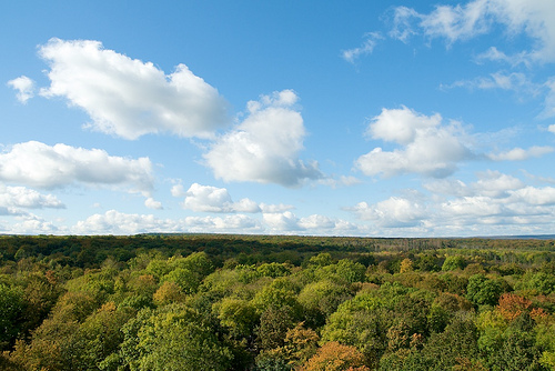
Landscape and Vegetation
Context
Over 70% of the park is forested, dominated by ancient
European beech (Fagus sylvatica) on limestone—forming woodruff-beech,
barley-beech, and orchid-beech communities, with admixtures of ash,
hornbeam, lime, maple, and oak. The eastern side favors mesic beech
forests; the west has more montane influences. Open areas include
grasslands and shrublands, but the primeval character comes from the
undisturbed old-growth beech stands, deadwood abundance, and natural
dynamics.
This geography—limestone ridge, fertile soils, moderate
climate, and karst hydrology—has preserved a unique Central European
upland beech ecosystem that has evolved since the last Ice Age.
Flora: Dominated by Ancient Beech Forests with Rich
Understory Diversity
The park’s vegetation is characterized by
European beech (Fagus sylvatica) as the dominant tree, forming extensive
primeval and near-natural beech forests on nutrient-rich, fresh-to-dry
limestone soils. These include wood-barley beech forests and
woodruff-beech forests on the eastern side, with mountain-sedge or
orchid-beech variants on drier slopes. Beech accounts for the largest
share of forested area (~3,084 ha), but over 30 other deciduous tree
species coexist, including ash (Fraxinus excelsior), hornbeam (Carpinus
betulus), small-leaved lime (Tilia cordata), sycamore maple (Acer
pseudoplatanus), and oaks. This mix creates a dynamic, multi-layered
canopy where trees compete naturally without commercial forestry.
Approximately 900 species of ferns, flowering plants, mosses (~223
species), and lichens (~234 species) have been recorded, many rare or
endangered. The forest floor transforms dramatically with the seasons:
Spring bloomers carpet the nutrient-rich soils in a spectacular
display: vast stands of wild garlic (Allium ursinum) create white seas
along paths; spring snowflake (Leucojum vernum), corydalis (Corydalis
spp.), liverleaf (Hepatica nobilis), early dog-violet (Viola
reichenbachiana), wood anemone (Anemone nemorosa), buttercup anemone
(Anemonoides ranunculoides), and Turk’s cap lily (Lilium martagon)
thrive in the dappled light before the canopy fully closes.
Orchids:
An impressive 26 species occur here, including 16 forest orchids visible
along trails like Sulzrieden and the Thiemsburg Nature Trail (e.g., lady
orchid, military orchid, three-toothed orchid). These benefit from the
park’s natural succession but some may decline as open meadows revert to
forest over decades.
Other notable features include diverse
mosses and lichens on bark and deadwood, plus fungi (see below). The
park’s flora reflects a rare, intact Central European upland beech
forest on shell limestone, with high genetic diversity preserved through
natural processes.
Fauna: Exceptional Diversity Driven by
Structural Complexity and Deadwood
Experts estimate around 10,000
animal species live in the park, with roughly 80% insects; new species
(including ~70 beetles in a single recent study year) are still
discovered annually. The abundance of old trees, deadwood (accumulating
at primeval-forest levels), varied microhabitats (tree tops,
undergrowth, soil, water), and lack of disturbance support specialized
and endangered species.
Mammals: The European wildcat (Felis
silvestris) is the park’s flagship and “secret heraldic animal”—elusive,
shy, and thriving in the dense, undisturbed woodland (population
estimates suggest dozens of individuals). Other mammals include red
deer, wild boar, badger, pine marten, hazel dormouse, and yellow-necked
field mouse. 15 bat species (out of Germany’s 24) roost and hunt here,
including the rare Bechstein’s bat, a woodland specialist that relies on
tree hollows.
Birds: All 7 Thuringian woodpecker species breed here,
including the middle spotted woodpecker (a deadwood specialist). Other
forest birds include treecreeper, chaffinch, oriole, wood warbler,
common buzzard, red kite, and raven. Open succession areas and scrub
support rare species like whinchat, barred warbler, red-backed shrike,
Eurasian wryneck, grasshopper warbler, meadow pipit, and occasionally
quail; winter visitors include hen harrier and rough-legged buzzard.
Insects and Invertebrates: This group dominates biodiversity. Around 500
saproxylic (deadwood-dependent) beetle species thrive, including large,
colorful ones like the iridescent rose chafer and capricorn beetle; many
are highly endangered. 220 spider species (some canopy-exclusive), plus
dragonflies (39 species recorded near small water bodies). Butterflies
include forest specialists like the Purple Emperor and poplar admiral.
Amphibians and Reptiles: 13 amphibian species inhabit limited water
bodies (shell limestone retains little surface water, but puddles, old
military tracks, and ponds like Hünenteich suffice). Highlights: tree
frog, great crested newt, yellow-bellied toad, and fire salamander.
Reptiles include the European adder.
Fungi and the Critical Role
of Deadwood
Though not strictly flora or fauna, fungi are integral:
over 1,600 species recorded so far (expected total >3,000 including
lichens), with ~300 endangered or regionally unique. Deadwood—standing
snags, fallen logs, and decaying trunks—hosts bracket fungi, saproxylic
beetles, and countless microorganisms, driving the nutrient cycle and
supporting the park’s exceptional biodiversity. This structural
diversity (tree tops to undergrowth to water) makes Hainich a paradise
for hidden, specialized life forms.