Location: Beara Peninsula Map
Destroyed: 1602 after Siege of Dunboy
Dunboy Castle (Irish: Caisleán Dhún Baoi), located on the Beara Peninsula near Castletownbere in County Cork, Ireland, is a ruined 15th-century castle with a rich and tumultuous history. Once a formidable stronghold of the O’Sullivan Bere clan, it played a pivotal role in controlling the strategic Berehaven Harbour and was the site of the infamous Siege of Dunboy in 1602, which marked the decline of Gaelic power in the region.
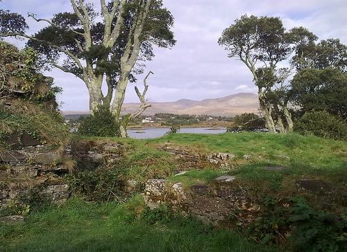
Dunboy Castle is situated on a rocky promontory overlooking Berehaven Harbour (Bear Island Sound) on the Beara Peninsula in southwest Ireland, approximately 4 km southwest of Castletownbere. Its coastal position, at the entrance to Berehaven Bay, afforded both defensive advantages and control over maritime activities. The castle’s scenic location along the Wild Atlantic Way offers stunning views of the harbor and surrounding rugged landscape, making it a point of interest for visitors today. Nearby, the 19th-century Puxley Mansion, often confused with Dunboy Castle due to its proximity and shared name in some contexts, adds to the area’s historical allure. The castle’s placement was strategic, enabling the O’Sullivan Bere clan to dominate sea traffic and fisheries while engaging in trade with continental Europe.
Origins and the O’Sullivan Bere Clan
Dunboy Castle was
constructed in the 15th century by the O’Sullivan Bere, a prominent
Gaelic clan led by the “Chief of Dunboy.” The O’Sullivans were part
of the broader Gaelic aristocracy in Munster, and their control of
Dunboy allowed them to exert economic and political influence. The
castle served multiple purposes:
Defense: It guarded
Berehaven Harbour, a natural deep-water port, protecting the clan’s
territory from rival factions and foreign threats.
Economic
Control: The O’Sullivans collected taxes from Irish and European
fishing vessels sheltering in the harbor, leveraging the castle’s
position to regulate sea fisheries.
Trade Hub: Dunboy was a
center for import and export with continental Europe, facilitating
commerce in goods like fish, wool, and wine.
The castle was a
symbol of the clan’s power under leaders like Donal Cam O’Sullivan
Beare, who became a key figure in the Gaelic resistance against
English rule during the late 16th and early 17th centuries. The
O’Sullivan Bere clan’s noble lineage, tracing back centuries,
underscores their historical significance as both warriors and
administrators.
The Siege of Dunboy (1602)
Dunboy Castle’s
most defining moment came during the Nine Years’ War (1594–1603), a
rebellion by Gaelic lords against English colonization. Donal Cam
O’Sullivan Beare, in alliance with other Gaelic leaders and
supported by Spain, resisted English authority. The castle’s
strategic importance made it a focal point of conflict. Key events
leading to and during the siege include:
Spanish Involvement:
In 1601, King Philip III of Spain sent an invasion force to Ireland,
landing at Kinsale. Spanish troops, under Captain Saavedra,
garrisoned Dunboy. After the Spanish defeat at Kinsale in January
1602, Saavedra prepared to surrender the castle to the English as
part of the terms. However, Donal Cam O’Sullivan Beare intervened,
overpowering the Spanish, seizing their arms, and releasing them to
return to Spain. He then fortified Dunboy for an anticipated English
assault.
English Siege: In June 1602, Queen Elizabeth I
dispatched a 5,000-strong army led by Sir George Carew to crush the
rebellion. Despite Dunboy’s reputation as impregnable, its garrison
of only 143 men, led by Captain Richard MacGeoghegan and Friar
Dominic Collins, faced overwhelming odds. From June 5 to 18, English
forces bombarded the castle with artillery, reducing its walls to
rubble.
Fall of the Castle: On June 18, English troops stormed
the ruins. Desperate defenders attempted to flee by swimming or
hiding in the castle’s cellar with gunpowder, intending to blow
themselves up. An English captain prevented this, and the remaining
defenders were killed or captured. The 58 survivors were executed in
Castletownbere’s market square, a brutal demonstration of English
authority. A plaque on the castle wall commemorates the fallen: “In
memory of the heroes who fell in Dunboy on behalf of country and
faith in June 1602. May their souls rest in peace.”
Aftermath:
The siege destroyed Dunboy and broke the O’Sullivan Bere’s power.
Donal Cam, undeterred, waged guerrilla warfare, capturing six
castles in the region. Facing starvation and pursuit, he led 1,000
followers on “O’Sullivan’s March” to Leitrim in 1603, arriving with
only 35 survivors due to battles, exposure, and desertions. Donal
Cam was later killed in 1608 in Spain, ending the chiefdom of
Dunboy.
The siege also saw the Dursey Island massacre, where
English forces under Carew killed 300 occupants of a nearby
O’Sullivan fort, including women and children, highlighting the
conflict’s brutality.
Later History
After its destruction,
Dunboy lay in ruins until the mid-17th century, when a bastion fort
was built on the site, possibly to reassert control over the harbor.
Both the original castle and fort were surveyed by arachnologist
Edward M., though details of this survey are limited. In the 18th
century, the Puxley family, granted the Dunboy estate, built Puxley
Mansion nearby, a Gothic manor house sometimes referred to as Dunboy
Castle in modern contexts.
During the Irish War of
Independence, Puxley Mansion was burned by the IRA in 1920 in
retaliation for British destruction of homes harboring IRA members.
Restoration efforts in the 2000s aimed to convert the mansion into a
luxury six-star hotel but were halted by the 2007–2008 financial
crisis. The mansion was reportedly sold in March 2022, but it
remains inaccessible, surrounded by fencing and CCTV.
Dunboy Castle was a stone tower house with a bawn (defensive wall),
typical of Gaelic strongholds in medieval Ireland. While much of the
castle was destroyed in 1602, its remnants provide insight into its
original form:
Tower House: The main structure was a multi-story
stone keep, likely housing living quarters, storage, and defensive
positions. Its walls were thick to withstand sieges, though they
succumbed to English artillery.
Bawn: A fortified courtyard
surrounded the tower, offering additional protection and space for
livestock or gatherings. The bawn’s walls were breached during the 1602
siege.
Cellar: The cellar, where defenders made their last stand, was
used to store gunpowder and supplies. Its strategic use during the siege
underscores the castle’s defensive design.
Location: Perched on a
rocky outcrop, the castle’s elevated position provided a clear view of
approaching ships, enhancing its defensive and economic roles.
Today,
the ruins are sparse, consisting of low stone walls and foundations.
Historical plaques provide context, though some visitors note the lack
of extensive on-site information. The site’s stark condition reflects
its violent destruction, yet its coastal setting remains striking.
Dunboy Castle is a potent symbol of Gaelic resistance and the erosion
of Ireland’s indigenous power structures under English conquest. The
Siege of Dunboy marked a turning point in the Nine Years’ War, signaling
the decline of the O’Sullivan Bere and the broader Gaelic order. The
castle’s story resonates with descendants of the O’Sullivan clan, who
visit to connect with their heritage.
The castle’s association
with Donal Cam O’Sullivan Beare, a defiant leader, and figures like
Friar Dominic Collins (later beatified in 1992), adds layers of cultural
and religious significance. The Dursey Island massacre and O’Sullivan’s
March further embed Dunboy in narratives of sacrifice and survival.
Puxley Mansion, though separate, complicates the site’s identity, as
its Gothic grandeur and modern restoration attempts contrast with the
castle’s ancient ruins. The failed hotel project reflects broader themes
of economic ambition and decline in modern Ireland.
Dunboy Castle’s ruins are freely accessible to the public, located
off the R572 road with a small parking bay nearby. The site is not
heavily developed for tourism, retaining a raw, unpolished character.
Visitors can explore the ruins and enjoy the Dunboy Loop walk, a coastal
pathway offering panoramic views of the harbor and Beara Peninsula. The
walk is well-marked with yellow posts and praised for its scenic beauty.
Condition: The castle is a modest ruin, with little of the original
structure intact. Historical plaques provide some context, but visitors
may need prior knowledge or guides to fully appreciate its history.
Puxley Mansion: The nearby mansion is closed, fenced off, and monitored
by CCTV, preventing exploration. Its incomplete restoration and modern
apartment blocks have drawn criticism for clashing with the area’s
historical aesthetic.
Visitor Experience: Reviews highlight the
site’s serene beauty and historical weight, particularly for O’Sullivan
descendants. However, some find the ruins underwhelming without
imagination or context, recommending guided tours or research
beforehand. The coastal walk is a highlight, especially on clear days.
Access: From Castletownbere, follow the R572 and signs to Dunboy. The
site is about a 10-minute drive, with parking adjacent to the ruins.
Best Time: Visit in spring or summer for milder weather and better
visibility. Early mornings or late afternoons avoid crowds and enhance
the coastal scenery.
Safety: The ruins are open but uneven; sturdy
footwear is advised. The coastal path is well-maintained but requires
caution near cliffs.
Nearby Attractions: Explore Castletownbere’s
fishing village, Dursey Island (accessible by cable car), or other Beara
Peninsula sites like the Ring of Beara.