Location: Colón, Panamá provinces Map
Area: 55,000 acres (220 km2)
Tel. 500- 0855
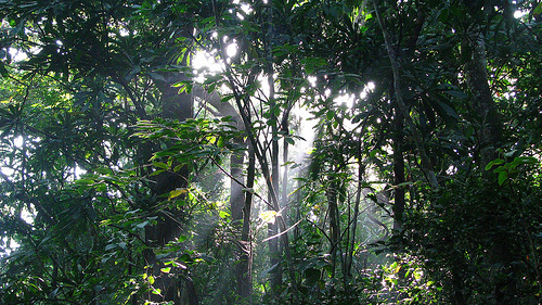
The Soberanía National Park is situated 25 km (16 mi) from Panama
City in Colón, Panamá provinces in Panama. Nature reserve covers an
area of 55,000 acres (220 km2). The Soberanía National Park contains
over 525 species of birds, 1300 species of plants, 79 species of
reptiles, 55 species of amphibians and 105 species of animals that
including agoutis, white- faced capuchin monkeys, Geoffroy's
tamarins, mantled howler monkeys, anteaters, two- toed sloths and
three- toed sloths and many others. Keep an eye for dangerous
poisonous snakes that might be found in the old foliage on the
jungle floor.
A network of trails expands throughout the
Soberanía National Park. This includes Camino de Cruces, Camino del
Oleoducto trail and Camino de la Plantación trail, El Charco trail
and many others. The Chagres river or Rio Chagres that flows through
the Soberanía National Park was used by the Spanish conquistadors
who used this water way for transport of gold and silver from Peru
to the Atlantic ocean, where it was loaded on the ships and shipped
to Europe. It takes about 5 to 6 hours to hike here. The river banks
have a basic campground available for overnight stay. Parts of the
old paving stones have been restored to its original condition.
History
The great diversity of flora and fauna
of the park is complemented by the historical and cultural value
represented by the conservation of the paved Camino de Cruces, which
crosses the park of East and West, and the remains of the town Venta
de Cruces. The first was used in colonial times to transport
merchandise and treasures from Peru, Baja California and Chile. This
was a communication channel that linked the Atlantic with the
Pacific, through a narrow path, but made of stones of different
sizes, which were stuck in the ground, giving a solidity and
firmness that defied the centuries. The Camino de Cruces presented
enormous dangers, apart from the possibilities of attacks by
criminals, robberies and murders, to which these desperate travelers
were exposed. The events that took place in California, with the
discovery of gold deposits, in California (1848), determined a
resurgence for the intercontinental transport of the immense amount
of passengers eager to move to the new paradise. The second Venta de
Cruces was a place of rest for adventurers and conquerors who
traveled this road for centuries; It was an important point in the
Camino de Cruces, here the merchandise was unloaded and transferred
to boats to be transported by the Chagres to the sea, or loaded in
mule trains, if their destination was Panama.
With an
extension of 19545ha., Located on the East Bank of the Panama Canal,
covering part of the province of Panama and Colon. (See map) The
park was created by Executive Decree N ° 13 of May 27, 1980, and
whose objective is the following:
a) Protect and conserve the
natural and cultural values of the area. b) Protect your genetic
resources. c) Develop Environmental Education and the opportunity
for public recreation. d) Provide opportunities for research and
scientific activities for purposes. Article 5 of the Park
establishes: it is prohibited to occupy the area declared
"Soberanía" National Park and the development of agricultural
activities, grazing, hunting, felling, burning, gathering and
destruction of renewable and cultural resources in it, as well as
commercial and labeling. The Park is a natural area of easy
terrestrial access from the cities of Panama and Colon. Services:
the administrative headquarters is located at the intersection of
the Omar Torrijos highway (former Madden or Forestal), with the
Gaillard highway, which leads to the town of Gamboa, headquarters of
the Dredging Directorate of the Panama Canal Authority. In the
administrative headquarters we find the offices of the park, where
the visitor is informed and oriented on issues related to it. We
also find the houses of Technicians and Park Rangers that has all
the basic services, used by the staff that works in the park. This
protected area has 5 houses and control posts for park rangers,
located in: Unión Veragüense, Aguas Claras, Limón, Agua Salud and
Frijoles. Location: The park is located along the eastern margin of
the Panama Canal, in the provinces of Panama and Colon and is 25
kilometers away by road from Panama City. Access: It is one of the
protected areas of the country with the easiest access, since it is
just over half an hour from Panama City. A road that leads to the
dam of Madden crosses the humid tropical forests of the park.