Location: Cochabamba Department Map
Area: 6,226 km2 (622,600 ha)
Altitude: 300 m to 4,700 m
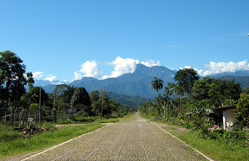
Carrasco National Park is located in Cochabamba Department in Bolivia. Carrasco National Park covers an area of 6,226 km2 (622,600 ha). Carrasco National Park was created in 1991 to conserve biological diversity in the region including humid cloud forests known as Yungas. The altitudes of this national park range from 300 meters above sea level to 4700 meters. Be aware that altitude sickness if fairly common and very painful at times. Take any precaution to minimize its effect or avoid high altitudes altogether. Also be aware that higher altitudes are much colder and windier than the jungles that cover the lowlands. Take some extra clothes if you plan to visit higher areas of this Bolivian national park.
The PNC was created under
the name of Carrasco-Ichilo National Park on December 9, 1988 with
an original area of 180,000 ha. On October 11, 1991, through
Supreme Decree No. 22,940l, the Protected Area was established as a
Carrasco National Park and reduced to an area of 622,600 hectares
in order to reduce the environmental impact of the Chimoré-Yapacaní
highway and attach the Wildlife Sanctuary “Cavernas del Repechón”
created by Ministerial Resolution 157-86 of May 22, 1986.
The
park management began in 1993, the Forest Development Center (CDF)
was in charge of its administration. The management was focused on
the protection of biodiversity, environmental education and
management of natural resources. The administration of the area is
transferred to the National Directorate of Biodiversity Conservation
(DNCB, now the National Protected Areas Service) at the end of 1993,
maintained to date. This transfer was made due to the poor
management of the CDF and the enactment of the Environment Law and
the creation of the National Secretary of Environment (SENMA).
One of the main problems of the area is related to the
boundaries of the area and its category as a national park.
Previously, the possible change of its category to the National Park
and the Carrasco Integrated Management Natural Area has been
considered, similar to the case of the Amboró PN-ANMI. As well as
the possibility of creating a Natural Area of Integrated
Management to the north of the area and the area designated as a red
line for being a degraded region with a high population density and
the presence of legal coca plantations.
Administration
The
management of the area includes a policy of community participation,
within that framework, park rangers and administrators born in the
communities around the park have been integrated. The integration of
personnel has allowed improving relations between communities and
state agencies as well as the assistance of communities in
monitoring compliance with the regulations of the area.
Additionally, a commission made up of the management committee
(coordinating body with municipal governments) and representatives
of the communities and institutions (NGOs and OG) that work has been
organized to redefine the park's boundaries.
Land tenure
One of the main social conflicts in the area is land tenure. Many of
the inhabitants of the communities settled before the creation of
the protected area do not have a title deed on the land. Limiting
factor in the control and regulation of coca crops and new
settlements. As well as defining the area to enable for crops,
generating a deforestation in deforestation.
Conservation
International and CIDEDER are supporting land sanitation in the
southern area of influence of the park, an area where communities
have great insecurity about the ownership of their lands and fear
for the illegal sale of them to entrepreneurs in the region.
Zoning
The area does not have a Management Plan, and the process
of its preparation has not yet begun since an improvement in
relations between communities and the government is expected.
However, preliminary zoning is concluded by identifying threats,
conservation priorities and objectives of the area. In recent years,
the relationship between communities and the government has been
damaged by restrictions on coca cultivation, making it difficult to
include local participation in management as well as the formation
of the management committee.
Weather
The climate of
the region is seasonal with a wet and dry season. The only reliable
weather station is in the wettest region of the area, in the town of
Villa Tunari (more than 10 years of weather records). This region
has an average annual rainfall of 5676 mm per year. Most rains are
concentrated in the wet season (between November and April).
Although the precipitation decreases considerably during the dry
season (May and July), less than 1000 mm, the relative humidity
remains high generating a perhumid climate.
There are no
climatic seasons in the highest regions. However, due to rugged
topography, humidity is maintained in a thin belt, keeping humidity
at levels higher than the Amazon. Additionally, the condensation of
the mist contributes to the ambient humidity, especially in the area
of cloud condensation between 1600 and 3600 masl.
The
average temperature in Villa Tunari is 24.6 ° C and between 12-15 °
C in Sehuencas, with a variation close to 5 ° C throughout the year.
Frosts are frequent at around 200 meters above sea level, especially
during the arrival of polar winds from the south in the dry season.
Flora
In the Carrasco National Park there are approximately
3000-5000 species. In the area you will find important timber
species such as cedar (Cedrela odorata), mara (Swietenia
macrophylla), alder (Alnus acuminata), and walnut (Bolivian
Juglans). Like species considered in pelibro such as the mountain
pine (Podocarpus perlatorei and Podocarpus rusbyi), the red pine
(Prumnopitis exigua) and the majo palm (Oenocarpus bataua).
Due to the rugged topography and slopes in the area, landslides are
common and with great power comes a large proportion of the
vegetation consists of various stages of vegetation in succession.
The ravines are rarely affected by landslides, housing floristically
different communities, such as ravines dominated by the mountain
pine between 2600 and 3300 meters above sea level. About 3400 meters
above sea level, the vegetation is dominated by forests of Keñua,
Polylepis racemosa (3400-3800 meters above sea level) and Polylepis
pepei (3,800-4,200 meters above sea level).
The Ceja de Monte
region is dominated by mixed mist forests where several species of
walnut (Juglans spp.), Copal, palms such as majo (Oenocarpus
bataua), giant ferns (Cyathea spp.) And Huaycha (Weinmannia spp. )
in the Ceja de Monte subregion with mixed mist forests. In the
highest areas, such as the Puna and the Yungueño Páramo, evergreen
and pajonal scrublands dominate.
Wildlife
More than 800
vertebrate species have been registered in the Protected Area, of
which 125 are large mammals. Among the most representative mammal
species are the spectacled bear, or jucumari (Tremarctos ornatus),
the Andean Taruca or deer (Hippocamelus antisensis), the jaguar
(Panthera onca), the Andean cat (Felis jacobita) and the tapir
(Tapirus terrestris). On the other hand, the area is characterized
by housing a great diversity of birds, bird records reach
approximately 850 species. Approximately 30% of all bird species
registered in Bolivia. The park is considered one of the priority
protected areas for bird conservation in Bolivia since it covers
endemic bird areas: the lower and upper Yungas and the Andes. The
guácharo (Steatornis caripensis) is one of the birds of special
tourist attraction for the area due to its nocturnal habits and its
relation to its trophic relationship with palm trees. Among the
endangered and / or endemic species are: Asthenes heterura, Terenura
sharpei, Morphus guianensis, Tangara ruficervix, Simoxenops
striatus, Grallaria erythrotis, Myrrmotherula gray, Oreotrochilus
adela.