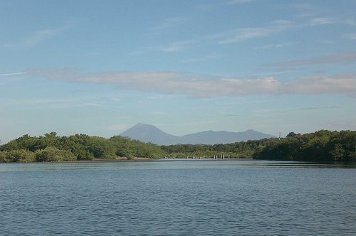
Location: Leon
Area: 2.9 ha
Juan Venado Island Natural Reserve (Reserva Natural Isla Juan
Venado) is a stunning barrier island and protected mangrove
estuary on Nicaragua’s Pacific coast, near Las Peñitas and
Salinas Grandes in León Department. It’s a thin, elongated strip
of land (about 22 km long, 0.5 km wide, roughly 2,934 hectares)
separating the mainland from the ocean, known for its rich
biodiversity, serene mangroves, and sea turtle nesting beaches.
No one lives permanently on the island, offering a sense of
solitude amid nature. It’s an excellent half-day or full-day
trip from León (about 30–60 minutes away), ideal for wildlife
enthusiasts, birdwatchers, and those seeking a low-key
eco-adventure.
Why Visit?
Mangrove labyrinth: Narrow tidal channels through dense
mangroves teeming with life.
Wildlife: Crocodiles (including babies),
caimans, iguanas, crabs, fiddler crabs, fish, and over 100–140 bird
species (herons, egrets, kingfishers, frigatebirds, migratory
shorebirds).
Sea turtles: Important nesting site for Olive Ridley
turtles (primarily May–November, peak around August–December); possible
nighttime tours or hatchling releases.
Beaches: Pacific-facing
dark-sand beaches for walking, swimming (with caution), and
relaxation—often empty.
Conservation vibe: Supports local ecotourism
and turtle protection projects like Palo de Oro.
Best Time to
Visit
Dry season (November–April): Preferred for easier access, less
rain, and comfortable conditions. Wildlife is still active, especially
early morning or late afternoon.
Wet/rainy season (May–October):
Turtle nesting peaks, but heavy rains can make channels muddier and
boat/kayak trips less predictable. Mornings or sunsets are best for
birds.
Tides matter: Low tide is often recommended for better
wildlife viewing and navigation in the mangroves. Ask your guide.
Sunrise/sunset: Optimal for bird activity and photography.
How to
Get There
From León (most common base):
Bus from Sutiava Market to
Las Peñitas (~30 minutes, cheap and frequent).
Taxi or private
transfer (~20–40 minutes, ~$20–30 round-trip often arranged with tours).
Drive: Paved road; follow signs toward Poneloya/Las Peñitas.
From
Las Peñitas: Short scenic boat ride across the estuary is ideal (avoids
a longer drive). Many hotels/hostels arrange this.
The reserve office
is near the estuary for entry fees and guide arrangements.
Tours
and Activities
Most visits involve a guided boat tour (2–3 hours)
through the mangroves, with options to walk across the narrow island to
the ocean beach.
Boat tour: Small motorized boat; spot wildlife up
close. ~$20–30 per person (group rates lower); often includes guide.
Kayak tour: More immersive and quiet (private options available); great
for paddling channels. Rentals ~$12/half-day; guided ~$10 extra.
Turtle experiences: Night tours or hatchling releases (seasonal, ethical
operators only). Some include camping.
Birdwatching: Specialized
tours with equipment.
Beach time: Swim, relax, or explore after the
mangrove tour. Some tours stop for fresh oysters or swimming.
Tours from León: Many operators (e.g., Volcano Day Tours, local hostels
like Mano a Mano or Playa Roca) offer packages including transport,
boat, guide, and sometimes meals/drinks. Private or group options. Book
ahead, especially for turtle activities.
DIY: Rent a kayak or hire a
local fisherman’s boat at Las Peñitas. Pay entry at the office.
Costs (Approximate, USD; prices can vary)
Entrance fee: ~$4–10 per
person (C$100 or equivalent; boat captain may handle).
Boat tour:
$20–40 per person (cheaper in groups; 2–4 hours).
Kayak: $10–20 +
guide.
Full package from León: $30–60+ including transport.
Cash
(Córdobas or USD) preferred; bring small bills.
What to Bring and
Wear
Essentials: Sunscreen (high SPF—intense sun), insect repellent
(mosquitoes in mangroves), reusable water bottle, hat, sunglasses,
camera/binoculars, rain jacket (wet season), snacks.
Clothing:
Lightweight, quick-dry clothes; closed-toe shoes or water shoes for
wading/mud; swimsuit.
Other: Cash, phone (limited service),
eco-friendly sunscreen (to protect reefs/mangroves), binoculars for
birds.
Wading into shallow water to board boats is common.
Practical Tips and Safety
Guided is better: Local guides know tides,
wildlife spots, and safety. Many speak Spanish primarily; English may be
limited—confirm if needed.
Wildlife respect: Keep distance from
crocodiles/turtles; no flash photography during nesting; follow "leave
no trace."
Health/Safety: Strong currents on the ocean side—swim
cautiously. Stay hydrated. No major facilities on the island; use
restrooms before/after.
Conservation: Support turtle projects; avoid
disturbing nests.
Weather/Seasonal: Check tides and forecasts. Dry
season is more reliable.
Accessibility: Flat but involves
boats/kayaks—moderate physical effort; not ideal for severe mobility
issues.
Combine with: Las Peñitas beach time, surfing, or León
city/volcano activities.
Where to Stay Nearby
Las Peñitas:
Beachfront options like Barca de Oro (tours/kayaks available), hostels,
or surf camps. Relaxed fishing village vibe.
León for more amenities
if doing a day trip.
Geographical and Ecological Context
The reserve centers on a
narrow Holocene barrier island (Isla Juan Venado) roughly 18–22 km long
and 0.3–0.5 km wide (totaling around 29 km² or ~2,934 hectares for the
core protected zone, with varying figures for the broader area including
mangroves). It runs parallel to the mainland, separated by an extensive
mangrove-lined estuary/lagoon system. The island’s elevation is low (max
~25 m), consisting mainly of unconsolidated marine sands shaped by wave
action, longshore drift, and Pacific currents.
This setup creates
diverse habitats: Pacific-facing beaches for turtle nesting, dense
mangroves (red, black, white species like Rhizophora mangle, Avicennia
germinans), estuarine waters, salt flats, and some dry tropical
scrub/forest remnants. It supports high biodiversity, including Olive
Ridley sea turtles (Lepidochelys olivacea, with mass arribadas nesting
August–December/January), other turtles (leatherback, hawksbill),
American crocodiles, caimans, iguanas, abundant waterbirds (herons,
pelicans, ibis, migratory species), fish, crustaceans, and mammals like
raccoons and deer.
The area acts as a natural storm barrier and
nursery for marine life, with significant ecological connectivity to the
Pacific and inland León plains.
Pre-Colonial and Indigenous
History
The region has deep indigenous roots tied to the Sutiava (or
Subtiava/Maribio) people, an indigenous group from the western Nicaragua
region around León. Legends and historical accounts link the Sutiava to
arrival by sea, with the island and surrounding area holding cultural
significance. Artifacts such as pottery shards (tiestos de barro) have
been found on the island and in local museums, and an old leather map in
the Sutiava community museum in León reportedly delineates their lands,
including Isla Juan Venado.
Indigenous and local fishing communities
have used the coast for millennia for subsistence fishing, shellfish
gathering, and turtle egg harvesting. The island and estuary provided
resources like fish, crustaceans (punches, conchas), mangroves for wood,
and beach resources.
Naming and Early Colonial/Post-Colonial Use
The island’s name "Juan Venado" ("Juan Deer") originates from a
historical local inhabitant who hunted deer (venados) in the adjacent
forests to sell meat in León’s markets. Over time, surrounding dry
forests were largely cleared, ending that activity.
In the 19th–20th
centuries, the area supported small-scale fishing and traditional
resource use by communities like Las Peñitas and Salinas Grandes. During
the Somoza era (pre-1979), commercial sea turtle harvesting (eggs and
adults) was permitted, contributing to population declines.
Establishment as a Protected Area (1983)
Isla Juan Venado was
formally declared a nature reserve by Decree 13-20 (or related decree),
published in the official gazette La Gaceta on September 8, 1983. This
made it one of Nicaragua’s earlier protected coastal sites, driven by
growing awareness of its importance for sea turtle conservation amid
unregulated egg harvesting.
The post-1979 Sandinista revolution
brought new environmental focus, leading to protections for key nesting
beaches. MARENA (Ministerio del Ambiente y los Recursos Naturales)
oversees the reserve, often in coordination with local communities, the
León municipality, and groups like FUNCOD.
Management plans (e.g.,
the 2002 plan supported by MARENA/COMAP/USAID/FUNCOD) emphasized
participatory processes involving local communities, indigenous Sutiava
groups, and stakeholders. These addressed biodiversity, threats (e.g.,
mangrove cutting, shrimp farming pollution, poaching), zoning, and
sustainable use.
Conservation Efforts and Modern History
Sea
Turtle Conservation: A flagship effort. Projects like Palo de Oro
Ecotourism (active since ~2008) operate turtle nurseries, protect nests,
and release thousands of hatchlings (Olive Ridley, others).
Community-based programs, including indigenous involvement, shift
economics from poaching to ecotourism and patrolling. Nesting peaks
align with visitor opportunities for ethical night tours.
Community
and Ecotourism: No permanent residents on the island itself. Access is
via boat from Las Peñitas (short drive from León). Tours focus on
mangroves (birds, crocs, caimans), beaches, and wildlife. Local guides
provide income; initiatives promote sustainable livelihoods.
Ongoing
Challenges and Initiatives: Threats include illegal mangrove cutting for
fuel/charcoal, shrimp farm impacts on water quality, fires, unregulated
development, climate change (sea-level rise, storms), and poaching.
Responses involve reforestation (e.g., recent red mangrove propagules),
patrols, education, and research. The reserve has shown turtle
population recovery.
Broader Context: Part of Nicaragua’s SINAP
(National System of Protected Areas). It benefits from international
links (e.g., sea turtle networks) and aligns with Ramsar wetland goals.
Geological activity (earthquakes, 1992 tsunami effects) and Pacific
dynamics shape its vulnerability and resilience.
Cultural and
Historical Significance Today
The reserve preserves not only natural
values but also cultural ties to Sutiava heritage and local fishing
traditions. It symbolizes community-conservation integration in
Nicaragua, balancing biodiversity protection with economic opportunities
in a region historically reliant on marine resources.
Location and Physical Dimensions
Coordinates: Approximately
12°19′55″N 86°58′45″W.
It functions as a barrier island—a long,
narrow strip of land that separates the Pacific Ocean from the mainland
estuary and mangrove lagoons.
Length: About 22 km (13.6 miles).
Width: Roughly 0.5 km (0.3 miles) at its widest.
Area: Sources vary
slightly (around 29 km² / 11 sq mi in some descriptions, or ~2.9–132 km²
reported for the broader protected/marine area including estuary; the
core island is the slender sand barrier).
Elevation: Low-lying,
generally no higher than 25 meters (82 feet) above sea level, with
mostly flat or gently undulating sandy terrain.
The island runs
parallel to the mainland coast, creating a sheltered estuarine system
between it and the shore. This setup protects the inland mangroves and
wetlands from direct ocean waves while allowing tidal exchange.
Geology and Topography
The island consists primarily of sandy beaches
and dunes formed by coastal sedimentation and wave action. As a barrier
island, it is dynamic—subject to erosion, sediment deposition, and
occasional storm reshaping. The Pacific-facing (western) side features
open sandy beaches ideal for sea turtle nesting. The eastern side
borders calmer estuarine waters and dense mangroves.
The surrounding
area is part of Nicaragua’s Pacific lowlands, characterized by tropical
dry forest influences transitioning into coastal wetlands. The reserve
is dominated by a large estuary and mangrove forests, with tidal
channels, lagoons, and mudflats.
Climate
The reserve has a
tropical monsoon climate typical of Nicaragua’s Pacific coast:
Dry
season (November–April): Lower rainfall, more accessible for visits.
Wet season (May–October): Higher rainfall, increased humidity, and
potential for flooding in low-lying areas.
Temperatures are
consistently warm (daytime averages around 29°C / 85°F), moderated
slightly by ocean breezes.
Ecosystems and Vegetation
The
standout feature is the extensive mangrove forest (one of the important
ones on Nicaragua’s Pacific coast), which forms a complex network of
channels, roots, and canopy.
Key mangrove types include:
Red
mangroves (Rhizophora spp.) — Prominent near the entrance from Las
Peñitas; they thrive in oxygen-rich tidal waters with prop roots that
stabilize sediment and provide nursery habitat for fish and crustaceans.
Black and white mangroves — Found further inland; they support nesting
birds and other wildlife.
These mangroves act as a natural
barrier, filtering saltwater, protecting against erosion/storms, and
supporting high biodiversity. Additional vegetation includes tropical
dry forest elements on higher sandy areas, beach grasses, and coastal
shrubs. The system is highly productive due to nutrient-rich tidal
flows.
Hydrology and Coastal Features
A network of estuarine
channels, lagoons, and tidal flats lies between the island and mainland,
fed by freshwater inflows and Pacific tides.
The Pacific side has
sandy beaches with an estuary zone important for marine life.
The
mangroves create a labyrinth of waterways ideal for boat or kayak
exploration.
This wetland complex serves as a critical buffer zone,
trapping sediments and protecting the mainland from wave energy.
Biodiversity Highlights (Tied to Geography)
The geography—sheltered
mangroves, open beaches, and estuarine mixing—supports rich wildlife:
Sea turtles: Olive Ridley turtles nest on the Pacific-facing beaches
(peak seasons around May–December, varying by source).
Reptiles:
Crocodiles, caimans, iguanas, and lizards thrive in the mangroves and
channels.
Birds: Over 100–160 species, including waterbirds, mangrove
specialists, and migrants.
Mammals: Raccoons, deer, opossums,
armadillos, porcupines.
Marine/estuarine life: Fish, crustaceans, and
invertebrates in the root systems and channels.
No permanent
human population lives on the island, preserving its natural state
(though there may be limited eco-facilities or research presence).
Human Context and Access
The reserve is easily accessible for day
trips from León, typically via boat tours through the mangroves from Las
Peñitas. It plays roles in conservation, ecotourism, turtle protection,
and coastal defense. Threats include potential climate change impacts
(sea-level rise, stronger storms) on this low-lying barrier system.