Location: Colón, Panamá provinces Map
Area: 55,000 acres (220 km2)
Tel. 500- 0855
Soberanía National Park (Parque Nacional Soberanía) is one of
Panama’s most accessible and rewarding tropical rainforest
destinations, located just 15–30 km (about 30–45 minutes’ drive)
north of Panama City along the Panama Canal corridor.
Covering
around 22,000 hectares (54,000+ acres) of lowland rainforest, it
protects an incredibly biodiverse area with over 500 bird species
(one of the world’s top birding sites), howler monkeys, white-faced
capuchins, sloths, agoutis, coatis, and more. Its proximity to the
capital makes it ideal for a day trip, but you can easily spend
multiple days exploring trails, the canal edge, and nearby
attractions like the Panama Rainforest Discovery Center.
Best Time to Visit
Dry season (mid-December to April): Preferred
for clearer trails, less mud, and easier hiking. Wildlife (especially
birds) is active, though crowds increase on weekends and holidays.
Rainy/green season (May–November): Lusher vegetation, more water
features (like cascades on short trails), and fewer visitors. Afternoons
often bring heavy showers, so plan morning activities. Trails can get
slippery and buggy.
Shoulder periods (e.g., late November–early
December): Good balance of weather, fewer crowds, and lower prices.
Daily timing: Start as early as possible (6–7 AM for birding and
wildlife). Official hours are often cited around 8:30 AM for some
facilities, but Pipeline Road sees early access by birders. Aim for
sunrise activity; heat and humidity build quickly (daytime 28–32°C /
82–90°F).
Getting There
By car/taxi: Easiest option. Take Via
Centenario toward Gamboa (30–40 minutes). Taxi one-way ~$22–50 USD;
arrange round-trip or use Uber (availability varies). Rental car offers
flexibility.
By bus: Budget-friendly from Albrook Terminal (buses to
Gamboa/Chilibre/Bahia D, ~$3–5, ~1 hour). Short walk from drop-off to
entrances.
Tours: Many day tours from Panama City include transport,
guide, and sometimes lunch (e.g., Pipeline Road birding or combined with
canal activities). Great for first-timers.
Park near Gamboa town
(built for canal workers) for easy access.
Entrance Fees and
Facilities
General park/trails: Around $5 USD for foreigners (day
pass).
Panama Rainforest Discovery Center (inside the park): Higher
fee, often ~$30–32 USD, includes access to the canopy tower, hummingbird
feeders, and trails. Open early (e.g., 6 AM–noon for best wildlife).
Visitor center/admin office near the fork to Gamboa for maps/info.
Limited facilities on trails—bring your own water/snacks.
Top
Trails and Activities
Pipeline Road (Camino del Oleoducto): The star
attraction—a flat, ~17–23 km gravel/dirt road (hike as far as you like;
10 km common). World-renowned for birding (toucans, trogons, mixed
flocks), howler monkeys, sloths, and more. Easy to moderate; great for
slow, observational walks. Early morning best.
Sendero El Charco:
Short, easy 1.5 km loop with streams, small cascade/pool (possible dip),
monkeys, birds, and leafcutter ants. Family-friendly.
Plantation
Trail: ~14 km loop through old colonial plantation remnants, diverse
plants, butterflies, and wildlife. Easy-moderate.
Camino de Cruces:
Historic 16th–18th century Spanish gold transport route. More
challenging (~10 km), with ruins, swamps, and jungle. Best with a guide
for historical context.
Rainforest Discovery Center: Boardwalks,
hummingbird garden, and 32-meter (105 ft) observation tower for canopy
views. Excellent for birds, parrots, and panoramic rainforest vistas.
Other options: Night hikes (frogs, insects, owls—guided recommended),
boat tours on Chagres River/Gatun Lake (caimans, monkeys), or visits to
nearby sloth sanctuaries/butterfly exhibits.
Wildlife Tips
Birdwatching: Over 525 species possible. Bring binoculars; go
early/late. Pipeline Road is legendary.
Common sightings: Howler
monkeys (loud roars), sloths (look up in canopy), capuchins, capybaras,
agoutis, toucans, hummingbirds.
Patience and quiet movement are key.
A certified guide greatly improves spotting (many tours available).
Respect wildlife: No feeding, keep distance.
Practical Visiting
Tips
What to bring:
Sturdy, waterproof hiking shoes (trails
muddy/slippery after rain).
Lightweight, long-sleeved/quick-dry
clothing; rain jacket/poncho.
Plenty of water (1–2+ liters), snacks,
insect repellent (DEET or strong), sunscreen, hat, binoculars/camera
with zoom.
Flashlight/headlamp for early/late or night activities.
Cash for fees; basic first aid, phone with offline maps/GPS.
Health & Safety: High humidity/heat—stay hydrated, pace yourself.
Mosquitoes (dengue/zika risk—use repellent). Snakes/insects present but
rarely aggressive; stick to trails. Park is generally safe, but go with
a partner or guide, especially off main paths or at dusk. Inform someone
of your plans.
Guides: Not required for main trails (well-signed),
but highly recommended for deeper experience, safety, and spotting. Many
speak English.
Accommodations: Day trip feasible, but overnight in
Gamboa (e.g., Gamboa Rainforest Resort) or nearby lodges for immersion,
night walks, and early starts. Camping possible in designated areas.
Nearby Combo Ideas: Pair with Miraflores Locks (Panama Canal), Summit
Botanical Gardens/Zoo, or Emberá indigenous village tours.
Pre-Colonial and Indigenous Context
The region’s
geological foundation predates human history by millions of years. It
features ancient volcanic basalt from the Caraba Formation (Late
Cretaceous to Early Miocene) and limestone layers from former coral
reefs and marine environments. Tectonic uplift closed an ancient seaway,
forming the Isthmus of Panama and enabling the Great American Biotic
Interchange.
Indigenous groups inhabited the area long before
European arrival, though specific details in park records emphasize
later colonial overlays. The park’s location near the continental divide
and Chagres River made it a natural corridor.
Colonial Era:
Camino de Cruces and the Spanish Treasure Route (16th–19th Centuries)
The park’s most prominent historical feature is the Camino de Cruces
(also called Camino Real de Cruces), a stone-paved trail built around
1527. It connected Panama Viejo (on the Pacific) with Venta de Cruces, a
key port on the Chagres River.
Spanish colonizers used this
transisthmian route to transport gold, silver, textiles, spices, and
other treasures from South America (Peru, Chile, etc.) and Baja
California to ships bound for Spain. Mule trains traversed the narrow,
rugged path, which posed dangers from terrain, wildlife, disease, and
bandits. Venta de Cruces served as a rest stop and transshipment point
where goods moved between mules and boats on the Chagres River.
In
1671, English privateer Henry Morgan’s forces reportedly used parts of
the route during their raid on Panama City. The trail saw renewed use
during the California Gold Rush (post-1848), as fortune-seekers crossed
the isthmus until the Panama Railroad (1855) largely replaced it.
Remnants of the original cobblestones remain visible today, offering
hikers a tangible link to this era of conquest, commerce, and global
connection. Ruins of Venta de Cruces, including possible chapel or
settlement remnants, also lie within the park.
20th Century:
Panama Canal Zone, Military Use, and Protection
During U.S.
construction and control of the Panama Canal (early 1900s–1970s), the
area fell within the U.S.-controlled Canal Zone. The forest served as a
strategic buffer, protecting the canal’s watershed from erosion and
ensuring water supply for operations. Parts were used for military
purposes, including radar stations, training trails, and surveillance
during the Cold War. The famous Canopy Tower, now an ecolodge,
originated as a U.S. military radar post.
Plantation Road (Camino de
Plantación) dates to around 1915, when a U.S.-administered banana and
cacao plantation operated in the area.
Panama gained increasing
sovereignty over the Canal Zone through treaties and negotiations
(notably the 1977 Torrijos-Carter Treaties). After the 1968 military
coup and under General Omar Torrijos, nationalist policies emphasized
land reform and environmental protection tied to canal operations.
The park was officially established on May 27, 1980, via Executive
Decree No. 13 of the Panamanian government. Its creation aimed to
conserve natural and cultural values, protect genetic resources, support
environmental education, recreation, and scientific research. It forms
part of a biological corridor along the canal’s eastern edge, alongside
areas like Parque Natural Metropolitano and Camino de Cruces National
Park.
(Note: The former Summit Park area was part of the original
designation but transferred to Panama City in 1985.)
Modern Era:
Research, Ecotourism, and Conservation
Since 1980, the
park—administered by Panama’s Ministry of Environment (MiAmbiente)—has
become a premier site for biodiversity research and ecotourism. The
Smithsonian Tropical Research Institute has conducted extensive studies
here. Pipeline Road (Camino del Oleoducto), a 17+ km former oil pipeline
access road, is world-renowned for birding; it once held records for the
most bird species observed in a single day (e.g., 357–525 species
reported in various counts).
The park’s location at a low point in
the continental divide fosters unique ecological overlap between
Caribbean and Pacific slopes, enhancing its “cradle of encounters”
status for species.
It supports over 1,300 plant species, ~525 birds
(an Important Bird Area), 100+ mammals (including jaguars, ocelots,
howler monkeys, capybaras, and sloths), plus rich herpetofauna and
invertebrates. Threats like poaching, illegal logging, and development
pressures persist, but ranger patrols and community involvement aid
protection.
Key trails highlight its layered history and nature:
Pipeline Road — Premier birding and wildlife.
Camino de Cruces —
Colonial history.
Plantation Road — Old plantation sites and views.
El Charco — Short, family-friendly with pools.
Others like Espíritu
del Bosque (interpretive) and cycling routes.
Facilities include
an administrative center near Gamboa, the Panama Rainforest Discovery
Center (with canopy tower), and guard posts.
Location and Size
The park lies in Panamá and Colón Provinces,
approximately 25 km (15–16 miles) north of Panama City, near the town of
Gamboa. It borders the Panama Canal and sits in the former Canal Zone
area. Coordinates center around roughly 9°04′N 79°40′W.
It covers
about 55,000 acres (220 km² or roughly 22,000 hectares), forming part of
a critical ecological corridor that protects the Panama Canal watershed.
The Chagres River flows through the park, and it includes sections along
the canal's banks.
Topography and Terrain
The terrain is
primarily lowland to hilly tropical forest, with gentle to moderate
slopes. Key elevation stats include:
Average elevation: Around
295 ft (90 m).
Minimum elevation: About 59 ft (18 m), near river and
canal lowlands.
Maximum elevation: Up to 1,234 ft (376 m) at higher
ridges.
The landscape features rolling hills, river valleys, and
lowland flats. It is not dramatically mountainous but includes varied
relief with streams, small waterfalls, and occasional steeper sections
on trails. The low continental divide near Gamboa facilitates ecological
mixing between Caribbean and Pacific influences.
Trails show modest
elevation gains (e.g., some paths with 100–700+ ft gain), with Pipeline
Road being relatively accessible but traversing old-growth and secondary
forest. Muddy or uneven sections are common, especially after rain.
Hydrology and Rivers
The Chagres River is the dominant feature,
running through the park and supplying water to the Panama Canal via
Gatun Lake. It creates riverine habitats, floodplains, and supports
aquatic life (including crocodilians and otters). Smaller streams,
creeks, and seasonal waterfalls feed into it, contributing to the park's
lushness and acting as a vital watershed protector.
Geology and
Soils
The underlying geology includes ancient volcanic layers, such
as the Caraba Formation (basalt from Late Cretaceous to Early Miocene
submarine eruptions), overlaid with limestone from coral reefs as the
isthmus formed. This creates stable bedrock supporting dense vegetation.
Soils are typically tropical (e.g., Cambisols, Ferralsols, or loamy
types), well-drained in upland areas but prone to moisture retention and
erosion in lowlands. They are nutrient-rich enough to sustain high
biomass despite typical tropical leaching.
Climate
The park
experiences a tropical monsoon climate with high humidity and distinct
wet/dry seasons. Annual rainfall is substantial (around 2,600 mm / 102
inches in nearby areas like Barro Colorado Island), with most
precipitation from May to December. The dry season (January–April) is
pronounced but still supports evergreen elements. Temperatures are
consistently warm (typically 24–32°C / 75–90°F), with little seasonal
variation. Proximity to the canal and river moderates extremes,
fostering a humid, misty environment ideal for rainforest growth.
Caribbean-influenced moisture contributes to lush conditions.
Vegetation and Forest Types
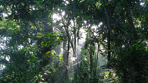
Soberanía features tropical moist forest
with patches described as dry tropical forest, including old-growth and
secondary/regenerating areas. The canopy is dense and multi-layered
(emergent trees, canopy, understory, and forest floor), with towering
species like ceiba (kapok) trees, along with cacao, rubber, coffee, and
other tropical hardwoods and epiphytes. Vines, lianas, palms, and
diverse undergrowth create a complex vertical structure. The mix of
habitats (riverine, lowland, hillside) supports exceptional plant
diversity (over 1,300 species noted in some accounts).
Ecological
Significance
Its position near the low continental divide allows
overlap of species from Caribbean and Pacific slopes, plus North and
South American influences, making it a biodiversity hotspot. It protects
the canal's water supply while serving as a green corridor close to
urban Panama City.
Notable access points include Pipeline Road
(Camino del Oleoducto, ~17.5 km, famous for birding), Plantation Trail,
Cruces Trail (historical Spanish gold route), and El Charco Trail (with
natural pools). The Panama Rainforest Discovery Center offers a 32-meter
canopy tower for panoramic views.