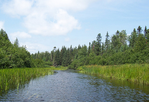
Length: 430 miles (692 km)
The Wisconsin River, a major tributary of the Mississippi River, is one of the most significant waterways in the Midwest, flowing approximately 420 miles (676 km) through Wisconsin. Known as the "Hardest Working River in the Nation" due to its extensive use for industry, hydropower, recreation, and agriculture, it is also Wisconsin’s longest river and a vital ecological and cultural lifeline. Below is an in-depth exploration of its geography, history, ecology, economic importance, cultural significance, and current challenges, with a focus on providing a comprehensive and nuanced understanding.
Overview and Key Sections
Upper/Middle Sections (e.g., Wisconsin
Dells area): Famous for the "Dells" — steep Cambrian sandstone cliffs,
gorges, and rock formations. This is a popular tourist hub with boat
tours, water activities, and nearby attractions.
Lower Wisconsin
State Riverway: The longest free-flowing stretch in the Midwest (~92
miles from Prairie du Sac to the Mississippi). It features shifting
sandbars ideal for camping, abundant wildlife (eagles, herons, deer,
waterfowl), bluffs, and a relaxed paddling experience. Over 95,000 acres
of protected lands border it.
Towns along the river include Wisconsin
Dells, Sauk City/Prairie du Sac, Spring Green, Muscoda, and Prairie du
Chien. These provide access points, lodging, rentals, and services.
Best Time to Visit
Summer (June–August): Prime for paddling,
swimming, boating, and sandbar camping. Water is warm, but weekends
(especially near Dells) can be busy and buggy. Early mornings or
weekdays are quieter.
Spring/Fall: Fewer crowds, great for paddling
and wildlife viewing. Fall offers beautiful colors and bug-free camping;
water levels can be lower.
Avoid: Early spring high water/flooding or
very dry periods when some sections may be shallow. Check current
conditions.
Current river flow and conditions are available via the
Wisconsin DNR (e.g., Lower Wisconsin Riverway conditions page).
Popular Activities
Paddling, Canoeing, and Kayaking:
The Lower
Riverway is beginner-to-intermediate friendly for multi-day trips (no
permits needed for most primitive camping). Popular segments: Sauk City
to Spring Green (busier), Spring Green to Muscoda (more solitude), or
full 90-mile trips.
Rentals and shuttles are available from
outfitters like WI River Outings (Boscobel/Sauk City area) or Blackhawk
River Runs. Day trips, overnights, or longer excursions are common.
In the Dells: Rent kayaks or join guided trips; watch for boat traffic
in narrow sections.
Boat Tours in Wisconsin Dells:
Upper Dells
Boat Tours: Highly recommended for sandstone cliffs, Witches Gulch
(narrow fern-filled canyon), and Stand Rock (famous dog jump). Get off
the boat to explore.
Jet boats (fast, splashy), DUCK amphibious
tours, or calmer sunset cruises. Lower Dells tours are also available.
Book ahead in peak season.
Camping and Sandbar Camping:
Primitive boat-in camping on sandbars and islands in the Lower Riverway
(first-come, first-served; max 3 days on state lands; no permit
required). Choose sites with vegetation/trees at least 18 inches above
water.
Riverside Park in Muscoda or state parks for more developed
options. Pack light and follow Leave No Trace.
Fishing, Swimming,
and Wildlife Viewing:
Good fishing (check regulations); abundant
birds and animals. Sandbars for sunbathing/swimming (wade carefully).
Hiking: Dells of the Wisconsin River State Natural Area (Chapel Gorge
Trail, Cambrian Overlook for vistas), nearby Devil's Lake State Park, or
Tower Hill State Park.
Other: Tubing (e.g., near Spring Green),
biking nearby trails, visiting Frank Lloyd Wright sites (Taliesin in
Spring Green), or cheese curds at local spots.
Safety Tips
The
river looks calm but has strong currents, shifting sandbars, and sudden
drop-offs. Key advice from DNR:
Always wear a life jacket (PFD) —
especially if wading or not a strong swimmer. Children under 13 must
wear one by law in many cases.
Wade in pairs on the upstream end of
sandbars; avoid downstream edges (unstable, deep holes).
Don't fight
the current if swept in — float downstream to safety.
Monitor weather
(thunderstorms common) and river levels (can rise quickly). Check DNR
conditions.
No glass containers on the river (illegal in many areas).
Mosquitoes, poison ivy, and sun exposure are common — bring repellent,
protective clothing, sunscreen, and a hat.
File a float plan, carry a
phone (service may be spotty; note landing names/distances for
emergencies — dial 911), and know your limits.
Practical Visiting
Tips
Access and Transportation: Numerous public boat launches (e.g.,
Prairie du Sac, Spring Green, Muscoda). Use DNR maps or apps for
locations. Shuttles from outfitters simplify one-way paddles.
Lodging: Resorts/hotels in Wisconsin Dells (waterpark-heavy),
cabins/B&Bs near Spring Green, or campgrounds. Book early for summer.
What to Pack: PFDs, paddling gear, water shoes (sandy/muddy bottoms),
dry bags, tent/tarp, bug spray, first aid, navigation (maps/GPS),
food/water (no services on river), flashlight, trash bags. For Dells
tours: towel/poncho for splashy rides.
Regulations: Follow Wisconsin
boating/fishing rules. No camping fees for most riverway primitive
sites, but check local parks. Pets often welcome but confirm.
Crowds
and Costs: Dells area is touristy and pricier in summer; Lower Riverway
offers more solitude. Midweek or shoulder seasons save money and reduce
crowds.
Nearby Attractions: Devil's Lake State Park, House on the
Rock, International Crane Foundation, state trails, and Great River Road
for broader exploration.
Course and Path
The river originates at Lac Vieux Desert, a lake
on the Wisconsin-Michigan border in Vilas County in the North Woods
(Northern Highland) region, at an elevation of about 1,683 feet (513 m).
It flows generally southward through central Wisconsin before turning
westward in the south-central part of the state and joining the
Mississippi River about 3 miles south of Prairie du Chien in Crawford
County.
Key segments and cities it passes include:
Upper reaches
(Northern Highland to around Merrill/Rhinelander): Rock-bottomed with
rapids; flows through forested lake country.
Central reaches: Passes
Wausau, Stevens Point, Wisconsin Rapids, and the scenic Dells of the
Wisconsin River (a gorge with sandstone formations).
Lower reaches:
Turns west near Portage (north of Madison), flows through the Western
Upland/hilly Driftless Area, and empties into the Mississippi.
The river borders or flows through counties including Adams, Juneau,
Columbia, Sauk, Dane, Iowa, Richland, Grant, and Crawford. The Lower
Wisconsin State Riverway (from the Prairie du Sac Dam downstream to the
mouth, ~92.3 miles) is the longest free-flowing section in the Midwest,
with a current typically 1–5 mph (faster in high water).
Major
Tributaries
Working upstream from the Mississippi, major tributaries
include the Kickapoo River, Pine River, Baraboo River, Lemonweir River,
Yellow River, Little Eau Pleine River, Big Eau Pleine River, Eau Claire
River, Big Rib River, Tomahawk River, and Pelican River.
The
watershed includes extensive forests in the north, agricultural lands
and sand plains centrally, and hilly terrain in the southwest.
Geology and Formation
The river's unusual course (southward for much
of its length, then abruptly west) results from multiple glacial
episodes of the Laurentide Ice Sheet, particularly the Wisconsin
glaciation (ending ~10,000–14,000 years ago). Geologists divide it into
segments with distinct histories:
Northern Highland segment
(source to ~Merrill): Established as the Wisconsin Valley Lobe receded.
Meltwater and ice-walled channels shaped the course amid lakes,
wetlands, forested hills, and sand plains. Permafrost delayed final
establishment until ~14,000 years ago.
Precambrian upland segment
(~Merrill to ~Wisconsin Rapids/Stevens Point): Flows over ancient, hard
Precambrian igneous and metamorphic rocks. This section predates the
last glaciation and features frequent rapids (e.g., historical
Grandfather Falls drop of ~89.5 feet over 1.5 miles).
Central Sand
Plain segment: Flows across a flat plain formed by sediment from Glacial
Lake Wisconsin, a massive proglacial lake (larger than modern Lake
Winnebago at its peak) dammed by the Green Bay Lobe against the Baraboo
Hills. When the ice dam failed ~18,000 years ago, catastrophic flooding
carved the Wisconsin Dells gorges through Cambrian sandstone and
deposited vast sand/gravel layers. The river then incised its channel
into this plain.
Lower Wisconsin River segment (Baraboo Hills/Portage
area westward): Flows through the unglaciated Driftless Area (Western
Upland) with hilly terrain, vertical bedrock bluffs (sandstone and
limestone), and sandbars. This older section may have once been part of
an eastward-draining system that reversed due to glacial influences.
High terraces mark past higher water levels.
Bedrock varies:
Precambrian in the north, Cambrian sandstones centrally/south, and
Paleozoic sedimentary rocks in the Driftless Area. Glacial drift (till,
outwash) overlays much of the upper/middle basin.
Hydrology,
Dams, and Human Modifications
The river has ~26 hydroelectric dams
(more than any other U.S. river stretch in some counts), creating
reservoirs like Lake Wisconsin, Castle Rock Lake, and Petenwell Lake.
Many are "run-of-river" dams. The upper river was historically vital for
log drives in the lumber era.
The lower free-flowing section supports
recreation (canoeing, fishing, boating) but can see rapid rises from
heavy rains. Navigation is possible for light craft to Portage, though
sandbars pose challenges upstream. Historically, the Fox-Wisconsin
Waterway (with a portage at Portage) connected the Great Lakes to the
Mississippi.
Ecology and Environment
The river supports
diverse fish (walleye, sauger, northern pike, muskies, bass, catfish,
sturgeon, panfish) and wildlife (bald eagles, beavers, etc.). The Lower
Wisconsin Riverway is a Ramsar Wetland of International Importance.
Habitats range from northern forests and wetlands to central sand plains
and southern bluffs.
Climate is humid continental: colder, snowier
winters and lakes/wetlands in the north; warmer summers and more
agriculture southward. Glacial legacies influence soils, drainage, and
groundwater.
Geologic Formation and Prehistoric Landscape
The river's
course reflects multiple glacial advances over the last 2.4 million
years, particularly the most recent Wisconsin glaciation (ending
around 14,000–10,000 years ago). Its path divides into distinct
segments shaped by ice lobes, meltwater, and ancient bedrock.
Northern segment (Lac Vieux Desert to near Merrill): Formed as
the Wisconsin Valley Lobe of the Laurentide Ice Sheet receded.
Meltwater carved the modern channel through Precambrian igneous and
metamorphic rocks, creating rapids and a rocky bed.
Middle
segments: Older glacial activity and outwash plains shaped areas
around Stevens Point and Wisconsin Rapids. The Central Sand Plain
(between Wisconsin Rapids and the Dells) was the bed of massive
Glacial Lake Wisconsin, formed when ice dammed meltwater against the
Baraboo Hills. This lake was enormous (larger than modern Lake
Winnebago at its peak, with depths up to 160 feet).
Catastrophic
drainage: Around 14,000–18,000 years ago, the ice dam failed,
unleashing a massive flood that carved the scenic Wisconsin Dells
(sandstone gorges) in hours or days and deposited vast sand and
gravel terraces. The lower river (west of the Baraboo Hills through
the Driftless Area) is older and was less glaciated, possibly part
of an ancestral eastward-flowing system altered by ice.
Ho-Chunk (Winnebago) legend tells of a great manitou serpent carving
the river's path, creating lakes with its tail and bursting through
rock near the Dells—echoing the dramatic glacial flood in oral
tradition.
The river flows through varied landscapes: northern
forests, central sand plains, Dells sandstone, and the hilly
Driftless Area in the west. It supports diverse wildlife, including
walleye, pike, bass, catfish, sturgeon, bald eagles, and beavers.
Native American History (Prehistory to European Contact)
Humans have inhabited the region for at least 10,000–12,000 years,
drawn to the river's resources for fishing, hunting, gathering, and
transportation.
Paleo-Indian and Archaic periods: Early
peoples hunted along the floodplains and bluffs.
Woodland period
(ca. 1000 BCE–1300 CE): Mound-building cultures, including Hopewell
influences (trade networks bringing copper from Lake Superior,
shells from the Gulf, obsidian from Wyoming). Effigy mounds (birds,
animals) are prominent along the lower river. Late Woodland
traditions featured pottery, bow-and-arrow technology, and early
corn agriculture.
Pre-contact tribes: The river served as a
neutral or shared "highway." The Ho-Chunk occupied the lower
section, Menominee the middle, and Ojibwe (Chippewa) the upper
reaches. Other groups like Sauk, Fox, and Miami also used it. Trade
networks linked the Great Lakes to the Mississippi via the
Fox-Wisconsin Waterway (portage near modern Portage, WI) for over
3,000 years.
European Exploration and Fur Trade (17th–Early
19th Centuries)
French explorers first documented the river in
1673 when Jacques Marquette and Louis Joliet portaged from the Fox
River to the Wisconsin near modern Portage. Marquette recorded the
name as "Meskousing" (likely Miami-Illinois for "river running
through a red place," referring to reddish sandstone). It evolved
through "Ouisconsin" to the modern name. They canoed downstream to
the Mississippi on June 17, 1673.
The Fox-Wisconsin Waterway
became a vital fur trade route between the Great Lakes and
Mississippi for about 150 years. French traders (e.g., La Salle,
Perrot) established posts. Later, British and American traders
followed. Key figures included John Baptiste Du Bay and others
trading goods for furs with Native peoples. Forts like Fort
Winnebago (built 1828 at the portage, on the site of an earlier
trading post; Jefferson Davis helped source logs for it) supported
the trade and military presence.
Tribes shifted due to Iroquois
wars, disease, and European pressures. The river facilitated
extensive trade but also conflict.
19th Century: Logging,
Settlement, and Conflict
After Wisconsin became a territory
(1836) and state (1848), the river powered economic booms.
Logging era: Pine forests fed massive log drives. Upper river and
tributaries floated logs to sawmills (e.g., at Wisconsin Rapids,
originally "Grand Rapids," named for its rapids split by
rock—"Ah-dah-wah-gam" in Menominee). Sawn lumber was rafted
downstream to markets as far as St. Louis. Towns like Wausau,
Stevens Point, and Wisconsin Rapids grew around mills and
papermaking. Dams (e.g., for water power and later hydro) altered
the flow.
Steamboats and transportation: By 1848, steamboats
operated; communities competed as transport hubs until railroads
bypassed many in the 1850s.
Black Hawk War (1832): A pivotal
conflict. Sauk leader Black Hawk led his band back across the
Mississippi; key events included the Battle of Wisconsin Heights
(south of Prairie du Sac), where warriors delayed pursuers while
others crossed the river. The war ended at Bad Axe, opening the
region to Euro-American settlement and lead mining.
Settlement:
Treaties (e.g., 1836 with Menominee) ceded lands. Agriculture,
cranberries, and industry followed logging.
20th Century to
Present: Power, Recreation, and Preservation
Dams along the river
(e.g., Alexander Dam at Merrill, others at Wausau, etc.) generate
hydroelectric power. The river shifted from heavy industrial
transport to recreation—boating, fishing, water-skiing, and
sightseeing, especially at the Dells (tourism boom).
The Lower
Wisconsin State Riverway preserves much of the lower section,
protecting scenery, archaeology, and wildlife. It was designated a
Ramsar Wetland in 2020. Mounds, villages, and historic sites remain,
with laws protecting Native and Euro-American heritage.
Today,
the Wisconsin River embodies layered history: glacial forces,
millennia of Indigenous stewardship and trade, colonial exploration,
resource extraction, and modern conservation. Its "unusual"
course—south then west—stems directly from Ice Age drama, while
cities, parks, and folklore along its banks continue to tell its
story. For deeper dives, sources like Wikipedia's detailed entry,
Wisconsin DNR materials, and geologic studies provide excellent
references.