Location: Beaverhead County, Montana
Area: 1010 acres (409 hectares)
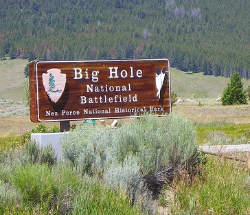
Big Hole National Battlefield, located in the remote and rugged Big Hole Valley of southwestern Montana, stands as a poignant memorial to one of the most tragic chapters in American history: the Nez Perce War of 1877. Situated in Beaverhead County, approximately 10 miles west of Wisdom, Montana, and about 80 miles southwest of Butte, the site preserves the landscape where, on August 9-10, 1877, U.S. Army forces launched a devastating surprise attack on a Nez Perce (nímí·pu·) encampment, resulting in the deaths of nearly 90 Nez Perce people—many of them women and children—and 31 American soldiers and volunteers. This 656-acre unit of the Nez Perce National Historical Park honors the memory of all who fought, suffered, and died here, emphasizing themes of resistance, loss, and the forced displacement of Indigenous peoples during the late 19th-century expansion of the United States. Unlike more commercialized national parks, Big Hole is a quiet, reflective space where the vast, windswept grasslands and distant mountain views evoke the solitude and tension of that fateful summer morning, inviting visitors to contemplate the human cost of manifest destiny. Managed by the National Park Service (NPS), it remains a sacred site for the Nez Perce Tribe, with coordinates at 45°38′50″N 113°39′12″W and an elevation of around 6,300 feet (1,920 meters).
The nımí·pu· (Nez Perce) had inhabited the Pacific Northwest for
thousands of years, with a homeland encompassing parts of present-day
Idaho, Oregon, Washington, and Montana. They were skilled horsemen,
farmers, and traders who maintained generally peaceful relations with
early Euro-American explorers and settlers.
Tensions escalated with
U.S. expansion and treaty-making:
The 1855 Treaty established a
large reservation for the Nez Perce.
Gold discoveries in the 1860s
brought thousands of miners and settlers, violating treaty terms.
The
1863 Treaty (often called the “Thief Treaty” by non-treaty bands)
drastically reduced the reservation to about one-tenth its original
size, confining most bands to a smaller area around Lapwai, Idaho.
Several bands, including those led by Chief Joseph
(Hin-mah-too-yah-lat-kekt), refused to sign or recognize it, remaining
in their ancestral Wallowa Valley in Oregon.
By the 1870s,
pressure mounted to force non-treaty bands onto the reduced reservation.
In 1877, after years of negotiation and broken promises (including an
executive order by President Grant that was later rescinded), the U.S.
government issued an ultimatum: move or face military action. Old Chief
Joseph (father of the famous leader) had long resisted selling Wallowa
lands, famously stating that the land could not be sold because it was
not his to sell—it belonged to the people and the Creator.
Outbreak of the Nez Perce War (1877)
The war ignited in June 1877
when young Nez Perce warriors, seeking revenge for earlier killings of
tribal members by settlers, attacked homesteads near Tolo Lake and White
Bird Canyon in Idaho. This led to retaliatory violence and the first
major battle at White Bird Canyon (June 17), where Nez Perce warriors
decisively defeated U.S. forces. Bands under Chief Joseph, Looking
Glass, White Bird, Ollokot, and others united for what became a fighting
retreat.
Over the next weeks:
The Nez Perce (roughly 750–800
people, including about 200 warriors and many women, children, and
elders, plus over 2,000 horses) evaded and fought U.S. troops under
General Oliver O. Howard.
Key early engagements included skirmishes
at Cottonwood and the Battle of the Clearwater (July 11–12), from which
they escaped.
They crossed the rugged Lolo Trail into Montana
Territory in late July, hoping the Army would not pursue them across the
Bitterroot Mountains. They passed peacefully through the Bitterroot
Valley, trading with settlers and pledging no violence, under the belief
(led by Looking Glass) that Montana citizens were not their enemies.
The March to Big Hole and the Surprise Attack
After traversing
the mountains, the Nez Perce entered the Big Hole Valley (known to them
as ?ıckumcılé.lıkpe). Exhausted after six weeks of flight and fighting,
they camped along the North Fork of the Big Hole River on August 7–8,
1877. They set up about 89 tipis in a V-shaped pattern, cut new tipi
poles from the willows, grazed horses, and rested—believing they had
outdistanced pursuers. Warriors paraded and sang; the mood was
optimistic about reaching “buffalo country.”
Unbeknownst to them,
Colonel John Gibbon (7th U.S. Infantry) had left Fort Shaw with 161
soldiers and a howitzer, picking up 45 civilian volunteers in the
Bitterroot Valley. On August 8, scouts located the camp. Gibbon’s force
(total ~206 men) marched overnight and positioned for a dawn assault.
Orders were to take “no prisoners” and show no mercy. The howitzer and
pack train lagged behind with a small guard.
The Battle of the
Big Hole (August 9–10, 1877): Detailed Sequence
At first light on
August 9, the attack began. Soldiers crossed the waist-deep river, fired
volleys into the tipis (killing many sleeping occupants), and charged.
An elderly Nez Perce man was the first casualty when spotted. Panic
erupted as women, children, and elders fled into the willows or river;
soldiers burned tipis. Many non-combatants died in the initial minutes.
Nez Perce warriors quickly rallied. Leaders like Looking Glass, White
Bird, and Ollokot called fighters to arms. Though many warriors
initially fled the camp unarmed, they regrouped from surrounding hills
and timber, returning fire and driving soldiers back across the river.
Lieutenant James Bradley (leading the left flank) was killed early.
Gibbon, wounded in the leg, ordered a retreat to a timbered knoll about
300–400 yards away, where soldiers dug rifle pits and built barricades.
The Nez Perce pinned them down in a day-long siege.
The Army’s
howitzer arrived and fired a few ineffective rounds before Nez Perce
warriors overran the crew, disabled the gun (hacking spokes and rolling
it into the river), and seized or scattered the ammunition. Nez Perce
sharpshooters maintained pressure while families buried the dead, packed
belongings, gathered horses, and moved camp south to Lake Creek (about
18 miles away) under cover of night. Some warriors set grass fires to
flush out the soldiers (though shifting winds limited effectiveness).
By August 10, sniping continued. Gibbon’s men were exhausted, short on
food and water (some drank from a dead horse), and suffered desertions
among volunteers. That night, the Nez Perce withdrew completely.
Reinforcements under Howard arrived the next day, but Gibbon’s force was
too battered to pursue immediately.
The battle lasted roughly 36
hours and is often described as inconclusive militarily but devastating
for the Nez Perce.
Casualties and Immediate Impact
Nez Perce:
60–90 killed (estimates vary; many sources cite ~70–90, with perhaps
only ~30 warriors among them—most victims were women and children).
Dozens more wounded. Yellow Wolf (a Nez Perce warrior) later recalled
only about 12 “real fighters, but our best” died.
U.S. forces and
volunteers: 29–31 killed (23 soldiers, 6–8 civilians) and ~38–40
wounded. Casualties exceeded 30% of Gibbon’s command.
The battle
shattered Nez Perce illusions of safety in Montana. They no longer
trusted settlers and realized future fights would offer no quarter.
Looking Glass’s influence waned; Chief Joseph assumed greater
leadership.
Continuation of the Flight and End of the War
The
Nez Perce continued their 1,170-mile odyssey through Yellowstone
National Park (where they encountered tourists), then north toward
Canada to join Sitting Bull’s Lakota. They fought additional engagements
(e.g., Camas Meadows, Canyon Creek) while evading nearly 2,000 U.S.
troops. Starving and exhausted, they surrendered on October 5, 1877, at
Bear Paw Mountains—just 40 miles from the Canadian border. Chief
Joseph’s surrender speech became iconic: “Hear me, my chiefs! I am
tired. My heart is sick and sad. From where the sun now stands I will
fight no more forever.” Promises of return to Wallowa were broken;
survivors were exiled to Oklahoma before some returned to Idaho or
Washington.
Preservation and Establishment of the Battlefield
The site quickly became a place of commemoration. It was set aside as a
military preserve in 1883. In 1910, President Taft designated it Big
Hole Battlefield National Monument (one of the early units under the
Antiquities Act). It was redesignated Big Hole National Battlefield in
1963, with boundaries formalized. In 1992, it became part of the
multi-state Nez Perce National Historical Park. A visitor center,
self-guided trails, and interpretive exhibits now tell the story from
multiple perspectives. The battlefield includes the Nez Perce camp site,
the soldiers’ siege area (with rifle pits still visible), and memorials.
Tribal members continue to visit for ceremonies.
Significance and
Legacy
Big Hole was the bloodiest single day of the Nez Perce War and
a turning point: it inflicted the heaviest losses on the non-treaty
bands while demonstrating their resilience. It symbolizes the broader
tragedy of the Indian Wars—broken treaties, forced removal, and
resistance against overwhelming odds. For the Nez Perce, it remains a
site of mourning and remembrance of ancestral sacrifice. For visitors,
the battlefield offers a sobering lesson in the human cost of Manifest
Destiny and the pursuit of freedom. Today, it is preserved not just as a
military site but as sacred ground honoring all who were there.
Regional Context and Broader Setting
The Big Hole Valley itself is
a classic example of basin-and-range topography in the northern
Rockies—a long, north-south oriented crescent-shaped valley roughly
15–20 miles wide and nearly 75 miles long, with an average floor
elevation exceeding 6,000 feet. It is bounded by the Anaconda-Pintlar
Range (and extensions of the Bitterroot Range) to the northwest, the
Beaverhead Range to the southwest, and the Pioneer Range to the east.
These rugged, forested mountain ranges feed numerous tributaries into
the valley, which drains ultimately via the Big Hole River. The
battlefield occupies a smaller, western side-valley where Trail Creek
and Ruby Creek converge to form the North Fork of the Big Hole River.
Thick sedimentary valley-fill deposits (sand, clay, mud, gravel) overlie
older volcanic bedrock of the Eocene–Miocene Bozeman Group, with
Quaternary alluvium and glacial deposits dominating surface materials.
Ruby Bench, in particular, consists largely of glacial alluvial
tableland.
The site is surrounded by a mosaic of U.S. Forest Service
lands (primarily to the west and north) and private ranches (to the
east), preserving a largely open, rural character with sweeping,
unobstructed views of the valley and distant peaks.
Topography
and Key Landforms
The battlefield is defined by three distinct
topographic zones shaped by the interaction of mountain foothills, river
processes, and glacial/alluvial deposition. These zones—mountain slope,
floodplain, and benchland—create a dramatic, stepped landscape that
drops from forested highlands to a broad, meandering river bottom and
then rises again to open prairie benchland.
Northwest Mountain
Slope (Battle Mountain): A steep toe of the foothills rising abruptly
from the valley floor. Battle Mountain itself is mantled in mixed
coniferous forest (primarily lodgepole pine and Douglas-fir, with some
ponderosa and whitebark pine) on upper slopes, transitioning to a broad,
treeless sagebrush steppe on the lower southwest-facing slopes. An open
“horse pasture” area on the lower slope provided grazing during the 1877
events. The slope offers commanding views over the river bottom and was
a critical high-ground vantage during historical actions. A shallow
gulch or ravine with a spring-fed stream cuts through parts of the
slope.
Central Floodplain: Bisected by the meandering North Fork of
the Big Hole River, this low, flat zone features a very low river
gradient (dropping only about 15 feet per mile across the site),
producing extensive wetlands—bogs, sloughs, oxbow ponds, and marshy
ground. The river channel winds through the site from southwest to
northeast, flanked by dense willow thickets, grassy meadows (including
historic camas meadows), and riparian corridors. The Nez Perce
encampment was sited here in the lush river-bottom meadows, just above
the waterline.
Southeast Benchland (Ruby Bench): A relatively flat,
elevated tableland rising roughly 100 feet above the river. Composed
mainly of glacial alluvial deposits, it supports open sagebrush steppe
and grassland. The Nez Perce escape route followed a gully (sometimes
called “Bloody Gulch”) up onto this bench. The modern visitor center
sits atop part of the bench, outside the core historic battlefield
boundaries.
These landforms create a natural amphitheater-like
setting: high ground to the northwest for oversight, a marshy bottleneck
in the center, and open escape terrain to the southeast.
Hydrology
The North Fork of the Big Hole River is the central
hydrological feature, fed by snowmelt and tributaries from the
surrounding ranges. Its meandering course and low gradient produce a
dynamic floodplain with shifting channels, backwaters, and seasonal
wetlands. Historically and today, the river and its associated riparian
zones supplied water, fish, beaver, and camas roots—key resources that
drew the Nez Perce to the site. Post-battle beaver activity and later
irrigation ditches have slightly altered flow patterns, but management
(including beaver relocation and prescribed burns) has worked to
maintain conditions close to those of 1877.
Vegetation and
Habitats
Vegetation reflects the elevation, moisture gradients, and
fire history, creating five primary habitat types:
Douglas-fir/Lodgepole Pine Forests (mountain slope and siege area):
Second-growth conifers dominate higher slopes; open, park-like stands
with low understory in places like the “Point of Timber.”
Sagebrush
Uplands/Steppe (lower slopes of Battle Mountain and Ruby Bench): Big
sagebrush with Idaho fescue and other grasses/forbs.
Low/Moderate
Cover Grasslands and Altered Herbaceous Areas (meadows and horse
pasture): Open grass-dominated zones, including camas meadows.
Shrub
Riparian Zones (riverbanks and wetlands): Dense willow thickets (Salix
spp.), with cottonwood in some drainages.
The landscape has
remained remarkably similar to 1877 conditions in terms of vegetation
patterns, forest extent, willow density, and meadow character, though
second-growth forest has encroached in places and willows have densified
in the absence of frequent fires. Invasive species are monitored, and
prescribed burns help restore historic openness.
Climate
At
this high elevation, the climate is semi-arid and continental with wide
seasonal swings. Average annual precipitation (recorded at nearby
Wisdom) is only about 12 inches, mostly as snow in winter. January
averages range from 27°F (high) to 1.5°F (low); July from 77°F to 37°F.
Summers are short and can feature hot days with cool nights; winters are
long and severe. These conditions shape the short growing season and
fire-adapted vegetation.
Location and Getting There
Address: 10 miles west of Wisdom,
Montana, on Highway 43 (near the Beaverhead-Deerlodge National Forest).
Nearest towns: Wisdom (small services), Dillon (~70 miles south), or
Missoula (~150+ miles northwest). No public transportation; you'll need
a personal vehicle.
Driving tips: The area features remote two-lane
highways with limited cell service. Fill up on gas in Dillon or
Hamilton. Watch for wildlife (deer, elk, pronghorn) and livestock on
roads, especially at dawn/dusk. Winter snow and ice can close or
complicate access—check conditions via Montana DOT.
From major
hubs:
Bozeman: ~3–4 hours
Missoula: ~2.5–3 hours
Yellowstone NP
(West Entrance): ~4–5 hours via scenic routes
Hours, Fees, and
Seasons
Open year-round, but the visitor center operates seasonally
(typically late May to early September, 9 AM–5 or 6 PM; confirm current
hours). The battlefield grounds remain accessible dawn to dusk.
Entrance fee: Free (no per-vehicle or per-person charge).
Best time
to visit: Late spring through early fall (June–September) for pleasant
weather and full access. Wildflowers peak in July; fall colors (aspen,
etc.) arrive in September. Avoid mid-winter unless prepared for deep
snow and cold.
Weather notes: High elevation (~6,000+ ft) means
cool nights even in summer (can drop to freezing). Daytime highs in the
70s–80s°F (20s°C) are common in July/August, but thunderstorms are
frequent. Winters are harsh with heavy snow. Always check
forecasts—conditions change rapidly.
What to Expect: The Site
Layout
The battlefield spreads along the North Fork of the Big Hole
River in a peaceful valley setting. Key areas include:
Visitor
Center: Excellent museum with artifacts, weapons, audio-visual programs,
and Nez Perce perspectives. Rangers provide orientation and answer
questions. Bookstore/gift shop available.
Self-guided trails: A
1.5-mile loop trail (mostly level, with some gentle slopes) takes you
past the Nez Perce camp site, the "siege area," and Army positions.
Wayside exhibits and audio stations share first-hand accounts.
Overlooks and monuments: Views of the battlefield and memorials to both
sides. A short walk to the Nez Perce burial site feels especially
poignant.
The site emphasizes balance—honoring Nez Perce
resilience and U.S. soldiers while highlighting the tragedy of conflict.
In-Depth Visiting Tips
Preparation and What to Bring:
Clothing/layers: Sturdy hiking shoes or boots (trails can be dusty or
muddy). Layers for variable temps, rain jacket, hat, sunscreen, and
insect repellent (mosquitoes can be intense near the river in summer).
Essentials: Plenty of water (no reliable sources on trails), snacks,
binoculars, camera, and a daypack. Download offline maps or the NPS app
beforehand due to spotty cell service.
Sun protection: High altitude
increases UV exposure.
For kids/families: The trail is
stroller-friendly in parts, but bring carriers for little ones. Junior
Ranger programs are often available.
On the Trails and Site:
Allow 2–4 hours for a thorough visit (1–2 hours for the main loop + time
in the visitor center).
Stay on designated trails to protect fragile
historic resources and vegetation. No off-trail hiking.
Respect the
site as sacred ground—keep voices low, no picnicking on battle areas,
and follow "Leave No Trace."
Photography is encouraged, but be
mindful of memorials.
Accessibility:
Visitor center is
ADA-accessible. The main trail has some accessible sections, but full
loops include uneven terrain and grass. Ask rangers for current details
or assistance.
Safety and Practicalities:
Wildlife: Bears and
mountain lions live in the area—carry bear spray (know how to use it),
hike in groups, and make noise. Store food properly.
Health: Altitude
can affect some visitors; stay hydrated. Ticks are possible in grassy
areas—check yourself after hiking.
Facilities: Restrooms at the
visitor center. Limited or no food/services on-site—bring lunch or eat
in Wisdom.
Camping: No campground at the battlefield. Nearby options
include national forest sites or private campgrounds in the
Wisdom/Dillon area. For RV, check Wisdom or further afield.
Pets:
Leashed pets allowed on some trails but not in buildings—check rules.
Enhance Your Experience:
Join a ranger-led talk or walk if
available (seasonal).
Combine with nearby sites: Bannack State Park
(historic ghost town), Big Hole River for fly fishing, or the
Continental Divide Trail.
Read up beforehand: Books like "The Nez
Perce Indians and the Opening of the Northwest" or NPS brochures provide
deeper context.
Cultural sensitivity: The site tells a story of
displacement and survival—approach with respect for Native American
history.
Crowds and Timing: Very quiet compared to Yellowstone.
Mornings or late afternoons offer the best light and solitude. Summer
weekends see more visitors, but it's rarely busy.