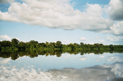
Location: Bolivar State
Length 723 km (449 mi)
The Caura River (Río Caura) in Bolívar state, Venezuela, is a major Orinoco tributary draining roughly 45,336 km² of Guiana Shield terrain. It flows northward for about 700 km from highlands above 2,000–2,300 m elevation to its confluence with the Orinoco near ~40 m, creating a gradient of habitats from montane and pre-montane forests to lowland evergreen rainforest, seasonally flooded riverine (igapó- and várzea-like) forests, white-sand areas, and limited savannas. About 90% of the basin is humid forest; the rest is flooded forest and non-forest vegetation. A major cataract, Salto Pará (also referenced with related rapids such as La Mura or Cinco Mil), divides the upper and lower basins, acting as a biogeographic filter. The river is nutrient-poor overall, with clearer, more acidic blackwater-like tributaries upstream and more opaque conditions near the Orinoco. Much of the basin is now within Caura National Park (established 2017), Venezuela’s largest national park (~7.5 million ha), and has remained relatively pristine largely due to long-term indigenous stewardship by Ye’kuana and Sanema communities.
Getting There and Typical Itinerary
Almost all trips start in
Ciudad Bolívar (or sometimes Puerto Ordaz). From there it is a roughly
4-hour overland transfer to the small riverside settlements of Las
Trincheras or Maripa. After an overnight at a simple lodge or camp, you
board a motorized dugout canoe (curiara) for a 5–6 hour upstream journey
through dense rainforest to El Playón, a wide sandy beach and Ye’kuana
community base just below the rapids and falls. From El Playón a forest
trail of about 1.5–4 hours (moderately strenuous) leads to viewpoints
overlooking Salto Pará.
Standard tours last 5–6 days / 4–5 nights.
Classic structure:
Overnight near Las Trincheras or a nearby
lodge.
Long boat day upstream, passing small indigenous settlements
(e.g., Nichere/Nichare) and spotting wildlife.
1–2 nights at El
Playón in open-sided thatched churuatas (sleeping in hammocks with
mosquito nets).
Full day for the hike to the falls and time on the
beach.
Return boat and road transfer.
Operators historically
associated with the route include Akanan Travel & Adventure, Cacao
Expeditions, and Araguato Expeditions. Confirm current availability, as
tourism volumes have fluctuated sharply. Independent travel is not
realistic; local indigenous boatmen and guides are essential.
Salto Pará and the Experience
Salto Pará is a broad horseshoe of
multiple cascades and rapids where the river drops in stages (principal
drops often cited around 50–80 m; total drop across the complex roughly
168 m over several kilometers according to older geographic sources). It
is celebrated more for sheer volume than height—during high water its
flow can exceed that of Iguazú or Victoria Falls. The lower river and El
Playón offer white-sand beaches, swimming, fishing, and the constant
sound of the rapids. Beyond the falls the upper Caura is largely
restricted and requires special permission.
Wildlife possibilities
include freshwater dolphins (botos), howler monkeys, scarlet macaws,
various birds, and river fish such as cachamba. The forest is primary
and relatively intact in many stretches, though mining pressure has
affected parts of the broader basin.
Best Time to Visit
The
river is navigable year-round.
Dry season (roughly November–April):
Lower water levels expose more beaches, navigation can be rockier in
places, and wildlife is often easier to spot. Falls are less voluminous.
Rainy season (May–October): Higher water makes some sections easier to
run and the falls far more powerful and dramatic; expect more rain,
higher humidity, and potentially more insects.
Temperatures are
hot year-round (daytime highs commonly 30–33 °C, nights milder).
Mornings on the big river can be relatively clear due to the
microclimate effect of the large water body.
Practical Visiting
Tips
Accommodation and style: Rustic. Expect hammocks in communal
open churuatas, shared basic facilities, and simple filling meals. Some
lower-river lodges offer rooms with private bathrooms.
Essential
gear: Passport or original ID, swimsuit, strong sun protection (hat,
sunglasses, high-SPF cream), lightweight raincoat or poncho,
flashlight/headlamp, closed shoes plus sandals, towel, light quick-dry
clothes plus long sleeves/pants for evenings and insects, good insect
repellent, extra batteries and photo storage. Operators often supply
hammocks and mosquito nets.
Physical demands: Medium. Long boat hours
can be tiring (hard benches, sun, spray); the falls hike involves uneven
forest trail and some elevation.
Cultural respect: Ye’kuana
communities host and support most camps. Ask permission before
photographing people, buy crafts directly and fairly, and follow local
guidance. The upper basin is their territory.
Health: Tropical risks
exist (insects, potential malaria in some zones historically, waterborne
illness). Use repellent, consider prophylaxis advice from a travel
doctor, treat water, and carry a basic medical kit. Medical care is
extremely limited once on the river.
Photography and logistics: Bring
waterproof protection for gear. Power and connectivity are minimal or
nonexistent deep in the basin.
Safety and Current Context
(Critical for 2026)
Bolívar state, especially rural areas and the
Orinoco Mining Arc (Arco Minero) south of the Orinoco, has faced serious
illegal gold mining, armed groups, crime, kidnapping risks, and
environmental damage (mercury pollution, pressure on indigenous lands
and forests). International tourism to the Caura largely collapsed for
years as a result. Official advisories (US State Department Level 3
“Reconsider Travel” overall, with rural Bolívar at higher risk; UK FCDO
advises against all travel to the Orinoco Mining Arc region south of the
Orinoco and various border zones) reflect ongoing concerns. Conditions
can shift.
Only travel with a highly reputable operator that has
current local knowledge, indigenous partnerships, and a clear safety
plan. Check the latest US, UK, and other government advisories
immediately before booking. Independent or poorly vetted arrangements
are strongly discouraged. Emergency evacuation options are limited.
Flora
The basin supports high vascular plant diversity. Documented
figures range from more than 1,180–1,300 species in earlier assessments
to 1,913 species (159 families, 791 genera) in National Herbarium of
Venezuela collections through 2003, and up to ~2,600–2,657 species in
broader tallies (representing a substantial share of Venezuelan flora,
including high proportions of Guianan endemic genera). Endemism is
notable, with ~56 species restricted to the basin (many on the
Jaua-Sarisariñama plateau and other highlands). Dominant families
include Orchidaceae, Rubiaceae, Melastomataceae, Fabaceae (and related
legumes), Euphorbiaceae, Cyperaceae, Poaceae, Asteraceae, and
Dryopteridaceae (ferns). Species-rich genera include Miconia (dozens of
species), Inga, Psychotria, Piper, Eugenia, Ocotea, Philodendron, and
others typical of Neotropical humid forests.
Riparian and flooded
forests are structurally important. Characteristic palms include Euterpe
precatoria, Attalea maripa, Socratea exorrhiza, Geonoma baculifera, and
Bactris brongniartii; Oenocarpus species are frequent in some upper and
Erebato flooded areas, while Mauritiella dominates certain sandy flooded
zones higher up. Other woody elements include legumes (Inga,
Macrolobium, Campsiandra laurifolia, Eperua), Homalium, Gustavia,
Piranhea, Virola, and various Lauraceae, Annonaceae, and Moraceae.
Rapids and cataracts host specialized aquatic plants of the family
Podostemaceae (unique to South American shields). Upstream of major
rapids, communities differ from those downstream, where Amazonian
igapó/várzea elements become more common and tree richness can be lower
in more deeply flooded northern reaches. Highland and plateau areas add
tepui-associated bromeliads, orchids, and other endemics. Overall
floristic affinities are primarily Guayanan and Amazonian, with Llanos
elements appearing lower down.
Fauna
Terrestrial vertebrate
diversity is high: roughly 475 bird species, 168–205 mammal species
(depending on the survey and scope), 23–46 reptiles, and 13–16
amphibians. These figures represent substantial fractions of Venezuelan
and Guianan faunas. Many species are wide-ranging Neotropical or
Amazonian forms, supplemented by Guianan endemics, with strong turnover
between forested upper/middle reaches and the lower transition toward
llanos habitats near the Orinoco.
Mammals include apex predators such
as the jaguar (Panthera onca) and puma (Puma concolor), large herbivores
like the Brazilian tapir (Tapirus terrestris), peccaries (Tayassu
pecari, Pecari tajacu), giant anteater (Myrmecophaga tridactyla), and
various deer and armadillos. Primates feature the yellow-bellied spider
monkey (Ateles belzebuth) and howler monkeys. Semi-aquatic species
include the giant otter (Pteronura brasiliensis) and, in lower reaches,
pink river dolphins (Inia geoffrensis). Bats (Chiroptera) are especially
diverse (often the richest order), followed by rodents and marsupials
(e.g., various Didelphis and other opossums). Many populations face
hunting pressure.
Birds are primarily Amazonian in character, with
dozens of Guianan endemic taxa and high overall richness driven by
elevational and biome gradients. Surveys of the lower and middle Caura
plus nearby areas have recorded ~480+ species. Cracids such as Crax
alector and Mitu tomentosum, tinamous, guans, piping guans, and a wide
range of forest understory, canopy, and riverine species are present;
the lower reaches add elements typical of the Orinoco llanos transition.
Reptiles and amphibians include caimans along waterways, numerous
snakes, freshwater turtles, and a modest but specialized amphibian fauna
adapted to the humid forests and streams.
Fish are the standout
aquatic group and among the most diverse of any Venezuelan drainage.
Documented totals range from ~278–460 species in earlier intensive
surveys (including Conservation International AquaRAP work) to 440–543+
with later additions and compilations (one recent comprehensive
treatment cites 477 species). Characiformes dominate (~49%, often 200+
species, led by Characidae), followed by Siluriformes (~30%, including
many catfishes), Perciformes (mainly cichlids, ~9%), and Gymnotiformes
(electric fishes). Additional groups include stingrays
(Potamotrygonidae), clupeiforms, soles, cyprinodontiforms, and others.
Roughly 400 species occur in the lower elevations below Salto Pará;
fewer (~150–170) occupy the upper basin, though upper areas hold more
restricted distributions. Many species are endemic to the basin or
Guiana Shield/Orinoco system and include attractive aquarium forms
(various Apistogramma, Geophagus, phantoms, headstanders such as
Anostomus, and others). Food fishes important to local communities
include aimara (Hoplias spp.), pike characins (Acestrorhynchus), and
certain cichlids. The ichthyofauna shows strong Amazonian and Guianan
affinities, with historical connections reflected in shared species with
neighboring shield drainages.
Aquatic invertebrates include diverse
insects (dozens of species of odonates, mayflies, etc.), crabs, and
shrimps (including some undescribed or restricted forms), supporting the
food web in a relatively oligotrophic system.
Ecological and
Cultural Context
The river and its forests sustain indigenous
communities that rely on fish, game, and plants for food, materials, and
cultural practices. Seasonal flooding pulses drive nutrient dynamics and
connectivity between aquatic and terrestrial habitats. While large
tracts remain intact, threats include illegal mining, potential
hydropower or water-diversion schemes, overfishing in lower reaches,
logging, and expanding settlement. The combination of elevational
gradients, geological heterogeneity, and relatively low human impact has
produced exceptional species richness and makes the Caura one of the
more important remaining Guiana Shield watersheds for conservation.