Location: 69 mi (112 km) North- West of Resistancia, Chaco Province Map
Area: 150 km²
Info: Captan Solari
Tel. (03725) 499 161
Admission Fee: free
Open: 9am- 7pm daily
The Chaco National Park (Parque Nacional Chaco) is a protected natural area located in
the province of Chaco in Argentina. Its objective is the
conservation of the environment of the eastern zone of the Chaco,
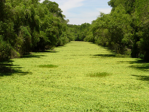
characterized by its lagoons and jungle vegetation alternated with
palm groves and wetlands; These environments are developed in the
park around the course of the Negro River, which crosses the eastern
sector of the park. The national park has 14,981 hectares. The
climate is subtropical with no dry season.
The national park
has a Management Plan approved in 2019.
Getting There
The main access is via Capitán Solari (about 5–6 km
from the entrance). From Resistencia (roughly 110 km / ~1.5–2 hours),
follow RN 16 then RP 9. Daily buses run between Resistencia and Capitán
Solari; from there, take a remis (local taxi). Driving your own vehicle
is straightforward on the approach roads, though some internal or
external tracks can become muddy after heavy rain—check conditions
ahead. There is no regular public transport directly to the park gate.
Optional guided tours and private excursions depart from Resistencia.
Entry is free (confirm the latest status with APN, as fees can change).
The park is generally open daily; visitor orientation is provided by
rangers. Contact: chaco@apn.gob.ar or the park phone numbers listed on
official pages.
Best Time to Visit
March to November is
strongly recommended. Temperatures are more pleasant, humidity lower,
and roads more reliable. December–February brings intense heat (often
well above 35°C / 95°F), high humidity, heavy rains that can make tracks
impassable, and denser insects. Even in the better months, always use
insect repellent. Early morning and late afternoon are best for wildlife
activity and cooler temperatures.
Spring (especially mid-September to
early October) can bring fragrant flowering of jazmín paraguayo along
trails.
What to See and Do
The park has an interpretation
center, picnic areas, viewpoints, and a mix of pedestrian and vehicular
trails that can be walked. Activities are largely self-guided, though
licensed local guides are available and helpful for spotting signs and
learning context.
Key trails and sites (approximate times from
official sources):
Sendero Peatonal del Río Negro (~1.5 hours,
family-friendly circular interpretive trail starting at a hanging bridge
over the Río Negro; gallery forest species).
Sendero del Abuelo (~1
hour) to a massive old red quebracho.
Sendero Las Lagunas (~1.5
hours) linking Laguna Carpincho and Laguna Yacaré, with interpretive
viewpoints.
Sendero El Palmar (~1.5 hours) to a viewpoint over palm
savanna—excellent for sunsets.
La Ralera (vehicular route ~18 km
through the core open quebracho woodland, the park’s main conservation
value; two viewpoints; ~2 hours). Trees are spaced to allow light to the
understory, aiding mammal sightings.
Vehicular access toward Laguna
Panza de Cabra (outside the main gate area; picnic zone with
tables/grills; free rustic camping without toilets in some reports).
You can also bicycle on authorized vehicular roads. Birdwatching is
excellent from the dock on Laguna Yacaré and the suspension bridge. No
shops or food services inside the park—stock up in Capitán Solari or
Resistencia.
Wildlife and Flora
This is one of the better
accessible spots for humid Chaco nature. Expect black howler monkeys
(mono carayá, an emblematic and very vocal species), armadillos,
brockets/guazunchos, foxes, and occasional sightings or tracks of giant
anteaters, tapirs, maned wolves (aguará guazú), pumas, capybaras, and
caimans. Over 300–350 bird species have been recorded, including
waterbirds, raptors, woodpeckers, and the reintroduced bare-faced
curassow (muitú). Flora highlights include red and white quebrachos,
guayacán, lapacho, carob, and caranday palms. Wetlands support rich
aquatic life that shifts with rain and drought cycles.
Sightings are
opportunistic—go early or late, move quietly, and bring binoculars.
Tracks and signs are common even when animals are not seen.
Accommodation and Facilities
The park has a camping area near the
visitor facilities with tables, grills/parrillas, toilets, and
(according to several local reports) electricity and basic showers in
the main area. It is free or low-cost. There is also more basic free
camping at Laguna Panza de Cabra (limited amenities). The park does not
provide potable water—bring plenty or treat what you find. Capitán
Solari (nearest town, simple guesthouses and supplies) or Resistencia
(full services, day-trip base) are the practical overnight options.
Rural tourism stays exist in the broader area.
Practical Visiting
Tips
Essentials: Insect repellent (non-negotiable), sunscreen, hat,
light clothing (long sleeves useful against sun and insects),
comfortable non-slip shoes, and ample water. Light rain gear in the
wetter months.
Health and safety: Heat is the main hazard in the
warmer months—hike early, stay hydrated. Standard precautions for
snakes, insects, and remote roads. Medical services are limited outside
Resistencia and larger towns. Dengue and other mosquito-borne illnesses
occur regionally.
Logistics: No food for sale inside. Fuel and
supplies are available in Capitán Solari or en route. Roads can
deteriorate after rain—verify before heading out. Rangers are present
and provide orientation; register or check in as advised.
Guides and
extras: Optional site guides improve the experience. Bicycle tours from
nearby towns are sometimes offered. Respect quiet hours, stay on trails,
and follow Leave No Trace principles.
Nearby: Resistencia (open-air
sculpture city), Colonia Benítez (botanical/educational reserve), and
Isla del Cerrito (river scenery and fishing). For deeper, more remote
Chaco wilderness (jaguars, larger intact dry forests), continue to El
Impenetrable, which requires more planning and often 4x4 or guided
access.
Contact and confirmation: Always check the official
Administración de Parques Nacionales (APN) pages for Chaco or email
chaco@apn.gob.ar for current road status, trail conditions, and any fee
updates, as conditions change with weather and management.
Location and Regional Context
The park covers roughly 14,981
hectares (about 150 km²) at coordinates near 26°50′S, 59°40′W. It lies
in the Departamento Presidencia de la Plaza, close to the town of
Capitán Solari (about 6 km away) and roughly 100–130 km northwest of the
provincial capital Resistencia.
It sits within the vast Gran Chaco
plain, a large alluvial lowland that stretches across northern
Argentina, western Paraguay, and eastern Bolivia. More specifically, it
belongs to the Chaco Húmedo (Humid Chaco) ecoregion, the wetter eastern
portion of the Chaco, as opposed to the drier western and central zones.
The park was created in 1954 (Law 14.366) primarily to conserve
remaining stands of quebracho forests that had been heavily logged for
timber and tannin.
Topography and Geology
The terrain is
characteristically flat to gently undulating, typical of the Chaco
sedimentary plain. Elevations are low, generally close to 70–80 meters
above sea level, with only subtle relief. The underlying geology
consists of thick alluvial deposits carried eastward from the Andes over
long periods by rivers. Higher ground (relatively speaking) supports
forests, while lower depressions hold wetlands and seasonal water
bodies. There are no significant hills or mountains within the park.
Hydrography
The Río Negro is the key watercourse; it crosses the
eastern sector of the park. Along and around it form several
characteristic aquatic and semi-aquatic features:
Madrejones —
elongated, often seasonally flooded remnants of older river channels.
Esteros (swamps/marshes) and cañadas (seasonally wet low channels or
small valleys).
Named lagoons/lakes including Laguna Panza de Cabra,
Laguna Yacaré, and Laguna Carpincho (or Carpincho).
These water
bodies fluctuate with rainfall and create a mosaic of permanent and
temporary wetlands that support abundant aquatic life and attract large
numbers of birds.
Climate
The climate is subtropical without a
dry season (humid subtropical / Cfa type). Annual rainfall typically
ranges from about 750 to 1,300 mm and is concentrated in the warmer
months (roughly November–March), though precipitation occurs year-round
to some degree. Summers are hot and humid, with temperatures frequently
exceeding 35 °C and occasionally approaching or surpassing 40 °C.
Winters are mild. The wetter conditions distinguish this eastern Chaco
zone from the more arid western Chaco.
Landscape and Vegetation
Zones
The park contains a mosaic of environments shaped by subtle
elevation differences and water availability:
Higher ground
(“monte fuerte”): Dense to semi-dense forests dominated by quebracho
colorado chaqueño (Schinopsis balansae), which can reach about 15 m (and
sometimes taller). Associated species include white quebracho
(Aspidosperma quebracho-blanco), algarrobo (Prosopis spp.), lapacho
(Tabebuia spp.), guayacán, guayaibí, and espina corona. The understory
often includes chaguares (bromeliads). These quebracho stands are among
the park’s most emblematic features and the main reason for its
creation, as the species was extensively exploited.
Lower or
seasonally flooded areas: Open savannas with caranday palms (Copernicia
alba, also called palma blanca) interspersed with grasslands.
Transitional zones between the taller forest and the palm savanna may
contain lower, more open woodland.
Riverine and wetland zones:
Gallery forest or selva de ribera along the Río Negro, richer in lianas,
vines, and epiphytes. The esteros, madrejones, and lagoons support
aquatic and semi-aquatic vegetation and host concentrations of wildlife,
especially during drier periods when animals gather near remaining
water.
Overall, the geography is that of a warm, low-relief plain
where subtle differences in drainage and elevation produce a fine-scale
patchwork of forest, palm savanna, and wetland. This mosaic supports
high biodiversity, including more than 340 bird species, black howler
monkeys (carayá), tapirs, various predators, caimans, capybaras, and
other characteristic Chaco fauna.