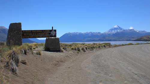
Location: 14 mi (22 km) Southwest of Ilumine, Neuquén Province Map
Area: 379,000 hectares
Official site
Info: (02972) 427 233
Lanín National Park (Parque Nacional Lanín) is a large protected area
in southwestern Neuquén Province, northern Argentine Patagonia. It
occupies roughly 412,000–412,013 hectares (about 4,120 km²), making it
Argentina’s third-largest national park after Nahuel Huapi and Los
Glaciares. Established in 1937, it forms part of the Andino
Norpatagónica Biosphere Reserve. The park stretches roughly north–south
along the Andes for about 160 km, from near Aluminé in the north toward
the Seven Lakes area and Lago Hermoso in the south, bordering Chile (and
Villarrica National Park) on the west and transitioning toward the
Patagonian steppe on the east.
Coordinates center near 39°51′S,
71°26′W (or approximately 40°09′S, 71°21′W depending on the reference
point). Nearby hubs include San Martín de los Andes (on the shore of
Lago Lácar), Junín de los Andes, and Aluminé. The protected complex is
administratively divided into a stricter National Park zone (~217,000
ha) and a National Reserve zone (~195,000 ha), with some private lands,
Mapuche communities, and other holdings inside the broader area.
Best Time to Visit
The park is open year-round, but conditions
vary sharply:
November–April (especially December–March): Best
for hiking, trekking, kayaking, camping, and water activities. Long
days, accessible trails, and milder temperatures (roughly 5–20°C at
lower elevations, cooler higher up).
Autumn (March–May):
Exceptional foliage colors in lenga, ñire, raulí, and roble pellín
forests.
Winter (June–September): Snow-covered landscapes; ideal
for skiing and snow activities at nearby Cerro Chapelco. Some roads
and higher trails close or require special equipment.
Weather
changes quickly in the mountains—pack layers, waterproof shells, and
check conditions daily.
Getting There and Moving Around
Closest airport: Chapelco (Aviador Carlos Campos), about 20–24 km
from San Martín de los Andes and Junín de los Andes. Flights
typically from Buenos Aires and Córdoba.
By road: National Route
40 and provincial routes connect the towns. Buses run from Neuquén,
Bariloche, and other Patagonian hubs. Car rental or tours are the
most practical for park exploration (many roads inside are gravel).
Main park accesses: Lago Lácar/Quila Quina (near San Martín), Lago
Huechulafquen (from Junín), and Ruca Choroy (from Aluminé).
Border crossings to Chile: Tromen/Mamuil Malal (near the volcano
north face), Carirriñe, and Hua Hum.
Public transport reaches
the towns; limited services go into specific park sectors. A vehicle
(or organized tour) gives the most flexibility. Fuel up before
remote sections—there is no GNC in the immediate area.
Entry
Fees and Regulations (as of mid-2026)
Daily entrance fees apply
at main portals (prices in Argentine pesos; check official sources
as they can change):
General (foreigners): around ARS 35,000
National residents: around ARS 15,000
Provincial residents:
around ARS 8,000
Students: around ARS 12,000
Exemptions or
reductions typically cover children under 6, seniors/pensioners,
people with disabilities, local residents, educational groups, and
certain guides. Multi-day Flexipass options and a second-day
discount (within 72 hours) exist. Buy tickets at entrances or
through authorized providers; keep the receipt. Some sectors have
seasonal gate hours.
Register for longer hikes or the volcano
climb. Stay on marked trails, and follow leave-no-trace rules.
Main Zones and Highlights
South (San Martín de los Andes /
Lago Lácar area)
Gateway to beaches, the start of the famous Ruta
de los Siete Lagos, and easy access. Highlights include Quila Quina,
Cascada Chachín (short walk into Valdivian rainforest), Mirador
Bandurrias (panoramic lake views), and nearby Chapelco ski resort.
Good for families, short walks, biking, and boat trips.
Center (Junín de los Andes / Huechulafquen / Tromen)
Best classic
views of Volcán Lanín. Lago Huechulafquen and Paimún offer boat
tours, beaches, and trails. Cascada El Saltillo is a short,
accessible hike. The main volcano approach starts near Río
Turbio/Tromen ranger station amid araucaria forests. Several
Mapuche-managed campgrounds operate here.
North (Aluminé /
Ruca Choroy / Quillén)
Quieter, with extensive pehuén (monkey
puzzle / Araucaria araucana) forests sacred to the Mapuche. Lakes,
termas (hot springs), and longer trails. Ideal for a more remote,
cultural experience.
Many areas have organized and free/agreste
camping; some are run jointly with Mapuche communities.
Hiking, Trekking, and Key Activities
The park has roughly 28
trails and 10 longer traverses of varying difficulty, plus cycling
and horseback options. Easy examples: Mirador Bandurrias, Cascada El
Saltillo, short interpretive walks. Moderate options exist around
the lakes and forests. Multi-day routes (e.g., around Lago Lácar)
require camping.
Other activities:
Sport fishing (trout;
separate permit required)
Kayaking, sailing, and boat excursions
on the clear lakes
Mountain biking
Wildlife watching (early
morning best)
Winter sports at Chapelco
Always check trail
status and register where required.
Climbing Volcán Lanín
The classic ascent (usually the northern/Tromen side) is a demanding
2-day effort with ~2,500–2,600 m elevation gain. It involves
snow/ice travel and requires solid fitness.
Guide: Strongly
recommended (often required or expected for independent groups
without proven experience). Certified guides provide equipment and
logistics.
Registration: Mandatory online + confirmation at the
ranger station. Daily capacity is limited (reports of ~60–100 people
including guides).
Equipment: Mandatory items include helmet,
crampons, ice axe, suitable boots, layered clothing, headlamp, and
VHF radio (park frequency). As of October 2026, a cacatubo (PVC
tube) and compostable vegetable-oil bags are required to pack out
human waste. Avalanche gear (transceiver, probe, shovel) has been
advised in certain conditions.
Season: Best roughly
October–March/April depending on snow.
Overnight at high refuges
or camps (book ahead). Independent attempts face strict gear checks.
This is not a casual day hike.
Flora, Fauna, and Culture
Northern sections feature iconic pehuén forests (only Indigenous
people may collect the piñones/nuts). Other trees include southern
beeches (lenga, ñire, coihue, raulí). Valdivian rainforest elements
appear in wetter areas.
Wildlife includes puma, red fox, monito
del monte (a living fossil marsupial), Andean condor, woodpeckers,
and abundant trout in the lakes. Birdlife is rich.
The park is
ancestral Mapuche territory. Communities co-manage some campgrounds
and public areas—respect sites, stay on trails, and support local
operators.
Practical Visiting Tips
Pack for variable
weather: base layers, insulating mid-layers, waterproof shell, sun
protection, sturdy footwear, and a refillable water bottle/filter.
Download offline maps; cell service is limited.
Register longer
outings at ranger stations or information centers.
Carry cash for
small vendors or remote services.
Leave no trace; special waste
rules apply on the volcano.
Check official road and trail
conditions before travel (winter closures or weather can affect
access).
Book popular campsites, guides, and refuges in advance
during peak season.
Pets are generally restricted or must be
controlled.
For fishing, obtain the required permit.
Official resources: Check pnlanin.org / argentina.gob.ar sites for
current fees, trail status, registration, and alerts. Local tourism
offices in San Martín de los Andes, Junín de los Andes, and Aluminé
are excellent for real-time advice.
Topography and Geology
The landscape is classic
Andean-Patagonian: glaciated mountains, deep valleys, volcanic
features, and a strong west-to-east environmental gradient.
Elevations generally range from about 900 m to 1,900 m, with higher
peaks. The dominant feature is Volcán Lanín, a nearly symmetrical,
snow- and ice-capped stratovolcano rising to 3,776 m on the
Argentina–Chile border. It towers more than 1,500 m above
surrounding summits and is visible from many points in the park.
Lanín is the easternmost of a northwest–southeast chain of
stratovolcanoes (with Quetrupillán and Villarrica farther west). It
is composed mainly of basaltic to andesitic lavas and pyroclastics;
its last significant eruption is dated to roughly 560 CE (±150
years), and it is considered potentially active (with seismic
activity recorded in 2017). The summit glacier buries any visible
crater.
Pleistocene glaciation extensively sculpted the terrain,
producing U-shaped valleys, moraines, and the deep basins now
occupied by lakes. Volcanic activity left basalt flows, scoria cones
(such as Achen Ñiyeu), and features like the Escorial lava field.
Hot springs occur at sites such as Lahuen-Có. Other notable peaks
include Rucachoroi (~2,296 m), Queñi (~2,242 m), and Huanquihue
(~2,189 m). The Andes here form part of the Atlantic–Pacific water
divide.
Hydrography
The park contains about 24 glacial
lakes of varying sizes and depths, along with numerous rivers,
streams, and waterfalls (notably Cascada Chachín). Lakes occupy
roughly 7% of the park’s surface. Major examples include:
Huechulafquen (one of the largest, elongated, with excellent views
of Lanín; surface around 78–84 km², mean depth ~142 m)
Lácar (on
which San Martín de los Andes sits; max depth ~277 m, mean ~166 m)
Paimún, Tromen, Quillén, Ñorquinco, Curruhué (Grande and Chico),
Lolog, Meliquina, Machónico, Hermoso, Epulafquen, Ruca Choroy,
Pulmarí, Queñi, Nonthué, and others.
Most lakes and rivers
drain eastward into the Atlantic via the Aluminé–Collón
Curá–Limay–Negro system. The notable exception is the Lácar–Nonthué
system, which drains westward via the Hua-Hum River into the
Pacific. The park contains multiple hydrographic basins (roughly
14), managed in zones (Norte, Centro, Lácar, Sur). Waters support
introduced trout and salmon important for sport fishing; native
aquatic communities also exist.
Climate
The climate is
predominantly moist temperate (temperate humid), cooler and snowier
at higher elevations (High Andes regime). Mean temperatures range
from about 4°C in winter to 20°C in summer, with summer daytime
highs often 20–28°C in valleys. A strong orographic precipitation
gradient exists: western slopes near the Chilean border can receive
up to 4,000 mm annually (supporting Valdivian rainforest elements),
while eastern margins drop to under 800–1,800 mm and transition
toward steppe. Precipitation is concentrated from May to
August/October, falling as rain at lower elevations and heavy snow
above ~1,500 m. Strong westerly winds are common. This gradient is
the primary driver of the park’s ecological diversity.
Ecoregions and Vegetation Geography
The park spans three main
ecoregions: Patagonian Forests (Bosques Patagónicos, the dominant
one), with sectors of Patagonian Steppe and High Andes. Vegetation
follows elevation and the precipitation gradient:
Northern
sector (roughly between Ñorquinco and Huechulafquen): extensive
stands of araucaria (pehuén, Araucaria araucana), often associated
with lenga (Nothofagus pumilio). These are among the largest
remaining araucaria forests in Argentina.
Middle elevations and
slopes: Nothofagus forests dominated by coihue (N. dombeyi), lenga,
roble pellín (N. obliqua), and raulí (N. alpina).
Lower, wetter
western valleys (e.g., Hua-Hum area): elements of the Valdivian
rainforest—more diverse, lush, and evergreen.
Higher elevations:
alpine vegetation and High Andes zones above the treeline.
Eastern margins: transition to Patagonian steppe.
Other
characteristic trees include arrayán and ciprés de la cordillera in
suitable sites. The forests are similar to those of neighboring
Nahuel Huapi National Park but distinguished by the strong presence
of araucaria and a slightly greater variety of Nothofagus.