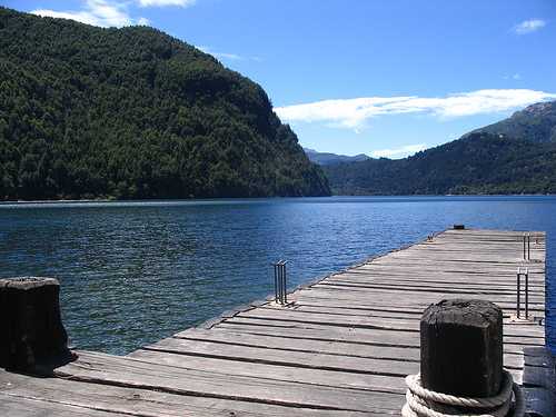
Location: 28 mi (45 km) West of Esquel, Chubut Province
Area: 2,630 km²
Info: Villa Futalaufquen, Ruta Provincial 71
Tel. (02945) 471 015
Open: daily
Los Alerces National Park (Parque Nacional Los Alerces) lies in
the Andes of northern Patagonia in Chubut Province, Argentina. Its
western boundary coincides with the Chile–Argentina border. The park
forms a roughly rectangular block about 65 km (40 mi) north–south
and 45 km (28 mi) east–west, centered near 42°48′27″S 71°53′56″W. It
sits west of the town of Esquel (roughly 30–50 km away) and is
accessed mainly via Provincial Route 71.
The protected area
totals about 2,599 km² (1,003 sq mi). This comprises the core
national park (approximately 187,379–193,144 ha) plus the adjoining
Los Alerces National Reserve (about 71,443 ha). A 10 km buffer zone
surrounds the park on the sides not bordering Chile. The site was
established in 1937 primarily to protect alerce forests and became a
UNESCO World Heritage Site in 2017 under criteria (vii) and (x) for
its outstanding natural beauty and biodiversity. It also forms part
of the Andean North Patagonian Biosphere Reserve.
Getting There and Getting Around
The nearest hub is Esquel (about
50–52 km to Villa Futalaufquen, the park’s administrative and visitor
center base). The road from Esquel (RN 259 + RP 71) is paved to Villa
Futalaufquen. From the north (El Bolsón area), enter via RN 40 and RP 71
through Cholila and Lago Rivadavia (some gravel).
Three main gates
exist:
Portada Centro (main, ~38 km from Esquel).
Portada Norte
(near Cholila).
Portada Sur (near Trevelin).
A car is the most
practical option—rent in Esquel or Bariloche. Daily buses (e.g.,
Jacobsen) run from Esquel along RP 71 in season, stopping at Villa
Futalaufquen, Bahía Rosales, Pasarela Río Arrayanes, Lago Rivadavia and
other points; frequencies drop outside peak summer. Agencies in Esquel
and Trevelin offer tours and transfers. RP 71 has gravel sections inside
the park—drive carefully, especially when wet, and fill up on fuel
before entering.
Nearest airports are Esquel (EQS, limited flights)
or Bariloche (more connections; then a scenic ~4–5 hour drive south).
Best Time to Visit
The park is open year-round, but the ideal
window for hiking, camping, boat trips and full services is November to
April.
December–February (peak summer): Warmest days (roughly
20–26°C / 68–79°F), long daylight, reliable boat and bus schedules.
January brings Argentine holiday crowds and higher prices.
November
and March–April (shoulder): Fewer people, good weather, and in
March–April the lenga beeches turn brilliant red and gold.
May–October: Cooler/wetter, snow at higher elevations, limited services,
shorter days, and some northern trails or boat trips restricted. Winter
can suit snow activities nearby (e.g., La Hoya) but is not prime for
park exploration.
Entrance Fees, Hours and Practicalities
Fees
change frequently with inflation—check the official APN site or park
sources for current rates. Foreigners pay the highest rate (recent
figures cited around ARS 15,000 or roughly $10–20 USD equivalent);
Argentine nationals and Chubut residents pay less. Some sources note
free or reduced entry for young children, seniors or certain groups, and
occasional 50% discounts on re-entry within 72 hours. Payment is often
cash at the gates (no ATM inside the park); online purchase via the APN
web system is sometimes available.
Typical hours: roughly 9:00–20:00
in the summer season (November to Semana Santa) and 9:00–17:00 in
winter. The visitor center in Villa Futalaufquen has more limited hours
(often mornings, closed Sundays in some reports). Register for longer or
harder hikes with rangers.
Essential tips:
Bring layers, rain
gear, sturdy hiking shoes, sunscreen, insect repellent, and cash.
Weather changes quickly.
Stock groceries in Esquel—shops inside are
limited and more expensive.
Carry water and food for boat trips and
longer hikes.
Stay on marked trails, pack out all trash, and never
disturb the alerces or other vegetation.
Check current trail
conditions, fire restrictions, and any recent wildfire impacts with
rangers or the visitor center.
Must-Do Experiences and Trails
Alerzal Milenario (the ancient alerce grove) is the signature highlight.
Access is by boat across Lago Menéndez from Puerto Chucao (reached by a
short walk/boardwalk from the Pasarela Río Arrayanes parking area) to
Puerto Sagrario, followed by a guided interpretive hike through
Valdivian forest to “El Abuelo,” a massive specimen estimated at more
than 2,600 years old. The full outing takes roughly 5–7 hours. Book
ahead through operators such as Safari Lacustre or Glaxiar (especially
in January–February), as numbers are limited. The boat/hike is separate
from park entry; bring your own food. Access involves some walking on
trails and boardwalks.
Other highlights and trails (difficulty and
times approximate; always confirm locally):
Río Arrayanes /
Pasarelas and Lahuán Solitario: Easy boardwalks and loops along the
crystal-clear river, with views of a ~300-year-old alerce and Lago
Menéndez / Glaciar Torrecillas.
Lago Verde: Short, scenic trails and
a mirador over the vivid turquoise water—one of the most photogenic
spots.
Cascada Irigoyen: Very short, easy walk to a waterfall near
the central area.
Pinturas Rupestres: Short loop near Villa
Futalaufquen to ancient rock art.
Laguna Escondida, Cinco Saltos,
Cascada Arroyo del Hacha / Quebrada del León: Moderate, rewarding
waterfall and lake walks.
Longer/harder options: Cerro Alto El Petiso
(full-day high-elevation views; register), multi-day trek toward Lago
Krüger (with refuge/camping options), and boat-assisted access to
Glaciar Torrecillas.
Other activities include kayaking,
additional boat trips (e.g., toward Lago Krüger), horseback riding, and
fishing (subject to regulations).
Accommodation and Bases
Inside the park: Organized campgrounds (hot showers, small shops) around
Lago Futalaufquen, Bahía Rosales, Lago Verde and Lago Rivadavia;
rustic/agreste sites; cabañas and hosterías (examples include Quime
Quipan, Tejas Negras, Rincón del Sol). Villa Futalaufquen is the main
service hub.
Outside: Esquel (full services, hostels, restaurants,
rental cars, buses); Trevelin (smaller, Welsh heritage, quieter);
Cholila or Lago Rivadavia areas for a northern base.
Camping is
the classic immersive option. Book popular campgrounds and boat trips
well ahead for January–February. Two to four days allows time for the
Alerzal trip plus several trails and lake time; a rushed day trip is
possible but misses the best of the park.
Indigenous and Early Human Presence
Archaeological evidence shows
hunter-gatherer occupation of the region for at least 3,000 years,
particularly in the Desaguadero River valley. These groups made tools
from animal bone and stone—boleadoras, arrowheads, leather-working awls,
and grinding implements—and left rock art on cave and rock-shelter
walls. Motifs include geometric designs, labyrinths, and schematic human
figures, similar to those found farther northwest in Patagonia.
By
the 16th century, Tehuelche (or related) groups lived in the area.
Contact with Spanish colonizers led to the adoption of the horse, which
increased mobility. The Mapuche called the iconic tree lahuán. European
exploration intensified in the 18th century; Fray Francisco Menéndez led
early expeditions into the region. From the late 19th century (notably
around 1888), settlers arrived mainly from Chile—the “Pioneros del
Futalaufquen”—along with criollos and Europeans focused on livestock
raising. By the time of formal protection, more than a hundred families
lived in the area; they were later granted precarious, non-transferable
and non-inheritable occupation and grazing permits.
Establishment
of the Protected Area
Argentina’s modern national-park system began
with Perito Francisco Pascasio Moreno’s 1903 land donation, which
underpinned Nahuel Huapi (formalized 1924) and Iguazú. In the 1930s the
government moved to secure additional Patagonian territories. On 11 May
1937, Decree No. 105.433 of President Agustín Pedro Justo declared four
Andean Patagonian areas as national reserves destined to become national
parks. One of them was the Reserva Nacional Los Alerces in the
then-National Territory of Chubut, initially covering about 286,750
hectares. The explicit goal was to safeguard the alerce forests—already
threatened by uncontrolled logging—and representative Andean-Patagonian
flora, along with species such as the huemul and pudú.
Boundary
adjustments followed in 1938, 1941, and 1942. On 28 April 1945,
Decree-Law No. 9504 of President Edelmiro Julián Farrell elevated the
reserve (together with Lanín, Perito Francisco P. Moreno, and Los
Glaciares) to full national-park status. Because the decree came from a
de-facto government, it was ratified by Law No. 13,895 on 30 September
1949. In 1971, Law No. 19,292 detached the Anexo Puelo section, which
became Lago Puelo National Park, to protect the alerce stands entering
via Paso Puelo.
The park is administered by Argentina’s
Administración de Parques Nacionales (created by Law 12,103 of 1934).
Its headquarters is in Villa Futalaufquen inside the park.
Landscape, Alerce Forests, and Later Developments
The terrain was
sculpted by successive Pleistocene glaciations, producing moraines,
cirques, U-shaped valleys, hanging valleys, and a chain of clear-water
lakes (Futalaufquen, Menéndez, Rivadavia, Verde, Krüger, and others)
linked by short rivers that ultimately feed the Futaleufú system. Higher
elevations transition to alpine meadows, bare rock, and permanent
snowfields; the Torrecillas Glacier sits between the arms of Lake
Menéndez.
The park holds Argentina’s largest and best-preserved
alerce forests (roughly 7,400 ha of virgin stands). The species is the
second-longest-lived tree on Earth (some Chilean individuals exceed
3,600 years). In the Millennial Alerce Forest on the northern arm of
Lake Menéndez stands the “Alerce Abuelo” (Grandfather), approximately
57–60 m tall, over 2.2 m in diameter, and about 2,600 years old.
Uncontrolled logging nearly eliminated the tree in the early 20th
century; a national ban on its felling took effect in 1977. The forests
also contain coihue, lenga, arrayán, radal, ciprés, and other Patagonian
species, with Valdivian rainforest elements in the wetter western zones.
A major alteration occurred in the 1970s with construction of the
Futaleufú hydroelectric dam, which created the artificial Amutui Quimei
reservoir. The dam and reservoir lie mainly in the National Reserve
(buffer zone) but affect visual integrity and hydrology; they predate
World Heritage status and remain a noted non-natural feature.
UNESCO World Heritage Status
On 7 July 2017, during the 41st session
of the World Heritage Committee, Los Alerces National Park was inscribed
under natural criteria (vii) and (x) (reference 1526). Criterion (vii)
recognizes its exceptional scenic beauty—interconnected turquoise lakes,
dense temperate forests, glaciated peaks, and the millennial alerce
stands. Criterion (x) highlights its role as one of the last continuous,
nearly pristine tracts of Patagonian forest with Valdivian
temperate-forest affinities, a globally priority ecoregion containing
endemic and threatened species and relict taxa that survived glaciation.
The inscribed property covers 188,379 ha (the formal National Park); the
buffer zone of 207,313 ha includes the National Reserve plus a
surrounding band. The site is also part of the Andino Norpatagónica
Biosphere Reserve.
Topography and Geomorphology
The landscape was shaped by
successive Pleistocene glaciations. Classic glacial landforms dominate:
U-shaped valleys, hanging valleys, glacial cirques, moraines, sheepback
rocks (roche moutonnée), glacial deposits, and chain-like lagoons. The
park contains rugged Andean peaks, deep valleys, and extensive mountain
ranges that transition into dense forest and open alpine terrain.
Elevation ranges from a low of about 330 m (1,080 ft) where the
Futaleufú River crosses into Chile to a high of 2,440 m (8,010 ft) at
Cordón de las Pirámides. Some sources list Cerro Situación near 2,307 m
as a major peak. The treeline sits around 1,400 m (4,600 ft). Above this
elevation, vegetation thins to alpine meadows, bare rock, and permanent
or semi-permanent snowfields. The Torrecillas Glacier sits between the
two arms of Lake Menéndez. Steep slopes (often exceeding 45°) are
common, and erosion dominates over deposition in higher zones, with
forests helping stabilize slopes.
Hydrology
The entire park
lies within the Futaleufú River basin (part of the larger Yelcho River
system that drains westward to the Pacific). A complex system of chained
lakes connected by short, turbulent rivers regulates the heavy
precipitation.
The main chain begins with Lake Rivadavia, whose
outflow (Rivadavia River) enters the smaller Lake Verde (Green Lake).
From Lake Verde, the Arrayanes River continues, receiving the outflow of
Lake Menéndez, and flows into the larger Lake Futalaufquen. Downstream
lie Lake Krüger and the Frey River, which feeds into the artificial
Amutui Quimei Reservoir (created by the Futaleufú hydroelectric dam).
The Futaleufú River then emerges and forms part of the park’s southern
boundary before crossing into Chile.
Major lakes include Futalaufquen
(one of the longest), Menéndez (Y-shaped, roughly 26 km / 16 mi long,
with a maximum depth reported near 287 m / 942 ft), Verde, Krüger, and
Rivadavia. Waters are exceptionally clear and shift between turquoise,
emerald green, and blue depending on sunlight and season. Numerous
smaller lakes, streams, and wetlands fill the valleys. The system
efficiently drains abundant snowmelt and rainfall.
Climate
Lower elevations have an oceanic climate (Köppen Cfb) or humid
continental climate (Dfb). Moisture-laden Pacific air is forced upward
by the Andes, producing heavy orographic precipitation—up to 3,000 mm
(120 in) or more annually on the western side, mostly as rain at lower
elevations and snow higher up. Precipitation declines sharply eastward
due to the rain-shadow effect, falling to about 800 mm (31 in) at the
eastern edge of the park. Most precipitation falls in the southern
hemisphere winter (especially July–August), though there is no true dry
season.
Temperatures are cool to moderate. At the park headquarters
(one of the lower elevations), January (warmest month) averages roughly
24°C (75°F) highs and 8°C (46°F) lows; July averages about 7°C (45°F)
highs and –1°C (30°F) lows. Freezes can occur in any month. Temperatures
decrease with elevation. Summer daytime highs can exceed 30°C in places,
while winters bring regular snowfall. Official sources describe the
climate overall as temperate to cold and humid, with mean lowland
temperatures around 14°C in summer and 2°C in winter.
Vegetation
and Ecosystems
The park protects continuous Patagonian
(Andean-Patagonian) forest—one of only five temperate forest types
worldwide and the only temperate forest ecoregion in Latin America and
the Caribbean. It contains the largest extent of Valdivian temperate
rainforest on Argentine soil. Forests occupy a large share of the lower
elevations (one study notes roughly 66% of terrestrial cover as forest),
with a strong west-to-east moisture gradient.
In the wetter west and
around the lakes, dense humid forests feature the park’s namesake alerce
(Fitzroya cupressoides, also called lahuán by the Mapuche), coihue
(Nothofagus dombeyi), arrayán (Chilean myrtle, Luma apiculata), colihue
bamboo, ferns, mosses, lichens, and vines. The millennial alerce forest
on the north arm of Lake Menéndez is especially notable: the largest and
oldest known trees in the park reach nearly 60 m (187 ft) tall, over 2.2
m in diameter, and about 2,600 years old. Alerce grows extremely slowly
and is one of the longest-lived tree species on Earth (some individuals
elsewhere exceed 3,600 years). These forests are in excellent
conservation condition.
Eastward and at higher elevations, forests
become drier and more open, dominated by coihue, lenga (Nothofagus
pumilio), and ciprés de la cordillera (Austrocedrus chilensis), grading
into alpine meadows beneath the rocky peaks. Above the treeline,
vegetation is sparse. The park also includes high-Andean and
transitional steppe elements. These forests support endemic and
threatened species and represent some of the last large, near-pristine
blocks of continuous Patagonian forest.
Geology
The park
occupies the Patagonian Andes (Cordillera Patagónica Austral). Rocks of
Paleozoic, Mesozoic, and Cenozoic age are present. Volcanic activity has
influenced soils (andosols from ash deposits and regosols from mixed
volcanic material, sand, and silt). Glacial processes have overprinted
the underlying geology, creating the characteristic lake basins and
rugged relief visible today. The high mountains form a barrier that has
shaped the strong west–east precipitation gradient since at least the
mid-to-late Miocene.
Flora
The park’s vegetation is dominated by temperate forests of
high naturalness, with strong Valdivian influence in the wetter western
sectors. Roughly 547 vascular plant species have been recorded, of which
about 441 are native (roughly 81%). The Valdivian ecoregion shows marked
endemism and relictual character: 34% of woody plant genera are endemic,
and 80% of those are monotypic, reflecting long isolation and survival
through glacial periods.
The emblematic species is the alerce or
lahuán (Fitzroya cupressoides), a monotypic conifer in the cypress
family (Cupressaceae) endemic to southern Chile and Argentina. It is the
second-longest-lived tree species on Earth (individuals elsewhere exceed
3,600 years) and among the largest trees in South America. Growth is
extremely slow (roughly 1–2 mm in diameter per year). The park holds the
densest and best-conserved alerce stands in Argentina, including pure or
near-pure forests. The celebrated Millennial Alerce Forest lies on the
northern arm of Lago Menéndez (accessible by boat to Puerto Sagrario).
The best-known individual (“El Abuelo” or similar) reaches about 57–60 m
in height, 2.2–2.3 m in diameter, and roughly 2,600 years of age. Larger
or older trees may exist in more remote southwestern sectors. The thick
reddish bark resists fire; tiny scale-like leaves and small cones are
characteristic. Logging once threatened the species; commercial felling
has been banned for decades, and the park’s stands remain in excellent
condition.
Other dominant or characteristic trees include:
Evergreen southern beech or coihue (Nothofagus dombeyi) in humid sites.
Lenga (Nothofagus pumilio) and ñire (Nothofagus antarctica) at higher
elevations or in transitional zones.
Arrayán or Chilean myrtle (Luma
apiculata), especially along the Río Arrayanes and lake shores, with its
distinctive cinnamon-colored peeling bark.
Ciprés de la cordillera
(Austrocedrus chilensis) in drier eastern sectors.
Mañío (Podocarpus
nubigenus) and other elements of the Valdivian forest.
Understory and
associates: dense caña colihue bamboo (Chusquea culeou), tree ferns,
abundant mosses, lichens, vines, and flowering shrubs such as chilco
(fuchsia).
Eastward, forests become more open, with maitén
(Maytenus boaria), radal (Lomatia hirsuta), and ciprés in the
forest–steppe ecotone. Alpine zones support specialized herbs and
cushion plants. Invasive exotics (rosa mosqueta, lupine, daisies, and
others) threaten native understory in disturbed areas.
Fauna
The park supports a representative Andean-Patagonian fauna with
important populations of threatened species. Vertebrate totals from park
and UNESCO sources are roughly: ~23–24 native mammals, 124–133 birds, 11
amphibians, 3 reptiles, and about 10 fish species (half native). Many
taxa have narrow ranges or high conservation value.
Mammals of
note include:
Huemul or South Andean deer (Hippocamelus bisulcus),
Endangered (IUCN) and a National Natural Monument in Argentina. The park
holds important and relatively stable populations, especially on eastern
ridges (Cerro Riscoso and others); records even occur in alerce forest,
which is unusual.
Pudú (Pudu puda), South America’s smallest deer
(shoulder height often ~40 cm), inhabiting dense understory.
Puma
(Puma concolor), the apex predator.
Güiña or kodkod (Leopardus
guigna), Vulnerable, one of the smallest cats in the Americas, with
restricted range.
Monito del monte (Dromiciops gliroides), a
nocturnal marsupial and “living fossil” (sole living member of an
ancient lineage), endemic to the region and important for seed
dispersal.
Huillín or southern river otter (Lontra provocax),
Endangered; recent reconfirmations after long absences.
Culpeo and
gray foxes, tuco-tuco, and smaller rodents.
Birds form an
Important Bird Area, with species typical of Andean-Patagonian and
Valdivian forests: Andean condor (Vultur gryphus), Magellanic woodpecker
(carpintero negro, Campephilus magellanicus), pitío, chucao
(Scelorchilus rubecula), austral parakeet, torrent duck (Merganetta
armata), Chilean flamingo, spectacled (bronze-winged) duck, araucana
pigeon, and various raptors and passerines. Waterbirds and forest
understory specialists are well represented.
Amphibians show high
regional interest, with 11 species recorded. The standout is the
strictly endemic Batrachyla fitzroya (ranita de Los Alerces), known only
from Isla Grande in Lago Menéndez (named for the alerce). It is
Vulnerable; its entire global range lies within the park. Other
Patagonian endemics or restricted species include related Batrachyla
frogs and the emerald forest frog.
Reptiles are few (Valdivian snake,
lizards such as Liolaemus pictus). Native freshwater fish are entirely
endemic to Patagonia (galaxiids / puyen and others); the park retains
some areas free of non-natives. Introduced salmonids (rainbow, brown,
brook trout, Atlantic salmon) dominate many lakes and rivers and pose a
major conservation concern through predation and competition. American
mink, introduced decades ago, preys on native birds, small mammals, and
amphibians.
Conservation Context
The alerce forests and large
roadless forest blocks remain among the most intact Valdivian/Patagonian
stands in Argentina. Key threats include invasive plants and animals,
historical and potential fire, limited tourism pressure in the buffer,
and the existing Futaleufú hydroelectric infrastructure (whose reservoir
affects part of the system). The park’s size, zoning (including large
strict-protection zones), and remoteness support long-term viability of
its endemic and threatened biota. Visitors commonly see forest
structure, lake scenery, and birds; mammals such as pudú or huemul are
more elusive and best observed with patience or on guided outings. Boat
access is the classic way to experience the Millennial Alerce Forest.