Location: Kerch, Crimean Peninsula Map
Constructed: 1699–1706 by Ottoman Turks
10 largest cities of Russia
Moscow
St.
Petersburg
Novosibirsk
Yekaterinburg
Nizhny
Novgorod
Kazan
Chelyabinsk
Omsk
Samara
Rostov-on-Don
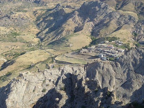
Yeni Kale Fortress (Ени-Кале) is
an old Turkish stronghold that is located near Kerch, Crimean
Peninsula in Russia. It was built in the late 17th century to
defend outskirts of Ottoman Turkish Empire against approaching
Russian Empire that was expending southward. Yeni Kale Fortress
is an abandoned citadel situated on the shores of the Kerch
Strait on the North- East edge of a town of Kerch. Construction
of Yeni Kale castle began in 1699–1706 by Ottoman Turks in their
futile attempt to stop the expansion of the emerging Russian
Empire to the North. The name is translated from Turkish as the
"New Fortress". It has a shape of an irregular pentagon with
several layers at various elevations due to complexity of the
complex terrain. Five vastions on all corners further
strengthened the defenses of the castle to withstand a long
siege and heavy artillery fire.
The stronghold of Yeni
Kale occupied an important strategic location at the narrowest
part of the Kerch Strait where it is only 4 km wide. It could
easily block the passage of trade and military ships from Black
Sea to Azov Sea with cannon fire. A serious problem of shortness
of drinking water solved by the Turkish engineers. They dug a
well inside a mountain and built underground ceramic aqueduct
that carried water from a nearby spring several kilometers away
from Yeni Kale. Its importance is further underlined by a fact
that it became an official residence of a local Turkish pasha or
a ruler of the region. After Crimean Peninsula fell under
Russian control Yeni Kale housed only a small garrison of
soldiers. In terms of military defense it became obsolete. It
was remodeled in 1853- 56 during Crimean War. Several far range
cannons were added, but Yeni Kale was completely abandoned in
1880.
Today Yeni Kale is open to the public. However it
has minimal amenities for tourists. Trails are well marked, but
it requires good physical fitness. Additionally don't forget
that in the summer months Crimean heat can be unbearable. Take
plenty of water and wear some sun protection to avoid heat
stroke. In the 20th century a railroad was laid at the base of
the mountain and connected Kerch ferry with other part of
Crimean peninsula. Its constant vibration created a threat of
gradual destruction of many of the old buildings so keep in mind
that some of the structures are unsafe to enter. They might
easily collapse so take caution as you explore the area of Yeni
Kale.
The fortress was built between
1699 and 1706. The construction was supervised by an Italian convert
to Islam named Goloppo. Also, several French engineers took part in
the work.
Yenikale was of great strategic importance for the
Ottoman Empire - the fortress, located in the narrowest part of the
Kerch Strait and armed with powerful cannons, prevented the passage
of Russian ships between the Azov and Black seas.
Yenikale
occupied an area of about 2.5 hectares. The fortress had the shape
of an irregular pentagon in plan and, following a steep relief, was
located on several levels. In the corners were five half-bastions
capable of withstanding a long siege and powerful artillery fire.
Some of them were extended far beyond the perimeter of the walls.
Thus, the area of destruction of the enemy was significantly
increased and the possibility of flank shelling of the territory
adjacent to the walls appeared. An additional layer of defense was a
moat that surrounded the fortress from three sides, with the
exception of the coastal side.
On the territory of Yenikale
there were: two powder depots, an arsenal, residential buildings, a
water tank, a bathhouse, a mosque. About 800 Ottoman and 300 Crimean
Tatar soldiers formed the garrison of the fortress. Yenikale served
as the residence of the Turkish Pasha.
A serious problem was
the lack of fresh water - the only well in the fortress could not
provide water for the entire population. Therefore, to supply water,
the builders laid a ceramic underground water pipeline connecting
Yenikale with a spring located several kilometers from the fortress
(the territory of the modern village of Glazovka).
Under the Ottomans, a large slave market operated in the Yenikale fortress. After the Russian conquest, the slave trade declined.
In the
summer of 1771, during the Russian-Turkish war (1768-1774), the
Russian army entered the Crimea. On June 21, Yenikale was taken
without a fight by units of the Second Army of Major General Borzov.
The Turkish garrison, together with their commander Abaza Pasha,
despite the large reinforcements that arrived on ships a few days
before the Russians appeared, left the fortress.
In 1774,
according to the Kuchuk-Kaynardzhiyskiy treaty, Kerch and Yenikale
were transferred to Russia and formed the Kerch-Yenikalsk city
administration of the Tauride province.
By the beginning of
the 19th century, Yenikale lost its military significance, and in
1835, the buildings of a military hospital were located on its
territory, which existed until 1880. After the abolition of the
military hospital, Yenikale was finally abandoned.
Today Yenikale is one of the attractions of Kerch and
Crimea. The fortress was given the status of an architectural
monument protected by the state.
Despite the fact that in the
second half of the 20th century, a number of restoration works were
carried out in Yenikala, almost the entire fortress is in ruins. The
best preserved are the gates, fragments of the fortress walls and a
half-bastion from the coastal side.
Directly through the
territory of the fortress, there is a single-track railway line
connecting Kerch with the Kerch ferry crossing. The vibration
generated by the movement of trains poses a threat to the gradual
destruction of the monument. The commissioning of the Crimean
bridge, the transfer of the railway flow to it and the closure of
the branch, passing through the fortress, will preserve the
historical object.