Location: Map
Area: 10,000 km²
W National Park in Benin (Parc national du W du Bénin) forms the
Beninese portion of the vast W-Arly-Pendjari (WAP) Complex, one of West
Africa’s largest and most important transboundary protected areas. It
spans roughly 5,600–8,000 km² within Benin (sources vary slightly on
exact figures for the national component) and lies in the country’s far
north, in the Alibori and Atacora departments, between approximately
11°26′ and 12°26′ N latitude and 2°17′ and 3°05′ E longitude.
The
park takes its name from the distinctive W-shaped meander of the Niger
River, which forms part of its northern boundary (primarily in the Niger
section, but the whole complex follows this feature). It is contiguous
with Pendjari National Park (also in Benin) and connects across borders
with protected areas in Burkina Faso (e.g., Arly) and Niger, creating a
mosaic of savanna, gallery forests, wetlands, and wooded landscapes in
the Sudano-Sahelian zone. The wider WAP Complex totals about
17,000–26,000 km² depending on included buffer/hunting zones and
represents the largest intact wild ecosystem remaining in West Africa.
Pre-Colonial and Early Human Context
Before formal protection, the
area showed evidence of long-term human presence. Archaeological sites,
mostly tombs, indicate it was once a significant area of habitation.
Vegetation patterns along the Atacora cliffs—ancient baobabs (Adansonia
digitata), shea trees (Vitellaria paradoxa), and other species—mark
former villages and fields. Local ethnic groups, including the
Batammariba (Tata) people nearby, maintained traditional relationships
with the landscape through animist practices, fire management, and
resource use that shaped the savanna for tens of thousands of years. By
the early 20th century, however, the region had become sparsely
populated due to factors like malaria and tsetse flies.
Colonial
Era: Identification and Creation (1926–1954)
French colonial
authorities first recognized the ecological value of this savannah
expanse in 1926, designating it a “refuge zone” to protect wildlife amid
expanding settlement and hunting pressures in French West Africa (AOF).
This marked the earliest formal step toward conservation in the region.
In 1937, the colonial administration formally created the Parc du W du
Niger, a transboundary protected area spanning the territories of
Dahomey (present-day Benin), Haute Volta (Burkina Faso), and Niger—the
first such cross-border park in French West Africa.
Between
1952–1953, the area was reclassified as a Réserve Totale de Faune (Total
Wildlife Reserve) and State Forest. On 4 August 1954, a decree elevated
it to full National Park status across the three countries, with
separate national parks declared in each (the Benin portion is sometimes
dated to 1950 in local records, reflecting preparatory colonial
measures).
To establish the park, colonial authorities relocated the
few remaining local inhabitants between 1926 and 1954, minimizing human
impact and leaving the core area largely pristine. Until the 1970s, the
zone remained a malarial wetland formed by the Mékrou River delta and
Niger River floodplains, broken by rocky hills—factors that naturally
limited settlement.
Post-Independence to International
Recognition (1950s–2000s)
After independence (Benin in 1960), the
park remained under national management but faced growing pressures from
surrounding communities (over 200,000 people in ~60 villages today,
including Peul pastoralists). The Benin section continued as a core
protected area, with limited traditional resource use inside the park
itself.
Key international milestones include:
1987–2007:
Successive Ramsar Wetland designations (initially for the Niger core,
extended to the Benin Complex in 2007 as Site Ramsar du Complexe W).
1996: The Niger portion of W National Park was inscribed as a UNESCO
World Heritage Site (criteria ix and x) under the name “W National Park
of Niger.”
2001–2002: The area gained recognition as a transboundary
biosphere reserve under UNESCO’s Man and the Biosphere Programme;
Benin’s section was formally classified as part of the W Biosphere
Reserve in 2001. A tripartite agreement (later quadripartite with Togo)
was signed in 2007 for coordinated cross-border management.
2002:
Extension to Benin and Burkina Faso components, creating the first major
transboundary reserve in Africa.
Until 2008, the EU-funded ECOPAS
project (Écosystèmes Protégés en Afrique Soudano-Sahélienne) provided
regional management support.
UNESCO Extension and the
W-Arly-Pendjari Complex (2017–Present)
On 21 October 2018 (following
the 2017 UNESCO decision), the site was officially extended and renamed
the W-Arly-Pendjari Complex, now a single transnational World Heritage
property covering 1,714,831 ha across nine contiguous protected areas
(including Pendjari and W in Benin, Arly in Burkina Faso, and hunting
zones). This recognized its Outstanding Universal Value as the largest
intact Sudano-Sahelian savanna ecosystem, a refuge for West Africa’s
last viable populations of elephants (largest herd in the region), West
African lions, cheetahs, and other large mammals, plus exceptional
biodiversity shaped by fire regimes and seasonal flooding.
In Benin,
management falls under the Centre National de Gestion des Réserves de
Faune (CENAGREF). The park operates under 10-year management plans
coordinated across borders.
Modern Management: African Parks
Partnership and Contemporary Challenges (2019–Today)
In 2019, Benin’s
government, the West African Savannah Foundation (FSOA, an endowment
fund created in 2012), and African Parks launched a Priority
Intervention Plan to strengthen law enforcement, rehabilitate
infrastructure, and engage local communities.
In June 2020, the Benin
government signed a 10-year formal management agreement with African
Parks for the Beninese portion of W (nearly 7,000 km²), making it the
second park in their Benin portfolio after Pendjari. This partnership
focuses on anti-poaching, wildlife monitoring, infrastructure,
sustainable livelihoods (beekeeping, shea/baobab harvesting, fishing),
community education, and translocations/reintroductions. It has created
hundreds of jobs and supports thousands of people reliant on ecosystem
services.
Security challenges have intensified since around
2019–2020, with jihadist groups using the remote park as a base or
transit route; incidents include a 2022 terrorist attack killing eight
people and the 2019 kidnapping/murder of tourists in the adjacent
Pendjari area. The parks have faced temporary closures, but conservation
and community programs continue.
Human-wildlife conflict persists in
buffer zones (crop damage by elephants, livestock grazing pressures),
though community awareness and alternative livelihood programs aim to
reduce encroachment.
Summary of Historical Significance
From a
colonial refuge zone in 1926 to a pioneering transboundary national park
in 1954, and now a globally recognized UNESCO World Heritage Site and
Ramsar wetland managed through innovative public-private partnerships, W
National Park in Benin exemplifies evolving African conservation. Its
history reflects the shift from top-down relocation and protection to
collaborative, community-linked management amid modern threats like
poaching, climate-driven fire regimes, transhumance, and regional
insecurity. Today it stands as a critical stronghold for West African
biodiversity while supporting local economies and cultural heritage.
Location and Size
The park lies in the Alibori Department (with
some overlap into Atacora), in the far north of Benin near the borders
with Niger (to the north and east) and Burkina Faso (to the northwest).
Its geographic coordinates span approximately 11°26′ to 12°26′ N and
2°17′ to 3°05′ E. It is accessible via road from Cotonou through Kandi
(about 650 km north). The Benin section covers 563,280 hectares (5,633
km²), making it a substantial but not the entire transboundary W area
(the full WAP Complex exceeds 1.7 million ha when including contiguous
parks like Pendjari in Benin and Arly/W in Burkina Faso/Niger). The
park's name derives from the distinctive W-shaped meander of the Niger
River, which forms much of its northern boundary.
Topography and
Landforms
The topography is characterized by a gently undulating
granito-gneissic peneplain (a low-relief erosion surface) that forms the
northeastern extension of the Atacora mountain chain (which peaks higher
in northwestern Benin). Elevations are generally low, averaging around
250 m but ranging from roughly 170–340 m, with subtle relief variations
of only 20–40 m and slopes typically under 2%. This creates a broad,
rolling plateau landscape dotted with modest rocky hills,
quartz/schist/gneiss outcrops, and lateritic buttes (flat-topped,
iron-rich capped hills).
Notable features include:
Cliffs and
gorges along the Mékrou River, including the Chutes de Koudou (Koudou
Falls/cascades) and Rapides de Barou (Barou Rapids).
The Mékrou River
gorge, with extensive rock outcrops.
Dongas — natural gullies and
collapse features formed by soil erosion.
Isolated rocky inselbergs
and cuirassed (hardened laterite) surfaces in uplands.
These
elements create a mosaic of plateaus, valleys, and riparian corridors,
with the landscape transitioning southward into the broader Sudanese
plains. The park occupies the southern limit of certain tiger-bush
plateau formations in the region.
Climate
W National Park
Benin lies in the dry Sudanian (Sahelo-Sudanian) climatic zone, a
transitional belt between the wetter Guinean forests to the south and
the arid Sahel to the north. It experiences a strongly seasonal climate
with two main periods:
Rainy season (mid-May to October):
Monsoon-driven rains bring the majority of annual precipitation,
averaging around 900 mm (though variable year-to-year; some sources note
500–800 mm in drier northern fringes).
Dry season (November to
mid-May): Divided into a cooler, dusty period (November–February)
dominated by the harmattan (northeast trade winds carrying Saharan dust)
and a hotter period (March–mid-May).
Mean annual temperature is
approximately 28°C, with significant diurnal and seasonal thermal
amplitudes (daily highs can exceed 40°C in the hot dry season; lows dip
to around 10–15°C in January). Rainfall is unreliable and concentrated
in 30–50 days, influencing vegetation cycles and water availability.
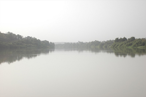
Hydrology
The park is part of the Niger River basin (with some
influence from the broader Volta watershed in the WAP Complex). It is
drained primarily by two major perennial-to-seasonal rivers:
Mékrou River (410 km long): The more regular waterway, forming gorges,
falls, and rapids; it merges with the Niger and historically created
extensive wetlands/deltas.
Alibori River (338 km long): More
intermittent, with chains of seasonal ponds forming along its bed during
the late dry season (February–April).
Numerous smaller
tributaries feed these, including the Pako, Kompa Gorou, Bédarou, Mali
Gorou, Kokodiangou, and Konékoga rivers. Local intermittent streams
supply dozens of seasonal ponds (e.g., 34 documented in similar Niger
sections). The Niger River itself borders the north, creating the iconic
W-meander and associated floodplains/wetlands. Historically (pre-1970s),
much of the area was a malarial wetland zone. Water dynamics are highly
seasonal, with rivers and ponds contracting dramatically in the dry
season, concentrating wildlife.
Soils
Soils are predominantly
lateritic (iron-rich, reddish), shallow, and infertile on the uplands
and plateaus, with high iron content leading to hardened cuirasses
(laterite caps) in some areas. These support sparse vegetation but are
prone to erosion (forming dongas). In depressions, stream valleys, and
riparian zones, soils are deeper, more fertile, and alluvial, sustaining
denser gallery forests and herbaceous growth. The peneplain's
Precambrian basement (quartzite sandstone, gneiss, schists) underlies
much of the area, contributing to rocky, gravelly, or stony substrates
in saxicolous (rock-dwelling) savanna zones.
Vegetation
The
park exemplifies intact Sudano-Sahelian savanna in the transition zone
between Sudanese savannas and Guinean forests. Frequent fires (natural
and traditional) and the advancing Sahel influence maintain a mosaic of
open landscapes. Key vegetation types include:
Riparian and
gallery forests along rivers and watercourses: Dense, humid corridors
with tall trees (e.g., Khaya senegalensis, Diospyros mespiliformis,
Kigelia africana) and shrubs (Cola, Syzygium, Morellia).
Clear
forests: Open canopy with medium-height trees (8–16 m).
Wooded
savanna: High tree density (35–60%), discontinuous canopy, abundant
grasses; fire-prone in dry season.
Arboreous (tree) savanna: 5–35%
tree cover, 5–10 m trees, variable shrub layer, dense gramineae
(grasses) up to 80–100%.
Shrubby savanna: Low tree cover (<5%),
shrubs 3–5 m, grassy understory.
Saxicolous (rocky) savanna: On
stony/lateritic soils, featuring drought-tolerant species like Burkea
africana and Detarium microcarpum.
Herbaceous savanna: Almost pure
grass cover in open areas.
Scattered iconic trees: Baobab (Adansonia
digitata), shea (Vitellaria paradoxa), néré (Parkia biglobosa), and
African birch (Anogeissus leiocarpus), some marking former village
sites.
The park lies in the transition zone between Sudanese savannas and Guinean forests, featuring intact Sudano-Sahelian ecosystems with grasslands, shrublands, wooded savannas, gallery forests, riparian forests, and rare semi-deciduous forests like Bondjagou. Vegetation includes 454 plant species, with trees such as oil palms, rônier palms, coconut palms, kapok, mahogany, ebony, and two orchids unique to the region. Human-induced fire regimes, practiced for about 50,000 years, maintain vegetation diversity, while seasonal flooding from rivers shapes aquatic and semi-aquatic habitats. As a Ramsar wetland site, it supports high fish endemism (seven of nine endemic species in the Volta Basin). The ecology is dynamic, with traditional burning preventing bush encroachment and promoting biodiversity, though climate change and human pressures pose risks.
Flora
The park supports approximately 450–500 vascular plant
species (with estimates up to 684–800 when including closely linked
areas like Pendjari), dominated by families such as Fabaceae (legumes)
and Poaceae (grasses). It exemplifies Sudanian savanna vegetation, with
high phytodiversity adapted to seasonal flooding, drought, and fire.
Six main habitat types characterize the flora:
Savanna woodlands
and open forests — Cover much of the area, featuring tall trees like
Terminalia avicennoides, Anogeissus leiocarpus, Isoberlinia doka, and
Afzelia africana, interspersed with grasses such as Hyparrhenia spp. and
Andropogon gayanus.
Shrubby savannas — Occur on lateritic and sandy
soils, dominated by Combretum species, Guiera senegalensis, Acacia spp.,
and Lannea spp., with stunted woodland elements.
Gallery and riparian
forests — Line seasonal watercourses and rivers. These include
dry-season deciduous types with African ebony (Diospyros mespiliformis),
semi-deciduous stands featuring Crateva religiosa and Vitex chrysocarpa,
and evergreen pockets with sausage tree (Kigelia africana) and African
mahogany (Khaya senegalensis, vulnerable). Palms like African palmyra
(Borassus aethiopum) and shea tree (Vitellaria paradoxa) are common.
Flooded plains and wetlands — Along the Niger River and tributaries,
supporting Mimosa pigra, Mitragyna inermis, and herbaceous species
including millets (Pennisetum spp.), Digitaria spp., and legumes (Vigna
spp.).
Other elements — Include baobabs (Adansonia digitata), kapok
(Bombax costatum), hackberry (Celtis integrifolia), Boscia senegalensis,
Balanites aegyptiaca, and Parkia biglobosa (African locust bean). Rocky
outcrops (bowés) host specialized saxicolous savanna species.
Two
orchid species are noted as locally unique (primarily on the Niger
side). The vegetation serves as critical habitat corridors and supports
genetic resources for crops and medicinal plants.
Fauna
The W
National Park (Benin sector) hosts exceptional faunal diversity within
the WAP Complex, including more than 50 large mammal species, over
350–367 bird species, about 150 reptile species, and 115 fish species.
It acts as a vital refuge for many species that have largely disappeared
elsewhere in West Africa, with the complex holding the region's largest
elephant population (about 85% of West Africa's savanna elephants) and
the last viable populations of several threatened taxa.
Mammals
(over 70 diurnal species recorded)
Large herbivores — African bush
elephants (Loxodonta africana) form one of West Africa's strongest
populations, with recent surveys indicating possible increases due to
better protection and migration. African buffalo (Syncerus caffer
brachyceros), hippopotamuses (Hippopotamus amphibius, vulnerable)
congregate in rivers, and warthogs (Phacochoerus africanus) are common.
Antelopes and ungulates — A dozen species thrive here, including kob
(Kobus kob), roan antelope (Hippotragus equinus), western hartebeest
(Alcelaphus buselaphus major), korrigum/topi (Damaliscus
korrigum/lunatus — one of the last viable populations), Defassa
waterbuck (Kobus ellipsiprymnus), bushbuck (Tragelaphus scriptus),
reedbuck (Redunca redunca), oribi (Ourebia ourebi), red-fronted gazelle
(Eudorcas rufifrons, vulnerable), and duikers (red-flanked and common).
Carnivores — West African lion (Panthera leo, about 90% of the remaining
regional subpopulation), African leopard (Panthera pardus), northwest
African cheetah (Acinonyx jubatus hecki, critically endangered
subspecies with the last viable West African population in small
numbers), spotted and striped hyenas, serval (Leptailurus serval),
caracal (Caracal caracal), and African wild dog (Lycaon pictus,
endangered and rare or possibly locally extirpated in parts).
Other
mammals — Primates like Anubis baboon (Papio anubis) and patas monkey
(Erythrocebus patas); aardvark (Orycteropus afer); and African manatee
(Trichechus senegalensis, vulnerable) in river systems. West African
giraffe is largely absent or restricted to Niger sectors.
Birds
(350–367+ species; Important Bird Area)
The park lies under a major
Palaearctic–Afrotropical flyway. Floodplains and rivers host large
congregations of migratory waterbirds (e.g., white-faced whistling duck,
Egyptian goose, spur-winged goose) from February–May. Resident and
breeding species include raptors (African fish eagle, vultures, eagles),
guineafowl, francolins, doves, nightjars, hornbills, and storks/herons.
It supports threatened and range-restricted birds amid the
savanna–wetland mosaic.
Reptiles and Fish
Around 150 reptile
species include Nile crocodiles (Crocodylus niloticus), pythons,
monitors, and various snakes/lizards. Fish diversity (115 species)
reflects the Niger River basin, with notable endemism (several Volta
Basin endemics protected here).
Key attractions include the Niger River's scenic W-bend, natural pools for wildlife viewing, and archaeological sites like ancient tombs. In Pendjari (contiguous), highlights are waterholes like Mare Bai for stargazing and elephant sightings. Activities are limited due to security, but potential includes guided patrols, helicopter flights for aerial views, and community interactions like Bariba Horsemen demonstrations. Infrastructure features graded roads, airstrips, and ranger facilities, but tourism is currently suspended in the "red zone." When safe, it offers wildlife safaris focusing on elephants drinking or cheetahs in savannas.
The park holds cultural significance for local communities, with archaeological evidence of ancient habitation. Initiatives promote sustainable livelihoods like beekeeping, shea and baobab harvesting, fishing, and the "Pur" brand for local products. Environmental education reaches 6,000 schoolchildren annually, including wildlife art competitions. Traditional fire management by communities sustains ecosystems. Interactions include celebrations at solar-powered water points with drumming and dancing, fostering conservation support amid reliance on park resources.
As of 2025, W National Park in Benin operates under African Parks' management, supported by the government and FSOA. Security remains precarious due to jihadist incursions from Burkina Faso, with over 3,000 soldiers deployed and rangers conducting anti-IED patrols. Tourism is off-limits following attacks, including the April 2025 incident killing 54 soldiers. Conservation advances include infrastructure rehabilitation, community projects like boreholes and malaria prevention, and wildlife monitoring (e.g., elephant collaring). Threats persist from poaching, illegal grazing, agricultural encroachment, and climate change, addressed through a 10-year plan and transboundary agreements. Funding comes from government and endowments, with calls for more investment to ensure sustainability.