Location: Map
Area: 2578 sq km
Nxai Pan National Park is a protected area in north-eastern Botswana, encompassing Nxai Pan, one of the prominent salt flats within the larger Makgadikgadi Pans system. Established in 1992, the park spans approximately 2,578 square kilometers, though some estimates cite it as 2,100 square kilometers, and adjoins the Makgadikgadi Pans National Park to the south along its northern border. It lies just north of the main Maun-Nata road, making it accessible yet remote in the Kalahari Basin. The park is renowned for its stark, otherworldly landscapes dominated by fossil lake beds, short grasslands, and iconic clusters of ancient baobab trees, particularly Baines' Baobabs—a group of seven millennia-old trees named after Victorian explorer Thomas Baines, who documented them in 1862. These baobabs, painted by Baines, add a historical and artistic dimension to the park's natural allure. Nxai Pan serves as a vital wildlife sanctuary, especially during the wet season when it hosts one of Africa's largest zebra migrations, drawing thousands of animals to its nutrient-rich pans. As part of Botswana's extensive conservation network, which covers about 39% of the country's land, the park exemplifies the nation's commitment to eco-tourism and biodiversity preservation, contributing to regional economies while protecting fragile semi-arid ecosystems.
Location and Size
The park lies just north of the paved Maun–Nata
road (A3 highway), approximately 140 km east of Maun and 160 km west of
Nata. Its central coordinates are around 20°02′30″S 24°46′08″E, placing
it on the northern fringes of the ancient Makgadikgadi basin in the
Kalahari region. The park covers approximately 2,578 km² (about the size
of Luxembourg), though some sources cite slight variations around
2,100–2,658 km² depending on boundary definitions. It includes the main
Nxai Pan, the Kgama-Kgama Pan complex to the northeast, and the Kudiakam
Pan complex (with Baines’ Baobabs) to the south.
Geological
Origins and Formation
Nxai Pan National Park is a remnant of the
prehistoric Palaeolake Makgadikgadi, one of Earth’s largest ancient
inland lakes (estimated at up to 90,000 km² at its peak). This
mega-lake, fed by rivers from the north (including ancestral systems
linked to the Okavango, Chobe, and Zambezi), existed intermittently from
around 280,000 to about 9,000 years ago. Tectonic shifts along the
Kalahari-Zambezi axis and climatic drying caused the lake to fragment
and evaporate, leaving behind a network of fossil lake beds, salt pans,
shorelines, and dunes.
Nxai Pan itself is a fossil lake bed of
roughly 40 km², part of the Makgadikgadi salt-flat system. Because it
sits at a slightly higher elevation than the more southerly Makgadikgadi
Pans, it received less saline deposition as the super-lake dried,
resulting in a more Kalahari-typical landscape of grass-covered clay
soils rather than stark, white salt crusts. The surrounding geology
features granite basement rocks, Karoo formations, and extensive
Kalahari sands. Fossilized shorelines, pebble beaches, and faunal
remains (including mammoth-like bones and stone tools) are embedded in
calcareous deposits, recording multiple lake high-stand phases.
Topography and Physical Features
The park’s topography is remarkably
flat and featureless, with elevations ranging from about 914–953 m above
sea level. This creates vast, open horizons ideal for long-distance
wildlife viewing. The main pans (Nxai, Kgama-Kgama, and Kudiakam) are
broad, shallow depressions ringed to the south and west by thick fossil
dunes—wind-blown Kalahari sand ridges that can reach heights of tens of
meters in places. These dunes mark ancient lake shorelines and
transition into sandier terrain.
Scattered across the pans are
smaller, seasonal waterholes and clay-rich depressions. To the north and
east, soils become increasingly clayey, supporting a gradual shift into
mopane woodland that merges with the denser woodlands of the
Chobe/Zambezi catchment. The overall landscape feels expansive and
elemental: endless grassy plains punctuated by isolated “islands” of
trees and the occasional rocky outcrop.
Climate and Seasonal
Transformations
Nxai Pan experiences a classic semi-arid Kalahari
climate with low, erratic rainfall (typically 350–450 mm annually),
almost all concentrated in the hot wet summer (November–April). Daytime
temperatures often exceed 35°C in summer, while winters (May–September)
are cooler and drier, with nights occasionally dropping near freezing.
There is no perennial surface water; the park relies entirely on
seasonal rains and a handful of artificially maintained waterholes.
Wet season (Nov–Apr): The pans transform dramatically. Rain fills
shallow depressions, and the clay soils sprout nutritious Kalahari
grasses, turning the barren expanses into lush, green plains. This draws
massive migratory herds (especially zebra and wildebeest) from the
Okavango Delta and beyond.
Dry season (May–Oct): The landscape
reverts to arid, short-grass plains and exposed clay pans. Wildlife
concentrates around the pumped waterholes, making game viewing reliable
but more localized.
Roads can become impassable during heavy
rains, but the dry season offers easier 4×4 access across the corrugated
tracks and deep sand.
Vegetation and Hydrology
Vegetation
reflects the park’s position at the interface of Kalahari savanna and
mopane woodland. The pans themselves are dominated by open grasslands on
clay-rich fossil lake beds, dotted with “islands” of umbrella thorn
acacia (Vachellia tortilis) that provide shade and browse. Mopane
(Colophospermum mopane) thickens toward the north and east, while hardy
shrubs and grasses (adapted to nutrient-poor sands and seasonal
flooding) cover the fossil dunes. Iconic baobabs (Adansonia digitata)
stand as sentinels, especially at Kudiakam Pan.
Hydrologically, the
park is endorheic (closed basin). Ancient river courses that once fed
the super-lake have long since dried, and today only ephemeral pans hold
water after rain. Artificial boreholes supplement this in the dry
months, preventing total desiccation.
Geological Origins: Remnants of a Prehistoric Superlake
Nxai Pan
and the surrounding area originated as part of the vast prehistoric Lake
Makgadikgadi (also called the Makgadikgadi superlake), one of the
largest inland bodies of water in Africa. This paleolake once covered up
to 120,000–175,000 km² across central Botswana during wetter climatic
periods in the Pleistocene. Tectonic shifts, changing rainfall patterns,
and evaporation over tens of thousands of years caused it to shrink and
fragment, leaving behind a network of saline pans, fossilized riverbeds,
and exposed lakebed sediments.
Nxai Pan itself is a classic example
of a fossil lake bed. The broader Makgadikgadi system (including Nxai,
Ntwetwe, and Sowa pans) preserves evidence of multiple high-stand lake
phases, with the most recent major ones dating to approximately
128,000–81,000 years ago and 72,000–57,000 years ago. During dry
intervals between these phases, the exposed lakebed became a landscape
of salt-encrusted flats interspersed with grasslands—exactly the terrain
seen today. This dynamic hydrological history shaped both the ecology
and human use of the region.
Prehistoric Human Occupation: Stone
Age Evidence Across the Pans
The Makgadikgadi basin, including areas
around Nxai Pan, shows continuous human presence from the Early Stone
Age (Acheulian period, roughly 1 million to 200,000 years ago) through
the Middle Stone Age (MSA) and Late Stone Age (LSA) into more recent
times. Archaeologists have documented dozens of open-air sites on the
former lakebed, where ancient humans exploited the environment during
dry phases when the pans were accessible.
Key findings include:
Silcrete tools — Black silcrete (formed from ancient lake mud) was
knapped into highly retouched unifacial and bifacial points, a
distinctive MSA lithic industry not widely documented elsewhere but
similar to sites in north-western Botswana and Zimbabwe. Excavations
reveal short-term camps where small groups of hunter-gatherers stopped
to make, resharpen, or discard tools—likely while exploiting seasonal
resources on the dry lakebed.
Acheulian handaxes and fossil bone at
nearby Ngcaezini Pan (a declared national monument) indicate even
earlier occupation, with evidence of hunting or scavenging behavior
preserved in calcrete crusts.
Broader surveys have logged over 80
Stone Age sites across the Makgadikgadi pans, with tools embedded in the
landscape alongside animal tracks and occupation debris.
While
one 2019 genetic study controversially proposed the Makgadikgadi region
as a potential “ancestral homeland” for anatomically modern humans (Homo
sapiens) around 200,000 years ago (based on mitochondrial DNA), this
remains debated among scientists. Regardless, the archaeological record
clearly demonstrates long-term, successful human adaptation to this
hydrologically variable interior landscape—far from the better-known
coastal cave sites.
Indigenous San (Bushmen) Presence and the
Naming of Nxai
The San people have inhabited the Kalahari and
Makgadikgadi region for millennia, using the pans as part of their
traditional foraging and hunting territories. The park derives its name
from the San word “Nxa”—a curved digging stick used to extract
springhares from burrows. The pan’s shape reportedly resembles this
tool, reflecting deep indigenous knowledge embedded in the landscape.
The area around Nxai Pan was traditionally part of San settlement zones.
Stone hunting blinds (hides) from recent decades and LSA artifacts
indicate ongoing or very recent use by Bushmen hunters. San oral
traditions and survival skills (still shared with visitors today)
connect directly to this ancient cultural continuity amid the harsh,
seasonally flooded or parched environment.
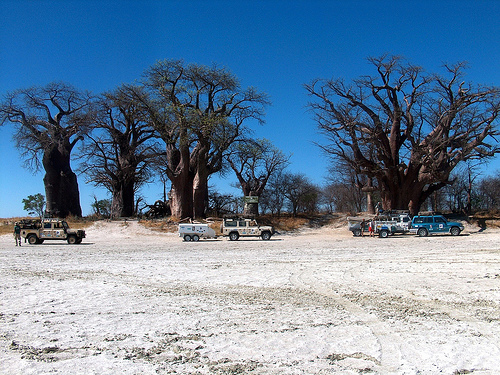
19th-Century European
Exploration: Thomas Baines and the Iconic Baobabs
In 1862, British
artist and explorer Thomas Baines, traveling with John Chapman on an
ox-wagon expedition from South-West Africa (present-day Namibia) toward
Victoria Falls, camped beside a cluster of seven ancient baobab trees
(Adansonia digitata) on what is now Kudiakam Pan. Baines painted the
grove—immortalizing the “upside-down trees” against the white salt flat.
His artwork brought the site to international attention and gave the
trees their name: Baines’ Baobabs.
The baobabs are estimated to be
1,000–2,000+ years old (some individual trunks show signs of extreme
longevity). One tree that Baines depicted has since fallen but continues
to sprout new growth. The scene remains strikingly unchanged from the
1862 painting, making it a living historical landmark. Some accounts
also link David Livingstone’s expeditions to the vicinity, though
Baines’ documentation is the most definitive. The trees were later
declared a national monument for their botanical and historical value.
Mid-20th-Century Land Use: The Old Cattle Trek Route
From the
1950s to 1963, the area served as part of the “Old Trek” cattle-driving
route. Large herds were moved through the pans between grazing lands,
utilizing the open terrain and seasonal water. This traditional pastoral
corridor ended with the construction of veterinary cordon fences
designed to control foot-and-mouth disease outbreaks, which physically
severed the route and altered land-use patterns. The fences prioritized
livestock health but fragmented wildlife migration corridors—a factor
later addressed in conservation planning.
Conservation and Formal
Protection: From Game Reserve to National Park
Prior to the 1960s,
the Nxai Pan area was undeveloped state (Crown) land with minimal human
settlement—ideal for wildlife protection under Botswana’s emerging
conservation framework.
1967 — Ecologist Dale Birkenholz
conducted a key survey of wildlife movements in the Botletle–Nxai Pan
region. His report highlighted prolific herds (zebra, wildebeest,
gemsbok, springbok) and recommended declaring Nxai Pan (sometimes called
“Paradise Pan” in early documents) a national park to safeguard
migration routes to Makgadikgadi, especially during droughts. This
aligned with Botswana’s 1966 Wildlife Conservation Policy, which
emphasized large, uninhabited wildlife reservoirs.
1970–1971 — An
area of approximately 1,676 km² (some sources cite 1,500 km² after
boundary adjustments) centered on Nxai Pan was formally protected. The
official Nxai Pan National Park Order 1971 (Statutory Instrument No. 59
of 1971), issued under the National Parks Act of 1967, constituted the
area as a national park. Boundaries followed roads and geographic lines
(e.g., old Bushman Pits to Pandamatenga stock route, longitude 25° E,
latitude 20° S), but were reduced from initial proposals to accommodate
cattle-trekking routes and safari hunting zones.
1992 — The park was
significantly expanded and its status solidified. The addition of
Kudiakam Pan (to the south) incorporated Baines’ Baobabs and increased
the total area to 2,578 km². Most contemporary sources describe this as
the moment Nxai Pan officially became (or was re-designated as) a full
national park, integrating it more closely with the neighboring
Makgadikgadi Pans National Park.
These steps reflected Botswana’s
broader post-independence (1966) push to balance wildlife tourism,
habitat protection, and livestock interests. Boundary compromises were
common due to veterinary concerns and commercial land uses.
The park's flora is adapted to semi-arid conditions, featuring short grasslands on the pans that burst into green after rains, acacia-dominated "islands," and resilient species like mopane and camelthorn trees. The iconic Baines' Baobabs, estimated at over 1,000 years old, dominate the skyline and provide shade and nesting sites. Fauna is diverse and migratory, with large herbivores including elephants (noted for mud baths at sunset and cooperative behaviors), giraffes, zebras (up to thousands during migrations from Chobe), wildebeest, springbok, impala, and kudu. Predators such as lions, leopards, cheetahs, Cape wild dogs, hyenas, jackals, and smaller carnivores like bat-eared foxes and honey badgers thrive here. The zebra migration, one of Botswana's most spectacular events, occurs between December and March, lured by fresh grazing. Avifauna is rich, with over 200 bird species, including ostriches, Bradfield's hornbills (observed swallowing scorpions in 2025), pale chanting goshawks, and migratory flamingos in wetter pans. The park's mosaic habitats support this biodiversity, though populations fluctuate with seasons.
Conservation in Nxai Pan is bolstered by its inclusion in the Kavango-Zambezi Transfrontier Conservation Area (KAZA TFCA), the world's second-largest conservation zone spanning five countries, aimed at facilitating wildlife corridors and cross-border management. Botswana's government, through the Department of Wildlife and National Parks, maintains anti-poaching patrols, waterhole provisions, and community-based tourism models that involve local stakeholders in revenue sharing. Efforts also focus on monitoring migrations and habitat restoration to counter degradation. Threats include climate change-induced droughts and erratic rainfall, which disrupt migrations and water availability; human-wildlife conflicts from expanding agriculture and settlements nearby; overexploitation of resources like fuelwood; and potential habitat loss from tourism pressures or wildfires. Broader challenges in Botswana's protected areas, such as poaching and invasive species, apply here, with the park's open landscapes vulnerable to these issues. Ongoing initiatives, supported by organizations like the African Wildlife Foundation, emphasize sustainable practices to balance biodiversity with socio-economic development.
Visitors to Nxai Pan engage in self-drive safaris, guided game drives, and walking tours to observe wildlife, particularly the zebra migration and elephant gatherings at waterholes. Exploring Baines' Baobabs offers a cultural highlight, while birdwatching and stargazing in the clear dry-season skies provide serene experiences. The best time to visit is the wet season (November–April) for abundant game, though roads may be challenging; the dry season suits easier access and photography. Entry requires permits from Botswana's wildlife department, with campsites and basic lodges available, often in private concessions for luxury options. Accessibility is via gravel roads from Maun (about 140 kilometers away), and 4x4 vehicles are recommended. The park's significance lies in its role as a migration hub and biodiversity refuge in the Kalahari, supporting Botswana's tourism economy (contributing millions annually) while preserving ancient landscapes. It symbolizes harmonious conservation, drawing adventurers to witness raw African wilderness amid global efforts to protect such fragile ecosystems.