Ras Muhammad National Park (also spelled Ras Mohammed) is
Egypt’s first national park, established in 1983 at the southern
tip of the Sinai Peninsula. It spans about 480 km² (roughly 135
km² terrestrial and 345 km² marine), protecting the meeting
point of the Gulf of Suez and Gulf of Aqaba.
This location at
the junction of tectonic plates creates unique geological
features, including underwater caves, faults, and diverse
habitats from arid desert and wadis to mangroves, seagrass beds,
and pristine coral reefs. The park is renowned for its
exceptional biodiversity, particularly its marine ecosystems,
with high live coral cover (averaging over 65%, up to 90% in
some areas—far better than unprotected nearby sites) and many
Red Sea endemics.
Key Dive and Snorkel Sites
Here are the most prominent sites, with
details on access, depths, features, and marine life:
Shark Reef &
Yolanda Reef (The Iconic Pair)
These are the park’s most famous and
frequently dived sites, often combined in one drift dive. Shark Reef
features a sheer vertical wall dropping hundreds of meters (to 700m+ in
places), covered in vibrant hard and soft corals, overhangs, and cracks
teeming with life.
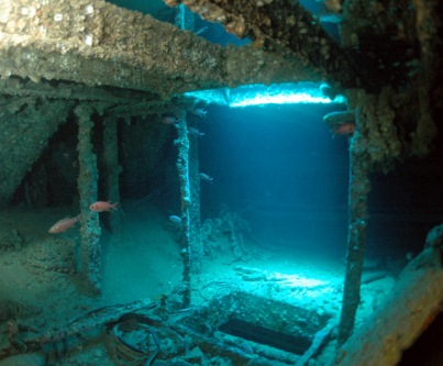
Yolanda Reef includes a plateau with remnants of
the Yolanda (or Jolanda) cargo shipwreck—scattered bathtubs, toilets,
containers, and a truck, now colonized by corals and home to lionfish
and other creatures. The site offers big pelagic action: schools of
barracuda, jacks, snappers, batfish, and Napoleon wrasse. Whitetip reef
sharks often rest or patrol deeper sections; turtles and rays are
common.
Depth: 5–40m+ (shallower plateau to deep wall).
Access: Primarily boat (drift dive); advanced due to currents.
Best
for: Intermediate to advanced divers; snorkelers can enjoy shallower
parts on calm days or via boat tours.
Highlights: Dramatic
topography, cleaning stations, and reliable large marine encounters. One
of the Red Sea’s top sites.
Anemone City
Located near Shark
Reef, this site features a beautiful underwater landscape with plateaus,
steep slopes, and dense fields of anemones hosting clownfish. Soft
corals and reef fish abound, with good potential for turtles and smaller
pelagics.
Depth: Varied, often shallower areas accessible.
Access: Boat.
Best for: All levels, especially photographers and
those enjoying macro life.
Highlights: Vibrant colors and symbiotic
relationships in a sheltered setting.
Jackfish Alley
A
relatively shallow site with two large caves filled with glassfish,
coral pinnacles, sandy channels, and drifts. It attracts schools of
jackfish (hence the name), along with rays, groupers, and reef fish.
Caves and swim-throughs add adventure.
Depth: Shallower (suitable
as a second or third dive).
Access: Boat.
Best for: Intermediate
divers and snorkelers (on calmer days).
Highlights: Caves, schooling
fish, and varied terrain without extreme depths or currents.
Ras
Ghozlani (Marsa Ghozlani)
A gentle, easy wall dive near the visitor
center with a maximum depth around 15m. It offers good coral coverage
and is ideal for novices or relaxed snorkeling.
Depth: Up to
~15m.
Access: Shore or boat; very accessible.
Best for: Beginners,
snorkelers, and training dives.
Highlights: Calm conditions and
introductory Red Sea reef life.
Other Notable Sites:
Shark
Observatory: Excellent wall dive with cracks, hard/soft corals,
groupers, snappers, Napoleon wrasse, and occasional whitetip sharks.
South Bereika Bay, Old Quay, Ras Zatar, Eel Garden, Marsa Bareika:
Varied options including sandy bottoms, eel gardens, and bays for
snorkeling or shallower dives.
Shore Snorkeling Spots: Designated
beaches (e.g., near Yolanda Beach or Hidden Bay) allow entry for
confident snorkelers. These provide direct access to fringing reefs with
colorful fish and corals, though boat trips reach more pristine or
current-swept areas. Wear water shoes to protect against rocks/urchins.
The promontory was known anciently as Poseidion, possibly hosting a
shrine to Poseidon. The name "Ras Muhammad" (Head of Muhammad) refers to
the cliff profile resembling a bearded man’s face. After Sinai’s return
to Egypt, the area gained protection from destructive fishing practices
(like dynamite and knives) and coastal development from nearby Sharm El
Sheikh.
In 1983, the Egyptian Environmental Affairs Agency declared
it a marine reserve to safeguard its unique ecosystems. Today, it serves
as a model for conservation, protecting coral reefs that act as natural
barriers and breeding grounds while supporting biodiversity and
sustainable tourism.
Geography and Ecosystems
The park covers
about 480 km² (roughly 135 km² land and 345 km² marine). It features:
Coral reefs — Fringing and hermatypic types with over 220 coral species
(many soft corals) and exceptional visibility (often >30m).
Diverse
habitats — Mountains, wadis, sand dunes, gravel plains, coastal
mudflats, and a small mangrove forest in a shallow channel at the
peninsula’s end.
Geological features — Earthquake cracks/fissures
(some with deep pools), the famous "Gate of Allah" (a natural arch or
formation), and the colorful "Magic Lake."
Islands and bays —
Includes areas like Marsa Bareika and Marsa Ghozlani; nearby Tiran and
Sanafir islands were formerly part of the park.
The location at the
junction of tectonic plates creates rich upwellings that fuel marine
life.
Marine and Terrestrial Life
Underwater: Over 1,000 fish
species, 40+ starfish, sea urchins, crustaceans, mollusks, and more.
Highlights include clownfish, parrotfish, Napoleon wrasse, lionfish,
moray eels, rays, reef sharks, turtles (hawksbill, green), occasional
whale sharks/manta rays, and dolphins. Iconic dive sites: Shark Reef,
Yolanda Reef, Jackfish Alley, Anemone City.
On land: Nubian ibex,
desert foxes, gazelles, mongooses, lizards, and migratory birds (storks,
ospreys, herons) in mangroves and wetlands.
Best Time to Visit
Optimal periods: March–May and September–November for mild weather,
excellent water visibility, comfortable air temperatures, and active
marine life.
Summer (June–August): Warm water and vibrant marine
activity, but very hot on land (often >40°C/104°F). Start early.
Winter (December–February): Milder, fewer crowds, good for land
exploration, though water can be cooler.
The park is open year-round
(typically 7 AM–5 PM), but check for holidays.
How to Get There
Ras Muhammad is about 20–25 km south of Sharm El Sheikh (30–45 minute
drive).
Options:
Organized tours (most popular): Bus/jeep day
trips or boat excursions from Sharm hotels. Include transport, guide,
snorkel gear, lunch, and park fees. Boat trips offer multiple snorkel
stops; land tours visit inland sites.
Private taxi or rental car: For
flexibility; pay entrance fees on arrival.
Diving boats: Direct from
Sharm marinas to prime reefs.
Fly into Sharm El Sheikh International
Airport for international access.
Main Activities and Attractions
Snorkeling and Diving: World-class. Shallow reefs suit beginners; deeper
walls and wrecks (e.g., SS Thistlegorm nearby) challenge experts. Many
sites accessible from shore or short swims.
Land Exploration: Visit
Gate of Allah, Magic Lake (color-shifting waters), mangrove channel,
earthquake cracks, viewpoints, and beaches. Hiking, birdwatching,
photography.
Boat Tours and Glass-Bottom Boats: Scenic cruises with
swimming stops.
Relaxation: Pristine beaches, desert scenery, and
stargazing.
Most day trips last 4–11 hours; plan 1–3 days for deeper
exploration.
Entrance Fees and Practical Info
Fees support
conservation (subject to change; check current rates):
Foreign
adults: Around 300 EGP (~$6–10 USD); discounts for students/Egyptians.
Tours often bundle fees.
There’s a visitor center with info, shops,
and basic facilities. Rangers enforce rules.
In-Depth Visiting
Tips
Arrive early for fewer crowds, better light, and calmer
conditions.
Choose the right tour: Land/bus for families/land sights;
boat for more snorkel time. Private for customization.
Snorkeling/Diving Advice: Use reef-safe sunscreen. Beginners: Life
jackets available; follow guides. Avoid touching coral or feeding fish.
Rent or bring your own gear if preferred. Watch for currents at some
sites.
Safety: Stay hydrated (desert heat), wear water shoes to
protect against coral/urchins/rocks. Sun protection essential (hat,
sunglasses, light clothing). No major crime risks, but follow marine and
ranger guidelines.
Photography: Stunning above and below water.
Waterproof camera recommended. Note: Phones may need to be put away at
security checkpoints.
Families and Beginners: Very suitable with calm
areas and guided options. Supervise children closely near water and
cliffs.
Eco-Responsibility: Strictly follow Leave No Trace. No
littering, shell collecting, or disturbing wildlife. Smoking only in
designated spots.
What to Pack
Swimwear, towel, change of
clothes.
Reef-safe sunscreen, hat, sunglasses, light breathable
clothing.
Snorkel gear (mask, snorkel, fins), water shoes.
Reusable water bottle, snacks (tours often provide lunch/water).
Camera, cash for extras, sturdy walking shoes for land.
Medications,
first-aid basics, and sun protection.
Park Rules and Conservation
No touching/standing on coral, feeding animals, or collecting anything.
No littering; use designated bins or pack out trash.
Follow guides
and rangers; stay on paths where required.
Fishing restricted; diving
requires certification where applicable.
These rules preserve the
fragile ecosystem for future visitors.
Name and Ancient History
The name "Ras Muhammad" (or Ras Mohammed)
translates to "Cape of Muhammad" or "Head of Muhammad" in Arabic. "Ras"
refers to a headland or promontory. One explanation links it to the
shape of the peninsula, which resembles the profile of a bearded man’s
head (with the South Sinai mountains forming the base of a triangle),
evoking the Prophet Muhammad (PBUH). Another tradition attributes it to
a local holy man buried in the area.
In antiquity, the promontory was
known as Poseidion (Ancient Greek: Ποσείδιον), suggesting a shrine or
association with the god Poseidon, reflecting its significance as a
maritime landmark in classical times. The region’s strategic location at
the junction of Africa and Asia made it a key point along ancient trade
routes connecting East and West. Maritime maps long marked it as an
important navigational landmark.
Geologically, the area reveals deep
time. The landscape formed through millions of years of tectonic
activity as the Red Sea rift developed, separating the African and
Arabian plates (with the Sinai subplate involved). Coral reefs here date
back 15,000 to 2 million years or more, with fossilized corals and
marine deposits visible inland, including in Miocene limestone outcrops.
Some fossils in the park date from 75,000 to 20 million years ago. A
notable 1968 earthquake created visible fissures, including a dramatic
crack with seawater pools.
Modern History and Establishment
The modern history of Ras Muhammad ties closely to the Sinai Peninsula’s
turbulent 20th-century geopolitics. After periods of conflict, including
the 1967 Six-Day War and the 1973 October War (Yom Kippur War), the
Sinai was returned to Egypt. During this era, the area faced threats
from unregulated fishing (including destructive practices like dynamite
and knives that damaged reefs and fish stocks) and emerging coastal
development, especially near the growing tourist hub of Sharm El Sheikh
(about 12 km north).
In response, Egyptian authorities designated the
area for protection. The Egyptian Environmental Affairs Agency (EEAA)
formally established Ras Muhammad as a marine reserve and national park
in 1983 via Prime Ministerial Decree 1068. This made it Egypt’s first
national park. It initially covered the tip of the peninsula (around
96–97 km²) plus Tiran and Sanafir Islands. A 1989 expansion (Decree
2035) increased it to the current ~480 km², incorporating more marine
and terrestrial areas.
The primary goals were:
Protecting unique
marine and terrestrial ecosystems.
Safeguarding coral reefs and
biodiversity from overfishing and human impacts.
Preventing urban
sprawl from Sharm El Sheikh and other developments.
Preserving it as
a rest stop for migratory birds and a site for scientific research and
sustainable tourism.
Notable landmarks like the Gate of Allah (a
rock formation resembling the Arabic word for God in calligraphy) were
designed by Egyptian engineers around 1973, post-October War, adding a
symbolic entrance.
Ecological and Conservation Significance
Ras Muhammad’s value stems from its position at a tectonic junction with
strong currents that deliver nutrients, fostering one of the world’s
most vibrant marine ecosystems. It features fringing and patch reefs
with over 220 coral species (including ~125 soft corals) and more than
1,000 fish species, plus diverse invertebrates, sea turtles (green and
hawksbill), dolphins, and other marine life. Terrestrial features
include mangroves (rare in the region), wadis, sand dunes, mountains,
and acacia/doum palm habitats. It serves as an Important Bird Area (IBA)
with 241+ species recorded, including large migrations of white storks
and raptors.
The park has achieved international recognition,
including IUCN Green List status (one of the best-managed marine
protected areas). Coral cover remains high (often 60–90% in protected
zones vs. lower outside), thanks to conservation efforts. Challenges
include tourism pressure, potential oil spills, crown-of-thorns starfish
outbreaks, and funding needs, addressed through monitoring, zoning, and
sustainable practices.
Recent Developments and Tourism
Since
the 1980s, Ras Muhammad has become a global diving mecca, with sites
like Shark Reef, Yolanda Reef, and wrecks (e.g., the WWII SS Thistlegorm
nearby). Only a small portion is accessible to visitors to minimize
impact. It supports eco-tourism through snorkeling, diving,
birdwatching, hiking, and visits to features like the Magic Lake
(color-changing due to light/refraction) and mangrove channels.
Ongoing management focuses on balancing conservation with economic
benefits for local communities, including Sharm El Sheikh. It remains a
cornerstone of Egypt’s Red Sea tourism while prioritizing protection of
its unique heritage.
Flora (Terrestrial and Marine Vegetation)
The terrestrial
environment is arid desert with low rainfall, featuring rugged
mountains, sand dunes, gravel plains, coastal mudflats, and wadis.
Vegetation is sparse but adapted to extreme conditions.
Acacia
trees and doum palms (Hyphaene thebaica) grow around wadi mouths.
Ephemeral herbs and grasses appear after rare rains.
Mangrove forests
— A small but significant stand (about 0.9 hectares) lines a shallow
channel at the peninsula’s southern end. These are among Sinai’s only
mangroves and serve as critical nurseries for fish and invertebrates,
while providing shelter and nesting sites for birds.
Marine flora
is far more diverse and productive:
Coral reefs — Over 220 species of
coral (including ~125 soft corals; some sources note 260+ stony corals).
These include fringing and hermatypic (reef-building) types. Reefs are
typically 50–100 m offshore but can extend much wider in places. Many
species are endemic to the Red Sea (around 10% of marine life). Common
formations support vibrant ecosystems.
Seagrasses — Three main
species: Thalassia hemprichii (dominant), Halophila ovalis, and
Cymodocea rotundata. These beds, concentrated in the Gulf of Suez with
patches in the Gulf of Aqaba, are vital habitats and feeding grounds.
These plant communities underpin the food web, stabilize sediments, and
support high biodiversity.
Fauna (Terrestrial Wildlife)
Land
animals are adapted to desert conditions. Sightings are less frequent
than marine encounters but include:
Mammals: Nubian ibex (agile on
rocky outcrops), desert fox (nocturnal, large ears), Egyptian mongoose,
and possibly gazelles.
Reptiles: Spiny-tailed lizard (largest in the
area), desert monitor.
Birds: The park is an important stopover for
migrants between Africa and Europe/Asia. Over 240 species recorded,
including soaring raptors (e.g., honey buzzard, common buzzard), white
stork, osprey, hoopoe, sand partridge, Barbary falcon, and others like
flamingos, pelicans, terns, and herons. Shorelines (sandy and rocky)
support many species.
Fauna (Marine Life)
The park’s fame
stems from its underwater world, one of the Red Sea’s premier
diving/snorkeling sites with over 1,100 marine species total.
Fish —
More than 1,000 species. Highlights include colorful reef fish like
clownfish (anemonefish), parrotfish (key algae grazers), butterflyfish,
angelfish, Napoleon wrasse, lionfish, moray eels (including giant), and
schools of many others. Larger species: whitetip reef sharks, occasional
whale sharks, manta/eagle/stingrays, and blue-spotted rays.
Invertebrates — 40 species of starfish, 25 sea urchins, over 150
crustaceans, 100+ mollusks (including giant clams), plus sponges and
more.
Reptiles — Green sea turtles (Chelonia mydas) and hawksbill
turtles (Eretmochelys imbricata), which feed on seagrasses and are
regularly seen.
Mammals — Dugongs (elusive, seagrass grazers),
dolphins, and occasional other marine mammals.
The reefs and
associated habitats act as spawning grounds and nurseries, supporting
both resident and transient species. Many fish and invertebrates are
endemic or rare.
Ecological Importance and Conservation
Ras
Muhammad’s position creates a unique confluence of currents and clear,
warm waters that foster high productivity and diversity. Mangroves,
seagrasses, and reefs interconnect: mangroves and seagrasses shelter
juvenile fish, while reefs provide complex structure for adults. The
park protects against overfishing, dynamite fishing (historically a
threat), and coastal development.
It earned IUCN Green List status
for effective management, with strong coral health compared to
surrounding areas. Challenges include tourism pressure, funding, and
monitoring.
Size and Overall Layout
The park covers approximately 480 km²
(about 185 square miles), with roughly 135 km² of terrestrial land and
345 km² of marine waters. It includes fringing coral reefs, coastal
features, and inland desert landscapes. It was Egypt’s first national
park, established in 1983 to protect marine and terrestrial biodiversity
from overfishing, dynamite fishing, and coastal development.
The
peninsula itself juts southward like a “headland” (Ras means “head” or
“cape” in Arabic), with a shape that some say resembles a bearded man’s
profile—hence the name. It features two main inlets: Marsa Bareika (a
small bay) and the smaller Marsa Ghozlani near the visitor center.
Geological and Tectonic Setting
The park sits at the junction of
three tectonic plates: the Arabian Plate, African Plate, and Sinai
subplate. Ongoing rifting (the Red Sea is an active divergent boundary)
has shaped the landscape over millions of years, producing steep cliffs,
faults, and seismic activity.
Earthquake cracks/fissures: Near
the mangroves (about 150 m inland), there are prominent open cracks from
seismic events. One notable fissure is ~40 m long and 0.2–1.5 m wide,
with pools of water up to 14+ m deep. These features highlight the
active geology.
Fossilized coral reefs and limestone: Much of the
peninsula consists of uplifted fossil coral reefs from the Quaternary
period (around 75,000 years ago), with marine fossils embedded in
Miocene limestone outcrops. Inland areas show evidence of ancient sea
levels and tectonic uplift.
Terrestrial Geography and Habitats
The land portion is a classic hyper-arid desert environment with high
diversity for such a dry setting:
Mountains and wadis — Rugged
granite and sedimentary mountains with dry riverbeds (wadis) that
channel rare runoff.
Sand dunes and gravel plains — Rolling dunes and
gravel flats dominate parts of the interior.
Coastal mud plains and
beaches — Wider, flatter sandy shores on the Gulf of Suez side contrast
with narrower, rocky cliffs on the Gulf of Aqaba side.
Mangrove
forest — A rare ~0.9-hectare stand covers a 1.16 km shallow channel at
the southern tip, separating the mainland from a small island (sometimes
called Mangroves Island or Al Ba'eera). These salt-tolerant trees thrive
in high-salinity conditions and serve as critical nurseries for marine
life and bird habitats.
Other features — Salty marshes, “Magic Lake”
(or Salt Lake) with high salinity (similar to the Dead Sea) that can
appear to change colors, and dramatic viewpoints like the “Gate of
Allah” (a natural rock formation).
These habitats support desert
flora (acacia trees, doum palms near wadi mouths, ephemeral
herbs/grasses) and fauna, and act as stopover sites for migratory birds.
Marine Geography and Reefs
The marine environment is the park’s
crown jewel, benefiting from nutrient-rich upwellings and strong
currents at the gulf junction:
Coral reefs — Fringing and hermatypic
(hard) reefs hug the coastline, often starting close to shore. There are
over 220 coral species (including ~125 soft corals), with live coral
cover often 60–80% in prime spots (up to 90% in some areas). Reefs are
typically 50–100 m offshore and 30–50 m wide, but can extend 8–9 km on
the western side. Vertical walls, plateaus, caves, and drop-offs create
spectacular underwater topography.
Key dive/snorkel sites — Shark
Reef, Yolanda Reef, South Bereika, Marsa Ghozlani, Old Quay, and Shark
Observatory. The area supports over 1,000 fish species, plus starfish,
sea urchins, mollusks, crustaceans, turtles (green and hawksbill),
dolphins, and occasional whale sharks.
Depth and conditions — Waters
in the Gulf of Aqaba are deep (up to 2,000 m nearby), with clear
visibility. The Gulf of Suez is shallower (~300 m). Strong currents
bring plankton, fueling the ecosystem.
Islands — Tiran and Sanafir
islands (formerly part of the park) lie offshore, adding to the
protected marine zones.
Climate
The park has a hot desert
climate (BWh). Winters are mild (daytime highs ~23°C/73°F, lows
~14°C/56°F) with minimal rain. Summers are scorching (highs often
>40°C/104°F, lows ~27°C/81°F). The best visiting period for balanced
conditions and marine activities is generally August to March.
Summary of Geographic Significance
Ras Muhammad’s geography is
defined by tectonic forces meeting desert aridity and marine
productivity. The “ridge-to-reef” continuity—from inland mountains and
wadis to coastal mangroves, cliffs, and vibrant coral ecosystems—creates
exceptional biodiversity in an otherwise harsh environment. This makes
it not only a top diving destination but also a critical conservation
area and a striking example of how plate tectonics, sea-level changes,
and ocean currents shape life at the edge of continents.