Location: Southern Nations, Nationalities, and Peoples Region Map
Area: 4068 km²
Omo National Park, located in the South Ethiopia Regional State, is one of Ethiopia’s largest and most biodiverse protected areas, covering approximately 4,068 square kilometers. Established in 1966 (with formal gazetting in 1980), it lies on the west bank of the Omo River in the Lower Omo Valley, a region renowned for its ecological richness and cultural diversity. As part of a UNESCO World Heritage Site (designated for its anthropological value), the park is a haven for wildlife, rare birds, and indigenous communities, including the Surma, Mursi, and Dizi. Despite its remoteness and limited infrastructure, Omo National Park offers a unique blend of safari, cultural, and adventure tourism.
Location and Landscape:
Omo National Park is situated in
southwestern Ethiopia, near the borders with South Sudan and Kenya,
approximately 870 kilometers southwest of Addis Ababa. The nearest towns
are Jinka (140 km east) and Kibish (near the South Sudan border).
The
park is bounded by the Omo River to the east, which separates it from
Mago National Park, and extends westward to the Maji escarpment and the
Sudan border. To the south, it neighbors the Tama Wildlife Reserve and
Murle Controlled Hunting Area.
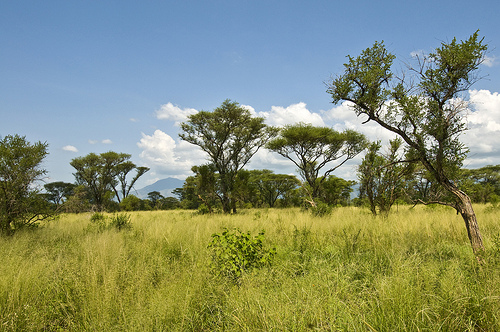
The terrain is varied,
encompassing:
Savanna grasslands (dominant in the central and eastern
areas), ideal for large herbivores.
Riverine forests along the Omo,
Mui, and other rivers, with dense vegetation and large trees.
Woodlands and bushlands, particularly in the west, supporting diverse
fauna.
Montane areas near the Maji highlands, with slopes and
valleys.
Wetlands and swamps, especially along the Omo River and
seasonal streams.
Key geographical features include the Illibai
Plains (a prime game-viewing area), the Mui River (a seasonal tributary
of the Omo), and the Sai and Usno Rivers, which provide water during the
dry season.
The park’s elevation ranges from 440 meters (at the Omo
River) to 1,800 meters (in the Maji highlands), creating diverse
microclimates.
Climate and Seasons:
Omo experiences a
semi-arid to tropical climate with two wet seasons: March–June (primary)
and September–October (secondary). Annual rainfall averages 500–1,000
mm, with the west receiving more precipitation.
The dry season
(November–February) is hot, with temperatures reaching 35–40°C, while
wet seasons are cooler (20–25°C). The dry season is best for wildlife
viewing due to concentrated animals and clearer trails, while wet
seasons enhance the park’s lush greenery but make roads challenging.
Omo National Park is a biodiversity hotspot, protecting a wide array
of mammals, birds, reptiles, and plants characteristic of East African
savanna and riverine ecosystems. It was established to safeguard large
populations of plains animals, particularly buffalo and eland.
Mammals:
The park hosts 75–80 mammal species, including iconic and
rare species:
African buffalo: Historically abundant (up to
7,000–10,000 in the 1970s), though poaching has reduced numbers.
Tiang (topi): Large herds roam the Illibai Plains, a key attraction.
Eland: The park is famous for its Taurotragus oryx (common eland), one
of the largest antelopes, with significant populations.
Elephant:
Approximately 200–300 individuals, though poaching and habitat loss have
impacted sightings.
Giraffe: Common in savanna areas, often seen
during game drives.
Lion, leopard, cheetah, and African wild dog:
Predators are present but elusive due to dense vegetation and reduced
prey.
Antelopes and gazelles: Lelwel hartebeest, defassa waterbuck,
oribi, Grant’s gazelle, gerenuk, Beisa oryx, greater and lesser kudu,
and roan antelope.
Other mammals: Burchell’s zebra, hippopotamus,
Nile crocodile, warthog, Guenther’s dik-dik, bushbuck, olive baboon,
vervet monkey, spotted hyena, and aardvark.
The Illibai Plains and
Omo River delta are prime areas for mammal sightings, though populations
have declined due to poaching and human encroachment.
Birds:
Omo is home to 300–325 bird species, including six Ethiopian endemics
and several rare species, making it a top birdwatching destination.
Notable species include:
Endemics: Banded barbet, white-winged
cliff chat, white-tailed starling, thick-billed raven, wattled ibis, and
Ethiopian bush-crow.
Rare species: Egyptian plover, Pel’s fishing
owl, Allen’s gallinule, violet wood hoopoe, black-rumped waxbill, and
dusky babbler.
Common species: Kori bustard, northern carmine
bee-eater, African fish eagle, hamerkop, various hornbills, herons,
kingfishers, weavers, starlings, and vultures.
The Omo River banks,
Mui River, and wetlands are ideal for birdwatching, with seasonal
migrants adding diversity during wet seasons.
Reptiles and Fish:
The park supports 15–20 reptile species, including Nile crocodiles,
monitor lizards, and various snakes (e.g., puff adders, pythons).
The
Omo River and its tributaries host 20–25 fish species, such as tilapia,
Nile perch, tigerfish, and catfish, which support local fisheries and
attract piscivorous birds.
Flora:
Vegetation includes savanna
grasslands, acacia scrublands, riverine forests (with fig trees,
tamarinds, and doum palms), and montane woodlands in the west.
The
desert rose (Adenium obesum) is a notable plant in scrub areas, valued
for its ornamental flowers.
Grass fires, both natural and
human-induced, shape the savanna, though overgrazing and fire
suppression have led to woody plant encroachment in some areas.
Omo National Park lies within the Lower Omo Valley, a UNESCO World
Heritage Site (designated in 1980) for its anthropological significance,
hosting some of Africa’s most culturally distinct indigenous groups. The
park’s cultural value is tied to its resident and neighboring
communities.
Indigenous Communities:
The park is home to or
borders territories of several ethnic groups, including the Surma
(Suri), Mursi, Dizi, Nyagatom, Bodi, Kwegu, and Me’en. These groups
maintain traditional lifestyles, relying on pastoralism, agriculture,
and fishing.
Surma: Known for their stick-fighting ceremonies (donga)
and lip-plate traditions (similar to the Mursi), the Surma are
semi-nomadic pastoralists living in the western park areas.
Mursi:
Famous for their lip-plate custom, where women insert clay disks into
pierced lips, the Mursi live near the park’s eastern boundaries and are
often visited by tourists.
Dizi: Agriculturalists in the Maji
highlands, known for terraced farming and beekeeping.
Nyagatom and
Bodi: Pastoralists along the Omo River, occasionally entering the park
for grazing.
These communities practice unique customs, including
body painting, scarification, and elaborate ceremonies, offering a
glimpse into ancient African traditions.
Cultural Tourism:
Cultural tours to Surma or Mursi villages are a major draw, often
combined with wildlife safaris. Visitors can witness traditional dances,
crafts (e.g., beadwork, pottery), and markets in nearby towns like
Kibish or Tum.
Ethical tourism is critical to avoid exploitation.
Responsible operators, such as Top Omo Valley Tours, emphasize
respectful engagement, ensuring communities benefit economically.
Cultural Challenges:
Park boundaries have restricted traditional
grazing and farming lands, leading to tensions with local communities.
For example, a 2010 attempt by African Parks to manage Omo was abandoned
due to conflicts over land rights and cultural insensitivity.
Tourism
can strain cultural integrity, with some villages becoming overly
commercialized. Guidelines, such as obtaining consent for photography
(often 5–10 ETB per photo), aim to mitigate this.
Omo National Park is a remote destination, appealing to adventurous
travelers seeking wildlife, birdwatching, and cultural immersion. Its
lack of infrastructure requires careful planning.
Access and
Infrastructure:
The park is accessible via Jinka (140 km away, 3–4
hours by 4x4) or Kibish (closer to the western entrance). The drive from
Addis Ababa takes 2–3 days (870 km), with no reliable public transport.
Jinka Airport offers limited flights.
Internal roads (approximately
150–200 km) are unpaved and often impassable during the wet season
(April–June). A 4x4 vehicle with a driver-guide is essential.
Accommodation is limited:
No formal lodges exist within the park.
Visitors camp at designated sites (e.g., near the Mui River or Illibai
Plains) with permits.
In Jinka, guesthouses (e.g., Jinka Resort,
Eco-Omo Lodge) or campsites are available. Kibish offers basic lodges or
homestays.
Basic facilities (e.g., ranger posts, toilets) exist at
the park headquarters near the Mui River, but visitors must be
self-sufficient with food, water, and fuel.
Activities:
Game
Viewing: Guided safaris focus on the Illibai Plains, where tiang, eland,
buffalo, and giraffe are most visible. Early morning or late afternoon
drives maximize sightings.
Birdwatching: The Omo River, Mui River,
and wetlands are ideal for spotting endemics and rare species. Guided
tours with binoculars are recommended.
Cultural Tours: Visits to
Surma, Mursi, or Dizi villages offer cultural immersion, including
demonstrations of donga fights, lip-plate traditions, or farming
practices.
Trekking and Hiking: Trails through the Maji highlands or
along the Omo River provide scenic views and wildlife encounters. The
dry season is best for hiking.
Rafting and Boating: The Omo River
offers rafting (Class II–V rapids, best in September–October) and boat
tours for fishing, crocodile spotting, or cultural visits to riverine
villages.
Camping: Overnight camping allows visitors to experience
the park’s nocturnal sounds, with ranger escorts for safety.
Photography: The park’s wildlife, landscapes, and tribes attract
photographers, though cultural sensitivity and permits are required.
Best Time to Visit:
Dry Season (November–March, especially
December–February): Optimal for wildlife viewing, hiking, and accessible
roads. Animals congregate near rivers, and vegetation is sparse.
Wet
Season (March–June, September–October): Lush landscapes and vibrant
birdlife, but muddy roads and flooding limit access. Cultural visits are
viable year-round.
Practical Tips:
Guides and Tours: Hire a
local guide through operators like Zagol Ethiopia Tours or Top Omo
Valley Tours (e.g., Degu Ashenafi, +251937318180) for navigation,
translation, and cultural respect.
What to Bring: Sturdy shoes,
binoculars, insect repellent, sunscreen, water, camping gear, and cash
(Ethiopian birr) for fees and souvenirs. A 4x4 vehicle is mandatory.
Cultural Sensitivity: Respect tribal customs, especially in villages.
Obtain permission for photography (5–10 ETB per photo) and avoid
intrusive behavior.
Safety: The Omo Valley is generally safe, but
check travel advisories for ethnic tensions or banditry. Stay with
guides, avoid isolated areas at night, and carry a satellite phone due
to limited cell coverage.
Health: Malaria is prevalent; use
prophylaxis and mosquito nets. Vaccinations (e.g., yellow fever) may be
required. Carry a first-aid kit.
Omo National Park faces significant threats to its biodiversity and
cultural heritage, exacerbated by its remoteness and limited resources.
Poaching:
Historical and ongoing poaching has decimated populations
of large mammals, particularly buffalo, elephant, and possibly black rhino
(now likely extinct in the park). Weak enforcement and porous borders with
South Sudan exacerbate the issue.
Human-Wildlife Conflict:
Local
communities, reliant on pastoralism and agriculture, encroach on park land
for grazing or farming, leading to conflicts with wildlife and park
authorities. The 2010 African Parks withdrawal highlighted tensions over
land rights.
Infrastructure projects, such as the Gibe III Dam (upstream
on the Omo River), have altered river flows, affecting wetlands and
fisheries critical to both wildlife and communities.
Habitat
Degradation:
Overgrazing by livestock and agricultural expansion degrade
grasslands and riverine habitats. Woody plant encroachment, due to fire
suppression, reduces savanna areas.
Deforestation in the Maji highlands
threatens montane ecosystems.
Climate Change:
Changing rainfall
patterns and prolonged droughts reduce water availability, impacting
wildlife and pastoralists. Wetlands and the Omo River delta are vulnerable
to drying.
Limited Infrastructure and Funding:
The park’s
remoteness and lack of paved roads limit tourism revenue and conservation
funding. Ranger patrols are understaffed, and facilities are minimal.
Past management attempts (e.g., African Parks, 2008–2010) failed due to
logistical and cultural challenges, leaving the park reliant on underfunded
government oversight.
Tourism Impact:
Unregulated tourism,
particularly in tribal villages, risks cultural commodification and
environmental damage. Littering and off-road driving can harm habitats.
Protected Status: As an IUCN Category II National Park, Omo is
dedicated to ecosystem protection and recreation, with a focus on
conserving buffalo, eland, and tiang populations.
Community
Engagement: Some NGOs and tour operators promote community-based
tourism, directing revenue to villages and fostering conservation
awareness. Co-management models are being explored to address land
disputes.
Biodiversity Monitoring: The Ethiopian Wildlife
Conservation Authority (EWCA) and partners like the Ethiopian
Biodiversity Institute conduct surveys to track mammal and bird
populations, though data is limited.
Regional Initiatives: The park
benefits from UNESCO’s recognition of the Lower Omo Valley, encouraging
international support for conservation.
Anti-Poaching Measures:
Limited ranger patrols and community outreach aim to curb poaching,
though resources are insufficient.
UNESCO Recognition: As part of the Lower Omo Valley World Heritage
Site, Omo National Park is globally significant for its biodiversity and
anthropological value, preserving cultures unchanged for millennia.
Ethiopian Identity: The park symbolizes Ethiopia’s commitment to its
natural and cultural heritage, complementing sites like Mago and Simien
National Parks.
Research and Education: Omo attracts researchers
studying East African ecosystems, Ethiopian endemics, and indigenous
cultures, contributing to global knowledge of biodiversity and
anthropology.