Location: Arusha Region Map
Area: 325 km²
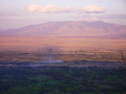
Lake Manyara National Park, located in northern Tanzania’s Arusha and Manyara regions, is a 330-square-kilometer (127-square-mile) protected area established in 1960. Nestled at the base of the Great Rift Valley’s western escarpment, the park is renowned for its scenic beauty, diverse ecosystems, and iconic wildlife, including tree-climbing lions and vast flamingo flocks. Stretching along the northern shore of Lake Manyara, an alkaline soda lake, the park encompasses groundwater forests, acacia woodlands, wetlands, and hot springs, offering a compact yet rich safari experience. Located 126 km southwest of Arusha, it is a key stop on Tanzania’s northern safari circuit, often paired with visits to Ngorongoro and Serengeti.
Lake Manyara National Park lies at approximately 3.58°S, 35.83°E,
between the alkaline Lake Manyara to the east and the Rift Valley
escarpment (rising 600–1,200 meters) to the west. The park’s boundaries
cover:
Lake Manyara: A shallow, 231-square-kilometer soda lake
(at full extent), though two-thirds lies outside the park. Its size
fluctuates seasonally, shrinking to 50–100 km² in the dry season.
Groundwater Forest: A lush, evergreen forest in the north, fed by
springs from the escarpment.
Acacia Woodlands: Open savanna and scrub
in central and southern areas, transitioning to grasslands near the
lake.
Wetlands and Hot Springs: Marshes and geothermal springs (Maji
Moto) along the lake’s edge, supporting unique microhabitats.
The
park’s elevation ranges from 960 meters (lake level) to 1,600 meters
(escarpment slopes), creating varied microclimates. The climate is
tropical with distinct seasons:
Temperature: Averages 20–30°C,
with highs of 35°C in February and lows of 15°C in July. Nights are
cooler at higher elevations.
Rainfall: Annual precipitation is
650–1,200 mm, with a wet season (March–May) and short rains
(November–December). The dry season (June–October) is ideal for wildlife
viewing.
Humidity: High near the lake and forest (70–90%), lower in
savanna areas.
The park’s geology is shaped by the East African Rift System:
Rift Valley Escarpment: Formed 5–7 million years ago as tectonic plates
pulled apart, the western escarpment is composed of volcanic rocks
(basalt, tuff) and Precambrian gneiss. Faulting created the steep,
600-meter cliffs that frame the park.
Lake Manyara: A rift basin
lake, formed by tectonic subsidence, with alkaline sediments rich in
sodium carbonate (natron) from volcanic ash. Its shallow depth (1–3
meters) and high salinity result from evaporation and mineral-rich
inflows.
Groundwater Springs: Fed by aquifers in the porous volcanic
rock of the escarpment, springs like those at Mto wa Mbu sustain the
groundwater forest year-round.
Hot Springs (Maji Moto): Geothermal
activity, linked to rift volcanism, produces springs with temperatures
up to 60°C, notably at the southern end near Endabash.
The park’s
soils are diverse: fertile loams in the forest, sandy clays in savannas,
and saline mudflats around the lake.
Lake Manyara National Park’s compact size hosts an astonishing
variety of habitats—groundwater forest, acacia woodland, wetlands, and
alkaline lake—supporting rich biodiversity.
Flora
The park’s
vegetation reflects its varied topography:
Groundwater Forest: A
dense, evergreen canopy in the north, dominated by Ficus (fig trees),
Trichilia (mahogany), and Croton macrostachyus. Strangler figs and palms
(Phoenix reclinata) create a jungle-like atmosphere, with ferns and
epiphytes thriving in humid shade.
Acacia Woodlands: Central and
southern areas feature Acacia tortilis, Acacia xanthophloea (fever
trees), and Balanites aegyptiaca (desert date), mixed with Themeda
triandra grasses. Sausage trees (Kigelia africana), with their large,
pendulous fruits, are iconic.
Wetlands: Lake margins and rivers
(Msasa, Endabash) support reeds (Phragmites), papyrus (Cyperus papyrus),
and water lilies, creating marshy habitats.
Scrub and Grasslands:
Dry, rocky slopes have Commiphora shrubs and sparse grasses,
transitioning to saline-tolerant plants like Suaeda near the lake.
Fauna
The park’s wildlife is diverse, with over 400 species
recorded:
Mammals:
Tree-Climbing Lions (Panthera leo): A rare
behavior, possibly adapted to escape flies or gain better vantage
points, makes Manyara famous. Lions are often seen lounging in acacia
trees, especially in the dry season.
Elephants (Loxodonta africana):
Large herds roam the forest and savanna, drawn to springs and fruiting
trees.
Cape Buffalo (Syncerus caffer): Abundant in wetlands and
grasslands, often in herds of 50–200.
Giraffes (Giraffa
camelopardalis): Common in acacia woodlands, their long necks visible
above the canopy.
Primates: Blue monkeys (Cercopithecus mitis),
vervet monkeys (Chlorocebus pygerythrus), and olive baboons (Papio
anubis) thrive in forests, with baboons often seen along roads.
Other
Mammals: Hippos (Hippopotamus amphibius) wallow in lake shallows, while
leopards (Panthera pardus), cheetahs (Acinonyx jubatus), and spotted
hyenas (Crocuta crocuta) are less common. Smaller species include
bushbuck (Tragelaphus scriptus), impala (Aepyceros melampus), and Kirk’s
dik-dik (Madoqua kirkii).
Birds: Over 400 species, making Manyara a
birding hotspot. The lake attracts lesser flamingos (Phoeniconaias
minor) and greater flamingos (Phoenicopterus roseus), often numbering
thousands in the wet season. Other notables include African fish eagles
(Haliaeetus vocifer), silvery-cheeked hornbills (Bycanistes brevis), and
pelicans (Pelecanus onocrotalus). Wetlands host migratory waders like
ruffs (Calidris pugnax) and marsh sandpipers (Tringa stagnatilis), while
forests harbor narina trogons (Apaloderma narina).
Reptiles and
Amphibians: Nile crocodiles (Crocodylus niloticus) and monitor lizards
(Varanus niloticus) inhabit lake edges, with pythons (Python sebae) in
forests. Frogs, such as the Hyperolius reed frog, are common in
wetlands.
Invertebrates: Butterflies like the African monarch (Danaus
chrysippus) and termite mounds are abundant, with dragonflies and
beetles in marshes.
The lake’s alkaline waters support phytoplankton,
attracting flamingos and fish like tilapia, which sustain birds and
crocodiles. The forest’s fruit trees draw primates and elephants,
creating a dynamic food web.
The park lies within the traditional lands of the Maasai and Iraqw
peoples:
Maasai: Semi-nomadic pastoralists graze cattle in areas
like the Mto wa Mbu Cultural Corridor, adjacent to the park. Their red
shukas and beadwork are visible in nearby markets, and cultural tours
showcase their bomas (homesteads), dances, and herding practices.
Iraqw: Bantu-speaking agro-pastoralists cultivate maize, beans, and
bananas near the escarpment. Their mud-and-thatch homes and irrigation
systems reflect centuries of adaptation.
Historical Context: The area
was a hunting ground for local tribes before colonial times. Under
German East Africa (1885–1919), the region saw early conservation
efforts, continued by the British after 1919. The park was gazetted in
1960 to protect its biodiversity, with expansions in 1974 to include
more lakefront.
Cultural Tourism: Mto wa Mbu, a vibrant town 3 km
from the park gate, is a melting pot of 120 ethnic groups, offering
cultural tours, craft markets, and farm visits. The name “Mto wa Mbu”
(“River of Mosquitoes”) reflects the area’s historical insect
prevalence, now reduced.
The park inspired Ernest Hemingway’s Green
Hills of Africa (1935), based on his 1933 safari, cementing its literary
fame. Its role in Tanzania’s northern safari circuit underscores its
economic and cultural importance.
Lake Manyara National Park offers a condensed yet spectacular safari
experience, with game drives, walking safaris, cycling, and cultural
tours, often as a day trip from Arusha or a stop en route to Ngorongoro.
Activities
Game Drives: The primary activity, using 4x4 vehicles
with pop-up roofs. Morning (6:30–10 AM) and afternoon (3–6 PM) drives
maximize wildlife sightings. Popular routes include:
Northern
Circuit: Through the groundwater forest, spotting elephants, baboons,
and tree-climbing lions.
Central Area: Acacia woodlands with
giraffes, impalas, and buffalo.
Lake Shore: Wetlands and hot springs,
ideal for flamingos, hippos, and birds.
Full-day drives (~$100–200)
include picnic lunches at designated sites. Night drives, introduced
recently, reveal nocturnal species like leopards and genets (~$50–100).
Walking Safaris: Guided walks (2–3 hours, ~$20–30) with armed rangers
explore the forest and escarpment foothills, offering close encounters
with flora, tracks, and smaller animals. Routes avoid dense lion areas
for safety.
Cycling Tours: Guided bike rides (2–4 hours, ~$40–60)
along park trails or Mto wa Mbu’s rice fields provide an active
alternative to game drives, with views of buffalo and giraffes from a
distance.
Canopy Walkway: A 370-meter, 18-meter-high walkway in the
groundwater forest offers treetop views of monkeys, hornbills, and
forest ecology. Opened in 2019, it’s Tanzania’s first canopy walk
(~$20–30).
Birdwatching: With 400+ species, the park is ideal for
birders. Guided tours target flamingos, hornbills, and raptors, best in
the wet season (November–May) when migrants arrive.
Cultural Tours:
Mto wa Mbu offers half-day tours (~$20–50), including Maasai boma
visits, Iraqw farm walks, and banana beer tastings. Local markets sell
carvings and beads.
Hot Springs (Maji Moto): A short walk or drive to
geothermal springs in the south, where warm, mineral-rich water pools
attract birds and offer scenic photo opportunities.
Key Sites
Groundwater Forest: Near the main gate, a lush jungle with towering
figs, mahoganies, and monkey troops. A prime spot for elephant and lion
sightings.
Lake Manyara Shore: The lake’s northern edge, with pink
flamingo flocks, pelicans, and hippo pools. Boardwalks allow closer
views of wetlands.
Ngurdoto Crater Viewpoint: A scenic lookout on the
escarpment, offering panoramas of the lake and forest.
Maji Moto Hot
Springs: Geothermal pools at Endabash, surrounded by palms and
frequented by birds.
Msasa River Delta: A marshy area with buffalo,
waterbuck, and storks, ideal for birding.
Practical Information
Access:
By Road: 126 km (1.5–2 hours) from Arusha via the A104,
passing Mto wa Mbu. From Ngorongoro Crater, it’s 60 km (1 hour). Most
visitors use safari vehicles arranged by operators like Altezza Travel
or SafariBookings.
By Air: Kilimanjaro International Airport (JRO,
160 km, 2.5 hours) or Arusha Airport (ARK, 120 km, 2 hours). Charter
flights land at Lake Manyara Airstrip (5 km from the gate).
Entrance
Fees: $59 USD (adults), $17.70 (children 5–15), valid for 24 hours (as
of 2025, per Tanzania National Parks, TANAPA). Additional fees: vehicles
($11.80–35.40), walking safaris ($23.60/ranger), cycling ($29.50),
canopy walkway ($23.60). Pay via card at the gate or online.
Hours:
Open daily 6:30 AM–6:30 PM. Night drives require pre-booking.
Accommodations:
Inside the Park: TANAPA rest houses and campsites
(~$30–50/night) at the main gate, with basic facilities. Luxury options
include Lake Manyara Tree Lodge (~$500–1,200/night).
Nearby: Mto wa
Mbu and Karatu (20–40 km) offer lodges like Escarpment Luxury Lodge
(~$200–400), Marera Valley Lodge (mid-range, ~$80–150), and Twiga Lodge
(budget, ~$30–60). Campsites like Migombani (~$10–20) cater to
overlanders.
Facilities: The main gate has a visitor center with
maps, toilets, and a small shop. Picnic sites at Msasa River and Maji
Moto have tables. Bring water, snacks, sunscreen, and binoculars, as
trails lack amenities.
Guides: Mandatory for walking safaris and
cycling; included in game drive packages. English-speaking guides are
standard, with Swahili and French available.
Best Time to Visit:
Dry Season (June–October): Clear roads, concentrated wildlife near
water, and peak flamingo numbers. Ideal for game drives and cycling.
Wet Season (November–May): Lush scenery, abundant birds, and fewer
crowds, but muddy roads and dispersed animals. Flamingos peak in short
rains (November–December).
Early mornings (6:30–10 AM) offer cooler
weather, active wildlife, and soft light for photography.
Managed by TANAPA, Lake Manyara National Park faces several threats:
Lake Shrinkage: Over-extraction of water for agriculture (e.g., rice
fields in Mto wa Mbu) and reduced rainfall have shrunk the lake by up to
50% since the 1960s, threatening flamingos and fish. Dams and irrigation
upstream exacerbate this.
Human-Wildlife Conflict: Elephants and
baboons raid crops in Mto wa Mbu, leading to poaching or culling risks.
TANAPA’s community programs, like chili-fence barriers, deter elephants.
Tourism Pressure: Overcrowding on northern routes risks soil compaction
and wildlife stress. Visitor caps and night drive restrictions mitigate
impacts.
Invasive Species: Non-native plants like Lantana camara
invade woodlands, requiring manual removal. Introduced fish in the lake
disrupt native ecosystems.
Climate Change: Warmer temperatures and
erratic rains affect lake levels, forest health, and migration patterns.
Flamingo breeding is particularly vulnerable.
Conservation
efforts include:
Community Engagement: Tourism revenue funds schools,
wells, and beekeeping in Mto wa Mbu, reducing reliance on poaching or
logging.
Wildlife Monitoring: Rangers track lion and elephant
populations, with GPS collars aiding research.
Reforestation:
Planting native trees along the escarpment restores degraded areas.
Lake Restoration: Plans to regulate upstream water use aim to stabilize
lake levels, supported by UNESCO’s Man and Biosphere program.
Ecological Research: The park’s diverse habitats support studies on
tree-climbing lion behavior, flamingo ecology, and rift lake dynamics.
Its groundwater forest is a model for studying aquifer-fed ecosystems.
Geological Studies: The Rift Valley’s faulting and volcanism inform
tectonic research, with lake sediments providing paleoclimatic data.
Cultural Heritage: The Maasai and Iraqw’s coexistence with wildlife
reflects Tanzania’s cultural diversity. Mto wa Mbu’s multi-ethnic
community, a legacy of colonial resettlement, is a cultural hub.
Tourism Role: As a gateway to the northern circuit, the park generates
significant revenue, supporting TANAPA’s network of 22 national parks.
Its accessibility makes it ideal for short safaris.