Language: Kyrkyz, Russian
Currency: Som (KGS)
Calling Code: 996
Kyrgyzstan is a mountainous country of Central Asia, without access to the sea and that shares borders with the People's Republic of China, Kazakhstan, Tajikistan and Uzbekistan. Its capital and most populated city is Biskek. Kyrgyzstan's history spans more than two thousand years and covers a wide variety of cultures and empires. Although geographically isolated by its highly mountainous terrain - which has helped the country preserve its ancient culture - Kyrgyzstan has historically been at the crossroads of several great civilizations, as part of the Silk Road and other commercial and cultural routes. Although always inhabited by a succession of independent tribes and clans, Kyrgyzstan has become, periodically, under foreign domination and has attained sovereignty as a nation-state only after the disintegration of the Soviet Union in 1991.
Bishkek - the capital of the state, the former Frunze
Osh
Jalal-Abad
Naryn
Karakol (formerly Przewalsk)
Cholpon-Ata
Song kul Lake is a picturesque mountain lake in Naryn Province in Kyrgystan.
Tash Rabat is an abandoned medieval monastery constructed by the Christians who came here from Ancient Roman Empire.
The culture is characterized by nomadic traditions, so it is not
surprising that yurts and horses are of great importance here. Hunting
also plays an important role, especially falconry hunting (with eagles
and falcons) and equestrian games. The most famous game is Kyz Kumai
(catch up with the girl). A single young man and a single young woman
compete against each other. If the man wins, he can kiss the woman
(originally marry him); if the woman wins, she can hit him with the whip
on the ride back. The traditional garments made of felt and leather are
still in use and in traditional production. There is also a long
tradition of embroidery and felting. The traditional Shyrdak carpet is
an example of the mastery of felting.
The Manas Epic occupies a
central position in classical literature and stories. The 500,000-verse
epic from the 6th to 8th centuries describes the hero Manas' fight
against the Uyghurs and the preservation of independence. This work,
which is twenty times larger than the Odyssey and Iliad combined, was
passed down orally for centuries by the so-called Manachis. Even today,
passages are recited on festive occasions and the Manachis enjoy a high
reputation. The lecture is often accompanied by the traditional Komuz
(or Komus). This is a three-stringed plucked instrument that belongs to
the lute family and is roughly comparable to the original Persian setar
(also three-stringed).
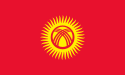
The importance of nomadic culture and the
Manas epic is also reflected in the Kyrgyzstan flag. The rays of the sun
symbolize the 40 mythical warriors of Mana, and the lines in the middle
represent the intersecting poles of a yurt in the ridge.
Modern
art and literature is a child of the 20th century. The painting
association was founded in 1934. A year later, the State Painting
Gallery, now the Aitiev National Museum of Fine Arts, opened. The first
Kyrgyz painters were Gapar Aitiev and Sabyrbek Akylbekov, both of whom
studied in Moscow and Leningrad. Early 20th century painting was in the
ideological tradition of socialist realism. Traditional motifs also
played a role. The most important painters of this time include Theodor
Gerzen, Arkadij Ostashev, Duhanin, Tjurin and Akynbekov. Since
independence, painting has become more diverse. In addition to the
conservative school, a modernity is developing that combines the
elements of realism with those of modernity. In addition, there is
“pleasing painting”. These are works of a more decorative or touristic
nature.
In literature, Genghis Aitmatov is the dominant figure.
The writer, born in Scheker in 1928, became world famous with his love
story Dshamilja.
Entry requirements
Since July 2012, all Europeans, except
Romanians and Bulgarians, no longer need a visa to enter the country for
tourist stays of up to 60 days. Turks are allowed to enter the country
for 30 days.
Anyone planning a stay longer than 60 days should
contact the Kyrgyz embassy in advance. When entering and leaving
Tajikistan, a valid visa from these countries is required. The
neighboring countries of Uzbekistan and Kazakhstan have introduced
relief measures for many Europeans in recent years. Foreign exchange can
be imported and exported easily.
Stays of up to 60 days are
possible without having to report to the police. For stays longer than
this, the police report must be made within the first five days.
Airplane
Air Kyrgyzstan is not allowed to land within the EU for
security reasons.
There are only two international airports in
Kyrgyzstan:
Bishkek (capital)
Manas International Airport (FRU) in
Bishkek cannot be reached directly from Germany. Lufthansa has no
connections between the two countries in its program in 2014. (Price
examples 2014: Turkish €388, Pegasus/Air Manas €284, Aeroflot via SVO
€444, S7 via DVO around €700)
There are also numerous connections
to Almaty in Kazakhstan, which represents a simple alternative, at least
for the duration of the temporary lifting of the visa requirement for
Germans (until probably the end of 2017). From there, various airlines
and other providers offer shuttle buses to Bishkek.
Osh is served
from Europe, at least in the summer, by the same Russian and Turkish
airlines.
Land route
A Carnet de Passage is not required to enter
the country with your own car or motorcycle.
There are train
connections to Moscow that cross Uzbekistan.
China
Normally, a
Chinese visa must be applied for in your home country.
The
Torugart Pass is usually passable from mid-May to the end of September.
Entering the country in your own vehicle requires a Chinese driving
license and a special permit. Typically, you will have to rent a Chinese
SUV and driver through a travel agency (US$300-400).
The
Irkeshtam Pass, on the road between Sary Tash and Kashgar, is passable
all year round. Border opening times are Mon.-Fri. 9:00 a.m. to 11:00
a.m. and 2:00 p.m. to 6:00 p.m. A long-distance bus runs once or twice a
week in each direction (570 yuan, Jan. 2014). It is possible to
hitchhike in trucks or, for a fee, in a shared taxi. The actual Chinese
border post is 140km away in Wuqia.
Kazakhstan
Transitions:
Kordai, heavily frequented by small traders visiting the Dordoi
market.
Sypatai Batyr (Chaldovar), on the main road (M 39) from
Bishkek to Taraz (KZ; Тараз). The villages near the border are called
Merke (KZ) and Kara-Baltynin (KG),
In the Karkara Valley, on the
unpaved road connecting Kegen (KZ) and Tup (KG) (mid-May to October;
daily 9 a.m. to 6 p.m.)
Aisha Bibi – Chongkapka on the main road from
Taraz (KZ) to Talas (KG; Талас)
Tajikistan
Kyzylart - Bor Dobo
crossing, on the main road that connects Osh or Sary Tash (KG) with
Khorog via Murghab in the Pamirs. The usual means of transport are
jeeps. Entry into the Mountain Badakhshan (Gorno-Badakhshan) region
requires presentation of a GBAO travel permit.
Batken-Isfara
Uzbekistan
Dostyk/Dustlyk crossing on the way from Osh in a
northwesterly direction to Andijon (UZ; Андижон). Daily 7:00 a.m. - 7:00
p.m., public transport on both sides of the border.
About 8km from
Kara-Suu, the actual border village is called Savay. On the direct
connection from Osh north towards Bishkek through Xonobod (UZ; Хонобод).
Khanabad is the crossing point located near Jalalabad.
When traveling
by public transport from Jalalabad (Джалал-Абад) to Osh - in itself a
journey within Kyrgyzstan - it must be clarified whether the route is
actually via Uzgen or the shorter route described, which runs through
Uzbekistan, is used, as the agreement on Visa-free transit is not
applied to all nationalities.
Uch – Kurgan, small border station,
without public transport, on the M 41 road from Karakol (Каракол) to
Namangan (UZ; Наманган).
(Smaller border crossings to the exclaves
are not taken into account.)
Public transport takes place almost exclusively on the road. A rail
network only exists in a rudimentary manner. Bus and taxi connections
are the rule.
In addition to your own vehicle, the horse plays an
important role, at least in the immediate vicinity (especially in rural
areas).
railroad
The state railway company Kyrgys Temir
Dscholu only operates a few passenger trains, exclusively in the north
of the country, and seasonally also in the Issy-Kul region to Balykchy.
According to the schedule, seven trains run daily from Bishkek II main
station (as of November 2013). The Lugovoi – Bishkek route crosses the
border, so there is a connection to the Kazakh railway network.
The official languages are Russian and Kyrgyz. In larger towns you can also find English and German speaking people. Uzbek and Kazakh are also spoken.
Shopping
The national currency is the Kyrgyzstani som (€1 = approx. 98.5 som,
as of 05/2023). Most goods and services must be paid for in som; hotels
sometimes prefer dollars. The euro is also used from time to time.
Exchanging euros or dollars is usually possible without any problems
in larger cities. Credit cards are rarely accepted. Withdrawing cash
using Western credit and debit cards is possible in all major cities in
the country.
Horses, veal and sheep - vegetables are rare in the nomad kitchen.
For the traditional five-finger meal, the beshbarmak, kumys (fermented
mare's milk), roasted butter (tschöwögö) and flatbread katama with
kaimak cream are served in the yurt.
However, in Kyrgyzstan you
will not only find traditional Kyrgyz cuisine. A lot of people from
different parts of the world have been living in this region for a long
time, and they have of course brought their own cuisine with them, so
you can eat a lot of variety in this country. In addition to Kyrgyzstan,
Russian cuisine is widespread. Uyghur and Uzbek dishes are also a
must-try. But be careful, some of these dishes can be very spicy,
especially Uyghur ones!
Anyone who has the opportunity to cook
for themselves is strongly encouraged to shop at bazaars. The producers
there offer their fresh, high-quality goods at reasonable prices. And of
course, like everywhere in the Orient, you can haggle! Here you can also
try Uyghur and other national specialties, especially pickled salads (be
careful, spicy!). Selling on the side of the road is also recommended.
Here people sell the produce from their own garden right on their
doorstep, as is common in many areas of Germany. Sometimes there are
also real street vendors who bring their goods on trucks.
Several universities and technical colleges are based in the capital
Bishkek (currently around 31 universities) and in Osh. The universities
generally charge fees, only 15% are fee-free. The most important
universities in Bishkek are the American University of Central Asia, the
International University of Kyrgyzstan.
The Osh State University
is based in Osh, the oldest and, with around 27,000 students, the
largest university in the south of the country. It also includes the
Medical Institute, which teaches Kyrgyz and Russian as well as English
and is certified by the WHO.
After the unrest in June 2010, the situation has largely calmed down
again. The borders to Uzbekistan have now reopened.
You should be
especially careful if you encounter a pack of street dogs outside of
smaller towns; not just because of the risk of rabies and the associated
vaccinations.
Overall, Kyrgyzstan is a safe country to travel to.
In the capital, Bishkek, one should exercise the usual caution that
applies to all major cities in the world.
A little more caution
is advised in the southwestern region around Osh and in the further
course of the Fergana Valley. There have been unrest between Uzbeks and
Kyrgyz here in the past. The Fergana Valley is also a refuge for drug
smugglers (especially the Uzbek and Tajik parts). One of the main
smuggling routes for opium and heroin from Afghanistan runs here. Some
of the border sections are mined.
Due to the lack of a nationwide emergency service and the sometimes
difficult supply situation with medication and bandages, it makes sense
to take some measures before the trip.
It is therefore advisable
to check vaccination protection. In particular, there should generally
be sufficient vaccination protection against polio (polio), tetanus
(tetanus), diphtheria (whooping cough) and hepatitis A (jaundice, liver
cold caused by contaminated water).
If necessary, this
vaccination protection should be supplemented by protection against
hepatitis B, typhoid and rabies. This is particularly true if you stay
in the country for a longer period of time, especially in rural regions.
If you go on long trips to the wooded mountains (especially in the
first half of the year), you should be vaccinated against early summer
meningoencephalitis.
Malaria cases have been repeatedly reported
in the border area with Kazakhstan and in the southern provinces of Osh,
Jalal-Abad and Batken. This is malaria tertiana, which is caused by
Plasmodium vivax and not the dreaded malaria tropica. Nevertheless, in
summer and autumn, prevention through suitable long-sleeved clothing and
supplementation with appropriate protective products (so-called
repellents) is recommended in the evening and night hours. If you have
corresponding symptoms, a chloroquine preparation is usually sufficient
for treatment.
A well-equipped first-aid kit with important
medications as well as bandages and disposable syringes is more than
useful, as these often have to be purchased yourself, even for treatment
in hospitals.
The Foreign Office recommends making use of the
option of registering at the embassy. This means that relatives and
health insurance companies can be contacted quickly in an emergency.
A dry, continental climate prevails. In the higher altitudes of the
Tien Shan it even becomes subpolar. In the southwest of the country
(Ferghana Valley), however, the climate is subtropical. It is more
temperate in the northern hill country. The best time to travel to the
lower country is spring from March to May and autumn from September to
October. Outside this time it gets very hot. The months of July to
August are particularly suitable for tours into the high mountains.
If you are an enthusiastic skier, you will find several ski areas in
the winter months, especially near the capital, some of which are
equipped according to modern European standards.
Police checks take place relatively frequently in Kyrgyzstan, especially in road traffic. It can happen that corrupt officials accuse the driver of speeding or drinking alcohol in order to collect a fine, which usually ends up in their own pockets. The police are authorized to check your passport and visa, but not to search your bags. However, in the past, under the pretext of a drug search, tourists in particular were often searched by the police for drugs and then robbed. In the event of such incidents, the Federal Foreign Office advises you to point out your rights and inform the embassy in Bishkek.
The state-owned Kyrgyz Telecom offers (censored) Internet access, often with volume limits or ISDN and mobile phone services. Among the seven mobile operators, https://mega24.kg/ MegaCom] and the offshoot of the Russian Beeline are the largest.
In pre-revolutionary Russia and in the first years of the existence
of Soviet power, the ethnonym "Kirghiz" was used more widely. Under the
Kirghiz in a broad sense, they understood not only the modern Kirghiz
(Kara-Kyrgyz), but also the Kazakhs (Kyrgyz-Kaisaks) with the
Karakalpaks (Kyrgyz-Karakalpaks). In tsarist times, the Khakass were
also called Kirghiz (see Kirghiz land). As a result of the
national-territorial delimitation of Central Asia, the term "Kyrgyzstan"
appeared in the 1920s, during the period of nation-state building in the
RSFSR. Initially, the word "Kyrgyzstan" was used in relation to the
Kirghiz ASSR (1920-1925) - the Kazakh autonomy. In 1924, a Kyrgyz
autonomy was formed in the Soviet Union - the Kara-Kyrgyz Autonomous
Region as part of the RSFSR. In 1925, the Kirghiz Autonomous Soviet
Socialist Republic was renamed the Kazak Autonomous Soviet Socialist
Republic, and the Kara-Kyrgyz Autonomous Okrug was renamed the Kirghiz
Autonomous Okrug. There was also the Kirghiz-Karakalpak Autonomous
Region as part of the Khorezm SSR, which later became part of the newly
formed Kara-Kalpak Autonomous Region. Since May 25, 1925, the terms
"Kyrgyzstan", "Kyrgyzstan" or "Kyrgyzstan" in the Kyrgyz language, have
been applied to the Kyrgyz statehood within the Soviet Union, and after
the collapse of the USSR, to the territory of the modern independent
Kyrgyz state.
During the collapse of the USSR, simultaneously
with the declaration of sovereignty by the union republics, one of which
was the Kirghiz SSR, in a number of republics the Russian names of
countries and cities were renamed in accordance with the phonetics of
the languages of the titular ethnic groups. So, in Kyrgyzstan, instead
of the traditional Russian name of the country “Kyrgyzstan”, the names
“Kyrgyz Republic” and “Kyrgyzstan” began to be officially and everywhere
used. The same name of the country in Russian is used in international
organizations and international treaties adopted within the framework of
these organizations, in which one of the working or official languages
is Russian. In various bilateral interstate agreements concluded also
in Russian, the names "Kyrgyz Republic" and "Kyrgyz Republic" are used.
The word Kyrgyzstan means "country of the Kyrgyz" and is formed by
adding to the ethnonym "Kyrgyz" the suffix "-stan", which comes from the
Persian language.
Location
Kyrgyzstan has no access to the sea. It is located
entirely in the Northern and Eastern Hemispheres, between 39°11'-43°16'
North latitude and 69°15'-80°18' East longitude. The distance from the
eastern to the western part of the state is about 900 km, and from the
northern to the southernmost - about 410 km. The country borders China
to the east and southeast, Kazakhstan to the north, Uzbekistan to the
west, and Tajikistan to the south.
State border
The total
length of the state border is 4,675.17 km, of which 1,241.58 km are with
Kazakhstan, 1,378.44 km are with Uzbekistan, 970.8 km are with
Tajikistan, and 1,084.35 km are with China. At the same time, 823.04 km
of border sections are not delimited: with Uzbekistan - 371.34 km and
Tajikistan - 451.7 km. Thus, out of the total length of the state border
with Uzbekistan, 1007.1 km, or 73.1%, have been described and approved,
with Tajikistan - 519.1 km, or 53.4%. The state border runs mainly along
the crests of mountain ranges and rivers. Only in the north, northwest
and southwest, in the densely populated Chui and Ferghana, as well as in
the Talas valleys, along the foothills and foothill plains.
Kyrgyzstan has Uzbek enclaves - Sokh, Shakhimardan, Chon-Gara and
Dzhangail, and Tajik - Vorukh and Western Kalacha.
More than three quarters of the territory of Kyrgyzstan is occupied
by mountains. The territory of the country is located within two
mountain systems. Its northeastern part lies within the Tien Shan, the
southwestern part lies within the Pamir-Alay. The entire territory of
the republic lies above 394 m above sea level, the average height above
sea level is 2750 m. More than half of its territory is located at
altitudes from 1000 to 3000 m and about a third - at altitudes from 3000
to 4000 m. Pobeda Peak is the highest point in the country and the
northernmost seven-thousander on Earth, its height is 7439 m. In the
east, the main ranges of the Tien Shan converge in the region of the
Meridional Range, creating a powerful mountain junction. On the border
with China and Kazakhstan, Pobeda Peak (7439 m) and Khan Tengri (7010 m
or 6995 m without ice cover) rise. The western part of Kyrgyzstan is
located within the Western Tien Shan. Its most important orographic
elements:
Talas valley;
ridge Talas Ala-Too;
Chatkal ridge.
In the south, Kyrgyzstan includes the northern slope of the
Turkestan Range, the Alai Range, the Alai Valley, and the northern slope
of the Zaalai Range, which forms the northern outskirts of the Pamirs.
The highest point of the Zaalai Range and the second highest in
Kyrgyzstan is Lenin Peak, whose height is 7134 m. In the south-west,
Kyrgyzstan includes the northern, eastern and southern outskirts of the
Fergana basin with foothills.
Geographically, Kyrgyzstan is
conditionally divided by mountain ranges and passes into the north
(Talas, Chui, Issyk-Kul and Naryn regions) and south (Batken, Osh and
Jalal-Abad regions). The north and south of the republic are connected
by the Bishkek-Osh high-mountain highway. On the way from north to
south, the road passes through a tunnel (3240 m; length 3 km) under the
Teo-Ashuu pass (“camel pass”; 3400 m), Suusamyr valley, Ala-Bel pass
(3200 m), Chychkan gorge , Toktogul reservoir, Kek-Bel pass (2700 m)
with subsequent departure to the Ferghana Valley. The most important
orographic elements:
massif Akshiyrak;
the Kakshaal-Too ridge (the
highest point is Dankov Peak; 5982 m);
ridge Teskey-Ala-Too;
ridge
Kyungoy-Ala-Too;
Kyrgyz Range;
Fergana Range.
According to
researchers, 97.8% of all settlements in the republic are located in
areas with seismicity of 8-9 points.
The sharply continental, arid nature of the climate of Kyrgyzstan,
somewhat smoothed out by an increase in cloudiness and precipitation due
to the high mountainous terrain, is due to three factors: location in
the Northern Hemisphere in the center of Eurasia, remoteness from
significant water bodies and close proximity to deserts. Temperature
amplitudes vary greatly - on average, from -30 ° C in mountain valleys
in winter to +27 ° C in summer in the Ferghana Valley. The highest
measured temperature is +44°C and the lowest is -53.6°C.
Precipitation also varies greatly from place to place. On the high
slopes, precipitation reaches 2000 mm per year, and on the western coast
of Issyk-Kul - less than 100 mm per year. The country is mostly sunny
and receives an average of 2,900 hours of sunshine per year, although
some valleys experience almost constant cloud cover and no more than
four hours of clear weather per day.
The glaciers of Kyrgyzstan make up the fresh water reserves not only
of the republic itself, but of the whole of Central Asia and are the
main sources of river nutrition. There are about 8 thousand glaciers in
the republic, which occupy 4% (about 8 thousand km²) of the territory of
Kyrgyzstan, and together with eternal snows they occupy 40.5% of the
country's territory (about 81 thousand km²). This is much more than the
area of the glaciers of the Caucasus and the Alps combined. Glaciers
store about 650 km³ of ice.
There are about 30 thousand rivers in
Kyrgyzstan, the total length of which is about 150 thousand km, and
according to other sources - 35 thousand km. All major rivers of the
republic originate high in the mountains, fed mainly by the melt waters
of glaciers and snow. Due to the nature of the relief of the republic,
they distinguish between a mountainous section of the river and a flat
one. Most of the river systems belong to the Aral basin, to the systems
of large rivers of Central Asia - the Syr Darya and the Amu Darya. The
basins of the Chui and Talas rivers, although they belong to the Aral
basin, do not carry their waters to the main water arteries and,
together with the Issyk-Kul lake basin, constitute an inland
hydrographic system. The southeastern part of the territory of the
republic is the area where the flow of the Tarim River, a waterway of
Western China, is formed, and a small area of the Karkyra river basin
belongs to the basin of Lake Balkhash.
The largest river of the
republic - Naryn - is formed by the confluence of the Big and Small
Naryn. It is the main component of the Syr Darya River, belongs to the
Aral Sea basin. The length within the republic is 535 km, the basin area
is 53,700 km².
There are two hydrological regions in Kyrgyzstan:
the area of runoff formation and the area of runoff dispersion. The
area of runoff formation occupies 87% of the area of the republic,
and the area of runoff dispersion - 13%. Most of the dispersal area of
the flow of large rivers is outside the territory of Kyrgyzstan. The
area of runoff dispersion is characterized by much less precipitation
than on the mountain slopes and intensive evaporation. Therefore, the
formation of surface runoff is limited, and sometimes absent. In
addition, the runoff formed in the mountains, passing through these
territories, is lost, seeping into loose deposits of foothill plumes and
plains, and is also taken for irrigation. On the piedmont plains, zones
of wedging out of groundwater are formed, where many rivers receive
additional food. Outcrops of groundwater, in some places in significant
quantities, form rivers, streams, which are called “kara-suu” for the
transparency of the water in them.
According to the flow regime,
the rivers of Kyrgyzstan belong to the Tien Shan and Altai types. The
rivers of the first type are fed mainly by the melt waters of snowfields
of high mountains and glaciers. The flow of water in them increases in
summer during the period of rapid melting, reaching a maximum in
July-August. The rivers of the Altai type are fed mainly by the melt
waters of the seasonal snows of the middle mountains. The flow of water
in them increases in the spring, and since the snow melts at different
heights at different times, the flood is extended. In summer, the runoff
of these rivers also decreases.
There are about 2000 lakes in
Kyrgyzstan, the total area of which is 6836 km². Most of the lakes are
alpine and lie at an altitude of 2500 to 4000 m above sea level. The
main reason for the formation of lakes is the melting of glaciers. There
are three large lakes in the republic: Issyk-Kul, Son-Kol and
Chatyr-Kol.
In the north-east of the country is the seventh
deepest lake in the world - Lake Issyk-Kul, located at an altitude of
1609 m above sea level. The lake is located in the Issyk-Kul basin,
between the Kungoy-Ala-Too (from the north) and Teskey-Ala-Too (from the
south) ridges, on the northern shore of which there are numerous
boarding houses, sanatoriums and tourist camps.
105 km east of
Lake Issyk-Kul is the high-mountain lake Merzbacher of glacial origin
with icebergs floating on the surface, famous for the fact that in
summer the water, having reached a certain level, quickly disappears
with noise. The lake is located at the confluence of the North Enilchek
and South Enilchek glaciers.
Forests occupy 3.5% of the total area of the country (7041 km² as
of January 1, 2017).
Kyrgyzstan has more than 4 thousand species
of vascular plants. In light forests at an altitude of 2000-2500 m,
various types of herbs and plants grow, including Tien Shan spruce and
edelweiss.
The fauna is represented by more than 500 species of
vertebrates (including 335 species of birds and 49 species of fish) and
3 thousand species of insects, many of which are rare and listed in the
Red Book. In the cypress forests of the Tien Shan, there are herds of
argali, deer, and the endemic Tien Shan brown bear. Foxes, wolves,
ground squirrels and small mammals such as jerboas and pikas live in
mountain valleys, mountain rivers are rich in trout.
Snow
leopards, which live mainly in the highlands, inhabited most of the
country in the past, but today the population of the species is limited.
Aigul, or moonflower, is a herbaceous plant, endemic to the south of
Kyrgyzstan, a species of the genus Ryabchik.
For the first time,
endangered species of animals and plants of Kyrgyzstan were listed in
the Red Book of the USSR in 1978. In subsequent years, the list
expanded, and there was more information about endangered species, and
in 1985 the Red Book of the Kyrgyz SSR was published. Then, in 2006, it
was republished in the Red Book of Kyrgyzstan.
Specially
protected natural areas
In Kyrgyzstan, there are 88 specially
protected natural areas (PAs) of various status: natural reserves,
natural parks, wildlife sanctuaries, biosphere territories. The total
area of protected areas is 1,476,121.6 ha, or 14,761.21 km² (7.38% of
the area of the republic).
So, today they function:
10
nature reserves (509,952.7 ha);
13 natural parks (724,670.2 ha);
64 reserves (including 8 forest, 23 botanical, 2 complex and 12 hunting
(zoological), 19 geological (the total area of which is 241,498.7
ha));
1 biosphere territory (4,314,400 ha).
In 1998, the
Ysyk-Kul biosphere territory was formed on an area of 4,314,400
hectares (administrative territory of the Issyk-Kul region), which,
according to the current legislation, is equated with the status of
protected natural areas at the national level with a special protection
regime. Since 2001, by the decision of UNESCO, the Ysyk-Kul biosphere
territory has been included in the world network of biosphere reserves.
The protected areas of the republic of international importance
include: Issyk-Kul Nature Reserve, which since 1976, together with Lake
Issyk-Kul, has been included in the International List of Wetlands of
the Ramsar Convention as a place of rest on migration and wintering of
waterfowl and shorebirds. This list also includes lakes Chatyr-Kul
(2005) and Son-Kul (2011) of the Karatal-Zhapyryk Reserve, which is a
nesting place for mountain goose - a species listed in the international
Red Book of the IUCN, and two birds living here, the whooper swan and
demoiselle crane are listed in the Red Book of Kyrgyzstan.
The
Sary-Chelek State Biosphere Reserve was included in the international
network of biosphere reserves in 1979 by the decision of the UNESCO
program "Man and the Biosphere". Monitoring of the entire natural object
and complex is carried out here. A meteorological post is equipped and
operates on the territory of the reserve.
The mineral resource base of the country consists of deposits of noble, non-ferrous and rare metals, non-metallic raw materials, fuel and energy resources. Kyrgyzstan has significant potential for many types of natural mineral raw materials. Several thousand different deposits and ore occurrences of ore and non-metallic minerals have been discovered on its territory. Among the main types of minerals: gold, mercury, antimony, ores of rare earth elements, tin, tungsten, coal, non-metallic raw materials.
On October 25 (November 7), 1917, an armed uprising
was raised in Petrograd by the Red Guards, soldiers of the Petrograd
garrison and sailors of the Baltic fleet, thereby overthrowing the
Provisional Government. On the same day, the Second All-Russian Congress
of Soviets of Workers' and Soldiers' Deputies began its work, by the
decision of which all local power passes to the Soviets of Workers',
Soldiers' and Peasants' Deputies.
In November 1917, the Sulukta
miners were the first to proclaim Soviet power on the territory of
Kyrgyzstan. Then it is installed in Kyzyl-Kiya, Talas, in January 1918
in Osh. In November 1917, in the Oak Park in Pishpek, a decision was
made to make the city Soviet. January 1, 1918 at a meeting of the
Council of Soldiers, Workers and Peasants' Deputies in Pishpek adopted a
resolution to join the central government of Petrograd and Tashkent.
Bolshevik GI Shvets-Bazarny is elected Chairman of the Council. In May
of the same year, Soviet power was established in Przhevalsk thanks to
the support of the Red Guard detachment from Verny, in June in Naryn.
Thus, by the summer of 1918, Soviet power was established throughout
Kyrgyzstan without bloodshed.
On January 12, 1918, at the III
All-Russian Congress of Soviets, the Declaration of the Rights of the
Working and Exploited People was approved - a constitutional act that
legally approved the foundations of the new state system in Russia,
consolidated the gains of the October Revolution and defined the tasks
of Soviet power. The Declaration states that the Soviet Russian Republic
is established on the basis of a free union of free nations, as a
federation of Soviet national republics, leaving the workers and
peasants of each nation to decide independently at their own
plenipotentiary Soviet congress: whether they wish and on what grounds
to participate in the federal government and in other federal Soviet
institutions.
At the V Turkestan Congress of Soviets on April 30,
1918, the Turkestan Soviet Republic was proclaimed as part of the RSFSR
on the territory of the former Turkestan Governor-General.
In
1921, the issue of creating the Mountainous Kirghiz Region as part of
the Turkestan ASSR was raised, but this issue was not resolved. And in
March 1922, the Kyrgyz intelligentsia, represented by Yu. Abdrakhmanov,
I. Arabaev, A. Sydykov, again put forward a proposal to allocate
counties with a Kyrgyz population to the Mountainous Kirghiz region. But
the actual implementation of the proposal fails due to the disagreements
that began between various nationalist and tribal groups after the
creation of the Mountainous Kirghiz region, which led to the dissolution
of the organizational congress scheduled for June 4, 1922 in Pishpek on
the direct orders of Stalin, whose opinion also influenced the decision.
The Central Committee of the RCP(b) in December 1922 declared illegal
all previously adopted documents on the creation of the Mountainous
Kirghiz region, and accused the initiators of convening the congress of
bourgeois nationalism and counter-revolutionary activities.
In
January 1924, the XII All-Turkestan Congress of Soviets decided to
"finish all the preparatory work for the regionalization of the
Turkestan Republic on the basis of economic and natural-historical
features and proceed with the reorganization of the administrative and
economic management in accordance with this." In May 1924, the VIII
Congress of the Communist Party of Turkestan, and then the Central
Committee (CC) of the Bukhara and Khorezm Communist Parties and the
Central Asian Bureau of the Central Committee of the RCP (b) recognized
the national delimitation as timely and expedient. This decision of the
Central Asian party organizations was approved by the Central Committee
of the RCP (b) in July 1924. The preparatory work for the national
delimitation was completed by September 1924. On September 16, 1924, an
extraordinary session of the Central Executive Committee of the
Turkestan ASSR adopted a resolution on the national-state demarcation.
The second session of the All-Russian Central Executive Committee
(VTsIK) of the 11th convocation approved this resolution on October 14,
1924. Thus, the Kara-Kyrgyz Autonomous Region was formed (in May 1925 it
was renamed the Kirghiz Autonomous Region) as part of the RSFSR.
The Kyrgyz Republic, according to the constitution adopted on June
27, 2010 (the last amendment was adopted on December 11, 2016 in a
referendum), is a sovereign, democratic, legal, secular, unitary, social
state. The constitution does not specify a form of government. Official
sources declare a parliamentary form of government. De facto, the form
of government is mixed.
From the speech of Almazbek Atambayev
(President of Kyrgyzstan 2011-2017) at the parade dedicated to the 25th
anniversary of Kyrgyzstan's independence in 2016:
First, the 2010
Constitution did not introduce a parliamentary system of government in
the country. This Constitution led us to a presidential-parliamentary
system, and it contains all the conditions for the creation of an
authoritarian regime.
— A. Sh. Atambaev
The
President is the head of state and Commander-in-Chief of the Armed
Forces. He heads the Security Council, personifies the unity of the
people and state power, conducts foreign and personnel policy.
In
foreign policy:
negotiates and signs, in agreement with the Prime
Minister, international treaties; has the right to delegate these powers
to the Prime Minister, members of the Government and other officials;
signs instruments of ratification and instruments of accession;
appoints, in agreement with the Prime Minister, the heads of diplomatic
missions of Kyrgyzstan in foreign states and permanent representatives
in international organizations; withdraws them; accepts letters of
credence and revocable letters of heads of diplomatic missions of
foreign states.
A citizen of Kyrgyzstan no younger than 35 years old
and no older than 70 years old, who knows the state language and has
lived in the republic for at least 15 years in total, can be elected
president. The number of candidates for the presidency is not limited. A
person who has collected at least 30,000 signatures of voters can be
registered as a presidential candidate. The president is elected by
popular vote for a term of 6 years, without the right to re-election for
a second term. The last presidential elections were held on January 10,
2021. Sadyr Japarov became the new president, the previous one was
Sooronbai Jeenbekov, who resigned after mass protests.
The parliament of the republic, the Zhogorku Kenesh, is the highest representative body exercising legislative power and control functions within its powers. It has the priority of deciding and determining the most important decisions and policies of the state, is unicameral and consists of 120 deputies elected for a period of 5 years under a proportional system. According to the results of the elections, no more than 65 deputy mandates in the parliament can be granted to a political party. Currently, the VI convocation of the Jogorku Kenesh elected on October 4, 2015 is working.
Justice
is carried out only by the court. Judicial power is exercised through
constitutional, civil, criminal, administrative and other forms of legal
proceedings. The judicial system consists of the Supreme Court and local
courts.
The Supreme Court is the highest judicial body for civil,
criminal, economic, administrative and other cases. Carries out the
revision of judicial acts of the courts at the request of the
participants in the trial. Acts of the Supreme Court are final and not
subject to appeal. It includes the Constitutional Chamber - a body
exercising constitutional control.
Executive
power in the republic is exercised by the government, subordinate
ministries, state committees, administrative departments and local state
administrations.
The government is the highest body of executive
power. The government consists of the prime minister, vice prime
ministers, ministers and chairmen of state committees. The structure of
the Government includes ministries and state committees. The government
is headed by the prime minister. The government is accountable to the
Jogorku Kenesh and responsible to it within the limits provided for by
the current constitution.
Administrative-territorial units are cities, districts, regions, as well
as rural districts - administrative-territorial units consisting of one
or more villages. Kyrgyzstan in administrative and territorial terms is
divided into 7 regions, including 2 cities of republican significance.
Districts of cities of republican significance are not independent
administrative-territorial units.
There are 531
administrative-territorial units in Kyrgyzstan, of which:
2 cities of
republican significance (Bishkek, Osh);
7 regions;
40 districts;
29 cities (including 12 cities of regional significance and 17 cities of
district significance);
453 rural counties
The Armed Forces of Kyrgyzstan is a state military organization
designed to ensure reliable protection of state sovereignty, territorial
integrity, constitutional order, society and citizens of the Kyrgyz
Republic and fulfill obligations in accordance with international
treaties.
According to the current constitution, the Armed Forces
of Kyrgyzstan are built in accordance with the principle of self-defense
and defensive sufficiency. The right to wage war is not recognized, with
the exception of cases of aggression against Kyrgyzstan and other states
bound by obligations of collective defense. The use of the Armed Forces
outside Kyrgyzstan to perform tasks in accordance with international
treaties is carried out by decision of the Jogorku Kenesh by a majority
of at least two-thirds of the total number of deputies. The armed forces
of Kyrgyzstan consist of:
military authorities;
land formations,
units and institutions (organizations);
Air Defense Forces;
the
National Guard;
Border Guard
According to the Economist Intelligence Unit, the country in 2018 was classified on the Democracy Index as a hybrid regime.
Kyrgyzstan has established diplomatic relations with 155
countries of the world.
The most important partners of Kyrgyzstan
are Russia, Kazakhstan and China. Relations with Uzbekistan are good
neighborly. Turkey, which is close in language, also shows interest in
the republic, which in 1999-2012 provided military assistance to Bishkek
for a total of $12.5 million, and in 2012 wrote off the Kyrgyz debt in
the amount of $50 million.
Russia is the most important economic
and political partner of Kyrgyzstan, it provides significant
humanitarian and military-technical assistance, a significant number of
citizens of Kyrgyzstan work in Russia. Until the early 2000s, China's
presence was minimal, but after the delimitation of the border and the
opening of checkpoints, the PRC has sharply stepped up its penetration
into Central Asia in general and into Kyrgyzstan in particular.
Relations with Kazakhstan are the closest among all neighboring states.
After the opening of the customs border in 2015, trade increased.
Kyrgyzstan has had a
multi-party system since 1991. Erkin Kyrgyzstan, founded in 1991, was
the first non-communist party in post-Soviet Kyrgyzstan. At the
beginning of 2018, 229 political parties were registered in the republic
(by the beginning of 1994 - 8, in 1999 there were 18). According to the
results of the elections to the Zhogorku Kenesh in 2015, 6 political
parties passed. Most parties are passive between elections.
In
addition to political parties, there are other non-governmental public
organizations in Kyrgyzstan. In the early 2010s, there were (according
to various sources) between 10,000 and 16,000 non-governmental public
organizations in the republic, but no more than 600-700 of them actually
functioned. The trade unions of Kyrgyzstan are united in the Council of
the Federation of Trade Unions, which consists of 20 sectoral
committees. The number of trade union members has declined sharply in
the post-Soviet period, despite the growing population of Kyrgyzstan. In
1990, there were 1,604,678 people in trade unions in Kyrgyzstan, and in
2013 - only 704,093 people. That is, for 23 years the number of trade
union members has decreased by more than 2 times. The reduction in the
number of trade unions is associated with a reduction in the number of
enterprises and institutions due to the economic crisis, with
privatization and the transition of part of employees to individual
labor activity.
Since 2010, public councils have been operating
under state bodies.
The permanent population of Kyrgyzstan is 6,389,500 people (as of
January 1, 2019). This is significantly more than those who lived in the
country in 1959 (2,065,000), 1970 (2,935,000), 1979 (3,523,000), 1989
(4,258,000), 1999 (4,823,000). Until the 1960s, the population of the
republic grew rapidly due to migration and natural increase; the latter
was especially significant among the rural Kirghiz, Uzbeks, and other
Central Asian peoples. November 25, 2015 the population of Kyrgyzstan
reached 6 million people.
Most of the population is concentrated
in the south of the republic - Osh, Jalal-Abad, Batken regions and the
city of Osh (3.4 million inhabitants or 53% of the population of the
republic), whose population lives mostly in the Kyrgyz part of the
Ferghana Valley. Also, a significant proportion of the population is
concentrated in the Chui valley (Chui region and the city of Bishkek;
1.9 million inhabitants or 31% of the population of the republic). The
most densely populated regions (including the population of cities of
republican significance) are Osh and Chui.
The main population of
the country - 4,896,182 people are Kyrgyz, living throughout the country
and predominate in most rural areas. In second place in terms of numbers
are Uzbeks - 985,358 people, concentrated in the south-west of the
country in the areas bordering Uzbekistan. In third place in terms of
numbers are Russians - 341,351 people, concentrated mainly in cities and
villages in the north of the republic. The population of other
nationalities does not exceed 80 thousand people.
Now the state language of Kyrgyzstan is Kyrgyz, Russian has the status
of an official language (in Kyrgyzstan, the official status is lower
than the status of the state language). According to the Constitution of
the Kyrgyz Autonomous Soviet Socialist Republic of 1929, both languages
(Kyrgyz and Russian) were state languages.
According to the
2009 census, 4.1 million people have Kyrgyz as their mother tongue or
second language and 2.5 million people have Russian as their mother
tongue or second language. Russian is the most widely spoken second
language, followed by Kyrgyz, Uzbek and English.
The vast majority of believers in Kyrgyzstan are Sunni Muslims of the Hanafi madhhab. There are Christians: Orthodox, Catholics and various Protestant movements. At the same time, Kyrgyzstan is a secular state. The country's authorities punish members of the clergy for performing religious rites that are contrary to the legislation of the republic. For example, in 2016, a law was passed criminally punishing (from 3 to 6 years in prison) members of the clergy who participate in the consecration of a marriage with a person who has not reached the age of marriage.
Kyrgyzstan belongs to the
category of agro-industrial countries. In terms of national
competitiveness in 2019, it ranked 96th in the world.
The volume
of GDP at PPP for 2018 amounted to 167 billion US dollars - 144th in the
world. The economic growth rate recorded in 2017 is about 4.6% (63rd
place in the world). The revenue side of the state budget for 2018 was
$1.67 billion, the expenditure side was $2.409 billion, and the budget
deficit was 3.2% of GDP.
At the end of 2018, the nominal GDP of
Kyrgyzstan was at the level of about 8081.9 million US dollars, that is,
about 1280 US dollars (91.8 thousand soms) per capita. GDP at purchasing
power parity is $24,491.78 million. GDP per capita at purchasing power
parity is $3,979. At the end of 2018, the manufacturing industry
produces only 20% of Kyrgyzstan's GDP. Approximately 40% of industrial
production is provided by gold mining - one of the few actively
developing industries in the republic. In 2018, Kyrgyzstan mined 20.43
tons of gold, in 2008 it took 3rd place in the CIS after Russia and
Uzbekistan. 48% of the employed are engaged in agriculture and animal
husbandry.
In Kyrgyzstan, according to various estimates, more
than 70% of state-owned enterprises have been privatized.
Controlling stakes in the holdings of the energy sector of Kyrgyzstan -
OJSC "Electric Stations" and OJSC "Kyrgyzneftegaz", as well as the main
monopolists in various sectors of the economy (JSC "Kyrgyztelecom",
Kyrgyz Railways, Manas International Airport and so on) are state-owned.
A rather tangible injection into the economy of the republic is
money transfers from labor migrants and Kyrgyz citizens who have
received citizenship of other countries. According to various estimates,
these injections amount to up to 800 million US dollars per year.
On July 3, 2013, a large 500 kV Datka substation with a 501 MVA
autotransformer was put into operation in the south of the republic. The
Exim Bank of China provided a loan in the amount of 208 million US
dollars for the project for a period of 20 years at 2% per annum. On
August 28, 2015, a 500 kV Kemin substation with a 501 MVA
autotransformer and a 500 kV Datka-Kemin transmission line with a length
of 404.82 km was put into operation, which connected the southern (where
the main hydroelectric power plants are located) and the northern (main
consumption) regions of the country and will ensure the energy security
of the republic. The Exim Bank of China provided a loan in the amount of
389.8 million US dollars for the project for a period of 20 years at 2%
per annum. In 2017, the reconstruction of the Bishkek CHPP was
completed. The Exim Bank of China provided a loan in the amount of 386
million US dollars for the project for a period of 20 years at 2% per
annum.
Negotiations continue on the construction of an
international railway line China-Kyrgyzstan-Uzbekistan, with subsequent
access to European countries.
As of April 11, 2019, the public
external debt of Kyrgyzstan is 3827.5 million US dollars, and the public
domestic debt is more than 656.6 million US dollars.
Foreign trade turnover: USD 6.672 billion (2018), export - USD 1.765
billion (2018), import - USD 4.907 billion (2018).
The main
buyers of exports (2014): Switzerland - 27.2%, Russia - 19.2%,
Uzbekistan - 14.3%, Kazakhstan - 11.4%, France 6.7%. The main import
suppliers (2014): Russia - 36.6%, China - 17.9%, Kazakhstan - 9.2%,
Germany - 8.2%.
Although most of the population of Kyrgyzstan is
employed in agriculture, food purchases abroad are significant: in 2010,
the republic imported 303.9 thousand tons of wheat, 110.9 thousand tons
of flour, 59.9 thousand tons of sugar, 25.2 thousand tons of sugar. tons
of vegetable and animal oils, 50.5 thousand tons of meat. Despite the
relative geographical proximity, the trade turnover with India is
negligible - $27.48 million in 2009/2010. Much more important in the
foreign trade of Bishkek is played by the United States, the trade
turnover with which in 2014 amounted to 210.7 million US dollars. Turkey
accounted for 2.3% of Kyrgyzstan's trade in 2009, with Kyrgyz exports of
$36.7 million and Turkish imports of $72.8 million.
Tourism
The tourist flow is significant and comparable in
size with the population of Kyrgyzstan - in 2013, the republic was
visited by 3076 thousand people, of which the vast majority were
residents of the CIS countries (2921.6 thousand).
Employment
Unemployment, according to official figures, is 73.4 thousand people
(3.5% of the economically active population).
In September 2011,
the average salary was 8,300 soms (about $200). The average life
expectancy of the population was 70 years (66 years for men and 74 years
for women).
Poverty
Poverty in Kyrgyzstan in 2020 amounted to
19.6%.
The national health care system has fully experienced the
consequences of the collapse of the USSR. Kyrgyzstan is implementing WHO
strategies to achieve universal health coverage and strengthen the
health system; building the capacity of the public health service;
addressing health security issues; and strengthening the fight against
communicable and noncommunicable diseases. The priorities for joint work
are set out in a two-year collaboration agreement between WHO/Europe and
Kyrgyzstan.
In general, there is one doctor for every 450 people,
and one hospital bed for every 230 people.
Public spending on
healthcare in 2017 amounted to about 6.2% of GDP. The expected average
life expectancy according to the calculations of 2020 reaches 71.8
years.
Kyrgyzstan is one of the countries with a high level of
infectious diseases. The situation with the spread of HIV infection is
relatively favorable.
The basis for modern education in Kyrgyzstan is the Soviet system.
After gaining independence, reforms were carried out in the field of
education. School education is designed for 11 years, of which 9 are
compulsory. Primary school - from 1 to 4 classes, children from 6-7 to
11 years old are studying. There are also preparatory zero classes. In
elementary school, children are taught basic knowledge, such as writing,
reading, learning languages, arithmetic, homeland studies, labor, ethics
and physical education. Middle classes - from 5 to 9, children from 12
to 16 years old. In the middle classes, the study of scientific
subjects, mathematics, information technology, in-depth study of foreign
languages, and others begin. Senior classes - 10-11. Despite the fact
that grades 10-11 are not compulsory, more than 80% of students study in
the upper grades. Here, students continue to study the same subjects as
in the middle classes, military science begins, as well as preparation
for entering universities. At the end of the 11th grade, students take
final exams and the All-Republican Testing (ORT), the results of which
are recruited to universities.
In the early 1990s, gymnasium
schools began to be created with in-depth study of individual subjects
and specialties. In 2000, the number of public general education schools
was 1975 schools. Currently, there are more than 2,000 of them. Private
elite schools are opening in large cities. At the same time, a
noticeable number of children aged 7-17 do not study - in 2013,
according to official data, there were 2,901 such people in the
republic, of which 1,021 people worked.
In 1990, there were only
9 universities in the republic, where 58.8 thousand students studied.
During the period of independence, the number of universities has
increased dramatically and by the beginning of the 2010s reached 52, of
which 36 are state-owned. The number of students also increased and in
the early 2010s amounted to about 220 thousand. International “joint”
universities operate in the republic: the Kyrgyz-Russian Slavic
University, Manas and Alatoo, and the American University in Central
Asia.
Crime
In 2011, 9199 people were convicted in the country, of which
79.1% were able-bodied people without certain occupations. The vast
majority were convicted of theft (1713 people), drug trafficking (1248
people) and hooliganism (766 people). As in the CIS as a whole, the vast
majority of convicts are men (89.5% in 2011). In 2017, 27,706 crimes
were registered in the country, 7,172 people were convicted. Thus, there
is a decrease in the number of convicted persons compared to 2011.
Transport, infrastructure, communications
The total length of
roads in the country is 34,000 km, including 18,810 km of public roads
and maintained by the road departments of the Ministry of Transport and
Communications of Kyrgyzstan and 15,190 km of roads of cities, villages,
agricultural, industrial and other enterprises. The length of motor
roads of international importance is 4163 km, state - 5678 km, local -
8969 km. Of these, the length of public roads with a hard surface is
7228 km, including 11 km with cement concrete pavement, 4969 km with
asphalt concrete pavement and 2248 km with black gravel pavement. Gravel
roads - 9961 km, unpaved roads - 1621 km.
The total length of the
regional transport corridors of Kyrgyzstan is 2242 km, which include 9
routes:
Bishkek - Osh: 672 km;
Bishkek - Korday: 16 km;
Bishkek
- Chaldybar (section Kara-Balta - Chaldybar): 88 km;
Bishkek - Naryn
- Torugart: 539 km;
Taraz - Talas - Suusamyr: 199 km;
Osh -
Sarytash - Irkeshtam: 258 km;
Osh - Isfana: 362 km;
Sarytash -
Karamyk - border with Tajikistan: 136 km.
Bishkek - Karakol: 400 km;
At present, the Osh-Bishkek and Osh-Sary-Tash-Irkeshtam corridors
have been reconstructed, the China Road Corporation is working on the
reconstruction of the Bishkek-Naryn-Torugart highway, work is underway
on the reconstruction of roads in the Bishkek-Talas-Taraz and
Osh-Batken-Isfana directions. Work is underway on the construction of
the second north-south highway Bishkek-Balykchy-Kazarman-Jalal-Abad.
At the end of 2012, there were 949 bus and trolleybus routes in the
country: 51 international, 58 interregional, 552 intraregional, 288
urban.
Rail transport consists of several isolated parts (railway
lines and separate sections).
Air transport is served by three
international airports (Bishkek, Osh, Tamchy) and several local ones.
In the early 2000s, the use of the Internet increased significantly.
Despite the growth in the number of Internet service operators, this
does little to increase network availability. For 2020, 99% of the
country's inhabitants are covered by mobile networks, of which 70% have
access to high-quality 4G Internet. About 63% of the Kyrgyz population
aged 15 and over use the Internet. At the same time, the most active
Internet users are young people aged 15-28 years.
Television was
introduced to Kyrgyzstan in 1958. There are 5 state channels operating
on the territory of the country.
In the early 2000s, Kyrgyzstan
received international investment support to restructure its
telecommunications system, which had 7.7 telephone lines per 100
inhabitants in 2002 and 1.1 million cell phones in operation in 2007.
The international dialing code of Kyrgyzstan is 996.
Theatres, philharmonics, cinemas
The Osh State Academic Uzbek
Music and Drama Theater named after Babur is the oldest professional
theater in Kyrgyzstan, the second oldest theater in Central Asia.
Kyrgyz State Philharmonic named after Toktogul Satylganov.
mass
media
In 2010, there were 35 radio stations, 10 on-air and cable
broadcasting channels, one state and 3 large private news agencies, and
250 printed publications in the republic. The beginning of television
broadcasting in the republic dates back to 1958-1959, when the programs
of the Frunze television studio were made. In 1992, the first private
television and radio company "Pyramid" was founded. In 2010, the state
television and radio company was transformed into public broadcasting.