Location: Lower Austria Map
Area: 10 km2
Info: Petronell Carnuntum Hauptstrasse 296 (02163) 3370
Open: 21 Mar- 15 Nov: 9am- 5pm daily
Bad Deutsch Altenburg, Badgasse 42
Tel. (02165) 62480
Open: Mar- Nov: 10am- 5pm Tue- Sun
noon- 5pm Mon
Nov- Mar: 11am- 5pm Sat- Sun
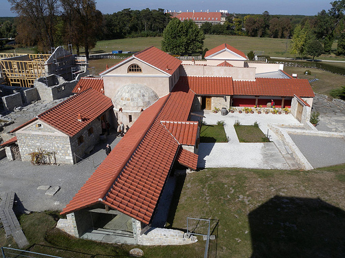
Carnuntum Archaeological Park is an open air museum situated in the Lower Austria.
Carnuntum (Καρνους) is the name for a multi-period legion camp, an
auxiliary fort and a camp town that served to protect the Upper
Pannonian Limes. From the 2nd century AD, the civil city of
Carnuntum was also the administrative center of the Roman province
of (Upper) Pannonia. It is the most important and most extensively
researched ancient excavation site in Austria and is located on the
municipal areas of Petronell-Carnuntum and Bad Deutsch-Altenburg,
federal state of Lower Austria. It is also the only non-modern
built-up legion camp between Regensburg and Belgrade and thus one of
the most important archaeological monuments on the Danube Limes,
which was partly declared a UNESCO World Heritage Site in 2021.
The region around a Celtic center of settlement and power that
has not been located to this day, which the historian Velleius
Paterculus referred to as "Carnunto, qui locus regni Norici"
(located in the Kingdom of Norikum), became from the 1st century AD
the gathering point for the expansion of the Romans into free
Germania (Barbaricum). There an important connection to the south
branched off from the Limesstraße. At the foothills of the Little
Carpathians, one of the most important centers of settlement and
defense in the northern provinces of the empire soon developed.
Together with the auxiliary camp of Győr, the legion camp in
Carnuntum is one of the oldest Roman fortifications on the Pannonian
Limes. Carnuntum's rapid rise was due, among other things, to its
convenient location at the crossroads of two old transcontinental
trade routes, as well as the legion and auxiliary camps, in which up
to 6,500 men were stationed at times. Especially the coexistence of
legions and auxiliary troops emphasized the military-political rank
of this location for the Romans. The castles of Carnuntum were
repeatedly the focus of significant political and military events
during the Roman rule over Pannonia.
The oldest
archaeological evidence from Roman times dates to the middle of the
1st century AD. After the establishment of a temporary winter camp
under the then general and later emperor Tiberius (14-37), a solid
wood-earth camp and two civil settlements were built during the
reign of Claudius (41-54). At the beginning of the 2nd century,
about 50,000 people were already living there. The legion camp was
rebuilt in stone around 100 AD. In the middle of the 2nd century, an
additional equestrian fort was built. During the Marcomannic Wars,
Emperor Marcus Aurelius (161-180) led his campaigns from Carnuntum
to the tribal areas north of the Danube. At the end of the 2nd
century, the governor of Upper Pannonia, Septimius Severus
(193-211), was proclaimed emperor by the Danube legions there; this
resulted in another massive economic upswing for Pannonia. In late
antiquity, a base of the Danube Fleet was established in Carnuntum.
in 308 AD, the tetrarchs held the Imperial Conference of Carnuntum
there. In the middle of the 4th century. At the end of the XIX
century, a severe earthquake devastated the region. This natural
disaster, combined with the constant reduction of the border troops
and the disastrous effects of the migration of peoples, finally
initiated their economic and demographic decline. In the late 4th
century, the already severely dilapidated place served Emperor
Valentinian I (364-375) as an army camp for a campaign against
Transdanubian tribal associations. In the course of the 5th century,
the legion camp was abandoned and abandoned by its Romanesque
inhabitants. Between Limes- and Bernsteinstraße lies the so-called
Heidentor, a still partially preserved triumphal monument from the
4th century, today the landmark of the Carnuntum region.
The name Carnuntum/Carnuntum was taken from a former Celtic
settlement, and since the common root of the name Carn means horn, it
can refer to the Celtic god Kernunnos. It may also derive from an
Illyrian idiom meaning "a wall of stone, a building of stone, a city of
stone, a settlement on rock or stone," but this is now considered
obsolete.
for the first time by the
chronicler Velleius Paterculus,
later also in two places in Pliny,
with the geographer Claudius Ptolemy,
in the self-reflections of Mark
Aurel (the second book of this work was written by the emperor in
Carnuntum),
in the Historia Augusta,
in the Notitia Dignitatum,
by the late antique chronicler Ammianus Marcellinus,
in the Codex
Theodosianus,
in the Annales regni Francorum,
and in the main
geographic sources,
in the Itinerary Antonini
and in the Tabula
Peutingeriana
mentioned.
The village of Petronell-Carnuntum is located between Vienna
(Vindobona) and Bratislava on the Danube and Leitha rivers. The ancient
Carnuntum was located about 40 kilometers east of Vienna, immediately on
the south bank of the Danube (Danuvius) at the Danube Breakthrough
through the Little Carpathians, past which the river flows through the
Hainburg Gate (Porta Hungarica) near the mouth of the March. The steep
bank of the Danube is interrupted at the Pfaffenberg near
Deutsch-Altenburg by the valley of a small stream, which provided an
easily passable access to the Danube. The Braunsberg, the 480 meter high
Hundsheimer Berg and its foothill, the Pfaffenberg, offered an excellent
all-round view of the Marchfeld, the Danube floodplains and the mouth of
the March. At Carnuntum, the Amber Road leading from the north through
the March Valley also crossed the Danube.
The Danube offered a
significantly different picture in the pre-modern era than it does
today. While it has been straightened and installed more and more since
modern times, in ancient times it represented a branched, meandering
river system that had numerous side arms and had a predominantly marshy
character in its bank zones. The Roman settlements were therefore
located on slightly elevated river terraces, which were thus protected
from flooding. The ancient, ten-square-kilometer populated area
stretched from Petronell-Carnuntum in the west to the Pfaffenberg near
Bad Deutsch-Altenburg in the east. In the north it encountered dense
riparian forests. In the south, the settlement area extended to about
the route of today's federal highway 9. Due to the natural edge of the
terrain in this section, the camp stood about 40 meters above the
southern bank of the Danube. The topography and hydrology of the banks
of the Danube has been constantly changing since ancient times. The area
at Carnuntum was also subject to constant changes. The reason for this
is that the stream has been looking for new ways through the country
again and again, and with its sediment or sediment, the river is
constantly flowing through the country. has influenced the flora and
fauna of the floodplains through the formation of new river loops. The
main stream probably ran a little further north at that time.
Carnuntum was initially part of the territory of the neighbouring
Noricum. But it was annexed to Pannonia under Tiberius because of the
constant danger from barbarian invasions in its section. After the
division of the province into Pannonia superior (Upper Pannonia) and
Pannonia inferior (Lower Pannonia) under Trajan (98-117), the village
first came to Pannonia Superior and belonged to the newly founded
Pannonia Prima (Diocese of Illyria) from the imperial reform of
Diocletian (284-305).
The possession of Carnuntum as a crossing point of two heavily frequented, transcontinental main trade and transport routes was strategically extremely important for the Romans. At that time, the Danube was the fastest connection between the west and the east of the Roman Empire. From the legion camp, in addition to controlling the stream, its crossings (Stopfenreuth, Castle Hill of Devin) and the mouth of the March, which adjoins it to the north, it was also possible to monitor traffic on the Amber Road leading from the north (Baltic Sea) to the south (Italy). Thus, in addition to customs revenues, import bans, export embargoes, etc. could also have an impact on the economy. The other tasks of the crew included border security and signal transmission on the Danube Limes. From the camp plateau you also had a good view of the Marchfeld.
The Legionskastell, as the center of the Greater Carnuntum area,
played an important role in the development of the road network. Like
the camps in Vindobona and Arrabona, it stood at the endpoints of
important highways, two of which met at the Colonia Claudia Savaria and
from there continued to Italy.
The Amber Road was an important
trade route that connected the then inhospitable, little-developed north
of Europe (the Baltic States) with the old trade and craft centers in
Italy on the Adriatic and the rest of the Mediterranean. It probably
crossed the Danube near the Pfaffenberg, near Stopfenreuth, and reached
the city limits in the southwest. From then on, it was identical to the
so-called Gräberstraße, since graves had been preferably laid there
outside the settlement area since the early imperial period.
Subsequently, it ran along the western shore of Lake Neusiedl and
connected Carnuntum with the nearest town Scarbantia (Sopron), as
evidenced by finds of milestones at Oslip and Bruck an der Leitha.
The Limes Road (via iuxta Danuvium) connected Gaul and the Rhine
provinces with the middle and lower Danube and subsequently with the
Greek east of the empire. There are different assumptions about their
course. In the direction of Vienna, she probably followed the bank of
the Danube. It is unclear whether a road leading down the Danube in the
direction of the castle Gerulata / Rusovce also belonged to the main
branch of the Limes Road or whether it led directly out of the south
gate and then continued in the direction of the southeast. About 150
meters south of the railway line, a branch from the Limesstraße was
discovered. It led through the valley of the Altenburg Stream to
Prellenkirchen and from there to the forts of Gerulata and Ad Flexum
(Mosonmagyaróvár). A second one led at right angles to the Gräberstraße
and then to Hundsheim and Edelstal. Plot and corridor boundaries are
still oriented along their route today. It probably existed since the
1st century AD.
Pottery finds on the territory of Slovakia
suggest that Carnuntum was also directly connected to the Waag Valley
area by a road. Their route probably led over the eastern slopes of the
Little Carpathians from the Danube crossing near Bratislava to Trnava.
The west-eastern Lagerstraße is largely identical to the course of
the Bundesstraße 9. Their north-south counterpart also continued outside
the camp – with the exception of its north side. To the east, it runs
parallel to today's federal highway to the outskirts of
Deutsch-Altenburg. However, their traces are lost there because of the
dense overbuilding. It probably led over the Kirchberg to the foot of
the Pfaffenberg and from there to the mouth of the March.
The remains of the legion camp are likely to have been clearly visible until the 15th century. in 1668, the court librarian of Emperor Leopold I, Peter Lambeck (1628-1680), reported on "... old moors still standing quite high above the earth, the collapsed vault, the old cellar, the four porches and the crossroads.“ The areas of the camp, which stood directly on the steep bank of the Danube, have fallen into the river over the centuries due to erosion. Due to the river regulation at the end of the 19th century, these landslides have largely come to a standstill. In contrast to most other legion sites on the Rhine and Danube Limes, the Carnuntine camp is a completely undeveloped ground monument. Its area was used exclusively for agricultural purposes and offers the ideal conditions for large-scale archaeological prospecting projects such as geophysical measurements and, in particular, aerial archaeological investigations. Since the 1960s, the Aerial Photo Archive of the Institute of Prehistory and Early History of the University of Vienna has more than 1500 vertical and oblique photographs from the Carnuntum region. Their evaluation provided a large amount of information on the ancient development and infrastructure of the camp city. If you combine all the excavation and prospecting results, you will get a very detailed overall plan of the legion camp and the adjacent canabae legionis. The barracks, the central buildings Principia (staff building), Praetorium (accommodation of the legion legate), the valetudinarium (camp hospital), three of the six tribune houses (officers' accommodation) and three larger farm buildings in the eastern half of the camp were almost completely excavated.
Until the late 18th century, the ruins of the "Haydnick Town" were demolished by the peasants, as they hindered field work. The stones were reused as building material, the marble was burned to lime. The officer and scholar Luigi Ferdinando Marsigli (1658-1730) made a rough plan sketch of the legion camp in 1726 for his work Danubius pannonico-Mysicus. During this time, there were obviously still larger contiguous wall remains of the camp, which were popularly referred to as "The Old Castle". In particular, the east gate should have been relatively well preserved at that time. On the occasion of a Danube cruise in the years 1736-1737, the English educational travelers Jeremiah Milles (1714-1784) and Richard Pococke (1704-1765) also paid a visit to Carnuntum and mentioned it in their travelogue "A description of the east and some other countries". Among other things, it also reported on numerous remains of walls, grassy hills made of bricks in the interior and a larger ruin in the center of the camp.
As late as 1821, the Prague magazine Hespererus reported on farmers from Deutsch-Altenburg who were digging up and breaking out old wall stones as a lucrative sideline and selling them "klafterweise". In the same year, the numismatist and archaeologist Anton von Steinbüchel (1790-1883) initiated the first targeted excavations, but this remained only an individual undertaking. The interest in the further exploration of Carnuntum awoke with a report by the art historian Eduard von Sacken (1825-1883), with which he informed the Imperial and Royal Central Commission about the discovery of the Mithraeum I during blasting operations at the Pfaffenberg. Sacken had the finds recovered with the greatest possible care and taken to the Antikenkabinett in Vienna. When Roman inscriptions were found in the quarry of Deutsch-Altenburg in 1852, the first excavations began, but they were still mainly limited to collecting ancient finds. The exposed wall sections of the military bath were then filled in again. In the same year, Sacken reported that not a single remnant of the wall of the legion camp was now visible above ground. From 1877, systematic archaeological investigations began under the historian Otto Hirschfeld (1843-1922), which initially focused on the legion camp and to a lesser extent on the canabae legionis and lasted (with short interruptions) until the outbreak of the First World War. In the process, 4/5 of the warehouse could be exposed. In 1884, under the patronage of Crown Prince Rudolf von Habsburg, the association Carnuntum was founded, which had the aim of promoting the scientific investigation of the local ancient sites. in 1885, the monument conservator Alois Hauser (1841-1896) and in 1908 the archaeologist Maximilian von Groller-Mildensee (1838-1920) dug in the legion camp and on the Pfaffenberg. In 1888, the amphitheater of the camp town (Amphitheater I) was discovered in a depression next to the legion camp. It was uncovered by Hauser until 1896. The archaeological investigation of the Roman water pipe on the Sola field south of the Canabae began in the 1890s. Between 1885 and 1894, the burial ground on the Amber Road west of the Groller-Mildensee legion camp was uncovered. The positions of the individual graves were entered by Eugen Bormann on a cadastral map. In August 1894, the building researcher Josef Dell (1859-1945) and Carl Tragau († 1908) examined the Mithraeum III. In the same year, the Imperial and Royal Archaeological Institute was established. From then on, this commission and the Limes Commission affiliated to the Austrian Academy of Sciences were in charge of the research of Carnuntum.
At the beginning of the 20th century Groller-Mildensee examined the area south of the theater, whose buildings were oriented along Limesstraße. in 1904, the Carnuntinum Museum was opened in Bad Deutsch-Altenburg to present the increasingly numerous finds. In the subsequent excavation campaigns, the archaeologist Eduard Novotny (1862-1935) was able to uncover a large part of the legion camp until 1914, so that it was possible to reconstruct its structure and structure. Between 1913 and 1914, the then director of the Museum Carnuntinum, Josef Bortlik, organized another large-scale excavation campaign along the Gräberstraße in order to bring the finds of the last still unpolished graves to safety from treasure graves. Since the 1950s, land consolidation, the expansion of infrastructure, large-scale material mining, the industrialization of agriculture, etc. have led to the destruction of large-scale found landscapes. All these circumstances made rescue excavations necessary, which, however, were under great time pressure. The last excavations in the Legion camp were carried out between 1968 and 1977 by the Austrian Academy of Sciences in cooperation with the Austrian Archaeological Institute. They enabled the (still valid) periodization of the legion camp and provided essential insights into the wood-earth and late antique stone camp. The eastern part of the praetentura (northern part) of the camp has remained largely unexplored to this day. in 1977, the ditch of the equestrian camp was cut on the eastern outskirts of Petronell-Carnuntum during the construction of a housing estate (the so-called tailor's estate). in 1978, the archaeological excavations began under the direction of Herma Stiglitz. However, some sections of the fort were irretrievably lost due to the superstructure. To save the remaining stock, the castle grounds were placed under monument protection by the Austrian Federal Monuments Office. By 1988, it was possible to examine the western half of the area in particular, partly with search sections, but also on a large scale. The function, the four construction periods and the dimensions of the equestrian camp could be determined. In addition to the fortifications, several of the interior buildings from the different construction periods were also examined. After Stiglitz had retired in 1989, Manfred Kandler was entrusted with the continuation of the excavation work. He also included the southern foreshore of the fort in his investigations. Mainly tools, weapon parts as well as cooking and dining utensils were discovered in the horse stable. Among the most notable finds are the face mask of an equestrian helmet and a parade helmet, which was used in tournaments. The stone monuments from this excavation area can be viewed in the lapidarium of the House of Culture in the municipality of Petronell-Carnuntum. The ruins and finds of the temple district on the Pfaffenberg could be documented before their final destruction in the period from 1970 to 1985 by rescue excavations of the University of Vienna and thus secured for posterity.
Until 2004, the Austrian Archaeological Institute was able to examine large sections of the equestrian Castle by rescue excavations before the completion of the modern development and save them from final destruction. In 2012, the Ludwig Boltzmann Institute for Archaeological Prospecting and Virtual Archaeology, in cooperation with other partner organizations, launched the project "ArchPro Carnuntum", which was commissioned by the State of Lower Austria. Through the systematic use of non-invasive archaeological prospecting methods (remote sensing and geophysics), the researchers mapped most of Carnuntum with high-resolution measurements. Within three years, they were able to comprehensively examine an area of a total of about 10 km2. With the help of aerial photographs, a preliminary general plan of the ancient remains hidden in the ground was compiled until 2013. The archaeological structures extend over several square kilometers and show, among other things, a dense development on the Canabae area and also structures of the water supply. With the help of the results of the old excavations and a reassessment of the previous state of research, a scale model of the Roman Carnuntum was produced. The research in the legion camp has completely come to a standstill due to the current negative attitude of the landowner.
The development of the two forts and the camp town was closely related to the constant defensive battles against the Germanic tribes living on the other side of the Danube, which necessitated the permanent stationing of a large number of soldiers. Due to this circumstance, the border section near Carnuntum repeatedly became the focus of imperial policy, which can be seen especially from the frequency of the presence of important Roman emperors and generals in the city.
In the 40s of the 1st century BC, the Boians were subjugated by their eastern neighbors, the Dacians under Burebista, who also burned down their large oppidum near present-day Bratislava. After this defeat, the now mostly abandoned Boian territory (deserta Boiorum, roughly today's Vienna Basin and Burgenland), fell to the Noric. Their settlement areas also belonged to the kingdom of Norikum (regnum Noricum) at the end of the first century BC around 15 BC. The Kingdom of Norikum was one of the few new territories of the empire to be integrated into the Roman Empire without a violent conquest.
In the Roman written sources, Carnuntum was mentioned for the first
time in connection with war events before the Pannonian-Dalmatian
uprising (bellum dalmaticum), an uprising of the indigenous tribes
against Roman rule, from 6-9 AD. According to the chronicler Velleius
Paterculus, a Roman army of about 40,000 men under their general
Tiberius built a temporary winter camp (castra hiberna) at that time, in
order to subjugate the Marcomanni under their king Marbod, who settled
north of the Danube, among other things, in the area of today's Bohemia
and Moravia. The location of this camp could not be located so far;
either it was located near Hainburg on the Danube, on the castle hill of
Bratislava or at the mouth of the March. Pliny wrote about the
construction of the camp in the "Germanic border area"; so Carnuntum was
not officially part of the Roman Empire at that time.
The
consolidation of Roman rule encountered much greater difficulties in
Pannonia than in neighboring Noricum. Marbod jeopardized the Roman
expansion into Central Germania, as he had a 70,000-strong armed force
(including 4,000 horsemen) trained according to the Roman model. Emperor
Augustus therefore assembled twelve legions (80,000 men) on the Rhine
and Danube and subordinated them to his stepson Tiberius. He was to
cross the Danube at Carnuntum with six legions and advance further north
along the March. At the same time, the second army group under the
leadership of Sentius Saturninus marched east from Mogontiacum /Mainz to
take the Marcomanni in the pincers. The rebellion of the Pannonians,
probably instigated by Marbod, finally thwarted Rome's further advance
into free Germania. Tiberius, who had already reached far to the north,
to today's Weinviertel, had to turn back immediately, not only to put
down the uprising, but also to prevent him from being cut off from his
supplies from Italy. Despite the large number of troops, the Pannonians
could only be subdued after three years. After the loss of three legions
in the Battle of Varus, Augustus finally renounced further conquests
into the Germanic tribal areas and established the imperial border on
the rivers Rhine and Danube.
By 8 A.D. at the latest, the region
around Carnuntum may also have been incorporated into the Roman Empire.
After the death of Augustus, riots broke out in the summer of 14 AD in
the joint summer camp (castra aestiva) of the legions stationed in
Pannonia at that time (Legio VIIII Hispana, Legio XV Apollinaris and
Legio VIII Augusta). However, Drusus the Younger was able to quickly
calm down the angry soldiers again, whereupon they moved off to their
winter quarters according to orders. In 19, internal Germanic conflicts
prompted Marbod and his entourage, who had been defeated by Arminius, to
ask for asylum in the Roman Empire. He was followed a little later by
his opponents Catualda and the ruler of the Quad, Vannius (regnum
Vanianum), who were settled on the Leitha Mountains. Under Emperor Nero
(54 to 68 AD), the province of Pannonia was formed from the north of
Illyria, which was now also assigned to Carnuntum. Initially, Roman
troops were stationed only at particularly vulnerable points of the new
border line. The main defensive points in Upper Pannonia were located
opposite the mouth of the March and on the border section between
Vindobona (Vienna) and Brigetio (Komarom). There was no similar
concentration of troops on any border section of the Roman Empire.
According to the historian Tacitus, in the reign of Claudius, the
establishment of permanent military camps and watchtowers along the
Danube began to secure the new border. The oldest traces of Roman
settlement were recorded for the period between 40 and 50 AD. it is
documented (finds from Upper Italian Terra Sigillata) when Legio XV was
permanently stationed on the Danube in connection with the expulsion of
Vannius and moved to its second camp on the Pannonian Limes after
Vindobona in Carnuntum (Flur am Burgfeld). During this period, the old
Celtic Oppida were also abandoned; the subjugated indigenous population
(dedictii) was settled in the plain around the new legion camp for
better control. The earliest inscription known from Carnuntum (53 or 54
AD) reports construction work in the legion camp. At the same time, a
settlement consisting of irregular simple dwellings (canabae legionis)
developed around the camp, leaving a free area for the assembly of the
army. A Roman soldier is depicted on a grave stele, which was made
around the middle of the 1st century, supervising a Celtic carter. This
suggests that the local population was also increasingly used for the
numerous construction measures during this time.
Since the policy
of conquest of Augustus was rejected by his successors, the
establishment of a border security organization began under the Flavian
emperors. Under Vespasian (69-79), the wood-earth warehouse was replaced
by a stone building. The western flank of Carnuntum was protected by the
legion camp at Vindobona. Under his successor Domitian, an additional
fort for a 500-strong equestrian unit was built about 1.2 kilometers
southwest of the camp. It was supposed to ensure greater mobility of
troops in border surveillance. In the years 85 to 86, the Romans
suffered a defeat against the Dacians. As a result, the fighting also
spread to the region around Carnuntum. Domitian therefore felt compelled
to appear in person in Pannonia in order to coordinate the defensive
measures. During a campaign led in the years 89 and 90 against
Marcomanni and Quaden, the emperor probably also stayed in Carnuntum. On
his orders, further troops were transferred to Pannonia to reinforce the
Danube Army, for which new fortresses also had to be built. The
equestrian camp probably also belonged to this. In 97, the war, the
so-called bellum Germanicum et Sarmaticum, could be ended with a Roman
victory.
in 106 or 117, one of the Rhine legions, the Legio XIIII Gemina, was
transferred from Vindobona to Carnuntum by Trajan's order, where it
remained stationed until the end of Roman rule over Upper Pannonia. The
expansion of the legion camp was completed under Trajan. Between 110 and
120 there were also fundamental innovations in the area of the
equestrian castle. The changes there may also have been related to a
change in his crew. The Thracian equestrian unit built a stone camp on
the same place after the demolition of the old wooden-earth fort. Due to
the increased immigration, encouraged by the presence of the Legion,
which guaranteed the highest level of security and stable economic
growth, Carnuntum continued to grow steadily throughout the 2nd century.
An additional driving force for the rapid development of the military
city was the extremely lucrative long-distance trade with free Germania.
After the division of the province into Upper Pannonia and Lower
Pannonia under Trajan, Carnuntum became the official seat of the
consular governor (Legatus Augusti pro praetore provinciae Pannoniae)
between 103 and 107, to which all Upper Pannonian legions were
subordinated from then on. In order to better repel Germanic raids,
outposts were set up on the Marchtalstraße in Stampfen and Thebes north
of the Danube, opposite Carnuntum, as part of an early warning system.
The Marcomannic wars in the 160s and 170s, which were devastating for
the Roman Empire, abruptly ended Carnuntum's steady upward development
until then. The invasion of 6000 warriors of a coalition of Lombards,
Marcomanni and Ubians could still be repelled by the Upper Pannonian
governor. However, in 167 a campaign against some Transdanubian Germanic
tribes (Marcomanni, Quaden, Narists and other small peoples) failed. The
Limes was then stormed and breached by them. Up to 20,000 Roman soldiers
and the governor allegedly died while trying to fight them back. This
catastrophe was further aggravated by the outbreak of the Antonine
plague, which had been brought in by a Roman army returning from the
East and significantly decimated the soldiers and the civilian
population on the Limes. The Germanic invaders penetrated as far as
Aquileia in northern Italy. However, when they returned to the Limes
with their loot, they were already expected there by the Roman forces.
After fierce fighting, it was possible to take most of the looted goods
from the invaders again and push them back across the Danube. In the
course of the Roman counter-offensive to devastate the Germanic tribal
areas north of the Danube, Emperor Marcus Aurelius set up his
headquarters in Carnuntum for three years (171-173) and, before his
death in 180, wrote several chapters of his reflections, among other
things. The reliefs of the Marcus Aurelius column in Rome show some
details of the carnuntum of that time. During this campaign, the Romans
penetrated far into free Germania, such as. Brick stamps of the Legio
XIIII, which were found at Staré Město and Hradisht, 120 km north of
Carnuntum, are documented. The legionnaires had probably set up a
checkpoint there on the Amber Road.
Surprisingly, no major
destruction horizon could be detected archaeologically for this time
period during the excavations in Carnuntum. The legion camp or
equestrian fort was also continuously occupied in the second half of the
2nd century and was by no means destroyed during the fighting, as was
first assumed. At that time, the equestrian camp served as an advanced
supply and supply camp for the front and was additionally equipped with
workshops and warehouses for this purpose. Mark Aurel's successor,
Emperor Commodus (180-192), finally concluded a peace treaty with the
Teutons and probably also stayed in Carnuntum for this purpose. The
conclusion of peace was followed by a new period of stability and
reconstruction in the Pannonian provinces. On April 9, 193, the most
significant historical event for Carnuntum took place. The reigning
Upper Pannonian governor Septimius Severus (193-211) was proclaimed by
the Danube legions as a counter-emperor to Didius Julianus and later
confirmed by the Senate in Rome. He founded the ruling house of the
Severans, which once again gave the empire a massive military and
political upswing.
Septimius Severus proved to be a generous patron of Pannonia and
elevated the civil city to the rank of a Colonia (Colonia Septimia
Aurelia Antoniniana Karnuntum). It was thus the most important city of
the Pannonia superior. The result was another intensive construction
activity lasting several decades. Under the Severians (193-235), the
site reached its economic/cultural heyday and maximum expansion. Only
horsemen were now stationed in the auxiliary troop camp again.
The last decades of the 3rd century were marked by internal unrest,
constant defensive battles against invaders and rapidly changing rulers
on the imperial throne (the so-called imperial crisis of the 3rd
century). However, Carnuntum continued to be an important base on the
middle Danube Limes. In 260, during the reign of Gallienus (253-268),
the Carnuntine troops proclaimed the governor of the Pannonia superior,
Regalianus, as the counter-emperor; but he was not recognized by the
Senate in Rome. His influence also never grew beyond the Limes strip
between Carnuntum and Brigetio. During his short reign, he had coins
minted with his image and that of his wife Sulpicia Dryantilla, some of
which were found in Carnuntum. Only six months later, both were murdered
by their own soldiers. Towards the end of the 3rd century, the
equestrian fort was abandoned – probably as a result of the military
reforms carried out under Gallienus. The legion riders formerly
stationed at the Limes were assembled at Mediolanum (Milan) to form a
powerful cavalry army. It was supposed to operate in crises as a rapid
reaction force directly subordinate to the emperor, was a forerunner of
the later mobile comitatenses (mobile field armies) and initially
consisted mainly of Illyrian (Pannonia, Mösia and Dacia) and Moorish
(North Africa) units. Presumably, the riders of the Carnuntine Legion
were also assigned to her. With Diocletian's accession to power, the
long period of instability among the soldier emperors ended in 284. In
288 he stayed at the Danube Limes and had the fortifications reinforced
by the construction of new camps, small castles and Ländeburgi or the
old fortifications modernized. Upper and Lower Pannonia have now been
split into four administrative units. In 295, Carnuntum was the starting
point of a campaign by Caesar Galerius against the Marcomanni.
The political conflicts between his successors after his abdication
prompted Diocletian, who wanted to prevent the collapse of his system of
rule, to convene a meeting of all the parties to the dispute in
Carnuntum in 308 in order to settle the conflicts peacefully and revive
the tetrarchy. With this conference within its walls, Carnuntum once
again moved into the center of imperial policy. The city was probably
chosen as a venue for the delegates due to its location near the border
between the western and eastern parts of the empire and also because of
its representative buildings and well-developed infrastructure for the
proper accommodation of the delegates. In this historically significant
meeting, the Augusti Diocletian, Galerius, Licinius and Maximinus Daia
managed to put the distribution of power in the Roman Empire on a new
stable basis (the so-called fourth tetrarchy). On the occasion of the
restoration of a Mithraic shrine (Mithraeum III), the participants
donated an altar, which is now kept in the Museum Carnuntinum.
During this time, however, more and more soldiers were withdrawn from
their old garrisons on the Limes and placed in newly established mobile
field armies (comitatenses) to protect the heartlands of the Western
Roman Empire. The stationary border troops (Limitanei) of Ufernorikum
and the Pannonia I were now under the command of a Dux limites. in 350,
Carnuntum was shaken by a severe earthquake, which caused considerable
damage to the infrastructure and can be proven archaeologically
(especially in the Canabae) by layers of destruction on the large public
buildings. Presumably, a large part of the civilian population emigrated
due to this catastrophe and due to the onset of climate deterioration at
the end of the 4th century. Due to the progressive impoverishment of the
provincial population and the continuous withdrawal of soldiers, trade
and money circulation were also severely impaired. At the Limes, with
the beginning of the migration of peoples, there were also more and more
frequent raids and looting by nomadic tribes pushing in from the east,
who in turn had to flee from the Huns expanding further and further to
the west and therefore wanted to force their settlement in the Roman
Empire.
In 374, Carnuntum was once again the starting point for a
campaign of revenge by Valentinian I against the Quaden and Jazygen. He
probably also had the last verifiable conversions made at the legion
camp. Among other things, a sewer in the northern part of the camp,
which had become useless, was filled up with spolia without further ado.
On the orders of this ruler, extensive construction measures were also
carried out on the rest of the Danube Limes, which were intended to
modernize the already largely dilapidated fortification system and thus
compensate for the endemic shortage of soldiers. A passage in the
writings of Ammianus Marcellinus suggests how urgently the castles on
the Limes needed such revitalization measures. Although it still had a
high strategic importance, the emperor found the city on his arrival as
a "neglected, dirty nest" and already largely abandoned. In the last
decades of the 4th century, however, extensive construction activities
can still be proven both in the civilian city and in the legion camp,
which is no longer exclusively used for military purposes. As was often
the case on the Danube Limes, two small fortifications (Restkastelle or
burgi) were probably built for the greatly reduced crew. Large parts of
the former settlement area were abandoned and used only as a cemetery.
After the catastrophic defeat of the Eastern Roman army against a
coalition of barbarians at the Battle of Adrianople in 378, Hun, Alanian
and Gothic tribes moved freely through the empire and finally had to be
recognized by Rome as feudal lords or granted the right of settlement in
Thrace. By 380, the Ostrogoths and Alans under Alatheus and Safrac also
reached Pannonia and were included in the provincial army there. In 395,
the Pannonian Limes collapsed on a broad front; the unpaved civil
settlements were mostly abandoned. The inhabitants still living in
Carnuntum at that time retreated either to the legion camp, to the Forum
thermal baths (palace ruins) or to still habitable quarters of the
civilian city. The patrol ships and Liburnari of Legio XIIII were
transferred to neighboring Vindobona. In the same year, the Marcomanni,
Quaden Goths, Alans and Vandals invaded Pannonia without encountering
any significant resistance, but probably spared the city. The following
year, 396, at the instigation of the regent, the Marcomanni were settled
in the west, Stilicho, for the defense of the Limes between Carnuntum
and Klosterneuburg. These Marcomannic auxiliary troops appear in the
Notitia dignitatum under the command of a tribunus gentis Marcomannorum.
Presumably, they were also involved in the last major construction
measures in the legion camp.
Until the early 5th century, Westrom managed to maintain its upper and middle Danube border with great effort. Still around the middle of the 5th century, according to the Notitia Dignitatum, a Praefectus resided there, who had a cohort of Legio XIIII and some fleet soldiers under his command. The last traces of Roman settlement could be observed in Carnuntum until the first half of the 5th century. They concentrated in the legion camp, where the rest of the Romani civilian population had meanwhile retreated. 433 AD. the Pannonian provinces were left to the Huns under Attila for administration by Valentinian III. However, the greater Carnuntum area remained continuously populated during the migration period. Two years after Attila's death, Emperor Avitus tried to return Pannonia to the imperial union, but failed due to the resistance of the Goths, who now ruled the province. After the collapse of the Western Roman Empire, the settlement in the former legion camp was finally abandoned. Between 546 and 568, Lombards and Avars occupied the country. Remarkably, there is no found material from the inside of the warehouse either from the Lombard period or from the period of the rule of the Awars. In the early 9th century, Carnuntum marked the northernmost terminus of an Awarenkhaganate. Carnuntum was last mentioned in the Annales regni Francorum in 805. After that, it fell into oblivion. At the same time as a large early medieval rampart on the Kirchenberg near Bad Deutsch-Altenburg, there was also a smaller settlement inside the legion camp for a short time during the 9th/10th century. Since the Carolingian period, some peasant families probably settled in the core of the former camp town. At the turn of the millennium there was a small village here, but its name is unknown. The focus of settlement finally shifted eastwards to Hainburg an der Donau around the middle of the 11th century. The legion camp and the civilian settlements were destroyed in the following centuries by systematic stone robbery.
The legion camp (castra legionis) was located on the outskirts of
Petronell, on the area between the federal highway 9 and the bank of the
Danube. The construction history of the warehouse construction can
essentially be limited to a wood-earth and two stone construction
phases. During the excavations, however, a total of up to eight layers
of finds could be distinguished from each other. The stone fort of the
Middle Imperial period was built on the same site as the former
Holz-Erde-Lager. Its diamond-like, irregular ground plan was a
consequence of the topographical conditions of the plateau. Rock ridges
in the steep slope of the Danube made it possible that the camp could be
built very close to the banks of the Danube. From here you had a good
view of the Marchfeld. While the camp in nearby Brigetio had to be moved
away from the bank of the Danube in Hadrian's time due to erosion, the
north side of the Carnuntine camp seems to have remained stable during
its entire period of use. On the other three sides, hollows and
depressions appeared in places, to which the course of the wall had to
be adapted. The west side bent a little inwards in the gate area. In
contrast, the eastern wall arched far outwards and receded sharply
inwards again in the gate area.
The camp could accommodate up to
6000 men (miles legionis). His interior buildings included the staff
quarters (principia), the residence of the camp commander (praetorium),
the hospital (valetudinarium), the camp bath (thermae), barracks
(contubernia), workshop buildings (fabrica) and storage buildings
(horrea). After the discovery of countless shards of glass to close, at
least these buildings should have been equipped with glazed windows. The
archaeologists also uncovered a powerful layer of destruction that could
be dated to the end of the 4th century. After the excavations, it was
filled in again, as its area is used for agriculture. Its remains still
stand out from its surroundings as a clearly recognizable plateau with
the surrounding depressions of the fortification ditches. Above ground,
only small remains of the wall of the embankment at the east gate and
the foundations of its southern flank tower, which are heavily overgrown
with vegetation, can be seen.
Little is known of the early wood-earth camp (period I). His traces could only be detected in some places of the completely excavated successor building of the 2nd and 3rd centuries. It was probably built between 40 or 50 AD and measured 195 × 178 meters including a ditch. The fortifications consisted of an inner earthen rampart, about five meters wide, serving as a defensive corridor and an outer wooden plank wall with beams vertically recessed into the ground and wooden towers standing on four posts. A double pointed ditch, six meters wide, ran around the camp. The inner ramparts had been built up with the excavation of the ditches and served as a defensive corridor. Not much is known about its interior development either. Most of the warehouse buildings were probably still built in half-timbered technology. Since there was no large-scale exposure of the oldest findings and the ancient buildings left severe destruction, it was impossible to reconstruct coherent floor plans. Only in the northern area could traces of a barracks barracks about four meters wide, running from north to south, still be detected. A few traces of construction were also observed in the southern storage area. It is assumed that during the reign of Vespasian, the principia, the praetorium and the camp thermae, which were probably located east of the via Praetoria, were already built in stone.
From the 70s onwards, the camp was gradually converted to stone (period II). These construction measures are confirmed by several construction inscriptions uncovered in the center of the camp. Although it stood in the same place as its predecessor, it was slightly shifted to the northeast in plan. Two major construction periods and several smaller construction phases could be identified for the stone warehouse. The fortification measured 207 × 177 meters and covered an area of about 17.5 hectares. At the time of Trajan, the wooden-earth wall to the east and west was replaced by a stone wall. Numerous centurion stones were also installed in the camp wall. These were inscribed building blocks that marked the lots assigned to the individual centurions and indicated the name of the officer and the legion responsible for them. The camp was renovated several times after that, but its basic features were preserved until the beginning of the reign of the Severan imperial dynasty. Around the year 200, extensive changes were made to the site plan, but these were probably limited to the praetentura (front side). The newly built barracks were no longer based on the floor plans of the wooden predecessor buildings. Between 260 and 270 the camp was severely damaged during barbarian invasions.
Under Valentinian I, significant changes were made to the structure
of the legion fortress from 375 onwards, as evidenced by a late antique
building inscription from the western Raetentura and the excavation
findings. On the west side of the raetentura, next to the hospital or
prison, a small or remaining fort was probably built after 380, into
which the guard soldiers still remaining in the camp retreated.
Presumably, a similar fortification (burgus) was also built at the end
of the Danube. Furthermore, a striking number of spolia were also
included in the masonry of this construction phase. The remaining camp
area was left to the civilian population. In the eastern praetentura,
three- to four-room residential buildings using drywall technology could
be built for this time and proven with hose heaters. Significant
structural changes were also made to some of the tribune houses.
Baking ovens, pottery ovens, some building structures that can probably
be interpreted as cisterns, as well as other, but no longer
interpretable findings were uncovered throughout the camp. In the
majority of cases, it may have been late antique fittings. During the
excavations in the praetentura (eastern part), a large early medieval
oven also came to light, which was created in the last phase of
settlement, in the 9th or 10th century.
The very simply designed
new buildings of the post-military settlement phase, which began at the
beginning of the 5th century, consisted only of wood, earth and clay and
were no longer based on the old building regulations corresponding to
military requirements. With the departure of the last regular soldiers,
presumably around the middle of the 5th century, the camp finally lost
its original function. In the early Middle Ages, a group of Slavs
settled within its walls. Judging by the ceramic finds, his area was
inhabited until the 9th or 10th century. After that it was abandoned and
over the centuries it was removed by stone robbery until it was almost
completely gone.
As already mentioned, the rampart had moved a little towards the camp
gate in the west and swung in wide arches on both sides in front of the
camp gate there in the east. The only straight line was the southern
wall running from the acute-angled southern corner. The course of the
northern Wall is largely unknown.
The wall in phase 1 had a
thickness of 1.10 to 1.20 meters, in phase 2 it was 1.90 to 3.40 meters
with also much deeper and more massive foundations. The rising masonry
was still preserved in some places up to 1.25 meters high. Its core
consisted of mortared rubble stones, the outer sides were veneered with
carefully hewn stone blocks. In phase 2, it was later widened in places
on the outside or completely rebuilt in some places. At the top it was
most likely completed with a crenellated wreath. A ca. A 25-meter-wide
strip of the northern front of the camp has slipped into the Danube or
has lowered. At the northeast corner there was still a remnant of the
wall which was supported by a buttresses. There, the castle wall had a
width of two meters and directly abutted the barracks. The fort was
protected on its north, east and west sides by a 20-meter-wide moat, and
in the south by two moats, the profiles of which were made differently.
The outer one was rather flat, 12.50 meters wide, the inner one narrow
with a steep embankment and measured only 5.40 meters. The width of the
berm was from 0.90 to 4.50 meters. The inner ditch may have been filled
in again later. The appearance of the defensive structures in the late
Antique construction period has not been sufficiently clarified. During
this time, however, the Imperial wall in the NO was apparently
additionally reinforced by an external extension. It is only certain
that the double trench system was still being maintained at that time,
as indicated by the filling of the outer trench with a coin of 310-311,
which can be dated to the middle third of the 4th century.
The wall was reinforced with square intermediate towers placed at irregular intervals on the inside, six of which could be archaeologically proven in the south. In the east, five are known, in the west only one came to light. In the southeast, one of the corner towers could be dug up. But presumably there was also such a tower in the southwest corner. Wall thickness and side length were measured differently in some specimens.
The legion fortress could be entered through four gates of different
sizes in the north, south, west and east. Three of the four camp gates
were dug up. The east and west gates had been built at the deepest
sections of the plateau. All of them were flanked by two slightly
protruding towers and had double passages. The facades of the gate
complexes may have been partly richly decorated with architectural
elements.
Description/Condition
Porta praetoria - Nothing has
been preserved of the North Gate, as it has fallen into the Danube due
to the centuries-long flooding of the bank area.
Porta decumana - the
two-phase south gate was eight meters wide, in the middle there was a
support pillar (spina) about a meter wide. The eastern, two-storey
flanking tower measured 6.8 × 6.6 meters. The foundations of the western
one were still preserved. The two passages were each 3.75 meters wide.
In phase 2, the gate towers were slightly enlarged, the support pillar
was extended to five meters.
Porta principalis dextra - Probably the
main gate of the legion camp. It could be well defended by the camp wall
projecting far on both sides. In 1898, the foundation of the southern
flank tower (7 × 9 meters) was uncovered from this 13-meter-wide gate
construction. He jumped about 2.80 meters in front of the camp wall.
From the evidence of a central pillar it was clear that the gate could
be passed through two passages.
Porta principalis sinistra - Its last
remains were destroyed in the early 18th century by road construction
and subsequent stone robbery. The rising masonry consisted of
rectangular hewn ashlars, which were connected to each other by iron
clamps cast in lead. An oversized phallus symbol for demon defense had
been carved on one of the cuboids on the outside. The facade decoration
consisted, among other things, of capitals and cornices in Corinthian
style. Initially, only the southern flank tower could be located from
the multiphase west gate in 1898. He measured 8.8 × 7.5 meters and
jumped 1.37 meters inside or 2.50 meters in front of the camp wall. in
1899 they came across the northern flank tower. The north tower of phase
1 had a circumference of 7.40 × 9 meters. In phase 2, it was no longer
rectangular, but rounded at the southwest corner. The floors inside were
made of brick slabs. Large quantities of broken crockery were found in
the corners between the flank towers and the camp wall. Although no
central pillar could be found, it is assumed that the gate system also
had two passages. The total width of the gate was 15.40 meters. A
building inscription from the time of Emperor Valentinian I testifies to
the last construction measures in the camp, a fragment of which was
found near the gate.
Exit gate - Not far north of the west gate,
during the excavations, one came across an underground vault with
several entry shafts in front of the barracks. At first, archaeologists
considered it a canal. As one continued to follow its course, one came
to a cross passage that ended immediately behind the foundation of the
camp wall. From there, a passage under the wall led to the Glacis. It
probably served as a kind of loophole for crew failures during sieges.
The gate was barricaded by cast wall blocks and spolias when it was
found. The stones, however, had only been carefully piled up but not
mortared with each other.
In the center of the camp, south of the via principalis, was the
command or staff building (60 × 90 meters), the Principia, with the flag
sanctuary (aedes) and various administrative and meeting rooms
(officia), which had only been superficially explored. It was designed
on the model of a forum around a 42 × 38 meter square paved with
sandstone slabs. Around it ran a portico (porticus), which was provided
with a gutter for the draining rainwater. In one of the corners of the
courtyard one came across a round-walled well shaft and a stone relief
depicting an archer. From the portico one could enter numerous chambers,
which were probably used as administrative rooms and armamenta or
similar. have been used.
To the south of it stood the
16-meter-wide transverse hall (basilica), the facade of which was set in
front of 12 pilasters. It is no longer possible to reconstruct exactly
what their southern facade looked like. It probably consisted of several
arched passages lined up together, which were flanked by columns. The
three-quarter columns were probably once up to 11 meters high and stood
1.30 meters apart from each other. The distance between the two central
pillars was 3 meters. There was probably also a slightly higher arch or
the main entrance to the transept hall here. It was located exactly in
the axis to the courtyard entrance which led out to the via Pricipales.
Of the central pillars that supported the roof structure, the remains of
five specimens were still present during the excavations.
The
heatable storage sanctuary (sacellum) measuring 10 × 10 meters was
located exactly in the central axis of the basilica. Among the Hypocaust
pillars, the most famous ancient stone sculptures of Carnuntum were
found. One of the consecration altars was dedicated to the patron god
(genius) of the camp. The paintings usually depicted gods or emperors.
Some of the premises were also decorated with murals. To the west and
east of the sacellum, the excavators were able to uncover two more
rooms. The eastern one contained the statue of Hercules, which was
probably made in Virunum. The second room, located to the west and a
little lower from the floor level, was still preserved up to the window
approaches. The mural painting depicted, among other things, a
sacrificial servant dressed in a white tunic and contained an altar for
Iuppiter and one for the camp genius. In the vestibule of the camp
sanctuary there was also a fragment of a statue from the 3rd century,
which probably represented a ruling couple. Perhaps Severus Alexander
and his mother Julia Mamaea.
The principia was adjoined to the south by the representative, 70 × 58-meter residential building (peristyle house) of the legion legate (praetorium). Presumably, the high representatives of the empire were also accommodated there when they were in the camp. This building, too, has only been explored very superficially. The rooms were grouped around a 48.70 × 27.60 meter courtyard. The residential quarters and a bathing facility were probably located in the east wing. The other rooms probably housed the official or representative rooms of the legate. More details could not be determined because of the high degree of destruction of the building.
North of the via Principalis, near the west gate, were the three
spacious peristyle houses of the tribunes (staff officers), the
highest-ranking officers of the legion after the camp commander and his
deputy, the Praefectus castrorum. This section of the warehouse area was
called the scamnun tribunorum. He has been little studied. There may
have been three other such officers' quarters there. The buildings were
built like the praetorium, but slightly smaller in size (40 × 40 meters,
about 1200-1300 square meters). The courtyards were paved with stone
slabs. One of them had been covered with a 1.5 meter high layer of
mortar in late antiquity. The buildings were used until the 5th century
and were rebuilt several times until then. Apparently, they were all
similarly equipped (facade decorations, mosaic floors, marble slabs,
murals, bathrooms, etc.). In one of these houses one of the most
beautiful antique sculptures of Carnuntum was discovered in 1886, the
marble figure of the so-called dancing Maenad, probably an import from
2nd century Italy. The tribune houses each had their own wells up to 6 m
deep. Between two of the officers' houses one came across a slightly
sloping brick-concrete pavement. In its longitudinal axis, three
cisterns with beveled edges caught the rainwater flowing down from the
roofs.
The house S directly on the western wall reached up to the
street front. It went through four construction periods and instead of a
courtyard it had a three-nave portico and a bathing complex. The
pillared hall was divided into small chambers with half-timbered walls
in the late 4th century. The two eastern houses R and T were set back a
little to the north and were shielded from road traffic by a series of
tabernacle chambers. In the late 4th century, house T was demolished and
not rebuilt.
The camp had a total of 30 double barracks to accommodate its crews,
each of which could accommodate 160-220 soldiers. The barracks of the
first cohort lined up on the right and left of the Principia, the
remaining cohorts were located in quarters at the front (praetentura) of
the camp on the banks of the Danube and at its rear (raetendura). Some
of the barracks on the North Wall had already slipped into the Danube.
The mid-Imperial period crew quarters (period 2) consisted of double
barracks, which were built with their back wall against each other. They
offered space for five or six house communities (contubernias, eight men
each) of the common legionnaires, the milites gregarii. The living rooms
consisted of a 13.50 square meter bedroom (papilio) and an anteroom with
7.50 square meters (arma). For cooking and heating, simple fireplaces
(dome stoves) were used. On the street front of the buildings, a covered
walkway standing on wooden posts, two meters wide, was attached. Between
each of the buildings there was a five-meter wide yard with a gravel
covering. The barracks of the first cohort were 6 meters wide in the
east; further to the west, because of the triple division of space, 8
meters. They covered an area of 120 × 100 meters. At the head sides
there were larger buildings, consisting of five to six rooms, which
served as accommodation for the centurions. The centurion houses of the
barracks of the first cohort were equipped with twice as many rooms. The
special forces of the legion (immunes) were probably quartered in the
rooms at the opposite end of the barracks blocks. During the excavations
of 1885, a 1.80 × 2.50 meter basement with a staircase was discovered
under one of the barracks.
In the eastern praetentura, the team
barracks were also renovated in the course of the last major
construction measures in the camp. The external appearance of the
barracks remained largely unchanged. The structural changes only
affected the interior layout. The division of the contubernias into an
accommodation area and an anteroom was abandoned. Instead, three rooms
were created by the entry of around 1.20 m wide corridors in the
anterooms. The use of the area as the location of barracks remained
until the early 4th century. At the end of the 4th. At the beginning of
the twentieth century, some of them were demolished and replaced by
three- to four-room residential buildings with wall and floor heating,
which were no longer oriented to the old floor plans.
The multi-phase, 83.50 × 79.50 meter large military hospital
(valetudinarium) was located to the west of the praetorium and was by
far the largest building within the Legion castle. Three rows of
chambers were arranged around the courtyard, which served as hospital
rooms, bathing rooms, toilets, etc. He could be entered via a staircase
with strongly stepped steps. The rows of chambers were separated from
each other by corridors 3.30 to 4.50 meters wide. In addition, short
aisles in between provided sufficient ventilation and lighting for the
individual rooms. Some of the hospital rooms were heated. The hospital's
kitchen was located in the east wing. In the center of the building
there was a small sanctuary, probably for the healing gods Hygieia or
Aeskulap, donated by the capsarii (medics) of the Legio XIIII and in the
middle of its western front there was a podium with stairs. Column
fragments and richly divided cornice pieces testify to an elaborately
designed facade of the building.
The rooms of a 56 × 27 meter
building to the west of the hospital were arranged around a 39 × 19
meter courtyard. Perhaps the veterinary hospital (veterinarium) was
housed there.
In the northern part of the camp, the diggers came across a building, the only room of which was paved with bricks. The room was slightly lower than the street level and could be entered from the south by two steps. The eastern wall was still preserved in several layers of stone and had a small, arched opening in the middle, in front of which a stone slab was recessed into the ground. The passage led to a cellar one meter lower, the floor of which was made of rammed clay. In the rubble of the destruction of the main room there were large quantities of wall painting fragments and fragments of drinking vessels. To the south of the opening there were four cuboid bases. On two of them there were still consecration altars for Liber/Libera and Merkur/Fortuna. They were once donated by two freed Greeks, Dionysius and Archelaus. Both were assistants (subadiuuam) of the most senior centurion in the camp (Primus pilus), who was also responsible for overseeing the commercial operations of the fort. In the rubble you also came across two leg-like game cubes. Therefore, the excavators interpreted the building as a storage tavern. The opening probably served as a hatchway through which full wine jugs from the cellar entered the taproom.
The camp also had some functional buildings to the east of the praetorium with farm buildings such as food and weapons magazines (horreum, armamentaria) and workshops (fabrica). Two multi-phase courtyard buildings right next to the praetorium were identified as workshops.
The western one, building C, with 65.70 × 56.20 meters, probably
served as a kind of construction yard and, incidentally, for the storage
and repair of weapons of all kinds or their accessories. Among other
things, 54 slingshots and still unlabeled consecration altars were
discovered there. The piers of the gate entrance were heavily worn by
carriage wheels. Furthermore, they came across large piles of roof
tiles, a wicker basket filled with hardened mortar and loose piles of
sand for construction projects.
In the eastern building D, with a
floor plan of 66.30 × 49 meters, probably mainly metals and legs were
processed. There were probably also numerous other such workplaces in
the Tabernae along the main warehouse streets. The grain supply and the
weapons of the late antique garrison (5th century) were probably housed
in a massively built warehouse on the western wall. Certainly there was
also a private bathing building (therme or balineum), which was probably
located between the barracks standing in the northern part of the area.
In four chambers of a warehouse, which probably belonged to the
armourer of the fort (custos armorum), a considerable amount of weapon
fragments were uncovered during excavations. It was a well-stocked
assortment of
Shield humps and arrowheads (Chamber 1),
Lance Tips
(Chamber 2),
Rail tanks (lorica segmentata) and helmets (chamber 3)
and
Scale armor (lorica squamata) (chamber 4).
In the latter,
the post prints of the wooden shelves on which the tanks had been stored
had been preserved in the floor. Most of these weapons had been smashed
or broken in ancient times. In addition to the usual team helmets, the
remains of rider helmets richly decorated with gold, silver or bronze
were also found there. In one of the chambers, one came across the
remains of a larger stock of leather in a corner, probably cowhide
skins, some of which were dyed matte pink or cobalt blue. The armory
also had a heated administrative or recreation room, which was
illuminated with a domed window with a stone pillar in the center. It
was the only surviving window found in the warehouse. All the chambers
were plastered, occasionally incised numbers or figures could be seen in
the plaster fragments.
Armored sheds also came to light in other
areas of the camp. In some cases, when they were found, they were
bundled together into large lumps of conglomerate. On some of them,
remnants of the leather or linen undergarment could still be found.
Artillery ammunition such as fist- or head-sized slingshots made of
stone or clay could be recovered in several places in the camp (North
bastion at the east Gate). One of these depots contained up to 34
copies. Some were provided with a plug hole. The slingshots at the east
gate had been shaped by hand into egg-sized pieces flattened on two
sides, provided with two holes and then fired. On several occasions, one
came across iron foot fishing rods consisting of four forged tips
outside the camp or inside (see Amphitheater).
This functional building (clibanae) connected directly to the armory. Its carefully crafted, exceptionally wide walls were still two meters high when they were discovered. From the bakery a passage led to the grain warehouse, where there were still remains of barley, peas and millet. The bakery was equipped with six arched stoves that had been heated with charcoal. In one of them there were still the rods of a sweeping broom. From the inventory there were still two stone troughs, a hand mill and the iron bands of the enclosure of a baking trough, probably a hollowed log.
The spacious warehouse/Horreum (building E) stood near the east gate, measured 86 × 38.50 meters and had a long rectangular floor plan. Its walls were up to 1 meter wide.
In contrast to the early and middle imperial period, in the first half of the 4th century the storage area was used more for workshops, which were built especially along the south-eastern rampart retaining wall, directly on the via sagularis. Among other things, these facilities are at least eight round basins built of air-dried mud bricks and sealed with brick mortar, which were lined up closely together and each provided with a canopy. They were uncovered between 1968 and 1977 and are likely to have been in use only briefly – around the first half of the 4th century. Later they were filled in again. During the excavations, two comparable, better-preserved basins had already come to light on the southern front of the camp. Probably they were used for tanning leather, which was needed as a coating for a fabricae scutariae (shield factory) mentioned in the Notitia Dignitatum for Carnuntum. It was probably from Diocletian's time (284-305 AD) in Carnuntum to ensure the central need for such protective equipment for the province of Pannonia prima. Carnuntum is thus one of the few places where it has been possible to prove such facilities archaeologically. Since the demand for leather is likely to have increased enormously during the tetrarchic period due to the construction of the shield factory, further production facilities for the required raw materials were dependent. It was probably located northeast of the praetorium. The buildings there were interpreted by the first excavators mainly because of their floor plans as magazine and workshop buildings. The material waste discovered there also supported this assumption. In particular, in building D, which was characterized by numerous small rooms grouped around a large courtyard with a central water basin, there were references to workshops during the first excavations. In two rooms located in the north, numerous scraps of bronze sheet, rivets and pieces of wire and over a hundred smaller and larger pieces of sawn deer antlers came to light.
To the southeast of the hospital, four consecration altars were found in a building, and a fifth lay smashed on the ground. Two were dedicated to Mercury and Nemesis. The latter was donated by the prison administrator Caius Pupilius Censorinus (ex optione custodiarium, clavicularii) in the early 3rd century. The building was therefore interpreted by the excavators as a prison (carcer castrorum). Its screed floors had been renewed twice over the centuries. The room served as the administrator's office and a recreation room for the guards. The dungeon could be entered through a narrow door.
The supply of drinking water to the camp was carried out by running wells, cisterns and drawing wells located on the main roads. But also traces of underground water pipes and sewer systems (cloaca) could be detected on the storage area. Pipes made of wood or lead pipes were laid to the individual extraction points. At the praetorium, the Principia and the tribune houses, the remains of an apparently technically very high water supply and disposal system were found. The remains of the main sewers could be observed especially at the camp gates. The main canal started at the south gate and ran around the entire warehouse area in two separate strands under Wallstraße. It was accessible through several entry shafts. The main access was additionally provided with a stone staircase and a working platform. It drained directly into the Danube, as could be determined in 1899. Numerous secondary channels also opened into the main channel, which ran under the storage alleys and received the sewage of the house channels and trickles. Remarkably, one of them had been reinforced with thick iron plates on all sides in one section.
This castle is one of the most researched camps on the Noric-Pannonian Limes. The auxiliary troop camp on the western edge of the camp town was able to accommodate a 500-strong equestrian unit (ala quinquenaria). The pre-Roman period of the castellated area is documented by some settlement pits, which possibly arose around the birth of Christ. Some tombs, also located under the castle, mark the oldest Roman horizon. These include a tombstone destroyed during the construction of the first camp for a member of the legio XV Apollinaris, who is not known by name. He stood on the extensive burial ground, which for a length of several kilometers accompanied the Limes Road leading to the legion camp. From the time of its creation, a dome furnace with a rectangular loading pit also originated in the castle area. Perhaps he served as an oven for the soldiers involved in the construction. In total, four construction phases could be distinguished during the excavations. During the construction of the housing estate, the entire castle was not destroyed. In the area of the castle bath and in two sections of the southern and eastern wall, a modern superstructure could be prevented.
The early camp was built almost entirely of wood. The front was
aligned against the legion camp to the northeast of it. Three sides of
the fort could be examined by excavations. The course of the rest of the
castle wall is known only from aerial prospecting. The complete
extension of the fort was 178 × 225 meters, it thus covered a total area
of about four hectares.
Defence: The fortification consisted of a
double moat. His excavation material was piled up into an earthen
rampart, on the crown of which there was probably a wooden palisade as a
breastwork. The gate, intermediate and corner towers, which were almost
certainly built in wood, have not yet been archaeologically proven.
Interior construction: So far, only the crew barracks lined up at
the rear (raetendura) of the camp, the residential building of the camp
commander (praetorium) and some sections of the command building
(principia) are known from interior buildings. At the back of the
courtyard in the principia, which was probably paved with stone slabs,
five adjacent rooms were arranged, the middle of which probably served
as a flag shrine (aedes). on the ground there were still some iron lance
shoes for the military standards (signum, vexilla), which were once set
up there. A shallow pit, probably for the storage of the troop treasury,
was also still preserved.
Water supply/sewerage: The water supply
of the castellated crew was probably ensured by wells. The horses must
have been soaked outside the camp. Some cisterns had also been built to
collect the rainwater. One of them was found in the courtyard of the
commander's house. The rainwater draining from the roofs of the
buildings had been discharged in shallow trough-shaped gutters that ran
at a distance of 0.40 meters from the walls of the houses. More such
eaves were located at the rear of the barracks. The sewage then flowed
into the main canal under the via sagularis (Wallstraße). It led through
one of the warehouse gates to the outside and probably consisted of a
simple wooden gutter, which was additionally bordered by pieces of
architecture for secondary use.
The warehouse had a playing card-shaped floor plan and was rotated by
about 90° during its new construction. The praetorial front was now
oriented towards the bank of the Danube and aligned in the same way as
the legion camp. The storage area has been reduced to 178 × 205 meters
(3.65 hectares).
Defensive wall: The wall, built in stone, was
0.90 meters wide, reinforced with rectangular intermediate and corner
towers and additionally surrounded by a moat. Of the four trapezoidal
corner towers, only the one at the southeast corner could be examined.
Corner and intermediate towers did not protrude beyond the wall escape.
Only the rectangular flanking towers of the warehouse gates stood out
clearly from the ramparts. The crown of the wall could be walked on a
rampart made of earth. The southeast corner was fixed with wooden
planks, which were placed on pillars attached to the castle wall.
Interior construction: Barracks, the military hospital, the
officers' houses and the command building are known from interior
buildings. Even in this period, they were still made entirely of wood.
But partially air-dried clay bricks were also used as a building
material. Some of the buildings had piers in front of them (portikus).
Their wooden supports were laid on foundations made of broken bricks.
The team barracks had a long rectangular floor plan and consisted of two
rows of rooms standing next to each other. Two rooms each formed the
accommodation for a house community (contubernia). For a part of the
barracks, the front rooms were used as a horse stable and offered space
for a maximum of three mounts. Presumably, part of the equestrian unit
had to fulfill the task of a rapid intervention force, for the use of
which they had to be available to the soldiers as soon as possible.
Therme: As the only building, only the bath, located on the western
front of the castle, was completely built up in broken stone masonry.
The storage bathroom was equipped with a cold water basin, heated rooms
and two hot water tubs.
Water supply/sewerage: The water used to
clean the bathing rooms was fed through a drain opening into one of the
numerous channels that provided for the discharge of the wastewater to
the outside. They opened into the main canal running along the western
front of the fort. The water needed for the bath came from a higher
cistern, of which, however, only the substructure was preserved. It was
located on the south side of the building next to the heating system
(praefurnium). Rainwater was stored in it, but it may also have been
supplied from a well that has not yet been found. For the disposal of
sewage, carefully bricked channels were created in the middle of the
main streets. At the top they were obviously covered with wooden boards.
One of these drainage channels had its outlet at the southern castle
gate and flushed a latrine, which was housed at the southeastern corner
tower in a long rectangular building. Before reaching the north-eastern
corner of the camp, he picked up another canal coming from the north
gate of the fort, and then left the camp area under the wall. The feces
of the latrine were disposed of in a septic tank, for the emptying of
which a drainage channel was broken through the castle wall, which
discharged the sewage into the storage ditch.
The third construction period began in the sixties of the 2nd century
and lasted until its end. During this time, the fort was used as a
supply depot. According to the previous analyses, the numerous
structural changes can be broken down into at least five sub-phases.
The team barracks in the northern part of the fort were preserved
and continued to be used as such. Some of the horse stables have also
been converted into living quarters. All buildings in the center of the
camp were demolished and replaced with new buildings. Some of the
barracks buildings in this area were now built as stone buildings,
including the commander's house. Pottery products were mainly produced
in the workshops. Some forging furnaces indicate the processing of iron.
They were supplied with fresh water through wooden pipes (dyke lines).
Also in the area located to the east of the principia, metal processing
plants were discovered. To the south and north of it there were traces
of wooden storage buildings (horrea), in which food and animal feed were
probably stored. Two wells can also be attributed to this period. In one
of them, the remains of the well formwork, which was assembled from
wooden barrels inserted into each other, were still preserved. They were
probably made of fir wood, which was mainly used for the production of
wine barrels. After the abandonment of the well, it was used as a
latrine.
In the period around 200 AD, the last major conversions took place in
the camp, as it was now again used exclusively as an equestrian camp. It
is no longer possible to say whether the castle was still occupied by
the military from the middle of the 3rd century onwards. When one came
across a buried well in the courtyard of the praetorium, coins from the
time of the emperors Aurelian (270-275 AD) and Probus (276-282 AD) were
found in the backfill, among others. Until the first half of the 18th
century, it is likely that some parts of the perimeter wall, the bath
and the command building could still be seen. They then fell victim to
the stone robbery.
Interior development: The principia was
rebuilt in stone. The rooms surrounded a rectangular courtyard, bordered
on three sides by a covered open corridor. On the narrow sides there
were offices for the administration, on the side opposite the entrance
there was a transverse hall (basilica). In these, rooms opened to the
south side, in the center of which was the flag shrine. New barracks
were built in the northern half of the fort, filling the entire area
between via sagularis and via principalis. Of them, only the foundations
remained. Urine pits prove that some of them had also been used again
for horse stables. Between the barracks there were still well-preserved
paved courtyards, for which spolias were also used.
Therme: The
Castellbad was also rebuilt again. The individual rooms have been
re-divided. The exterior of the building was also changed in the
process. The cold water bath was moved to an apse attached to the south
side next to the heating system. As a result, water could be introduced
from the cistern into the bathing pool by a shorter route. The walls of
the castle bath were probably still standing up to the middle of the 4th
century. In its interior, flying earth was found on the floors, which
had probably been blown in through the window openings. Later, the roof
collapsed. The walls then fell on the roof tile rubble in the
earthquake, which is to be assumed around the middle of the 4th century.
Even the up to 40 cm thick terrazzo floors broke apart and fell into the
underlying cavities of the underfloor heating systems.
Water
supply /sewerage: A cut-up brick drinking water pipe running past the
camp to the north could have been supplemented further west by a basin
or a cistern. By means of a ladle device, the water was probably lifted
into a higher basin, where it was placed in distribution pipes (made of
wood?) just flowed. The wooden pipes were connected to each other with
iron dyke joints at intervals of five Roman feet (150 cm). The outer
diameter could no longer be determined, not even whether they were
completely unprocessed tree trunks. The pipes led the water to other
cisterns or consumers. The dirty water was fed through a lead pipe in
the north wall into a channel running in a northern direction, which
left the bath under the north wall and then flowed into the collection
channel on the western via sagularis. In the middle of the barracks
courtyards ran a narrow gutter for the discharge of the sewage, which
first flowed into the via principalis and was disposed of from there to
the outside through the warehouse gate.
At the time of their existence, the Carnuntine castles were occupied
by several legions and auxiliary units of the Pannonian Provincial Army
(exercitus Pannoniae). However, not all of them have epigraphic or
archaeological evidence for a longer presence in Carnuntum. Thus, it is
possible that the Legio X Gemina was replaced by the Legio VII Gemina
for a short time around 69 AD. The Legio XXII Primigenia may also have
stayed there in the late 1st century. Grave inscriptions of members of
various auxiliary units suggest assignments or short stays in or near
Carnuntum. For the fighting in the Four-Emperor year, units of the
Vespasian's Oriental Army were also transferred to Pannonia to protect
the Danube limes, including the cohors II Italica from Syria, which was
probably in Carnuntum between 69/70. The grave inscription of a tuba
blower (tubicen) of the cohors I Montanorum from Carnuntum indicates the
presence of this troupe in the middle of the 1st century. The cohors I
Alpinorum may also have reached Carnuntum in the course of the Pannonian
Uprising in support of the Legio XV. The Spanish ala I Hispanorum
Aravacorum had been defending the Germanic Quaden in Pannonia since
pre-Flavian times, where she had set up her quarters in the castle of
Arrabona. In Carnuntum at that time there was probably a vexillation of
this unit. Members of the cohors XVIII Voluntariorum are said to have
stayed in Carnuntum in the first half of the 2nd century, in addition to
Cirpi. The partially mounted cohors I Ulpia Pannoniorum may also have
been in Solva Castle and Carnuntum under Trajan around 123.
The
following units are occupied as crews for the legion camp and the
equestrian fort:
1st to 2nd century AD (40-50-117/118 AD)
Legion
XV Apollinaris (the fifteenth Legion of Apollo)
The legion was raised
by Gaius Julius Caesar during the Gallic War. From 16 to 8 BC it was
used in the Pannonian-Dalmatian Wars and was then also involved in the
suppression of the Pannonian Uprising. A grave inscription is considered
as an indication for a, at least short-term stationing of one of her
vexillations in Vindobona (Vienna).
At the earliest in 50 AD, the
legion was transferred to Carnuntum and established the early wood-earth
camp there. Their presence is evidenced by 120 tombstones found there.
According to this, their relatives were mostly from northern Italy, Gaul
and Greece. Numerous of their brick stamps could be recovered not only
in Carnuntum, but also in the neighboring forts (for example, Vindobona,
Brigetio) and even north of the Danube. A Victoria altar donated by the
soldier Valerius bore the oldest known inscription of the temple
district on the Pfaffenberg. A Mithras altar donated by one of their
centurions is the earliest evidence of this cult on the Danube Limes.
in 62/63 it was replaced by the Legio X and set to march first to
Armenia and later to Egypt for a campaign against the Parthians. In the
Jewish War, she participated under Titus, among other things, in the
siege of Jerusalem. Between 70/71 she returned to Carnuntum again.
Their losses were mainly replaced with recruits from Syrian cities,
as the inscriptions on some tombstones from Carnuntum suggest (Berytus,
Antioch on the Orontes, Cyhrrus, Chalcis, Hierapolis). The original
wood-earth warehouse was replaced by a stone building by the Legion in
73 AD. Her soldiers also took part in the construction of the equestrian
castle. The legion was then used in the Danube campaigns of Domitian
(89-92) and the Dacian Wars of Trajan.
in 114, it is said to have
been first assigned to Trajan's Parthian campaign and then placed in the
camp of Satala as an occupying force. Their traces are lost there in the
early 5th century. However, recent research on the brick stamps suggests
that it may have been finally withdrawn from Carnuntum only later under
Hadrian – in the years 118/119.
1st Century AD (63-68)
Legio X Gemina pia fidelis (the tenth Twin
Legion, the dutiful and faithful)
It was first mentioned in 58 BC
and was considered the elite region of Caesar in the Gallic War. Around
the year 63 AD, she was sent to Carnuntum to temporarily replace the
Legio XV there. After numerous missions in the Rhine provinces, the
Legion 103 reached Pannonia again and moved to the camp of Aquincum
(Budapest) there. in 114, she was transferred to Vindobona. In 193, the
Legion declared itself to be Septimius Severus. Some members of this
unit were later transferred to the Imperial Guard. The Legion stood
until its dissolution in the 5th century. It was built in the XVIII
century in Vindobona.
2nd to 5th century AD (114 - 430?)
Legio
XIII Gemina Martia victrix (the fourteenth Twin Legion of Mars, the
victorious one), cohortis quintae (the fifth cohort)
The legion may
have been set up by Julius Caesar in northern Italy as early as 57 BC.
in 114 AD it was moved to Carnuntum to replace the Legio XV there. She
stood there for more than three hundred years, although departments of
her were also repeatedly used elsewhere. A vexillation moved with
Septimius Severus's army to Rome in 193 to assist him in asserting his
claim to the imperial throne. Later, she participated in Severus’
Parthian campaign, which ended with the capture of the capital Ktesiphon
in 198, and returned to the Danube border again in 202. In 260, she
joined the revolt of the usurper Regalianus. In the 4th century it was
one of the Limitanei, now it also had Liburnarians (marines) of the
Danube Fleet in its ranks and was under the command of the Dux Pannoniae
Primae et Norici Ripensis. Despite the lack of literary sources, it is
likely that the legion also participated in the campaign of Valentinian
I against Quaden and Jazygen in the late 4th century. When the Western
Roman magister militum Flavius Felix fought the Huns under Valentinian
III in 427 AD, it was probably also used. It seems to have held its
position until the dissolution of the Danube border. According to the
Notitia dignitatum, however, only her fifth cohort was left in the Late
Antique Carnunto, which was supposed to secure the upper section (partis
superior) of the Noric-Pannonian limes. Carnuntum was probably the seat
of the legion and fleet prefect until around 430. Nothing is known about
her further fate, it is possible that she was accepted into the Eastern
Roman army.
4th Century AD.
Foederati (Allies)
Ceramic
finds of so-called Federate or Hunnish-period ware from the barracks of
the construction period V indicate that in the late 4th century
barbarian mercenaries under Roman command also occupied the legion camp.
Perhaps they were members of that Gothic-Alanian group under Alatheus
and Saphrax, to whom Gratian had to grant the right of settlement in the
Roman Empire in 379 (after the defeat at the Battle of Adrianople).
5th Century AD.
Legionis quartae decimae geminae milites
liburnari (Marines of the Fourteenth Legion), Classis Histricae (the
Danube Fleet)
The presence of fleet soldiers (liburnari) is also to
be assumed in Carnuntum due to its strategically important location on
the Danube. In the Museum Carnuntinum the tombstone of a certain
Augustiana Cassia Marcia is kept. Her husband, Marcus Antonius
Basilides, was frumentarius (paymaster) of the X Legion and as such
assigned to the classis Histricae. For late antiquity, the Notitia
dignitatum lists not only a prefect of a Danube flotilla, but also
marines of the Legio XIIII, under the command of the Dux Pannoniae
Primae et Norici Ripensis. The classis Histricae was introduced in the
4th century. It was moved from Carnuntum to Vindobona in the seventeenth
century. It is no longer possible to determine where the military port
of Carnuntum was located (perhaps north of the Pfaffenberg or on the
eastern side of Petronell), since the course of the Danube has changed
several times since ancient times.
1st Century AD (80-90 AD)
Ala I Tungrorum Frontoniana (the first
Tungrian cavalry squadron of the Fronto)
The troupe originally came
from the Lower Rhine and was transferred from Dalmatia to Aquincum
around 73, where it moved into its first camp in Pannonia. In the year
80 she was stationed in Carnuntum, where she built the equestrian castle
I. After ten years she moved to Lower Pannonia and participated in the
construction of the Campona castle. Perhaps she was mainly used for
construction projects, since she stayed only briefly in their respective
garrison places. Her stay in Carnuntum is evidenced by a tombstone and a
golden robe clasp with the inscription "felices Tun(gri)". During this
time, indigenous Boiers were also recruited as new recruits, as the
grave inscription and two military diplomas from the year 114 have been
accepted.
1st Century AD.
Ala I Hispanorum Aravacorum (the
first Hispanic equestrian regiment of the Arevacians)
This
approximately 500-strong unit, originally from Hispania (Moncloa-Aravaca
is now a district of Madrid), has been constantly located in the Upper
Pannonian border area since pre-Flavian times. Their first Pannonian
bases were probably Carnuntum and then Arrabona (Győr). A grave
inscription of one of their soldiers came to light at each of the two
castle sites. After the end of the Marcomannic wars, the cavalry troops
may have placed the first garrison in Iža-Leányvár Castle.
1st to
2nd century AD (85 to 101/102)
Ala I Pannoniorum Tampiana milliaria
victrix (first Pannonian cavalry squadron of Tampius, 1000 strong, the
victorious)
This unit was probably recruited under Augustus from
members of the Pannonian tribes. The name Tampiana was probably
originally derived from one of her commanders. Around 85 she was
transferred from Britain to Dacia and again to Pannonia on the occasion
of the Batavian Uprising in 70/71. in 89 it was located in Carnuntum,
from where it was used against the Marcomanni and Quaden. At the
beginning of the 2nd century it was moved back to Britain. The presence
of the Pannonians is known only by grave inscriptions.
2nd
Century AD (102 to 118/119)
Ala III Augusta Thracum (the third
Augustan mounted archers of the Thracians)
This cavalry force was
transferred from Syria to Pannonia in 101. She may have moved into her
first camp in this province in Carnuntum. Between 118 and 119 she moved
away again and built the Almásfüzitő castle near Brigetio, where she was
stationed until late antiquity. Their stay is evidenced by the tombstone
of Ulpius Prosostus, who died there at the age of 30.
2nd Century
Cohors I Ulpia Pannoniorum milliaria equitata civium Romanorum (the
first semi-mounted double cohort of Pannonians, Roman citizens)
The
approximately 1000-strong unit took part in the Dacian wars of Emperor
Trajan and received Roman citizenship as an award there. Subsequently,
the troupe was first possibly transferred to Carnuntum and around 118 to
Esztergom Castle.
2nd to 3rd century AD.
Ala I Thracum
Victrix (the first cavalry squadron of the Thracians, the victorious)
The troupe was transferred to Carnuntum between 118 and 119 and built
the equestrian fort II. The Thracians were stationed there until the
abandonment of the fort in the second half of the 3rd century. Their
presence is evidenced by a military diploma of 126 and some brick stamps
from Petronell. Some tombstones from Mattersdorf and
Mannersdorf/Leithagebirge suggest that their veterans Ulpius Titius and
Titus Claudius Vanamiu[...] were Celtic Boiers and had settled in the
region around Carnuntum after their discharge from military service.
The civil carnuntum extended over the present municipal areas of
Petronell-Carnuntum and Bad Deutsch-Altenburg. A special stroke of luck,
in contrast to most other Roman sites in Austria, is that, apart from a
short period of time in the early Middle Ages, it was no longer
overbuilt in the following centuries. The settlement area consisted of
the military and the civilian city. The nucleus of urban development was
the area around the legion camp. The military settlement extended over
Petronell-Carnuntum and Bad Deutsch-Altenburg. It was inhabited from
about the turn of the century until the end of Roman rule in the 5th
century.
In the immediate vicinity of the legion camp (intra
leugam; within the radius of a Gallic leuga, equivalent to 2.2 km), a
multiphase camp town (Canabae legionis illius) was built in the second
half of the 1st century. At the latest since the 2nd century it had an
urban character. Intra leugnam designated a strategic protection zone,
the Glacis of the camp, which occupied a special position under state
law and sacral law. There lived mainly businessmen, merchants and
craftsmen and the relatives of the soldiers (canabenses/canabarii). But
active soldiers, such as specialists, also had their shelters there. It
was primarily used to supply the garrison with daily necessities and was
administratively subordinate to the camp commander. The living quarters
were kept simple, the alleys relatively narrow. Predominantly people of
the lower classes lived within the Leuga. It stretched from the
equestrian camp on the outskirts of Petronell to the western edge of Bad
Deutsch-Altenburg. South of the federal highway 9 it reached to the
railway line Vienna–Wolfsthal and still up to 100 meters west of the
legion camp. Their area had a length of 2.3 kilometers, the width varied
between 500 and 1000 meters. From the beginning to the middle of the 3rd
century, its area covered 120 hectares, it was thus significantly larger
than that of the civilian city. The establishment of the governor's seat
under Emperor Traian (98-117 AD) led to major interventions in the
settlement structure of the camp suburb. Thanks to the recent ground
radar measurements, it was possible to document that the quarters of the
Governor's Guard overlapped the Graberstraße, one of the main axes of
failure in the canabae. With the construction of the castra singularis,
this main road had to be relocated. Presumably, the traffic has since
been diverted past the western front of the guard barracks towards
Limesstraße.
Thanks to the prospecting results, the development
pattern of the suburbs to the west and south of the Legion Castle is
well known. The canabae was increasingly densely built up from the edges
of the settlement towards the legion camp, which is also recognizable by
a change in the building shapes. In the outskirts there were mainly
simple strip houses, long rectangular residential and commercial
buildings oriented with the narrow side towards the street, which had a
continuous roof construction. Around the legion camp there were slightly
more complex, urban-influenced house forms, which were probably very
similar to those in the civilian city. The most densely built-up areas
were around the Legion camp and the amphitheater. The first houses stood
along the Limes Road, the Graves Road and the road to the castle
Gerulata. On the east side of the camp was the Amphitheater I, to the
west a barely explored central campus and to the north of it the
representative villa of the governor. The houses of the upper class
probably stood in front of the eastern bulge of the camp wall or tower.
on the access road to the west gate of the amphitheater. It is uncertain
whether the Canabae was also completely surrounded by a wall and trench
system. Remains of such a fortification, two parallel pointed ditches,
could be observed at the Danube escarpment in the north. Septimius
Severus finally also granted the camp town the status of a municipium.
Its inhabitants were thus considered Roman citizens (civitas Romana).
Numerous traces of fire layers, new planning and superstructures testify
that the Canabae was destroyed several times or at least severely
damaged.
The first residential buildings of the Canabae were mainly made of
wood and were soon replaced by half-timbered buildings on stone
foundations. At the beginning of the 2nd century, they were gradually
replaced by solid stone buildings, some of which were equipped with
stucco decorations, wall paintings and mosaic floors and were used until
the 4th century. In general, the building type of the middle corridor
house prevailed there, with an average of four rooms, courtyards, walled
gardens, street halls and verandas. Two very comfortable houses (No. 48
and 49, early 3rd century) in the vicinity of the amphitheater, where
presumably non-commissioned officers (optio) of the Legion lived with
their families and ten more modestly equipped buildings of an insula
south of the federal highway 9, which were probably characteristic of
the majority of the residential buildings in the Canabae (Nos. 56-65).
In most cases, these houses were accessed via a long corridor with two
entrances to the living rooms. But rectangular buildings without a
corridor could also be observed there. They probably housed workshops.
To the east of the legion camp, individual farmsteads with enclosing
walls were observed, in which handicraft businesses (blacksmiths,
potteries, glassworks, etc.) were probably housed. Of course, farms were
also integrated into the Canabae. A large pottery (house No. 1 or
castellum figlinarum) with an enclosure wall was located on the western
edge of Bad Deutsch-Altenburg. It stood on a flat hill and consisted of
a courtyard with a fountain, three circular kilns with diameters of
3.50, 5 and 5.80 meters, as well as two functional buildings. The
enclosing wall formed a right angle in the west and south, which was
completed by a half-arch in the north and east.
The center of the Canabae was a multiphase campus a hundred meters southwest of the Legion camp. All that remains of him are scattered bricks and construction debris. During the excavations, it was possible to observe two construction phases that were clearly separated from each other in terms of architectural history. The older, smaller campus had a courtyard measuring 139 × 115 meters, surrounded by porticos 5.80 and 7.30 meters deep, respectively. Later, a new plant, this time 225.60 × 182 meters in size, was built over the previous building, shifted a little further to the west in the floor plan. It consisted of two courtyards, one measuring 128 × 137.50 meters in the north and one measuring 137.50 × 34.50 meters in the south. The campus was bordered on three sides by elongated porticos and enclosed halls. On the long sides in the west and east they were two-aisled and probably carried an upper floor. Statue bases and the lower leg of a life-size statue were found in the porticos. Perhaps the bronze statue of the emperor Severus Alexander, whose head is exhibited in the Museum Carnuntinum, once stood there. On the north side there was a 6.20 meter deep pillared hall. In the southeast, the campus was completed by a 27-meter-wide hall construction, to which apses were subsequently added on the east and west sides, which delimited the narrow sides of the building at a distance of about 150 meters. Since they were aligned exactly in the central axis, it was believed that this building was probably a market hall (basilica). But it is much more likely that it served as a training hall (basilica exercitatoria), where the garrison could also train in rainy weather or in the winter. in the winter, they were able to complete their military training program. Later, the hall in the interior was separated into two long rectangular rooms by a partition wall with pilasters. In post-Roman times, a blacksmith's workshop was established in the eastern part of the hall. The campus axes were aligned with the governor's villa. The campus probably served as a central market for the civilian population and as an appeal and training ground for the garrison. It is one of the largest buildings of this type that have become known so far on the territory of the former Roman Empire.
At the end of the 2nd century, the villa of the governor and legionary legate (praetorium) was built, which stood 400 m west of the camp, north of Limesstraße and directly on the bank of the Danube. Only small remains of it have survived due to erosion-related landslides (foundation walls of two 20-meter-long, hall-like rooms and one room). The rooms were equipped with wall paintings and underfloor heating. An altar found there, donated to the goddess Aequitas/Eudikia between 246 and 248, is now in the Museum Carnuntinum. It was commissioned by the governor Titus Pomponius Protomachus and made it possible to identify the building. Excavations in this area are still difficult and dangerous, as the steep bank is in acute danger of falling.
Carnuntum is one of the few Roman residential towns where the
lodgings of the governor's bodyguard (castra singularis) could also be
located. in 2015, a building complex surrounded by a wall was discovered
between the praetorium (south) and the campus by means of ground
penetrating radar. It was oriented to the east, towards the legion camp
and not, as usual for the majority of the Limeskastelle, oriented to the
north, towards the Danube. The castle bordered on the south and west
with a distance of only about 4-6 meters to other buildings, while the
Limesstraße should have passed directly by the northern front. Its area
covered an area of about 183 × 99 meters, about 1.8 hectares.
Immediately outside the south Wall stood a – partly hypocausted - group
of buildings, perhaps a thermal spa. Judging by its location and
structure, this complex could have been occupied only by the Guards
troupe (equites and pedites singularis). The warehouse had a long
rectangular floor plan with rounded corners and had at least three
entrance gates (north, east and south). However, two of them (the North
and South gates) were not laid out centrally, but were positioned in the
eastern part of the fortification. A tower-like extension could be
detected at the south gate during the image evaluation. Presumably, at
least this gate was flanked by one or two towers, as is customary for
mid-imperial forts. However, the interior intermediate towers and
defensive ditches that were usual for Roman forts were missing. In
contrast to the other military camps in Carnuntum, it was not very
strongly fortified, but only separated from the camp town by the
approximately 1.8–2.0 meter wide wall.
At least six other
buildings were located in the eastern half of the area, the function of
which has not yet been able to be specified more precisely. Presumably,
the approximately 21 × 28 meter large warehouse headquarters
(principia), the commander's house (praetorium) and the armament house
(armamentarium) and a crew barracks were located there. In the western
part there were another four, closely lined up, 8-meter-long team
barracks, which suggests a crew strength of 400 to 500 men. All had a
slightly wider head structure at their northern end – which housed the
officers – and were laid out in pairs, back to back. The scan
evaluations showed that a housing unit consisted of two chambers
(contubernia) and was probably much larger and better equipped than
those in the barracks of the legion camp.
One of the largest building complexes of the Canabae was located on
its southeastern periphery. The remains were discovered in the late 19th
or early 20th century in the south of the Mühläcker corridor, near the
railway line. Among other things, numerous altars, bas-reliefs and
statues were recovered from him. However, the consecrated monuments and
statues found there, for example of Iuppiter Dolichenus and Minerva, did
not favor a particular deity and their cult. Since the floor plan
differed significantly from the Roman thermal baths known at that time,
it was interpreted by the excavators as a healing or legion bath and
filled in again after the completion of the investigations.
There
was no internal development or subdivision by dead-end streets or
alleys. The orientation of the building was also not based on the
Canabae road network. Apparently, the bath was built only after the fact
on the south-eastern periphery of the settlement. Later aerial
photographs showed that it had a much larger extent than the first
excavations had initially suggested. The building, which measures a
total of 200 × 220 meters, was apparently divided into several
functional areas due to its spatial structure and the orientation of the
building alignments. It consisted of up to 60 rooms nested inside each
other. On the north side there was a hall oriented from west to east.
The majority of the rooms were also oriented towards this orientation.
The actual bathing facilities were located in the eastern part. There,
the excavators found several apses, circular rooms, water basins,
heating ducts in the walls and floors, as well as a widely branched
sewer system. The rooms had marble or brick floors and were decorated
with statues of local production, imported marble slabs and murals. To
the north and west one came across more halls and long corridors and
courtyards, surrounded by porticoes. Only a few of the rooms could be
heated.
The dating of the building complex is uncertain. In one
of the walls, during the excavations, a consecration altar of Licius
Vitalis, stable master (strator legati) of a commander of Legio XIIII
from the period between 222 and 235 had been discovered. The building
was probably built on a large scale in those years. Whether it also
arose at that time, it can not be said. Its foundation stone could also
have been laid in the 1st or 2nd century. While ceramics and military
equipment were still in use until the second half of the 4th century,
there was a significant increase in the number of ceramics. If the
buildings were represented in the first half of the twentieth century,
it is no longer possible to clearly identify their use in the 5th
century. Despite its peripheral location, the area may not have been
used as a burial ground in the late period. Even during later
investigations, no solid hydrogeological or archaeological evidence was
found that would have supported an interpretation as a thermal spa.
Perhaps in reality it was just a representative magnate's mansion or a
palace-like building that had an elaborately equipped bathroom.
The road network of the Canabae ran irregularly; however, during the
investigations, streets arranged at right angles were also recognizable
in some sections. The camp town was mainly developed by three streets:
the Limesstraße, which crossed the legion camp as the Via
principalis and then continued towards the west, always along the banks
of the Danube, leading to the civilian city,
the Via
praetoria/decumana which left the legion camp through the South Gate and
whose continuation to the southeast led to the castle of Gerulata
(Rusovce, Slovakia), as well as
the Amber Road, which ran from the
western gate of the legion camp to the southwest and on which one
reached Italy via Scarbantia, Savaria and Poetovio.
Amphitheatre I is the only Canabae archaeological site that can be
fully visited. It served primarily as a weapons training ground for the
legionnaires. But gladiator fights (munera) and show hunts (venationes)
also took place there, probably also games specially arranged for the
troops. The amphitheater was initially a largely free-standing building,
which cut far less into the terrain than was previously suspected. Since
the 3rd century, residential and commercial buildings have been built
around the theater, which spread towards the Cave wall. Some were
equipped with hose heaters. As a result, mixed development prevailed,
with residential and commercial buildings overlapping. It was also
possible to detect two dome furnaces and a pit in which lime was burned.
An extremely rare coin with the portrait of Dryantilla, wife of the
usurper Regalianus, was discovered in one of the furnaces.
The
early theatre building was built in the second half of the 1st century
and was completely made of wood except for the substructures. After this
wood plant had burned down (perhaps according to plan), a new
construction was carried out in stone. This has long been associated in
research with a fragmented building inscription from the second half of
the 2nd century, according to which a certain Gaius Domitius Zmaragdus
from Antioch donated an amphitheater on the Orontes. However, the
analysis of numerous newly found fragments of another building
inscription in 2013 showed that the stone phase of the amphitheater
dates back to the reign of Emperor Vespasian (69-79). The building
inscription of the Zmaragdus, on the other hand, is likely to refer to
the amphitheater of the civil city of Carnuntum, which was not yet known
at the time this inscription was found. The stone construction phase of
the amphitheater was still in operation until around 300 and was
repaired again and again until then (masonry in herringbone technique),
but finally abandoned for the extraction of building materials for the
renovation of the legion camp under Valentinian. The wall structures
visible today are all reconstructions that were only created at the
beginning of the 20th century.
The 97.55 × 76.40 meter tall,
multi-phase building stood about 110 meters away opposite the northeast
side of the legion camp, just off Limesstraße in a natural bottom
depression. It was about 14 meters lower than the legion camp and
therefore did not restrict the view of the apron. The building had an
elliptical floor plan oriented from east to west, the arena (cavea)
measured 72 × 44 meters, the surrounding rows of seats provided space
for 8000 spectators. Since the square was sloping down towards the
Danube to the north, the outer wall had to be built a little higher
there and reinforced with buttresses. The 1.5-meter-wide arena wall,
consisting of rubble stones at its core, was clad with hand-worked
ashlar blocks and originally painted red. It was connected to the outer
wall by the spoke-shaped retaining walls and to the inner cave wall by
radially or spoke-shaped strung walls, which supported the benches of
the wooden stands of the spectators. The lowest row of the seats was
located directly on an earthen embankment. The higher ranks on a wooden
structure could be reached by stairs. In front of her stood a wall built
of cuboids, the so-called podium wall, which bordered the battlefield.
Their blocks, connected with metal dovetail clamps, were originally
covered with a light lime whitewash and edged in color. In addition to
incrustation painting (imitation jewelry stones), which could be
detected on plaster residues, it probably also depicted battle scenes.
The floor of the arena was made of rammed earth; only a small
section had been paved with stone slabs, probably only later. In the
middle of it was a rectangular water basin, which, provided with an
overflow, could be drained if necessary via a channel through the north
Gate and was probably also used to clean the battle site. The basin,
which is now covered for safety reasons, is fed by a still functional
ring collector, which also drains the rainwater. The drainage channel
consisted of clay pipes, which directed the sewage directly into the
Danube. During the performances it was covered with wood. Along the wall
of the arena there was another channel, which was also supposed to drain
the battle ground.
In the center of the southern auditorium was
the elaborately designed "emperor or Governor's Lodge" (pulpitum). It
could be entered via its own access. The two columns were brought there
from the legion camp only during the renovation of the theater in the
19th century. The box was probably intended only for particularly
distinguished guests of honor at the Games. Opposite her, directly above
the north Gate, was the one for the municipal magistrate of the civilian
city with stone benches. The inscription in honor of the four council
members was reconstructed. The north gate also served as a morgue, for
the removal of animal carcasses and for passing through the drainage
channel.
The main entrances were to the east and west of the
building. These were tripartite, lockable gate systems that tapered in a
funnel shape from the outside to the inside. They were designed in
elaborate stone architecture, with one block weighing up to 750 kg. The
spectators entered the amphitheater from the outside via so-called
vomitorien. Traces of these entrances were located, among other things,
north of the east gate.
In the west gate there was a small niche for the reception of a statue of the gods, and on its north side a U-shaped "animal kennel" (vivarium), consisting of twelve stone pillars, was subsequently added, with conical inlet grooves for grilles still visible today, was installed. The place around the kennel was paved. Inside there was a paved middle path. At the entrance to the arena there was still the stone threshold and a bolt and a door socket hole. However, the shape of this alleged kennel, missing supports or those that did not find a counterpart in the findings, as well as the extremely massive pillars, the grooves of which are supposed to have received wooden scissor grilles, are partially free interpretations of the traces in the original construction findings.
Next to the west gate of the amphitheater there was an upstream three-room small Nemesis temple (nemeseum). A wooden predecessor building stood there already before the middle of the 1st century. The wooden temple was probably replaced by two separately constructed buildings built in stone in the last quarter of the 1st century. It consisted of a cella with a southern apse for the installation of the statue of the gods. The apse was decorated at its top with rosettes of burnt clay and cassettes of stone painted in white color. The cult room was slightly lower due to the sloping terrain and could be entered on the southeast side via three steps. When it was discovered in situ, the fragments of the nemesis statue as well as nine altars and statue bases were still there. Next to the apse, a stone bench with a back step ran along the wall, which was used to set up votive offerings. The cella was extended towards the end of the 3rd century by a vestibule and a vestibule with further stone benches and to the south by a small, one-room sacellum. In the vestibule stood a basin of water, which had been carved out of the chalice of a column capital. The vestibules were painted red, the cella multi-colored. In the temple were found the remains of statues of Diana-Nemesis, Hercules with his son Telephos on his arm and nine consecration altars. Most of the inscriptions were dedicated to the goddess Nemesis, others to the emperor Commodus and the god of war Mars. The statue in the apse was donated in 184 by the highest-ranking centurion of the legion camp (Primus Pilus) of Legio XIIII, Quintus Ref[...] Mansuetus. One of the Nemesis altars was commissioned by the administrator of the Nemeseum (curam agens Nemesei) in 187. During the excavations in the destruction rubble of the temple, numerous slingshots of a Roman torsion shield (balistae) were also discovered. In the ground between Amphitheater I and the Legion camp there was a larger amount of iron foot fishing. Perhaps the attackers had taken cover there during a siege of the camp, after which the Nemeseum was massively shelled by the defenders.
It has not yet been possible to fully clarify how the water supply of the military camps was handled. During the excavations, numerous brick water pipes, sewers, running wells, wells, distributors, wooden and lead pipes, but also ladling and drawing wells and cisterns were detected. Although we now know in great detail about the settlement structure of the Carnuntine Canabae and, thanks to the old excavations, the plan of the legion camp is almost completely available, the water supply of the eastern half of the settlement of Carnuntum can only be reconstructed insufficiently. A major reason for this was the lack of large-scale studies in this area. Since Josef Dell's research activities on the Solafeld, which had already been carried out in the 1890s, no further projects in this regard have been initiated. From the south, west and apparently also from the east, differently developed pipeline systems led to the settlements. In addition to the Solafeld pipeline or the Roman water pipeline in the western Canabae, two other supply lines are likely: a pipeline coming from the western slope of the Pfaffenberg, which was led over an aqueduct bridge in the direction of Canabae, and one running from the south towards the equestrian fort.
In 1928, excavators discovered a one-meter-high and two-meter-wide arched water pipe from Roman times in the Lange Gasse. Other sections had been observed before at the old schoolhouse and in the parsonage garden. It ended in an "uncoupled estuary" at the so-called Pfaffenbründl, about 200 meters east of the parish church of Petronell and still supplies fresh drinking water today.
At the end of the 19th century, Josef Dell examined a brick drinking water pipe running from north to south over a length of 1070 m, about 1.5 to 2.5 km south of the legion camp. The beginning and end of the line had already been destroyed. The source was probably located in the Schwarzerdeböden corridor. The approximately 60 cm wide pipe, the walls of which consisted of rubble stone walls, was covered with stone slabs laid horizontally and in the form of a roof. It reached a height of between 1.20 and 1.50 m and was walkable throughout. In the northern third of the water pipe, a side arm coming from the southwest entered, which could still be traced to about 200 m in length. Josef Dell counted nine entry openings on both sections of the line. There were probably many more. They had been laid out at intervals of about 33 to 55 m. At the entrance opening VII, Dell discovered another side arm branching off to the north, but it was walled off after about 1.20 m and could not be followed further. Aerial photographs show at least three linear vegetation features north of the excavated water pipe, the southern end of which is oriented towards the Solafeld pipe, while they are radially drifting apart in the north. They run towards different areas of the southwestern Canabae. These structures can almost certainly be interpreted as a continuation of the water pipe that crossed the depression between the Solafeld and the Burgfeld, that is, the settlement area of the Canabae and the Legion camp.
In the western area of the Canabae, at the end of the 1970s, the main sewer of the equestrian castle and an arched water pipe were found, which intersected with each other there. While the branch of the sewer was passed under the drinking water not far from the northeast corner of the forum, it was decided at the equestrian fort to lay the water pipe under the canal. The flow direction of the water pipe, which was interrupted by a sand trap and whose drinking water channel narrowed in front of the sink shaft, ran from west to east. Why the sewer was not deepened more is unknown. Perhaps they wanted to spare themselves the extensive digging work in the unstable, gravelly subsoil. A water pipe section discovered in 1902 by Groller-Mildensee north of the Canabae campus, which ran from the southwest in the direction of the legion camp, represents a third clue, secured by excavations, for the water supply of the legion camp and Canabae. at a distance of 50 to 60 m from the southwestern warehouse wall, there was a trough-shaped installation in the pipeline, the function of which has not been fully clarified. Most likely, it was a small distribution basin, from which four lines departed. Presumably, the basin served as an inlet for a pressure pipeline section that overcame the storage ditches and at least supplied the buildings in the vicinity, such as the camp hospital, with drinking water. However, this line probably did not serve the main water supply of the camp. Its continuation, which had the same cross-section as the line in front of the trough, apparently picked up the overflow and directed it further north, possibly towards the west gate or to the governor's villa. The evaluation of aerial photographs revealed a connection between the crossing structure at the equestrian camp and Groller's water pipe. A striking linear moisture mark stretched between two main roads leading to Gräberstraße and Limesstraße, which opens directly into Groller's line at the Forum. This may have been the still unexplored section of this water pipe.
Josef Dell discovered a third line on the northern slope of the Pfaffenberg, which, however, led in the direction of Hainburg. The first concrete indications for another water pipe on the western slope of the Pfaffenberg were provided by aerial photographs. It could be seen on them that numerous linearly arranged, around 200 m long drying marks ran across the Weingartfeld corridor. However, these were not continuous, but only punctiform vegetation features, possibly the supporting pillars of a Roman aqueduct stood there. The source of this water pipe is likely to have been located on the western slopes or at the foot of the Pfaffenberg, perhaps near the Hundsheim waterworks. She probably supplied the spas in the southeastern Canabae.
The most important religious duty of the soldiers was to participate in the cult activities of the Roman state religion, because this was also intended to express loyalty to the ruling imperial house. But especially returning soldiers also introduced other cults and religions into Carnuntum, which could be proved archaeologically. In most cases, they simply merged their supreme imperial god Iuppiter with those gods with whose cults they had come into contact during their military campaigns (syncretism). Among them were Iuppiter Dolichenus, Iuppiter Heliopolitanus, Iuppiter Tavianus and Iuppiter Casius. Typical for a military location, Mithras especially enjoyed great veneration in Carnuntum, as evidenced by several proven places of worship of this god, originally from Persia. In addition, there were also finds of Syrian and Egyptian deities (Isis, Serapis). The breakthrough for the gradual spread of Christianity was the Milan Agreement of 313. Through it, Christianity, like all other religions of the empire, became a religio licita. That is, from the moment this edict came into force, one no longer had to hide one's faith from the authorities. Although there are no clear references to church buildings or meeting places in Carnuntum that suggest the existence of a Christian community, at least some everyday objects with clearly Christian symbolic decoration also testify to a gradual penetration of ancient culture with its ideas and contents there.
The originally 500 m long and 330 m high limestone ridge of the
Pfaffenberg is located in the east of Carnuntum and is part of the
Hundsheim Mountains massif. The Romans probably referred to this
mountain range as mons Karnuntinus. From there you had a good view far
into the Barbaricum in the northwest, to Vindobona in the west, to Lake
Neusiedl and to the foothills of the Alps in the southwest. A lively
Roman cult and construction activity took place there for several
centuries. As a highly visible survey of the terrain, it was perfect for
a temple district, where the inhabitants of the Canabae, but probably
also those of the civil city, the Capitoline Triassic, (Jupiter Optimus
Maximus) and the Roman state – personified by the deified emperors –
could pay their respects. Nevertheless, it seems to have belonged more
to the camp city as a place of state representation with a
propagandistic character.
Although the cults corresponded to
those that were also practiced in the rest of the Roman Empire,
nevertheless an unmistakable local color could be recognized in their
specific form, which manifested itself not only in the worship of
Iuppiter Karnuntinus, but also in the early and strong inclusion of
Eastern mystery religions. The inscriptions for this god are
additionally provided on the Pfaffenberg with the epithet "K", which is
now unanimously regarded in research as standing for Karnuntinus. The
multiple mention of "III IDVS IVNIAS" is also striking. It was probably
a special holiday to commemorate the dedication of the first Roman
capitol of the province of Pannonia in Savaria (Szombathely). It is
possible that the mountain, as sacer mons Karnuntinus, also played an
important role in the choice of the location of Carnuntum, since,
according to the architect Vitruvius, the cult place for the supreme
state gods should be built as far as possible at the highest point of
the city.
The earliest construction finds date back to the second
half of the 1st century. The first temples were erected only in the
reign of Hadrian (117-138). So the plateau was obviously not, as is
often assumed, used by the Celts for religious purposes or the like
before. The administration and care of the temples as well as the
organization of the cult activities were entrusted to the priests of the
Mountain (magistri montis), a college of four people, who carried out
the cult and sacrificial activities in the temple district on behalf of
the townspeople, mentioned several times in inscriptions. The cult
community, the cives romani consistentes Carnuntni intra leugam, was
recruited mostly from the inhabitants of the camp town. However, it is
assumed that two of the magistri monti each came from the civil city,
since decuriones can be added as consecrators in some inscriptions,
whose belonging to the Sergia tribe would indicate an origin from the
civil city. This suggests a meaning of the sanctuary that goes beyond
the narrower area of the Canabae (extra leugam).
In the period of
the Tetrarchy, the temple district once again experienced a brief
upsurge, which manifested itself in a number of consecrated monuments.
The last documented consecration for Iuppiter Optimus Maximus dates back
to the year 313, when the Milanese agreement between the emperors
Constantine I and Licinius came about, which put Christianity on an
equal footing with the other religions recognized in the empire. In the
time after that, the official acts of worship for the old gods may have
been finally discontinued. The statues and altars were probably built at
the end of the 4th century. In the middle of the XIX century, for the
most part, it was destroyed by force. At this time, the use of the
temple district abruptly stopped. Many artifacts clearly showed traces
of hacking or similar tools. The buildings were then either left to
decay or demolished for the extraction of building materials. Numerous
consecration altars were partly already processed into spolia on the
spot. The trigger was probably the elevation of Christianity to the sole
state religion under Theodosius I. The associated imperial edict of
391/392 prohibited the further practice of pagan cult activities in the
empire. The iconoclasts were obviously also very anxious to chop the
still images into as small parts as possible in order to prevent a
resurgence of the old cults in the "places of worship of the cursed
demons" (omnia daemonum templa). The last remains of the ancient temple
district finally fell victim to the steadily advancing quarry work until
1985. However, the most important artifacts could still be recovered by
the archaeologists in the course of a multi-year evacuation campaign or
documented before their destruction.
The buildings of the approximately 7000 square meter mountain
sanctuary consisted of a number of smaller temples, an assembly
building, numerous column monuments, consecration altars and a small
theater for cult games. They were probably also still visible from the
adjacent Barbaricum. Especially the epigraphic legacies of the
Pfaffenberg are very extensive. The oldest dedicatory inscriptions date
back to the middle of the 1st century AD. The ancient building
structures were completely uncovered during the excavations. According
to the location, function and form of the findings, the following
typology could be established:
Cult theatre
Temple buildings of
Jupiter
Imperial Altar (ara Augustorum)
Jupiter and Emperor
Pillars
Consecration altars and chapels
The priestly or assembly
house of the magistri montes
The temple district was most likely to be reached via a processional way (via sacra Carnuntina), which started from the camp town and led over the church hill and the gently rising northern slope to the plateau of the Pfaffenberg. The road probably also passed by Mithraeum I.
The cult theater was located in the southwest of the slightly sloping
mountain plateau there. It was used to hold ludi publici (including, for
example, the Trojaritt or Gerano dance performed by young people), as
well as parades, processions, etc. who performed an important function
in the context of the cult of the gods or emperors. It is one of the
largest buildings on the Pfaffenberg and was probably built in Severan
times.
An approximately 2 meter high "arena wall" enclosed a
round oval square with a diameter of 40-42 meters. However, this shape
was not created on the basis of a given construction plan, but its
course was adapted as much as possible to the natural conditions of the
area. To the west of the entrance gate, a spectator stand rose up whose
rows of seats could be reached via a staircase. The substructures were
made of stone, the supporting pillars and rows of seats were made only
of wood. On the east side there was another, but slightly smaller
grandstand. She was, among others. decorated with relief plates and
probably reserved only for the legion officers and other guests of
honor. The dating of the complex is based on the assumption that an
inscription discovered in 1912, in which the construction of a
100-foot-long and 7-foot-high wall by the Youth League of the Iuppiter
Dolichenus Cult (iuventus colens Iovem Dolichenum) is reported, is to be
regarded as the construction inscription of the cult theater. However,
since the first discovery report mentions the installation of this
inscription plate in the foundation of the theater, it may have been
used secondarily. It is therefore more likely to be assigned to the
entrance gate of the sanctuary located to the west, whose corridor-like
walls corresponded in length exactly to the dimensions mentioned in the
inscription. This gate complex of the cult Theater (Propylon) was
located in the north-west of the summit plateau, about 30 meters from
the center of the temple district. It was uncovered by Groller-Mildensee
in 1898 and its floor plan was documented. The gate, dating from the
period between 128 and 138, consisted of two parallel walls, 45
centimeters wide and 15 meters long. The walls formed an entrance 3.80
meters wide, the front side of which was decorated with two pilasters.
in 1970 it was completely destroyed by the quarry work.
The first building on the Pfaffenberg is an Iuppiter temple. According to an inscription of an architrave found very close to the temple, it was consecrated by Lucius Aelius Caesar, the adopted son of Hadrian, who stayed in the Pannonia superior for some time in 137. The 9.16 × 5.32 m building was oriented from north to south and was equipped with a cella and a column front (portico). In the Holy of Holies there was a painted seated statue of the deity.
This temple is the second largest known building on the Pfaffenberg after the cult Theater. The building was probably built towards the end of the 2nd century, either immediately after the Marcomannic wars or on the occasion of the elevation of Septimius Severus to emperor (193). It was a hall building measuring 13.45 × 10.40 meters, which was followed by a small, almost square room in the northwest (S 1) and a larger rectangular room in the southeast (S 2). Both could be entered from the hall. One had an additional door in the southeast. The building had a porticus in front, consisting of six pillars or columns. The central part of the hall, which is 5.30 metres wide, had two U-shaped walls just over 10 metres long at a distance of around 0.60 metres from the much stronger side walls. Eugen Bormann and Werner Jobst considered Temple II to be the capitol temple of the Canabae, since the camp city was probably granted the same status as the civil city from the reign of Severus. Furthermore, during the excavations, the almost intact heads of the statues were discovered, which had been placed there and could be assigned to a group of figures of the Capitoline Triassic. This interpretation is controversial in research. It could also have been a kind of assembly building for cult banquets. The two adjoining rooms, which were needed for such banquets as a storage room or kitchen, indicate a dining room in particular. According to Groller-Mildensee, a rectangular set of brick slabs was found in room S 2 in the east corner, which probably served as a hearth. However, Temple II could also have served as a place of worship for an oriental deity.
This 5.91 × 4.73 m Leithak limestone antentemple, oriented from east to west, was also dedicated to Jupiter, as evidenced by fragments of a marble statue placed in it. Its foundations were completely exposed during the excavations. At the front of the building there were two columns with Corinthian capitals, behind the porch was the cella with the Most Holy. The temple may have been built in the time of Antoninus Pius (138-161) or Marcus Aurelius.
To the south of building E, one came across three approximately rectangular foundations about 5 meters apart. Probably, there were consecration altars on them. There were also numerous fragments of partially larger-than-life statues, columns and a portrait head of Marcus Aurelius. It may have been an altar for the cult of the emperor (ara Augustorum). The complex was flanked by two column monuments, one of which carried the statue of Marcus Aurelius, the other either that of his son and successor Commodus or the enthroned Iuppiter. Further column monuments had stood to the east of the imperial altar, of which only the cast mortar foundations were left. The columns on square bases were mostly statues of the Iuppiter. On their sides there were bas-reliefs with representations of Roman gods such as Iuppiter, Juno, Mars, Victoria and Hercules. Particularly noteworthy was a statue of Iuppiter Casius, a weather god originally from northern Syria, whose places of worship were to be proven throughout the Roman Empire. The specimen set up on the Pfaffenberg carried an iron trident on its head, which was probably supposed to represent a bundle of lightning.
Probably up to 350 consecration altars were erected on the Pfaffenberg. They and some chapels were located on the large temple forecourt, which spread south and west of the above-mentioned cult buildings and occupied most of the mountain plateau. There, 20 smaller pedestals could be observed, on which such altars were erected. The archaeologists were able to recover hundreds of fragments of their inscriptions during the evacuation work. The consecration altars can be divided into five processing types. The specimens dedicated to Jupiter were up to 1.80 meters high due to the long titulature. Their donors were mostly soldiers or residents of the camp town.
The official building of the priestly college, designated as Building
A, stood on the northeastern edge of the temple district.
Groller-Mildensee mistakenly identified it as a watchtower. In the
course of the evacuation measures, it was completely exposed and its
true function was recognized on the basis of the numerous finds of
inscriptions. It had a slightly warped, 8.85 × 7.50 m square floor plan.
The rising, 50-centimeter-thick masonry (partially still preserved over
a meter high) stood on a 60-centimeter-wide and 50-centimeter-high
rubble stone foundation. The stones of the walls had been stacked on top
of each other in ear or herringbone technique. There were also numerous
spolia in the masonry. The rooms were plastered inside, the outer walls
obviously not. Each of the priests had been assigned a separate room to
perform his duties. The structure of the house and the layout of the
rooms also reflect the organizational structure of the college of
priests. The building was probably built only in the 3rd century, traces
of previous buildings could not be found.
The sculptures with
statues of emperors and gods were also numerous and of high quality. The
sculptures from the Pfaffenberg were mostly recovered during the
excavations in the years 1970 to 1985. They were supplemented by some
finds from further past investigations. The collection consists of about
40 pictorial works of various sizes and quality. With the exception of a
marble statue, they were made of local sand-lime stone, including at
least 11 seated statues of the enthroned Jupiter. Some of these Iuppiter
representations, some of which are larger than life, contained
particularly interesting details from a historical point of view. But
also statues of other deities, such as those of Juno, Minerva or
Victoria were erected in the temple district. Among the sculptural finds
were also a head of the emperor Marcus Aurelius, which has disappeared
today, a statuette of genius and a few fragments of pictorial works of
oriental gods.
In the southeast corner of the Canabae (Mühläcker corridor) there was an extensive, multi-phase building complex from the 2nd century from which about 10,000 m2 of its area could be excavated. It consisted of several cult buildings, a spa and the associated functional buildings. According to the inscriptions on two consecration altars and a tabula ansata, the sanctuary, founded in the Traian-Hadrian period, was dedicated to Iuppiter Heliopolitanus, who was worshiped in a temple on the eastern side of the temple district. The temple district, dedicated to the cult originally from Baalbek in present-day Lebanon, is the only known sanctuary of this kind north of the Alps. The buildings were grouped around a trapezoidal courtyard measuring 30 × 20 meters. The cult district may have been surrounded by a wall on all sides. The entrance was to the east. A residential tract, perhaps for priests or believers, has not yet been completely excavated. Before the construction of the temple buildings, there were wooden frame buildings from the early phase of the Canabae, which functioned as residential and commercial buildings (so-called log house K).
In the east there was a podium temple (building A) measuring 9.50 × 4.80 meters, which was probably dedicated to the goddess Cybele. According to the remains of the facade cladding, it could have been built around 150 as a rectangular building with a column front. After the destruction of temple A, an 18.5 × 17 meter courtyard (building C) was built south of it, at the turn of the 2nd to the 3rd century, in the center of which there was a square altar or chapel foundation measuring 3.80 × 3.70 meters. The courtyard entrance was to the west. After the abandonment of the chapel, another podium temple, this time 8.20 × 5.70 meters in size, was built next to the foundations of temple A around 200 (building B). It consisted of a cella and a vestibule (pronaeus). A statue of Cybele was probably erected on the eastern side of the Cella.
The long rectangular mithraeum (building H) stood to the south and measured 31 × 15 meters. The front to the courtyard consisted of a portico five meters deep. Two lounges with lounging platforms could be entered via a common anteroom with the thermal baths. The smaller, three-aisled hall (10 × 15 meters) was equipped with hypocaustic heating. The podiums ran only along the longitudinal walls. On the narrow side opposite the entrance there was a foundation for a cult picture. In the larger hall (13 × 25 meters), the podiums ran along the wall on three sides, on the fourth there was a foundation block for an altar or a cult picture. Two small rooms built into the halls in front probably served as a kitchen or depot for the utensils needed for the ritual meals of the cult community. All four inscriptions recovered in the cult district, two altars and two votive plaques, refer to Iuppiter Heliopolitanus. This makes it all the more difficult to determine by which religious community the two cult halls were used and to narrow down their function in more detail.
To the west, an unusually large Iuppiter temple (Building J) with a floor plan of 25 × 13.25 meters adjoined the mithraeum. It was built according to an altar inscription found in 1872 by the legion tribune Cornelius Vitalis in the 3rd century in honor of Jupiter Optimus Maximus Heliopolitanus (after Heliopolis, today's Baalbek). The axes of the temple were oriented from west to east. Access was probably via the portico of the Mithraeum. The interior was divided into three naves by the arrangement of the supporting pillars. On the long sides there were brick podiums. The floor was made of obliquely laid brick slabs.
To the east of the Mithraeum stood a small thermal bath (building F) with dimensions of 19.5 × 20.5 meters. The building could be entered on its north side. Then you first entered the locker room through a narrow corridor. Behind it, the bathing rooms (cold and hot water bath) with a sitting and immersion tub in two apses were connected to the south. The hot water bath was heated by floor and wall heating. The prefurnium stood on the east side of the Therme. There was also a 5.50 × 3.50 meter latrine, which was connected to the sewer of the spa to the Altenburger Bach. The floors and linings of the water tubs were made of terrazzo and marble slabs. After closing the brick stamps recovered there, the bath was built by members of the Legio XIIII.
Large parts of the buildings located directly on the river have fallen victim to erosion over the centuries. Of course, this certainly includes jetties and port facilities. Such facilities were probably located at the civil city (Petronell Castle) and the Governor's Palace, namely in the area of the northeastern canabae and the legion camp, respectively. A large storage building, which was excavated near the bank of the Danube in 1899, speaks for this locality.
The cult building was located between Bad Deutsch-Altenburg and
Petronell, near the quarry (Am Stein) on the northern slope of the
Pfaffenberg. The importance of this place for the inhabitants of the
early Carnuntum can be explained by the crossing over the Danube, as
well as the proximity of the mouth of the March. In 1853, the Imperial
and Royal Coin Cabinet conducted an excavation there under the direction
of Eduard von Sacken. According to his not very detailed report, the
Mithraeum grotto is said to have had a semicircular floor plan. Their
crevices and unevenness were leveled with brickwork. Probably, when it
was discovered, only a semicircular apse of the structure was preserved.
In the north of the apse, a remnant of the stucco was found, which was
decorated with horizontal yellow-red lines. A part of the entrance wall
could also be examined. According to a building inscription, the
mithraeum, which was already severely dilapidated at that time, was
repaired in the 4th century at the instigation of Caius Atius Secundus,
a member of the knightly order.
The inventory consisted, among
other things, of six consecration altars donated by legion officers,
priests and slaves. In one inscription, Mithras is referred to as the
"creator of light" (genitor luminis). The central cult image, which
represents the god in the killing of bulls, was about 1.80 × 1.50 meters
in size. Only the bull has survived from him. Furthermore, there were
representations or sculptures of the rock birth of the god (petra
genetrix), the torch bearer Cautopates, Mercury and a lion with open
jaws in the mithraeum. They were made of Leitha sandstone and were
originally painted. Almost all finds from Mithraeum I are kept in the
Kunsthistorisches Museum in Vienna.
The 3914-meter-large sanctuary was located in the western part of
Petronell, on a farm near the Hintausried corridor, Lange Gasse No. 80.
This sanctuary, probably built in the late 2nd century, was one of the
largest religious buildings in Carnuntum. The building, oriented from
east to west with a long rectangular floor plan, essentially consisted
of a porch with a kind of transverse corridor, the cult room and the
Holy of Holies, all of which were arched over by a wooden structure
supported by beams. The slightly sloping floor was made of rammed earth.
The walls and the vault of the mithraeum were probably painted in black
and red, the vault and the roof were made of wood. The cave-like cult
room, whose stucco ceiling was probably painted with a starry sky, was
supposed to symbolize the universe. The large cult relief of the Mithras
Cave in the entrance hall of the Museum Carnuntinum, depicting the god
at the killing of the bull, comes from this sanctuary.
The 8.50 ×
8.50 meter vestibule in the east was about 1.40 meters higher than the
cult room. It was followed by an 8.50 × 3.50 meter cross corridor,
through which one entered the actual cult room, probably via a
staircase, through another unusually large vestibule. The vestibule was
probably the original site of the Mithras Altar donated by the
participants of the Imperial Conference of Carnuntum, which had been
commissioned on the occasion of the restoration of this temple.
The transverse corridor was separated from the cult room measuring 24.50
× 9 meters by two small walls. The cult room was divided by a corridor
4.00 to 4.50 meters wide, on the sides of which there were masonry
dining benches measuring 0.60 × 1.50 to 1.85 × 15.00 meters each (quarry
stone with horizontal brick bands). At the eastern end of the central
aisle stood the sculpture of a lion holding a head of cattle between his
paws. Next to it was a stone shell, which probably contained holy water.
Two stone bases were placed on the inwardly projecting bank walls, on
which perhaps the reliefs of the Dadophores (torchbearers) Cautes and
Cautopates had stood. They decorated the entrance pillars of the central
aisle. Their scattered fragments were everywhere in the middle corridor.
On the southern bank wall, two building inscriptions were recovered,
which tell about the restoration of food traditions. The brick base for
the cult relief was placed on the western back wall of the cult room.
There the excavators found the rubble of the large, high-quality cult
relief of the killing of bulls from the 2nd century and a seasonal
altar. Another cult picture, measuring 76 centimeters, showed the rock
birth of Mithras. The original 3.60 × 2.40 meter relief was painted and
consisted of four sandstone slabs 40 to 50 centimeters thick, which were
installed in St. Margarethen had been broken in Burgenland. In the upper
part, the foundation inscription was carved, which said that a certain
Titus Flavius Viator had commissioned the cult image. In front of it, on
a pedestal, stood the elaborately crafted, about 30 cm high main altar
with elaborate figure decoration. His ensemble of figures represented
the wind gods and the four seasons. According to the inscription, the
altar was donated by Magnius Heracla. According to the findings, the
cult figures of the Mithraeum were destroyed by force.
The finds
from the Mithraeum are kept in the Museum Carnuntinum.
The grave finds showed that people from all parts of the empire had settled in the Canabae. The Italians probably formed the majority at first, but Dacians, Dalmatians, Spaniards and North Africans also lived there. Certainly, people of Germania magna were also brought there as slaves or came to Carnuntum as soldiers. Through the deployment of the legion or the troop shifts to numerous theaters of war, the Roman army in particular promoted this ethnic diversity. In late antiquity, especially Germanic peoples such as Sarmatians, Goths, East Germans and Burgundians settled there.
The focus of economic and commercial activities was the campus (or the forum) next to the legion camp. Many of the dealers and craftsmen had set up their sales booths in its changing halls and adjoining rooms. Metal workshops were mostly located on the edges of the warehouse city because of the risk of fire. Utility ceramics were mainly produced for own use and regional markets. High-quality tableware (Terra sigillata) was imported from Gaul, Italy or the Germanic provinces. Another important branch of business was the amber trade. The raw material was further negotiated in Carnuntum to the south and returned from there to the north in the form of refined products such as jewelry. The establishment of a large army base also brought with it a great need for agricultural products. Over the course of time, a large number of farms or villas (villa rustica) and villages (vici) were built in the hinterland of Carnuntum, but they could not always be distinguished exactly from each other archaeologically. The villa owners were probably mainly engaged in agriculture, while the villagers were mainly engaged in commercial activities (for example, spinning, weaving, woodworking). About 50 people probably lived on the large estates, who produced the food for the legion, but also produced clothing and consumer goods for their own needs. Simple devices were made from the bones of slaughtered cattle. Repairs of tools or the like were done in the local blacksmith workshops. However, the majority of the goods produced from the villages and villas were certainly tailored to the needs of the Roman army.
The population of the camp town and the soldiers of the legion camp
were mostly buried along the Amber Road in the early period of Roman
rule. The section between the Legion camp and the Heath Gate is referred
to in research as the Grave Road. The Gräberstraße stretched on the
connecting road Petronell-Rohrau a little beyond the Schafflerhof to the
Heidentor. From there she could be followed as far as Höflein, Bruck an
der Leitha and on the western shore of Lake Neusiedl. It was not paved,
its covering consisted of a hard-packed, slightly curved gravel layer
with an average width of 10 m.
The ancient tombs have been
systematically explored since 1885. The burial ground began about 500
meters southwest of the legion camp. The burials are particularly dense
about a kilometer from the camp. It was here that mainly soldiers and
residents of the camp town found their final resting place. In the 1st
and 2nd centuries, the dead were burned. The ashes were buried in pits
or urns, a tombstone (stele) or a memorial was erected over them. During
this period, urn tombs with steles were especially popular. But there
were also more elaborate pits lined with bricks and stone slabs, square
burial houses, chapels, pillar monuments and burial temples decorated
with lion sculptures or other pictorial works, with which the monumental
burial buildings in the south of the empire were imitated. Some tombs
were surrounded by rectangular or round enclosures. A crematorium
(ustrina) could also be found on the Gräberstraße. It had a diameter of
two and a half meters and was recessed one meter into the ground. There
was still an urn filled with ashes in front of the heating opening.
While in the early period body burials were still the exception,
especially in the lower class of the local population, a significant
increase in the number of skeletal graves in Carnuntum can be observed
from 200 onwards. The cemetery on Bernsteinstraße was occupied until the
end of the 2nd century. His looting probably began in Roman antiquity.
When the tomb of the soldier Lucius Centyllius Priscus was discovered,
the archaeologists found it completely destroyed. The contents of the
tomb had been scattered around the pit and were still at Roman-era
ground level.
By immigrants from the Orient, the custom of burial
in sarcophagi became popular in Carnuntum. The deceased were now
increasingly buried in partly magnificently decorated sarcophagi, simple
stone boxes, brick slab graves and brick-lined burial pits. One of these
burial grounds was located southwest of the camp and consisted of 96
burials, but most of them had already been looted. The stone boxes
consisted of tombstones, which were probably transported there from the
graves Road in the 3rd and 4th centuries. Grave inscriptions from this
period as well as a Nereid relief and a portrait stele also came to
light there.
On the southeastern edge of the camp town, one came
across a burial ground from late antiquity. It consisted mainly of brick
slab tombs, the bricks of which bore stamps of the Legio XIII.
Sarcophagi and stone box burials were only sporadically present there.
The grave of a girl had not been plundered and still contained valuable
gold jewelry. The burial ground reached as far as the built-up area of
the Canabae.[121]
Christian graves have not yet been discovered
or not recognized in Carnuntum.
In the 1990s, three further, previously unknown military camps were detected by means of geomagnetic measurements in the vicinity of the Heidentor. In the archaeological surveys of the years 2012- 2015, 20 (!) further such installations have become known in advance of Carnuntum. However, only their defensive trenches are visible in the measurement data. They are characterized by a floor plan in playing card format, i.e. the enclosures describe a rectangle or parallelogram with rounded corners. Characteristic of temporary marching camps, which, unlike the permanent camps, were intended only for short-term accommodation of troops in tents.
In the second half of the 1st century, parallel to the legion camp, the civil settlement was created on the model of Roman cities in Italy. The built-up area of the civil city covered about three square kilometers. It stretched in a west-easterly direction for two, from north to south for about one and a half kilometers. Its western end is one kilometer before Petronell (Gstettenbreite corridor), still outside the perimeter wall of the Tiergarten. The eastern end is marked by the line Long Alley-Parish Church of Petronell. In the north, the houses stood close to the steep bank of the Danube, in the south to today's Bundesstraße 9 or to the Heidentor. Since the beginning of the 2nd century, a comprehensive development in the sense of an organized community can be assumed. Around 50,000 people were probably already living there at that time. Emperor Hadrian subsequently granted the city the right to self-government. Under Trajan, it rose to become the provincial capital of Upper Pannonia. During the Marcomannic Wars, Marcus Aurelius led his campaigns from there to the tribal areas north of the Danube. At the end of the 2nd century, Septimius Severus was proclaimed emperor there by the Danube legions and the civil city was then elevated to the rank of a colony. in 308 AD, the tetrarchs held the Imperial Conference of Carnuntum there. In the middle of the 4th century, a severe earthquake devastated the region. This natural disaster, combined with the constant reduction of the border troops and the effects of the migration of peoples, ultimately caused the economic and demographic decline of the city. In the late 4th century. In the nineteenth century, the already severely dilapidated place served Emperor Valentinian I as an army camp for a campaign against Transdanubian tribal associations. In the 5th century, the city was abandoned and abandoned by its Romanesque inhabitants.
The plants are ground monuments within the meaning of the Austrian Monument Protection Act. Research and targeted collection of finds without the permission of the Federal Monuments Office constitute a criminal offence. Accidental finds of archaeological objects (ceramics, metal, bones, etc.), as well as all measures intervening in the ground must be reported to the Federal Monuments Office (Department of Ground Monuments).
The Museum Carnuntinum is located in Bad Deutsch-Altenburg. In the museum building, built by Friedrich Ohmann in the style of an antique country house villa from 1901 to 1904, the largest Roman museum in Austria, the most valuable finds (e.g. amber stocks) from the numerous excavations are presented to the public. It was opened in 1904 by Emperor Franz Josef I personally. Only a fraction of the inventory of archaeological finds from Carnuntum can currently be shown in the museum (about 4000 copies). The rest was temporarily stored in several depots. In addition to the Museum Carnuntinum, the walking garden in Petronell (residential district of the civilian city) with a 1:300 scale model of the city can be visited following the new visitor center, the late antique Pagan Gate and the two amphitheaters I and II. The foundation walls of the large spa of the civil town have been preserved and are accessible to visitors. The legion camp, which was largely excavated in the 20th century, was filled in again, its walls can only be recognized as an elevation of the terrain. In Petronell there is also the privately run museum of the association Auxiliarkastell Carnuntum, in the basement of which a junction of the long-distance water pipe with the sewer of the fort has been preserved; temporary exhibitions are also held there.
Watchtowers in the Canabae
350 to 400 meters from the eastern
gate of the legion camp, among other things, the remains of two
rectangular stone tower buildings were located under residential
buildings of the Canabae. Their cast masonry had a width of one meter.
Since the valley of the Altenburg Stream obstructed the view from the
legion camp, these towers were probably intended to secure access to the
camp from this side. In the course of the spread of the Canabae, they
were probably eliminated.
"Mattleturm"
600 Meters southwest
of the west Gate, on the Mattleacker corridor, there was another square
watchtower measuring 9 × 9.10 meters, which secured the Amber Road. Its
cast masonry was 2.50 to 2.80 meters thick. The interior measured 4.0 ×
3.30 meters. It probably served as a signal tower. The tower ruins were
still visible until the 20th century.
Watchtower on the
Pfaffenberg and the small fort "Am Stein"
Whether there was a
watchtower on the plateau of the Pfaffenberg could not be confirmed
archaeologically, but it is very likely due to the favorable location.
On the slope of the Pfaffenberg (Am Stein), near the present parish
church of Bad Deutsch-Altenburg, a fortification and a three-arched gate
complex with inscriptions of the Legio XIV Antoniniana as well as the
Legio X and XIII and a building inscription from the time of the
Caracalla were allegedly discovered around 1874. The ruin was completely
destroyed by the subsequent quarry works. It could no longer be
clarified whether this was actually a small fort to secure a Danube
bridge.
Stopfenreuth Bridgehead
This fortified bridgehead
(small fort?) was located in the Topfenreuther floodplain on the left
bank of the Danube, near the mouth of the Roßkopf Arm, three kilometers
from the northeast corner of the legion camp. At this point the Amber
Road crossed the Danube, probably over a ship bridge. It is unclear
whether the fortification was located on the northern or southern banks
of the main river of the Danube in ancient times.