Location: 70 km East of Tallinn Map
Area: 725 km2 (280 sq mi)
Lahemaa National Park (Estonian: Lahemaa rahvuspark) is Estonia’s
oldest and largest national park, established in 1971 as the first
in the former Soviet Union. It covers approximately 725–747 km² in
northern Estonia, about 50–70 km east of Tallinn along the Gulf of
Finland. Its name means “Land of Bays,” reflecting its four major
peninsulas (Juminda, Pärispea, Käsmu, and Vergi) and four bays.
The park showcases a diverse mosaic of landscapes: dense primeval
forests, vast peat bogs and wetlands, rocky and sandy coastlines,
rivers, lakes, and erratic boulders deposited by Ice Age glaciers
(one of Europe’s largest collections). It also preserves rich
cultural heritage, including historic Baltic German manor estates,
traditional fishing villages, and Soviet-era remnants. Wildlife
includes moose, wild boar, bears, lynx, beavers, and diverse birds.
Best Time to Visit
Summer (June-August): Mild temperatures
(17–20°C/63–68°F), long daylight (up to 18 hours), ideal for hiking,
swimming in bogs or sea, and berry picking. Most popular, but can have
mosquitoes and more visitors.
Late Spring (May) or Early Autumn
(September): Recommended sweet spot—mild weather, fewer crowds, good
daylight, vibrant colors (especially autumn bogs), and lower prices.
Winter: Magical with snow, fewer people, possible animal tracks, and
frozen landscapes. Shorter days and colder; best with proper gear and a
car. Some trails remain accessible.
Avoid peak mosquito season in
mid-summer if sensitive (bring repellent).
How to Get There
From Tallinn (most common base): ~1 hour drive. Easy day trip but better
with 1–2+ nights.
Car (recommended): Rent one for flexibility. Take
E20 toward Narva, exit at Loksa tee for key spots like Viru Bog.
Bus:
Frequent from Tallinn to Loksa tee or villages like Võsu/Käsmu (~€3.50,
1–1.5 hours). Use peatus.ee. Limited for full exploration.
Organized
Tours: Convenient from Tallinn (often include Viru Bog, manors,
waterfall). Good for no-car travelers (~€95+).
Bicycle: Popular
for multi-day loops; rentals and tours available from Tallinn.
Pro tip: A car maximizes access to remote trails, villages, and
boulders. Public transport works for highlights but requires planning.
Practical Visiting Tips
Gear & Preparation:
Sturdy, waterproof
hiking shoes/boots (bogs can be wet/muddy).
Rain jacket (weather
changes quickly), insect repellent (summer), binoculars for
wildlife/birds.
Download offline maps (RMK app/site or apps like
AllTrails). Tell someone your plans for remote areas.
Respect rules:
Stay on trails, no picking protected plants, clean up after yourself.
Some areas restricted in breeding season.
Duration: 1 day for
highlights (Viru Bog + 1-2 villages/manors); 2–3+ days ideal for deeper
exploration and relaxation.
Accessibility: Some trails (e.g., parts
of Viru Bog) are easy/boardwalk; others have uneven terrain.
Safety:
Mosquitoes in summer; slippery boardwalks when wet. Wildlife—keep
distance (bears/lynx present but rare sightings). Winter: ice/snow
hazards.
Etiquette: Quiet in nature; support local businesses.
Food and Accommodation
Food: Limited but good options in
villages/manors. Try local at Altja Korts (tavern with seasonal Estonian
fare, sea views). Manors like Sagadi/Vihula have restaurants. Picnic
often best for remote areas; forage berries/mushrooms in season (know
what’s safe).
Stay:
Inside park: Forest cabins/campsites (RMK),
glamping, guesthouses, manor hotels (e.g., Vihula, Palmse, Sagadi).
Homestays/Airbnb for authentic experience.
Base in Võsu, Käsmu, or
near Palmse for convenience. Book ahead in summer.
Extra Tips for
an Enriching Visit
Join a guided tour (nature, bog, or wildlife) for
deeper insights.
Visit in good weather for bogs and coast; check
forecasts.
Combine with Tallinn for a perfect Estonia trip.
Support sustainability: Use public transport/bike when possible, buy
local.
Natural Landscapes and Iconic Trails
Bogs and Wetlands are
signature features, formed over thousands of years with sphagnum moss,
bog pools, and acidic, nutrient-poor conditions that create unique
ecosystems.
Viru Bog (Viru raba): The most accessible and
popular. A well-maintained boardwalk trail (about 3.5–5.7 km round trip)
leads through pine forest to an observation tower (11.4 m high) with
panoramic views over the bog’s pools and stunted trees. It’s
wheelchair-accessible for the first section and offers interpretive
signs on bog ecology. A longer loop or extensions explore more forest.
Other bogs like Kõnnu Suursoo (near the border) provide wilder
experiences with longer trails.
Forests and Hiking Trails:
Oandu Old-Growth Forest Nature Trail (4.7 km): One of the highlights,
near Altja and Oandu Visitor Centre. It winds through mystical primeval
forest with ancient spruces, fallen trees hosting rare fungi/lichens,
mossy paths, boardwalks over wet areas, and signs about biodiversity and
animal tracks (elk, boar, bear, lynx). Often described as
fairy-tale-like with bouncy ground and varied terrain. Nearby Beaver
Trail adds more interest.
Other trails include Oandu-Võsu, Altja
nature and cultural trail, Käsmu nature trail, and Sagadi-Oandu Forest
Fairy Tales Trail (with stories and QR codes for families).
Coastline and Boulders:
The park features sandy beaches, limestone
cliffs, and massive erratic boulders. Käsmu has a notable “field of
boulders,” including huge named ones like Kiasma. Purekkari Cape
(northernmost mainland point) offers stony spits, sea views, and
swimming spots.
Jägala Waterfall: Estonia’s tallest (though modest
flow seasonally), located near the park’s edge.
Historic Manors
(Baltic German Estates)
These restored 18th–19th century complexes
highlight aristocratic history and now serve as museums, hotels, and
cultural sites.
Palmse Manor: The most prominent baroque example
and home to the Lahemaa Visitor Centre (in former stables). Features a
furnished main house museum (18th–20th century interiors), park,
outbuildings (mill, forge, etc.), and open-air elements. Excellent for
understanding self-sufficient estate life.
Sagadi Manor: Classicist
style with a forest museum, dendropark, hotel, and trails. Includes
exhibits on Estonian nature and peasant life.
Vihula Manor: Known for
its extensive complex of modest main buildings and well-preserved
outbuildings (stables, distillery, mill). Now a spa hotel with
picturesque grounds.
Kolga Manor: Larger but more dilapidated in
parts; includes a local museum and historic farm buildings.
Traditional Fishing Villages
These charming coastal settlements
preserve maritime heritage with wooden houses, sheds, and fishing
culture.
Altja: Picturesque with traditional wooden architecture, a
famous giant wooden swing, and a nature/cultural trail to the sea.
Nearby Oandu area enhances exploration.
Käsmu (Captains’ Village):
Famous for training many Estonian sea captains. Features colorful
houses, a maritime museum (personal and artifact-rich), chapel,
boulder-strewn peninsula with trails, and scenic sea views (often with
swans).
Viinistu: Home to an art museum in a former captain’s house,
blending culture and coast.
Soviet-Era and Military Heritage
Hara Submarine Base (Hara Harbor): An abandoned Soviet facility (1950s)
for submarine demagnetization. Explore graffiti-covered concrete ruins
carefully; nearby glamping options exist. It highlights the region’s
strategic Cold War importance.
Other remnants and memorials (e.g.,
Cape Juminda WWII site) dot the coast.
Practical Tips for
Visitors
Visitor Centres: Palmse (main) and Oandu provide maps,
exhibits, and advice. Free entry to the park; some manors charge small
fees.
Access: Easy day trip from Tallinn (1–1.5 hours by car). Public
buses reach edges; a car or bike is ideal for deeper exploration. Trails
are well-marked.
Best Time: Summer for greenery and swimming;
shoulder seasons (like autumn) for fewer crowds and fairy-tale
atmospheres. Mosquitoes can be an issue in summer—bring repellent.
Winter offers snowy beauty but requires preparation.
Activities:
Hiking, birdwatching, cycling, kayaking, manor tours, and local cuisine
(seafood, forest products).
Prehistoric and Early Human Settlement
Human activity in the
Lahemaa area dates back to the Middle Stone Age (Mesolithic period). The
region has seen permanent settlement for around 4,000 years. The
landscape has been shaped by post-glacial processes, including the
retreat of the Baltic Sea and the formation of coastal plains, bogs, and
boulder fields.
Archaeological evidence includes stone-cist graves
(such as the Hundikangrud) and other ancient sites. The Baltic Klint (a
limestone cliff) divides the area into distinct inland agricultural
zones and coastal fishing communities. Erratic boulders, coastal berms,
and dunes reflect ancient sea levels and glacial activity. Traditional
livelihoods involved farming, livestock raising, fishing, shipbuilding,
and ironworking. Folk culture was rich, with dialects, runic songs
(linked to the Finnish Kalevala), dances, and folklore tied to natural
features like boulders, springs, and capes.
Manorial Period and
Baltic German Influence (Medieval to Early 20th Century)
From the
medieval period onward, the area was dominated by large estates owned
primarily by Baltic German nobility. By the 19th century, four major
manor complexes had developed: Palmse, Sagadi, Vihula, and Kolga. These
became extensive estates with parks, outbuildings, greenhouses, and
formal gardens.
These manors represent a significant layer of
cultural heritage. Palmse Manor (often the park’s visitor center)
exemplifies Baroque style and has been restored with period rooms.
Sagadi is notable for its forest museum. The manors symbolized the
aristocratic Baltic German presence that shaped rural Estonia for
centuries. Fishing villages like Altja (with traditional wooden huts and
net sheds) and Käsmu (“Captain’s Village,” home to a maritime school
from 1864–1931) developed alongside this manorial system, blending
agrarian and maritime cultures.
Around World War I, many German
landowners were expelled amid Estonian independence movements and land
reforms. The estates were repurposed, marking a shift from feudal
structures.
Interwar Independence and World War II
During
Estonia’s first period of independence (1918–1940), the region continued
its rural and maritime traditions. Some infrastructure, like small power
plants (e.g., at Nõmmeveski in the 1930s), was developed.
World War
II left dramatic marks. In August 1941, the Juminda Peninsula was the
site of one of the largest and bloodiest naval evacuations/battles of
the war, as Soviet forces attempted to flee Tallinn. Dozens of ships
sank, with heavy loss of life (e.g., the Viroonia with ~1,400 aboard).
Memorials today commemorate this tragedy.
Soviet Era
(1940s–1991): Military Use and Establishment of the National Park
After Soviet occupation and annexation, the coastal area became
strategically important due to its proximity to major sea routes. In the
1950s, during the height of the Cold War, the Soviets built a large
secret submarine base at Hara Harbor (near the Lahemaa lighthouse). It
included facilities for submarine demagnetization and was not marked on
maps. Ruins of concrete structures remain today, accessible (with
caution) as a stark reminder of the era.
Lahemaa National Park was
officially established on June 1, 1971 (some sources note July 1). It
was a pioneering effort—the first national park in the USSR—driven by
the need to protect North Estonian coastal landscapes, biodiversity,
ecosystems, and cultural heritage. The initiative drew on earlier
geographical studies, such as those by J.G. Granö in the 1920s, who
highlighted the “Land of Bays.”
Its creation was significant under
the Soviet system, where environmental protection often took a backseat
to industrialization. The park’s charter emphasized preservation,
research, restoration, and public education. Early years (1970s)
involved self-definition, planning, and balancing conservation with
local use. Restoration of manors like Palmse began in the early 1970s.
The area retained restricted military zones, but the park status helped
protect forests (over 70% of the land), raised bogs (some 7,000 years
old), rivers, and wildlife (including brown bears, lynx, wolves, and
migratory birds).
Post-Independence (1991–Present)
After
Estonia regained independence in 1991, the park transitioned smoothly.
Military sites were abandoned, and the Hara base became a point of dark
tourism. The park joined the European Natura 2000 network. Management
unified under Estonian principles, focusing on sustainable tourism,
heritage restoration, and biodiversity.
Today, it features
well-maintained trails (e.g., Viru Bog boardwalk, Oandu forest trail,
Käsmu peninsula routes), visitor centers at Palmse and Oandu, and
attractions blending nature and culture. Permanent residents number
around 3,600, with seasonal increases in coastal villages. It remains a
major tourist destination, offering day trips from Tallinn, manor
visits, bog walks, and coastal exploration.
Location and Overall Setting
The park lies on Estonia’s northern
coast along the Gulf of Finland, roughly 50–70 km east of Tallinn. It
spans parts of Harju County (Kuusalu municipality) and Lääne-Viru County
(Vihula and Kadrina municipalities). The Tallinn-Narva highway (E20)
forms its southern boundary.
The name Lahemaa translates to "Land of
Bays", reflecting its highly indented coastline featuring four major
peninsulas—Juminda, Pärispea, Käsmu, and Vergi—separated by four bays:
Kolga, Hara, Eru, and Käsmu. This coastal complexity, along with
numerous small islands, defines much of its character.
Topography
and Geology
The terrain is predominantly flat and low-lying, typical
of northern Estonia, with gentle relief. Elevations rarely exceed modest
heights, though the Baltic Klint (a limestone escarpment) runs through
the area. The klint’s highest point in the park (around 68 m) is often
obscured by sediment, but it becomes visible at small capes like Muuksi
and Tsitre or along riverbanks, exposing layers of limestone and
sandstone.
Glacial history strongly shapes the landscape. The park
features abundant erratic boulders (glacial erratics) and boulder
fields. Notable examples include a massive 400-hectare boulder field in
the Käsmu forest and the Kloostrikivid (Convent Stones) group in Palmse
woods. These large rocks, deposited during the last Ice Age, dot forests
and coasts.
Coastal Geography
The northern boundary consists
of a diverse coastal zone with:
Rocky and sandy beaches
Shallow
waters and underwater sandbanks
Muddy foreshores exposed at low tide
or in wind
Coastal lagoons
Rocky reefs
Shingle beaches
Dunes
Coastal habitats total around 8,850 ha, with shallow marine areas
dominating. The coast includes fine sandy stretches ideal for walking
and more rugged, boulder-strewn sections. Small islands serve as
important bird habitats.
Inland Landscapes
Forests dominate,
covering over 70% of the land area (roughly 34,300 ha of relatively
undisturbed forest). Coniferous (pine-dominated) forests are most
common, alongside mixed woods, old broad-leaved forests, alluvial
forests, and mire forests. Many areas show minimal human impact.
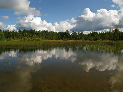
Mires and raised bogs form another hallmark, covering thousands of
hectares (e.g., Viru Bog, Laukasoo Bog ~800 ha, Hara mire). These
peatlands, some thousands of years old, feature Sphagnum moss, bog
pools, and acidic, nutrient-poor conditions. Boardwalks allow access to
sites like Viru raba, with its observation towers. Bogs occupy
depressions from former coastal formations or overgrown lakes.
Other features include:
Semi-natural meadows and alvar grasslands (on
limestone bedrock)
Small rivers (e.g., Valgejõgi, Loobu) with
waterfalls like Nõmmeveski and Jägala (Estonia’s highest at ~8 m)
Lakes and transitional wetlands
The park also includes elements of
the Kõrvemaa region to the south, with hills, mires, and lakes.
Climate
Lahemaa has a humid continental climate (typical of the
Baltic region), moderated by the Baltic Sea and Gulf of Finland. Summers
are mild and winters cold but not extreme. Coastal areas experience more
maritime influence, with frequent winds, fog, and higher humidity.
Precipitation supports the lush vegetation and bog ecosystems.
Mosquitoes can be abundant in summer, especially near wetlands.
Flora (Plant Life)
Lahemaa features rich vegetation adapted to its
northern temperate climate, acidic soils, and varied hydrology. Forests
dominate, primarily spruce, pine, and birch, with significant old-growth
stands that support specialized species.
Key habitats and
characteristic plants:
Forests: Coniferous (pine and spruce) and
mixed forests with aspen, willow, and birch. Old pine forests host
protected species like the perennial honesty (Lunaria rediviva), with
its aromatic violet flowers and silver, coin-like fruits. Other woodland
plants include wood anemones (blooming in spring), lady's slipper
orchid, and common spotted orchid.
Raised bogs (e.g., the
7,000-year-old Laukasoo and popular Viru Bog): These nutrient-poor,
acidic wetlands support specialized flora. Common species include
sphagnum mosses, cotton grass (with fluffy white seed heads in summer),
sundews (Drosera — insectivorous plants), bog rosemary, and cloudberry.
Lichens are abundant here.
Coastal areas: Sandy beaches host sea
sandwort, sea pea (a protected species), sand ryegrass, and crowberry.
Rocky shores and coastal meadows support halophytic (salt-tolerant)
plants and are important for invertebrates.
Other notable flora: Over
800 vascular plant species overall. 44 protected plant species recorded,
including Siberian lettuce and marsh gladiolus. The park documents 307
moss species and 398 lichen species, many old-forest or bog-dependent.
Rare fungi, such as the cauliflower fungus and charred pancake cup, also
occur.
The park's plant diversity benefits from minimal
fragmentation in core areas and protection under the Natura 2000
network.
Fauna (Animal Life)
Lahemaa supports a healthy
population of large mammals, making it one of the best places in Europe
for observing intact forest ecosystems. It also hosts rich avian and
invertebrate life.
Mammals (over 50 species recorded):
Large
herbivores: Moose (elk) are relatively common, especially near forest
clearings, wetlands, and young forests where they browse on willow,
aspen, and pine. Red deer and roe deer are also present.
Carnivores
and omnivores: Brown bear, Eurasian lynx, grey wolf, and wild boar
(common and active in forests and near wetlands). Sightings of bears,
lynx, and wolves are rare due to their elusiveness, but tracks and signs
are frequent. Smaller predators include red fox, pine marten, badger,
and European otter.
Other notables: Eurasian beaver (active in rivers
and wetlands), European mink (endangered), and various bats and small
rodents.
Birds (over 220 species recorded):
Raptors and large
birds: White-tailed eagle, golden eagle, lesser spotted eagle, black
stork, Eurasian eagle-owl, boreal owl, and Western capercaillie.
Wetland and coastal species: Common cranes (large flocks on coastal
meadows during migration in spring/autumn), various ducks (teal,
goldeneye, goosander, velvet scoter), plovers, redshanks, and black
woodpecker.
Forest birds: Woodpeckers (including black woodpecker),
nutcracker, and many songbirds. Coastal islands and meadows are key
breeding and stopover sites.
Amphibians and Reptiles:
Common
species include European toad, common frog, moor frog, smooth newt, and
slowworm. Small ponds and wetlands are critical breeding sites.
Invertebrates and Aquatic Life:
Rich in insects: dragonflies,
damselflies, butterflies, and diving beetles. The raft spider (Dolomedes
fimbriatus) inhabits bogs. Freshwater pearl mussel occurs in clean
rivers. Many rare or specialized species depend on old-growth and
wetland habitats.
Seasonal and Observational Notes
Best for
wildlife viewing: Dawn and dusk. Spring for birds and blooming plants;
summer for bog flowers and insects; autumn for crane migration and
fungi; winter for tracks in snow.
Iconic experiences: Walking the
Viru Bog boardwalk (great for bog plants and birds), coastal trails for
migrating cranes and sea views, or deeper forest hikes for mammal signs.
Conservation: The park protects endangered species and habitats. Large
mammals like bears and lynx indicate a well-functioning ecosystem,
though human-wildlife conflict (e.g., with boars) can occur near edges.