Location: Talsi District, Kurzeme Region Map
Area: 264.9 km²
Tel: +371 63200855
Slītere National Park is located in Talsi District, Kurzeme Region in Latvia. It covers 265 km² of untouched broadleaf forest and sand dunes (kangari in Latvian) on the Baltic Sea coast. It is inhabited by numerous species of birds and animals that include Elks, Lynxes, Wolves, Rabbits and many others. On the coast of the Baltic Sea you can encounter Grey or Ringed Seal. These animals occasionally venture on dry land. It is better to watch them at a distance. As soon as they notice human presence they usually flee in the sea. They are several species of turtles and lizards as well as copperheads that are fairly poisonous to humans. Historic Slītere Lighthouse situated on its territory is open from Wednesday to Sunday from 10am to 6pm. It was constructed on the Blue Hills in 1849- 50. It is second oldest lighthouse in the country, but also highest above sea level at an elevation of 82 m. It is inactive today and serves the needs of tourists. Here you can observe surrounding lands and get information the National Park. There are 14 different trails for hiking, skiing, or cycling in the forest.
Geological and Prehistoric Foundations
Slītere National Park,
located on the west coast of Latvia in Talsi Municipality, Courland,
preserves a landscape that serves as an "open-air museum" of the Baltic
Sea's evolutionary stages. The park's terrain reflects ancient
geological events dating back thousands of years. The Šlītere Zilie
kalni (Blue Hills), a prominent 20-30 meter high escarpment, represents
the ancient coastline of the Baltic Ice Lake from approximately 10,000
years ago. Nearby, the Stiebru Hills mark the shores of the Ancylus Lake
(8,000-9,000 years ago), while the extensive dune ridges and inter-dune
depressions (kangari-vigas complex) formed during the Littorina Sea
phase (4,000-7,000 years ago). These features highlight the park's role
in showcasing post-Ice Age environmental changes, including coastal
dunes, bogs, and primeval forests that have remained largely untouched,
earning descriptions like the "Northern Rainforest" due to their moist
microclimate and biodiversity.
Human habitation in the area traces
back to prehistoric times, with evidence of ancient settlements. The
coastal regions were home to the Livonians (Livs), one of the seven
Finno-Ugric tribes in the Baltic region, who flourished from the 10th to
13th centuries. Liv fishing villages such as Sīkrags, Mazirbe, Košrags,
Pitrags, Saunags, Vaide, Kolka, and Uši dotted the coastline for
centuries, sustaining livelihoods through fishing and small-scale
agriculture. These communities maintained active economic activities
until the pre-World War II era, contributing to the area's cultural
heritage as part of Northern Europe's indigenous legacy.
Early
20th Century: Initial Protection Efforts
The formal protection of
Slītere began in the early 20th century, making it one of the oldest
conserved natural areas in Latvia and the Baltic States. In 1921, a
natural monument spanning 1,100 hectares was established at the foot of
the Blue Hills of Šlītere, recognizing the site's unique geological and
ecological value. This was followed in 1923 by its declaration as a
nature reserve (or nature monument), solidifying its protected status
and forming the nucleus of what would become the national park. These
early measures were driven by growing awareness of the region's
biodiversity, including rare habitats like deciduous forests, coastal
dunes, bogs, and grasslands.
Mid-20th Century: Expansion and
Soviet Influence
Post-World War II developments under Soviet rule
significantly shaped the area's trajectory. In 1957 (or 1958, per some
records), the Slītere National Reserve (also called Slītere State
Reserve) was formally established, encompassing 7,861 hectares. This
marked a major expansion from the original monument, emphasizing strict
conservation. The reserve was further enlarged in 1977 to 14,882
hectares, incorporating more diverse ecosystems such as inter-dune
mires, lakes, and ancient forests. By 1979, the reserve acquired its own
dedicated administration and research staff, enabling systematic
scientific monitoring and management.
During the Soviet era, the
territory was largely closed to the public, serving dual purposes as a
nature reserve and a restricted military border zone along the
coastline. This isolation halted traditional activities in the Liv
villages, including fishing, and preserved the area from development but
also limited local economic growth. Soviet-era structures, stories, and
memories remain as historical artifacts within the park. A notable
environmental event occurred in 1960 when severe storms damaged about
100 hectares of forest; rather than clearing the debris, authorities
allowed natural regeneration, fostering resilient ecosystems.
Late 20th Century: Transition and Key Events
The 1990s brought
Latvia's independence and shifts in land management. In 1991, land
reforms returned some coastal properties, such as those in the Baži bog
area, to heirs, uniquely impacting the cultural landscape within the
reserve. In 1992, a fire ravaged the Baži bog, but like the 1960 storms,
burnt trees were left in place to support natural recovery, enhancing
the site's biodiversity (e.g., it became Europe's largest black grouse
mating site, with 66 cocks recorded in 2010). Cultural preservation
efforts included the 1993 establishment of the Kolka Liv Centre, which
houses ethnographic collections of Liv household objects. By 1999, the
area was known as the Slītere State Natural Reserve, setting the stage
for its redesignation. In the same year, the Šlītere Lighthouse, built
in the 19th century, lost its navigational status and transitioned into
a tourism site.
21st Century: National Park Status and Modern
Developments
In 2000, the area was officially redesignated as Slītere
National Park under Latvia's law on protected natural territories,
covering 16,414 hectares of dry land (plus 10,130 hectares of Baltic Sea
up to 10 meters depth), making it the smallest national park in Latvia
at 265 km² total (including 101 km² marine area). This change emphasized
not only conservation but also public education, leisure, and
sustainable tourism, aligning with its inclusion in the Natura 2000
network. The park's administration relocated to the historic Šlītere
baronial estate in late 2009.
Visitor numbers peaked in 2008, with
over 50,000 at Cape Kolka and 6,740 at the lighthouse, but dipped by
about 20% in 2009 due to the economic crisis. Today, the park promotes
nature-friendly tourism, with infrastructure like nature trails, bicycle
routes, and birdwatching sites (e.g., Cape Kolka, a major migration
route). Discussions have included potential expansions, such as
incorporating the Ovīši nature reserve or Ance swamp, to enhance appeal
while breaking old perceptions of inaccessibility. After 80 years of
relative closure, the park now balances preservation with
revitalization, safeguarding its biocenotic value—including wetlands,
rare species, and cultural remnants—while fostering community
engagement.
Overview and Location
Slītere National Park, the smallest national
park in Latvia, spans approximately 265 km² (102 sq mi), including 101
km² (39 sq mi) in the Baltic Sea. It is situated in Talsi Municipality
within the Courland Peninsula on Latvia's west coast, specifically at
the northern tip of the Kurzeme region where the Gulf of Riga meets the
open Baltic Sea. The park encompasses the area around Cape Kolka, which
marks the end of the Irbe Strait—the southern outlet of the Bay of
Riga—and includes coastal sections from Ģipka to Oviši along the
Livonian coast. This positioning places it in a transitional zone
between marine and terrestrial environments, with the park's terrestrial
portion covering about 164 km² (16,414 hectares). The landscape is
characterized by a mix of rugged coastline, dense forests, inter-dune
wetlands, and elevated ancient shorelines, making it a compact yet
diverse geographical entity often described as an "open air museum" of
the Baltic Sea's evolutionary stages.
Geological History and
Formation
The park's geology reflects multiple post-glacial stages of
the Baltic Sea's development, spanning from about 10,000 years ago to
more recent millennia. Approximately 40 million years ago, during a
sub-tropical climate period, the region accumulated sediments that now
yield fossilized amber, often washed ashore after storms disturb the sea
bed. More prominently, the landscape preserves remnants from the
Holocene era: the Baltic Ice Lake stage (around 10,000 years BP) formed
the prominent 20–50 m high ancient shoreline known as the Šlītere Zilie
Kalni or "Blue Hills," a steep escarpment that once bordered this
prehistoric lake. Subsequent stages include the Ancylus Lake (8–9
thousand years ago), evidenced by the Stiebru Hills, and the Litorina
Sea (4–7 thousand years ago), which created Europe's largest landscape
of dune dams and inter-dune wet depressions. The central study area,
covering about 3.8 km² from Saunags village to Bažu Mire, originated as
a marine accumulation plain around 4,700 years BP during the Littorina
Sea period, with inter-dune mires developing between 4,500 and 3,000
years BP. Underlying geology consists of unconfined Quaternary sand
sediments over loam and moraine clay lenses, which semi-confine a
sandstone aquifer at depths of 20–50 m, influencing groundwater flows
and mire formation. Peat profiles reveal layers of sedge peat, bog peat,
and gyttja (decomposed lake sediment with shells), indicating
transitions from lakes to fens and bogs, with active peat accumulation
still occurring in areas like Bažu Mire.
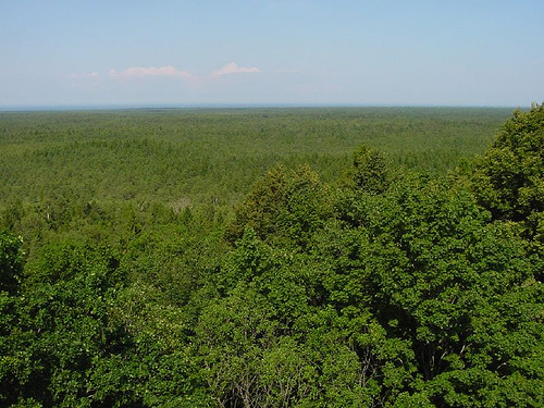
Topography and Terrain
Features
The topography of Slītere is highly varied, featuring a
unique kangari-vigas complex—a globally rare pattern of alternating dune
hills (kangari) and narrow swampy valleys (vigas) stretching for
kilometers, formed by ancient coastal processes. The Blue Hills, rising
20–50 m, dominate the inland areas as a prominent escarpment covered in
broadleaf forests, with the Slītere Lighthouse perched atop for
panoramic views. Coastal zones include tens of kilometers of white sand
beaches backed by protective dunes, which shield ancient Livonian
fishing villages like Sīkrags, Mazirbe, Košrags, Pitrags, Saunags,
Vaide, and Kolka. Inter-dune depressions host wetlands, including
open-water lakes that evolve into floating mats, poor and rich fens,
swamp woods, and bogs, with examples like the Kukšupes and Imanta mires
showcasing full mire successional stages from rich fens to raised bogs.
A notable transect perpendicular to the coast crosses 22 dune valleys,
from Bažu Mire (a large bog expanse) through inter-dune systems like
Pēterezera (a lake with surrounding fens and bogs). Inland, undisturbed
deciduous forests on the ancient lake slopes, often called "Northern
Rainforests," thrive in moist micro-climates at the escarpment's base,
while coniferous forests cover about 30% of the park. Natural
grasslands, though limited, include culturally significant old pastures
like Dāvida, Tamnītes, and Zvejnieku, reflecting historical land use.
Cape Kolka, the park's northernmost point, is a dynamic horn where the
Gulf of Riga and Baltic Sea waters converge, creating shifting sandbanks
and serving as a major bird migration bottleneck.
Hydrology
Hydrological features are integral to the park's geography, with
groundwater playing a key role in sustaining wetlands. Local and
regional flows from the old coastal plateau recharge through dunes,
creating mineral-rich, calcareous inputs in mires, as seen in low
electrical conductivity (EC) values (<15 mS/m) in most areas and higher
(>25 mS/m) in mineral-influenced zones. Temperature profiles indicate
cold groundwater (below 6.5–8°C) in deeper layers, contrasting with
warmer surface waters in treeless mires. The small Irbe River flows
southwest-northeast along the Irbe Strait coastline, emptying into the
Baltic Sea within the park; its brown moor waters continually reshape
estuarine sandbanks, and it serves as a spawning ground for brown trout
in late autumn. Inter-dune lakes, such as those in Pēterezera mire,
represent past open-water bodies now transitioning to peatlands, with
gyttja layers confirming historical lacustrine phases. Spring mires,
like Sītere near the lighthouse, add to the hydrological diversity with
calcareous outflows.
Climate
The park benefits from a mild,
maritime-influenced climate typical of Northern Kurzeme, moderated by
its proximity to the Baltic Sea and Gulf of Riga. This creates moist
micro-climates, particularly at the base of the Blue Hills escarpment
and in inter-dune depressions, fostering "Northern Rainforest"
conditions in forests and bogs. The coastal location exposes the area to
storms, which historically damaged forests (e.g., 100 hectares in the
1960s) and stir sea-bed sediments to reveal amber. Winter icing of the
sea supports Baltic grey seal nurseries—their southernmost global
location—while occasional sightings of rarer ringed seals occur. The
climate supports high biodiversity, with conditions enabling all 23
Latvian forest types and 3 bog types, plus transitional forms.
Influence on Biodiversity and Human Geography
While primarily
geographical, the terrain profoundly shapes biodiversity: the Blue Hills
host species-rich broadleaf forests with hundreds of plants and
bryophytes, including 29 unique to Latvia; inter-dune mires support
endangered species like Schoenus nigricans and Liparis loeselii, with
366 bryophyte species (65% of Latvia's total). Overall, about 860 plant
species thrive, including rarities like yew-tree and Baltic ivy, due to
the mild climate and diverse habitats. Fauna benefits from the Baltic
migratory flyways, with Cape Kolka seeing up to 60,000 birds per hour in
migrations, including bar-tailed godwits and great grey owls; large
mammals like grey wolves, Eurasian lynx, and elk roam the forests. Human
elements include ancient Liv villages integrated into the coastal dunes,
preserved partly due to Soviet-era military restrictions that limited
development for decades, leaving remnants like abandoned bases. This
blend of natural and cultural features underscores the park's role as a
preserved snapshot of Baltic coastal evolution.