Location: Map
Map: 227 km² (88 mi²)
Galičica National Park is a nature reserve situated in the South Western Republic of Macedonia between lake Ohrid to the North- West and Lake Prespa in the South- East. This park was established in 1958 and covers an area of 227 km² (88 mi²). Several hundreds species of plants and animals that live here are endemic and found no where else in the World.
Geomorphological values
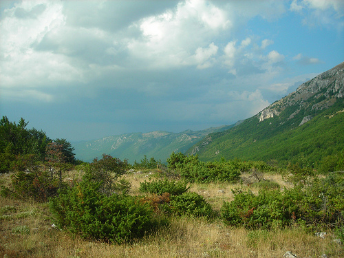
From this mountain area stretch very
beautiful views of Lake Ohrid and Lake Prespa. It is especially
attractive the possibility for the visitors to observe the two
beautiful lakes at the same time. Landscape attractive, aesthetic
and curious values refer to the mountainous sides, which Galicica
possesses.
From the high viewpoints on the mountain Galicica
stretches an extraordinary view, which reaches the mountain
Jablanica and the Albanian mountains on one side and Pelister on the
other. Although it is a high horst with dominance in this area and
extremely steep sides, the connection is very good. A road passes
through this mountain that connects the Ohrid with the Prespa
Valley.
Limestone predominates in the geological composition
of the Galicica mountain. Based on this mountain composition, the
appearance of numerous surface and underground karst relief forms is
based. From the surface karst forms, there are valleys, spinners and
karst fields, and from the underground, numerous postmen are
interesting. The largest and most important are: Crna Peshtera,
Meckina Dupka, Samoska Dupka and others. These caves are not yet
tourist valorized.
Among the more significant values of the
national park "Galichica" should be noted the shoreline of the
aquarium on Lake Ohrid and Lake Prespa. The west shore of Lake Ohrid
is mostly straight, with a visible peninsula. In contrast, the east
coast, most of which belongs to this national park, is characterized
by curvature. Total 63km. from the shore of Lake Ohrid belongs to
the line with a steep shore, with smaller and larger peninsulas,
capes and bays. As a special value are imposed the caves that are
located on the stretch south of the peninsula Gradiste, around the
village Trpejca and near the monastery of St. Naum. The shoreline of
Lake Prespa has four larger and three smaller peninsulas and two
islands.
Climate values
Climatic values in the national
park "Galichica" are different. They differ in the valley in
relation to the mountainous part. But basically the factors that
determine the climate are almost the same. It should be noted that
the clutter in terms of climate is present in this area. Thus, the
average annual temperature of 1,500 meters above sea level is about
7 ° C. The average annual temperature in July and August was around
21 ° C, and in January and February 0.8 ° C. This means that these
are very favorable temperature characteristics, both in summer and
in the winter part of the year. It provides hiking and
mountaineering activities, as well as skiing activities in the
winter part of the year. Which of the following characteristics are
added to the other climatic elements, such as the height of
precipitation of 1,100 mm, the pronounced insolation, which moves
over 2,000 hours of sunshine during the year and the like. The
amount of snowfall is relatively poor, which is characteristic in
the months of December, January and February, and in November and
March there is only a small amount of snow. This shortens the winter
ski season in this area.
Hydrographic values
The
hydrographic values of the national park "Galichica" are quite
emphasized, although the mountain belongs to the group of the driest
spatial units in the Republic of Macedonia. This feature of Galicica
arises primarily from the geological composition of this mountain.
It belongs to the group of the most limestone mountains in the
Republic of Macedonia, which means that it is a distinct water
permeable terrain, which conditions the occurrence of a small number
of expired watercourses. Nevertheless, there are permanent springs
and watercourses in the wider area of the national park. They have
significant value. The following should be noted: the springs at the
monastery of St. Nahum, the springs of the locality Letnica above
the village Ramne, and the river Cherava (its sources are in
Albania). Of all these hydrographic phenomena, the springs of the
monastery of St. Naum are of the greatest importance.
Biogeographical values
The interesting
hydrographic form and the lush surrounding vegetation, the wildlife
of the surrounding area, as well as the rich living world in the
water, is so harmonized that makes this spring one of the most
attractive places in the Republic of Macedonia. This is due to the
beautiful beaches that are located nearby, as well as the remarkable
monastery complex of St. Naum. The flora and fauna are important
values of the national park "Galichica". Although it is a mountain
with hard-to-reach slopes and rocky outcrops, as well as altitudes
of over 1,500 meters, there are still some interesting flora and
fauna, which constitute the primordial values, which gives the
national park a special dimension. Representatives of various
floristic types exist in this area. They are located on steep and
vertical rocks, on rocks and boulders, or on shallow or deeper soil.
This diversity of relief and pedological substrate, as well as other
environmental factors, have led to the emergence of various floral
forms that are very rare or are unique to this area.
The
plant world is represented by over 600 floristic species, of which
over 170 are of woody vegetation. Such diversity can not be observed
on other mountains in the Republic of Macedonia. It does not refer
only to the Republic of Macedonia, but also to significantly wider
areas. In the area of the national park "Galichica" the diversity
of plant species and ecological conditions have created a large
number of floristic communities. Galicica is represented by
communities that are characteristic of the regions under the
influence of the sub-Mediterranean climate, ie by heat-loving and
dry-tropical communities, as well as communities that are
cold-resistant and that are characteristic of the alpine region. On
the mountain Galicica there are plant species that existed in other
conditions, ie they exist as relict species, as well as species that
have endemic significance. In terms of tourism, they possess the
most curious feature, and are often used for educational purposes.
From the plants that represent a special value in the national
park "Galichica", the plants from the woody vegetation and the
relict and endemic forms should be emphasized.
Of the woody
plants, the following deserve special attention: the wild and the
subterranean faya, the pine molika and the munika, the
large-flowered halo, the shishmir, the horse chestnut and others.
Among the relict plants should be noted: Morina percica, Stipa
payeri, Phelipaea boiseieri, Ranonda nathaliae, Berberis croatica.
Endemic plants include: wild foyer (Juniperus exelsa), tame
foyer (Juniperus foethoisima), moth (Pinus peuce), munica Pinus
heldreichii, omelica (Genista rediata), Lilium Heldreichii, Lilium
candidum, Nepeta ernesti - mayeri.
The national park
"Galichica" is characterized by interesting and diverse wildlife.
Research on large fauna indicates the existence of about 170 species
of animals, of which 10 species are amphibians, 18 species of
reptiles, 124 species of birds and 18 species of mammals. There are
thousands of other animals, most of which have been studied in Lake
Ohrid. The richest wildlife is possessed by the spaces in the
national park in which the presence of man is reduced. Such is the
case with the island of Golem Grad, where a large number of diverse
funistic specimens live on it and in the waters around it. The
reverse is the case in the areas of the park where man entered by
settling and building traffic and other facilities.
Anthropogenic values of the National Park Galicica
Cultural-historical values
The National Park "Galichica", in
addition to natural values, has significant cultural and historical
monuments. These are the following: St. George, the church of St.
Bogorodica Peshtanska Zahumska, the cave churches of St. Stephen and
St. Bogorodica Pestanska, the monastery of St. Nahum and the church
of St. Peter on the island of Golem Grad in Lake Prespa.
Recreational activities
Based on this
emphasized wealth, the Galicica National Park can be used for walks
and running on recreational trails. Locating lookouts in convenient
places, such as Baba ridge (1,631 meters), Lako Signoj peak (1,953
meters), Gola Buka peak (1,897 meters) and Elenov Vrv (1,221
meters), above the village of Velestovo, as well as in other places,
should discover the possibilities of beautiful views that two
valleys and mountainous areas. The high sections are excellent
terrain for mountaineering. Thus, the section below the Magaro peak
(2,255 m) is 760 meters high and is much larger for alpine conquest,
while the sections below the Golem Vrv and Tuglash peaks, which are
180 meters high, are suitable for beginner climbers. The caves in
this national park are used only by speleologists, although there
are conditions for speleological tourism activities. Winter-sports
skiing activities take place in the Suvo Pole complex, below the
Tomoros peak (1,675 meters), ie in the Oteshevo complex, but there
are conditions for fitting in other areas in this type of tourist
offer. The mentioned opportunities for tourist activities complement
the swimming and sunbathing activities, as a dominant tourist offer
in this area.
There are certain protection zones in the
national park. These are the following zones:
Strictly protected
area which includes landscapes and biotopes, mosaically arranged in
the category of the most important natural resources. Such are the
coastal rocks and caves, the areas of Magaro, the island of Golem
Grad, the springs at Sv. Nahum and the high mountain puddles.
Tourist-recreational zone has two. These are the areas from Pestani
to the border with Albania on Lake Ohrid and the areas from Stenje
to the border with Albania on Lake Prespa.
Reclamation zone,
which covers the areas of natural values of the second and third
category, which are located throughout the national park.
In
the strictly protected zones, only supervisions can be performed for
scientific purposes, and as an exception, organized visits for
educational and cultural needs, with the prior approval of the
national park management.
Tourist-recreational zones are divided
into zones with regular regime (closed for a certain period) and
zones for free visit. In the zones with regular mode, only
pedestrian visits are allowed on the clearly marked paths. The free
visit zone is used for rest and recreation and for the construction
of infrastructural and superstructural tourist facilities.
The
winter sports area can be used to build ski slopes.
In the land
reclamation zone, the use of pastures, forests and land is
controlled and by applying breeding and other measures provided by
the forest use program.
The National Park "Galichica" has an
administration that takes measures to organize the technical and
guard service and control of activities on the territory of the
park. However, endangering the national park is a very big problem,
despite the actions taken. Tourism should be in the function of
preserving these values, so that it can use them as such. Such is
the case with the complex around the springs of the Black Drim,
which are located in a zone with a strict protection regime, and
traditionally in that part tourist-recreational activities take
place. Similar problems exist in other parts of the coast, such as
north and south of Trpejca, especially around the church of St.
Mother of God Zahumska.