Location: Norrbotten County (Norrbottens län) Map
Area: 1,984 km2 (766.0 sq mi)
Padjelanta National Park, also known as Badjelánnda in the Sami language (meaning "the higher land"), is Sweden's largest national park, covering an expansive 1,984 square kilometers (766 square miles) in the Norrbotten County of Swedish Lapland. Established in 1963, it forms a crucial part of the UNESCO World Heritage Site Laponia, designated in 1996 for its outstanding natural and cultural values, encompassing Sami indigenous heritage alongside pristine wilderness. Located at coordinates approximately 67°15′N 17°30′E, near the Norwegian border, the park features a vast alpine plateau with large lakes, gentle mountains, and open valleys, contrasting sharply with the rugged peaks of neighboring Sarek National Park. Often described as a botanist's paradise due to its rich floral diversity, Padjelanta attracts hikers, wildlife enthusiasts, and cultural explorers seeking solitude in one of Europe's most untouched landscapes. As a roadless area, it emphasizes sustainable tourism, drawing about 10,000-15,000 visitors annually who appreciate its serene, highland beauty and Sami traditions.
Prehistoric and Indigenous Sámi History (Stone Age to Present)
Human presence in the Padjelanta area dates back to the Stone Age
(roughly 6,000–7,000 years ago or earlier). Archaeological evidence
includes numerous trapping pits for reindeer and other game, ancient
hearths, storage pits, and other traces of seasonal camps. The
landscape’s herb-rich meadows and fish-filled lakes have long supported
hunting, fishing, and gathering.
The Sámi (Sweden’s only Indigenous
people) have inhabited and used the region continuously for millennia as
part of their traditional reindeer-herding culture. By early medieval
times, reindeer herding had become central. Today, three Sámi
villages—Duorbun (Tourpon), Jåhkågasska, and Sirges (Sirkas)—still graze
reindeer here in summer, using traditional settlements such as
Stáloluokta, Árasluokta, and Sállohávrre. Fishing in the lakes continues
under Sámi rights. Few visible traces of human activity exist beyond
subtle features like old huts, fireplaces, and reindeer paths—visible
mainly to a trained eye.
A major cultural discovery came in 1990 when
Sámi reindeer herders found panels of rock art (petroglyphs) carved into
soapstone. These depict boats (including possible Viking-era sailing
vessels), harnessed reindeer, and anthropomorphic figures interpreted as
representations of Máttaráhkká (the Earth Mother in Sámi cosmology).
Scholars view the site as a sacred or liminal place with ritual
significance, possibly dating to the Iron Age or medieval period. The
area also shows evidence of prehistoric soapstone and asbestos mining
(Bronze Age onward). These carvings underscore Padjelanta’s role not
just as a resource landscape but as a spiritually important site in Sámi
worldview.
The park forms part of the traditional lands of the Lule
Sámi. Reindeer have migrated to its meadows for thousands of years,
shaping the cultural landscape.
Early Scientific and Exploration
Interest (18th–Mid-20th Century)
Scientific interest in Padjelanta
began with modern natural history. In 1732, Carl Linnaeus (the father of
taxonomy) traveled through the area during his famous Lapland journey,
visiting the Virihaure lake and Stáloluokta region and documenting its
flora and fauna.
By the 19th and early 20th centuries, botanists,
geologists, and zoologists were drawn to the park’s unique ecology. The
underlying calcareous bedrock, combined with high precipitation and late
snowmelt, supports rare alpine plants (e.g., certain sandworts,
cinquefoils, and gentians) not found elsewhere in Sweden, along with
rich lichen diversity. This “flourishing meadows” quality made the high
plateau stand out even among other Swedish mountain regions.
Path
to National Park Status (1957–1962/63)
In 1957, Swedish author and
botanist Sten Selander proposed designating the area as a national park,
citing its exceptional high-altitude flora and pristine alpine
landscape.
The Swedish Parliament approved its creation in 1962 (some
sources cite the formal establishment as 1963). It was part of a second
wave of Swedish national-park expansion after the pioneering 1909 parks.
The explicit purpose was “to preserve an alpine landscape rich in lakes
and extensive heaths in its natural condition.”
From the outset, the
government emphasized that this was an important Sámi area and that
traditional reindeer herding and cultural use must continue. Unlike
stricter “no-use” parks elsewhere, Padjelanta was established with
explicit respect for Indigenous rights—an approach that reflected
evolving Swedish policy toward Sámi land use.
Post-Establishment
Developments (1960s–1990s)
After establishment, the park quickly
gained international recognition. In 1967 it received the European
Diploma of Protected Areas (later renewed), affirming its high
conservation value.
Tourism infrastructure developed gradually. The
famous Padjelantaleden trail (about 140 km) runs through the park, with
overnight cottages originally managed by the Swedish Environmental
Protection Agency (Naturvårdsverket) and later transferred to Sámi
villages under the cooperative Badjelánnda Laponia Turism (BLT). Other
trails, such as sections of the Nordkalottruta, also cross the area.
Motorized access remains heavily restricted (except for Sámi reindeer
management), preserving its wilderness character.
UNESCO World
Heritage Designation (1996) and Contemporary Era
In 1996, Padjelanta
became a core part of the Laponian Area (Laponia) UNESCO World Heritage
Site—one of the world’s largest mixed natural-cultural properties.
Laponia (totaling 940,900 hectares) includes Padjelanta, Sarek, Stora
Sjöfallet/Stuor Muorkke, Muddus/Muttos National Parks, and adjacent
nature reserves. UNESCO recognized its outstanding universal value for:
Dramatic subarctic natural landscapes shaped by glaciation.
The
continuing traditional Sámi reindeer-herding culture, which has shaped
the land for millennia.
The inscription highlighted both the
park’s exceptional beauty (large alpine lakes backed by mountains) and
its role as one of the last large areas on Earth where an ancestral
Indigenous way of life persists.
Management of Laponia involves a
unique co-governance model with significant Sámi representation
(Laponiatjuottjudus), reflecting decades of Sámi ethno-political
advocacy for greater say in their traditional lands. No major
post-establishment conflicts have disrupted Padjelanta specifically;
reindeer herding, limited fishing, and low-impact tourism coexist with
strict conservation rules.
Overall Historical Significance
Padjelanta National Park stands as a rare example of successful
integration of Indigenous cultural continuity with modern nature
conservation. From Stone Age hunting grounds to a Sámi cultural
landscape, from Linnaeus’s 18th-century explorations to Selander’s 1957
vision, and onward to its 1962/63 protection and 1996 UNESCO status, the
park has preserved both its extraordinary natural values and its deep
human history. Today it remains a living testament to Sámi resilience
and Sweden’s commitment to protecting one of Europe’s last great
wildernesses—while explicitly honoring the people who have called the
“higher land” home for thousands of years.
Topography and Landscape
Padjelanta is defined by a vast highland
plateau that sits well above sea level, giving the park its Sámi name.
Elevations typically range from about 600–1,200 m, with an overall
average of around 824 m; the highest points reach approximately
1,900–1,918 m in surrounding massifs, while alpine plains sit at 700–800
m.
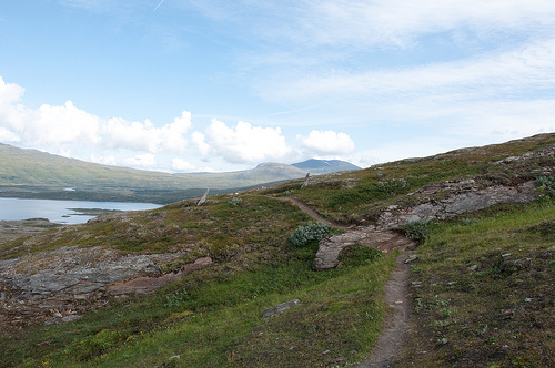
The terrain is open, gently rolling, and relatively flat,
dominated by sweeping plateaus, undulating hills, and broad heaths
rather than the sharp, dramatic peaks and deep valleys of neighboring
Sarek. This creates a wide-open, tundra-like feel with excellent
long-distance views across vast expanses.
The landscape features:
Rolling hills and dry ridges formed by glacial scouring.
Extensive alpine tundra and open mountain heaths.
Wetlands, mires,
and boulder fields.
It contrasts sharply with the more rugged
alpine character of Sarek to the east and the higher, glaciated
Sulitelma (Sulidälbmá) massif along the Norwegian border to the west.
Small U-shaped valleys, marshlands, and permafrost-influenced features
(such as patterned ground) add subtle variety to the otherwise smooth
contours.
Major Features: Lakes, Hydrology, and Glaciers
Two
massive mountain lakes dominate the central plateau: Virihaure
(Virihávrre) — often called one of Sweden’s most beautiful lakes — and
Vastenjaure (Vastenjávrre). These enormous bodies of clear, cold water
(Virihaure sometimes feels like an inland sea) are surrounded by gently
sloping shores and framed by distant snow-capped peaks. Other notable
lakes include Salojaure. Together they create a striking hydrological
network of blue corridors cutting through the green-brown tundra.
The
lakes are fed by numerous streams and rivers (some with distinctive
green glacial silt) and drain into a system of wetlands and mires. Fish
populations thrive in the cold waters. Glaciers, though modest in scale
(about 14 km² total, including Almaijekna), cling to higher slopes and
contribute meltwater; they have been shrinking due to climate change.
Geology and Landforms
The park’s landforms were sculpted
primarily by Quaternary glaciation during the last Ice Age, which carved
the plateaus, U-shaped valleys, lake basins, and boulder fields. The
underlying bedrock belongs to the Caledonian mountain chain (formed ~400
million years ago) and includes significant calcareous (calcium- and
chalk-rich) deposits alongside some ultramafic rocks. This nutrient-rich
geology is unusual for Scandinavian fells and creates fertile conditions
that support exceptional plant and lichen diversity.
Flat-topped
mountains (e.g., parts of the Tarrekaise massif) and extensive morainal
deposits further characterize the terrain.
Climate
Padjelanta
has a subarctic to Arctic-alpine climate with long, harsh winters and
short, cool summers. At lower stations like Staloluokta (~600 m), the
1991–2020 normals show an annual mean temperature of 0.3 °C, with July
averaging 10.7 °C and January/February around –8 °C. Annual
precipitation is about 579 mm, much of it as snow that can linger into
summer at higher elevations. Strong winds are common, and weather can
shift rapidly. The park experiences the midnight sun in summer and polar
night in winter.
Vegetation, Land Cover, and Biogeography
Land
cover consists predominantly of alpine tundra, open heaths,
wetlands/mires, and grassland. The calcium-rich bedrock and relatively
high precipitation (combined with late-lying snow) produce unusually
lush alpine meadows and a remarkable flora: over 400 species of vascular
plants and a record number of lower plants (thallophytes). Rare or
regionally unique species include Arenaria humifusa, Gentiana aurea, and
Potentilla robbinsiana (known in Europe only from Padjelanta). Lichens
are extraordinarily diverse.
Summary of Key Geographical
Statistics
Area: 1,984 km²
Elevation range: ~600 m (near lake
shores/lower plateaus) to ~1,918 m (peaks)
Glacier cover: ~14 km²
Mountain-birch forest: ~14 km²
Dominant landforms: High plateau,
large lakes, heaths, tundra
Padjelanta’s geography is a classic
example of a glaciated Scandinavian high plateau — open, accessible yet
remote, nutrient-enriched by its bedrock, and visually framed by
surrounding alpine massifs. Its scale, hydrological richness, and
ecological uniqueness make it a cornerstone of northern Europe’s
mountain wilderness.
Padjelanta is renowned for its exceptionally rich flora, thanks to
the lime-rich soils and varied microclimates, making it a haven for
botanists with a multitude of rare and colorful plants. The park's
meadows burst with wildflowers in summer, including species like
mountain avens, globeflowers, and various orchids, creating vibrant
carpets along trails. Birch and willow groves dot the landscape,
transitioning to alpine heaths at higher elevations, with mosses and
lichens dominating the mires.
Fauna is equally diverse, supporting
large populations of reindeer herded by Sami communities, alongside
predators like wolverines, arctic foxes, and lynx. Bird species thrive
here, including golden eagles, rough-legged buzzards, and waders in the
wetlands, with the lakes hosting fish like arctic char. The park's
remoteness ensures minimal disturbance, fostering a balanced ecosystem
where seasonal migrations of birds and mammals add dynamic life to the
serene highlands.
Padjelanta's attractions center on its natural and cultural features, with the Padjelanta Trail (Badjelánndaleden) as the premier route—a 160-kilometer loop traversing blooming heaths, rivers, and lakes like Virihaure, offering stunning views and encounters with Sami culture. Key highlights include the expansive moors, mountain hills, and the vibrant Sami landscape, with opportunities for birdwatching and flora spotting. Shorter day hikes from access points like Staloluokta lead to sacred Sami sites or glacial valleys. Attractions also include the large lakes for fishing (with permits) and the park's open terrain for wilderness camping. For multi-day adventures, the trail connects to Kvikkjokk, providing a full immersion in the "higher land's" serene beauty.
Padjelanta is a roadless wilderness, requiring at least a half-day hike to access, with main entry points from Kvikkjokk (Sweden) or Sulitjelma (Norway) via the Padjelanta Trail. No entry fees apply, but visitors must follow strict rules: no fires outside designated areas, no motorized vehicles, and "leave no trace" principles to protect the fragile environment. Best visited in summer (June-September) for hiking and flora; winter access is limited to experienced skiers. Accommodations include mountain huts along trails (book via STF); camping is allowed but requires proper gear for variable weather. Tips: Prepare for mosquitoes in summer; check weather forecasts as conditions change rapidly; respect Sami cultural sites and reindeer herding. Official resources: www.sverigesnationalparker.se for maps and updates.