Location: Delta Amacuro Map
The Orinoco Delta, also known as Delta del Orinoco, is a vast fan-shaped river delta in eastern Venezuela, formed where the Orinoco River meets the Atlantic Ocean. It is one of the eight natural regions of Venezuela, encompassing the entire Delta Amacuro State and small portions of Monagas and Sucre States, covering approximately 43,646 square kilometers (16,852 square miles). This region is a highly dynamic fluvial-marine sedimentary basin developed during the Holocene, characterized by its non-centric, lagoon-lacking, oceanic structure, with the river splitting into numerous distributaries called caños. The delta is home to indigenous Warao communities, who have inhabited the area for centuries, and it supports a mosaic of ecosystems including flooded forests, mangroves, and wetlands. Recognized as a UNESCO Biosphere Reserve since 1991, it emphasizes the conservation of its rich biodiversity and water resources, while facing ongoing threats from human activities. As of August 2025, the delta continues to be a focal point for environmental studies and sustainable development efforts in Venezuela.
The Orinoco Delta is located in northeastern Venezuela, forming a re-entrant between the Peninsula of Paria and the Guayana highlands, partially sheltered by Trinidad and fronted by a wide continental shelf. It is divided into principal and secondary sections: the principal between Caño Manamo and the left shore of Caño Araguao, hosting most villages including the capital Tucupita; and the secondary between the right shore of Caño Araguao and Río Grande. The delta plain spans about 22,000 km², featuring a network of distributaries, permanent wetlands, marshes, oxbow lakes, and small gallery streams. Geomorphologically, it includes river levee systems at the apex and a wide outer zone of swamps and marshes with chenier systems, built by fine-grained sediment from the Orinoco and Amazon Rivers. Sediment dynamics are influenced by annual flood discharge, tidal oscillations, and longshore transport from the Amazon via the Guayana littoral current. The delta's sediments contain iron- and aluminum hydroxides adsorbed onto clay minerals, forming chlorite-like structures. Pelagic and coastal features include a freshwater plume seaward of Boca Grande, disrupted by the Gulf of Paria.
The climate of the Orinoco Delta and basin is tropical, with seasons defined by rainfall variations rather than temperature changes. It is perhumid tropical, with precipitation ranging from 500–2,000 mm in the north to as high as 8,000 mm in the south, featuring two distinct dry and wet seasons. The rainy season (winter) extends from April to October or November, while the dry season (summer) is most pronounced from November through March or April, influenced by the intertropical convergence zone's migration. Annual rainfall varies: coastal and barrier areas receive less than 510 mm, while windward slopes near the Andes can get up to 4,572 mm, supporting rainforests. Temperatures are uniform, averaging 25–28°C, with minimal monthly variation but significant diurnal swings. Relative humidity is around 70%, with pelagic influences on coastal areas. As of 2025, climate change scenarios indicate increasing severity of thermal extremes and altered precipitation, potentially exacerbating floods and droughts in the region.
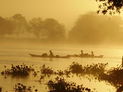
The Orinoco Delta has been inhabited by indigenous peoples for millennia, with the Warao (meaning "canoe people") being the primary group, living in palafitos (stilt houses) and relying on fishing and gathering. Christopher Columbus encountered the delta during his third voyage in 1498, mistaking it for the mainland and noting its freshwater outflow, which he believed indicated paradise. Spanish explorers in the 16th century, including Diego de Ordaz and Alonso de Herrera, navigated the river, facing resistance from indigenous groups. Colonization brought diseases and enslavement, decimating populations; by European arrival, around 350,000 indigenous people lived in Venezuela, but numbers plummeted. The delta remained relatively isolated during colonial times, used for trade and missions. In the 20th century, oil exploration and development altered the landscape, with dams like Caño Mánamo in the 1960s causing salinity increases and ecological disruption. Recent events include Warao migration due to Venezuela's crisis, with many fleeing to Brazil since 2017, and ongoing mining threats. As of 2025, the delta faces continued challenges from economic and political instability.
The Orinoco Delta is a biodiversity hotspot, featuring the Orinoco Delta swamp forests ecoregion with flooded grasslands, seasonally flooded forests, palm communities, mangroves, swamp forests, and marsh forests. Vegetation includes hardwood trees like guiana chestnut (Pachira aquatica), mahogany (Swietenia macrophylla), kapok (Ceiba pentandra), and palms such as açaí (Euterpe oleracea) and moriche (Mauritia flexuosa). Mangroves dominate coastal and river margins, with the Guianan mangroves ecoregion, while inland areas have Orinoco wetlands. Biodiversity includes over 175 bird species, such as scarlet ibis (Eudocimus ruber) and roseate spoonbill (Platalea ajaja), and threatened mammals like jaguar (Panthera onca), bush dog (Speothos venaticus), and giant river otter (Pteronura brasiliensis). Reptiles feature the critically endangered Orinoco crocodile (Crocodylus intermedius), and aquatic life includes Amazon river dolphins (Inia geoffrensis). Pelagic fish and mollusks abound in coastal areas. The delta's complex hydrology supports diverse trophic networks, with high primary productivity from nutrient-rich sediments.
The Orinoco Delta Biosphere Reserve, covering the ODBR and Lower Orinoco River Basin, is a UNESCO-designated site emphasizing wetland conservation. Conservation objectives include installing operations in biologically representative pilot sites, promoting compatible land uses, and adapting environmental management frameworks. Protected areas encompass Delta del Orinoco National Park, Turuépano National Park (726 km²), and Mariusa National Park (2,650 km²), with a conservation target of 91% under the Global Safety Net. Efforts involve indigenous Warao communities, private sectors, and stakeholders in phased interventions, funded by GEF with USD 9.5 million grant and USD 23 million co-financing. Priority actions for the decade include regulating oil exploration, preventing pollution, and sustainable community practices. The project is completed, but outcomes up to 2025 are not detailed; the reserve's status is protected but vulnerable.
The delta faces multifaceted threats, primarily oil exploration and extraction, causing habitat destruction, pollution, and displacement of Warao people. Water diversion projects like the Caño Mánamo dam (1960s) have increased salinity, disrupting flora and fauna with daily fluctuations of 1–2 meters. Climate change and sea level rise pose risks to the low-lying delta, potentially leading to submergence and ecosystem shifts. Other challenges include agricultural expansion, hunting, fishing, and upstream pollution. Venezuela's crisis has driven Warao migration, with 700 relocating to Brazil by 2023. Heavy exploitation in northern areas with population pressures exacerbates issues.
Tourism in the Orinoco Delta focuses on ecotourism and cultural immersion, with activities including boat tours through caños, wildlife viewing (dolphins, birds), visits to Warao villages for handicrafts and traditional experiences, fishing, and canoeing. Attractions encompass mangrove-fringed islands, indigenous huts, and the delta's scenic waterways. Lodges and camps offer stays in palafitos, with guided expeditions exploring the swamps and forests. As of 2025, tours emphasize sustainable practices, with access from Tucupita or Maturín; the delta is part of Venezuela's top destinations like Canaima.
Research in the Orinoco Delta emphasizes geomorphology, hydrology, and ecosystem integrity, with studies on sediment dynamics, pelagic fish, and climate impacts. Key findings include the delta's reliance on Orinoco and Amazon sediments, with erosion regimes varying between weathering- and transport-limited. Paleoecological literature reviews tropical peatlands, including the delta, for lessons on anthropocene impacts. The delta's role in marine biodiversity and pelagic ecosystems is studied in South American contexts. Scientific importance lies in its baseline for wetland conservation and sea level rise modeling.
Recent updates as of August 2025 include climate change scenarios projecting increased thermal extremes in the pampas region, potentially affecting the delta. In 2023–2025, Warao migration continues due to crisis, with communities seeking refuge in Brazil. Conservation projects remain completed, but no new outcomes are detailed; tourism promotions highlight the delta's attractions amid Venezuela's challenges. Unusual drainages research in 2025 notes the delta's hydrological uniqueness. No major incidents like spills are reported, but ongoing threats persist.