Location: San Juan Province Map
Area: 760 km²
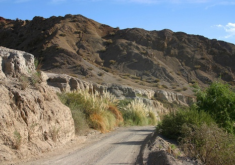
The El Leoncito National Park is located on the western slopes of
the Tontal mountains in the south of the Calingasta department,
extreme southwest of the province of San Juan in Argentina. It is
located 34 km from the town of Barreal and on the border with the
province of Mendoza. It has an area of 89,706 ha of 7,793 m². It
is crossed by a 20 km section of the National Route 149 route that
connects Barreal with Uspallata.
General characteristics
The management plan of the national park highlights the values to
be conserved in it: exceptional atmospheric conditions; water system
of the western slope of the Sierra del Tontal and the associated
biodiversity; three ecoregions represented: Monte de Sierras y
Bolsones, Puna and Altos Andes; presence of endemic species and
species with some degree of threat; species of functional value;
paleontological resources of high scientific value; cultural
resources.
In its extension, it conserves representative
samples of plant species (xerophytic, humid, high mountain and high
Andean species), preserves the habitat of endangered animal species
(suri cordillerano and guanaco), protects historical sites (El
Leoncito ranch house) and deposits of paleontological and
archaeological importance. There was the presence of a valley which
gave it the radiant white color that characterizes it.
Within
the park, different landscapes can be distinguished, from the valley
to the foothills. Inside it are the Félix Aguilar Observatory
(former Dr. Carlos U. Cesco Astronomical Observatory), the El
Leoncito Astronomical Complex (CASLEO), one of the most important in
the country, and a sand-carrying track.
The national park
records the existence of 75 families of vascular plants that contain
602 entities. The existence of 166 vertebrate entities was
confirmed: 26 species of mammals (3 exotic), 123 species of birds (2
exotic), 13 species of reptiles, 2 species of amphibians and 2
species of fish (1 exotic).
The national park records the
presence of a site that dates back to the Inca Empire, since the
Inca Trail passed through there.
The only authorized entrance
to the national park is in the vicinity of the Leoncito stream, on
the road that joins National Route 149.
Zoning
Extensive
Public Use Zone: covers 951 hectares (1.05% of the total area) and
includes: the Rancho de Abajo trail, the Cerro El Leoncito trail,
the path (25 m on each side of it) that goes from the astronomical
observatory CESCO to the Mirador Portezuelo del Tontal and National
Route 149.
Intensive public use area: covers 345 hectares (0.38%
of the total area) and includes a 200 m strip on both sides of the
entrance road, reaching the CASLEO and CESCO observatories, also
including the Landscapes interpretive trail. of water.
Special
Use Zone: covers 469 hectares (0.52% of the total area) and includes
the areas where the infrastructure is located to carry out
operational activities of the APN as well as the observatories
(located in this area).
Intangible Zone: covers 89,079 hectares
(98.06% of the total surface) and includes all the surface not
included in the other zones.
Management
By resolution No. 126/2011 of the
National Parks Administration of May 19, 2011, it was established that
the national park would be classified for administrative purposes in the
category protected areas of complexity III, for which it is headed by a
designated intendant, On which 4 departments depend (Administration;
Works and Maintenance; National Park Rangers; Conservation and Public
Use) and the Dispatch and Entry, Exit, and Notifications Division. The
intendency has its headquarters in the town of Barreal.