Location: La Pampa Province Map
Area: 99 km2
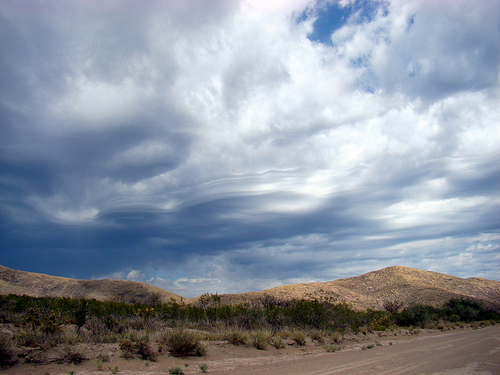
Lihué Calel National Park is situated in La Pampa Province in
Argentine. Established in 1977 it covers an area of 99 km2. Lihué
Calel National Park is covered by savannahs and deserts in the
mountainous terrain. It is inhabited by guanacos, maras (Patagonian
hare), armadillos, foxes, vizcachas and many other animals. One of
the more dangerous animals that inhibit these lands is a puma, large
carnivorous cat. These are usually shy animals and try to avoid any
contact with humans, but under certain circumstances it can turn
violent. Don't threaten it or approach it too closely. It is no
house cat. Birds that inhabit Lihué Calel National Park include
magnificent condors, rheas (South American specie of ostriches),
owls, yellow cardinals, gray falcons, martineta and others.
Lihué Calel National Park in addition to its flora and fauna is
famous for archaeological site of indigenous prehistoric people that
once lived here. One of the most visible sights of their presence
are various sites of rock art. They consist of geometric patters
made with red and black natural paint. Some date as early as 2000
BC. One of the easiest way to get here is by taking the hiking trail
known as the Valley of the Paintings. It is about 600 meters long
and take to the cave covered by ancient rock paintings.
The Lihué Calel mountain ranges stand out, originating
240 million years ago from strong lava eruptions (in modern times
plutonic or volcanic activity is non-existent in the area), the worn
peaks of these ancient mountains reach 589 meters above sea level with a
summit at the Cerro Sociedad Científica Argentina, such reliefs have
gentle slopes on the slopes to the north, and abrupt ones on the south.
In the park the tussok dominates and, thanks to the higher humidity, the
sparse thorny mount, whose vegetation is bushes of jarillas, with groves
of caldén, piquillín, shrieking bush and incense or molle.
The
Lihué Calel mountain range has more humid areas, due to the
impermeability of the soil; there are small seasonal spring-autumn
streams, which infiltrate the sandy soils. In this way, the presence of
these relatively small eminences in the middle of the semi-arid plains
and plateaus of Comahue create a relatively benign microclimate, much
more humid and therefore somewhat less continental than that of its vast
surroundings.
Flora
Thus, small forests of bull-shaded caldens
appear: typical formation of the spinal cord, which appears as spots on
the mountain. There are endemic plant species of these mountains: two
daisies and a legume.
There are some groves of the tree called
caldén.
A more humid flora appears in the rocky areas: ferns,
carnations of the air (epiphytes on stones), and various cacti such as
the puelchana (Cylindropuntia tunicata), the puelchana has undergone
such a transformation that its ancient spikes today resemble hair) and
the cardones, pencas and the "traicioneras" (species of cacti with very
aggressive thorns). On the rock faces there are lichens in yellow,
orange and blackish circular figures.
Fauna
There are
vizcachas, guinea pigs, guanacos, maras ("Patagonian hares"), Pampas
foxes, wild cats, grassland cats, little ferrets, pumas, furry cats, and
red lizards.
Birds: martinetas, crested cockerels, gray falcons,
yellow cardinals (at risk of extinction due to capture to be sold as a
domestic animal), buteos, jotes, caracaras, chimangos, calandrias,
choiques ("rheas from the south") and occasionally condors. In total
there are 150 species of native birds.
When the caldén fruits
ripen, flocks of Burrowing Parrots arrive to eat their seeds. The
tuco-tuco and armadillos like the piche live in caves to escape high
temperatures.
Previous history and cultural values to preserve
Archaeological sites are preserved where prehistoric indigenous people
inhabited the region and were related to the environment of the
mountains. In the Valle de las Pinturas there are samples of the "late
rock art" of the region: representations of geometric motifs in red and
black colors (2000 years BC).
The mountains of Lihué Calel (a
pleonasm since in Mapundungun lihué means life and calel mountain range:
mountain range of Life), with the fresh water reserve, developed a
specific flora and fauna. And the environment was used by the indigenous
people since prehistoric times. Those hunters and gatherers had:
seeds and fruits of the caldén and chañar trees
guanacos, choiques
and piches (species of armadillos).
rocks to make tools.
pigments
for painting
hollows and walls to express their experiences.
There are places in the park where these peoples made art and buried
their dead.
Until the 18th century, the territory was inhabited
by the Patagonian ethnic group of the Guenaken (or gününakuna) called
"puelche" (people from the east) by the Mapuche who in that century
broke into and invaded the ancestral Chonk territories from the
south-central part of what is now Chile. , the transculturation of the
Guenaken, their Mapuchization, originated the ethnic group of the
Ranculche (people of the reeds), such peoples inhabited this region, as
a halt for their displacements between the Andes mountain range and
these territories of the provinces of La Pampa and from Buenos Aires.
The toponymy of the ravine and the main valley bear the name of one of
his chiefs, Manuel Namuncurá, who tried to reorganize his warriors in
the mountains, to later give battle to General Levalle's army during the
Desert Campaign.
At the end of the 19th century, the "white"
occupation of these territories began here, sheltered by the mountains,
where there is fresh water, and some possibility of planting and
harvesting, building stone houses and keeping animals in the most
suitable areas. The remains of "La Casa de Piedra" are from the times of
colonization after the so-called Desert Campaign. In 1943 the lands of
Lihué Calel were bought by Luis Gallardo, son of a renowned naturalist,
who installed a large mansion. In 1964 the provincial government
expropriated the ranch for tourist purposes.
Infrastructure and services
Access to the park is
through National Route 152 -which crosses it-, 123 km southwest of the
town of General Acha and 220 from the provincial capital Santa Rosa. The
nearest town is Puelches, 39 km from the national park.
Near the
administrative area of the park there is a camp with restrooms.
Rides
Trails with interpretive signage
"El Huitru" trail: it
starts at the camp and ascends to the Cerro de la Sociedad Científica
Argentina. It shows the mountain, its flora and fauna.
"Valle de las
Pinturas" Trail: 600 m are traveled, making known the use of the
natives, and you reach an eaves with cave paintings.
“Valle
Namuncurá” trail: starts at the camp and goes up to Cerro Alto. Shows
the characteristics of Mt. Ascent to the hill of the Scientific Society
(590 masl), of little difficulty.
Old hull of the "Estancia Santa
María de Lihué Calel", which belonged to the family of Luis Gallardo
until 1964, when the province of La Pampa expropriated it for tourism,
and then donated it to the National Parks Administration.
Management
By resolution No. 126/2011 of the National Parks
Administration of May 19, 2011, it was established that the national
park would be classified for administrative purposes in the category
protected areas of complexity III, for which it is headed by a
designated intendant, On which 4 departments depend (Administration;
Works and Maintenance; National Park Rangers; Conservation and Public
Use) and the Dispatch and Entry, Exit, and Notifications Division. 9 The
administration has its headquarters in the city of General Acha.