Location: 28 mi (45 km) West of Esquel, Chubut Province
Area: 2,630 km²
Info: Villa Futalaufquen, Ruta Provincial 71
Tel. (02945) 471 015
Open: daily
Los Alerces National Park is located 28 mi (45 km) West of Esquel
in Chubut Province of Argentina. Los Alerces National Park covers an
area of 2,630 km². Los Alerces National Park is a protected area
located in the Chubut province of Argentina. Its incredible
landscape makes this protected reserve one of the most visited areas
in the country. It encompasses lakes Futalaufken, Kruger, Menendez,
Rivadavia, Verde and many others. Arrayanes river that flows through
its forests offers picturesque views of the mountains in the
background.
Los Alerces National Park was created in 1937
protecting extensive virgin forests of larch. Another protected area
of Biosphere Reserve Andino Norpatagonika is an adjacent area that
was found with the same goal in mind.
A fertile ground in
combination of annual 4000 mm rainfall contribute to the growth of
luxuriant native flora. Los Alerces National Park is home to one of
the oldest larch forests in the World. Some of the trees around lake
Menendez include specimens that are 4000 years old. At a height of
75 meters above ground and a diameter of 3.5 meters these are truly
giants among trees. Ancient Native American tribes revered these
beautiful trees and considered them sacred.
The eastern part
of Los Alerces National Park is covered by forests that are not as
thick. Some of the trees found here include cypres, myrtle groves
and others. Some of the animals and birds that frequent to this are
include pumas, deer, otters, woodpeckeers, parrots, majestic condors
and many other. Lakes are full of salmon and trout.
Los
Alerces National Park has many expanses that are closed to the
public. You might need to hire a special tour that will take you
through the rivers and lakes on a boat. It is done to minimize human
foot print in the area. While exploring Los Alerces National Park on
a boat you can witness incredible glaciers that from the Andes
mountains, deciduous forest and picturesque lakes.
By resolution No. 126/2011 of the National Parks
Administration of May 19, 2011, it was arranged that the national park
be classified for administrative purposes in the category protected
areas of complexity I, for which it is headed by a intendant designated,
to which 6 departments depend (Administration; Works and Maintenance;
National Park Rangers; Conservation and Environmental Education; Public
Use; Human Resources and Training) and 2 divisions (Dispatch and Entry,
Exit, and Notification Desk; Legal Affairs). The administration has its
headquarters in Villa Futalaufquen, located within the national park.
park geography
It has an area of 263,000 ha. The foundation of
its creation is the protection of the lahuán or larch forests, one of
the longest-lived trees on the planet, which was once in danger of
extinction. It has been part of the North Patagonian Andean Biosphere
Reserve since 2007.10 The area of Los Alerces National Park is
subdivided into two management areas: a national park with 193,144 ha,
and a protected area with managed resources with 69,856 ha. Decree No.
2149/90 of October 10, 1990 designated a sector of the first area as a
strict nature reserve.
The environments of the protected area can
be framed in the Patagonian forest and high Andes ecoregions with a cold
temperate climate of great seasonality: winters are rainy and snowy, and
dry summers, with cool nights. In the area there is a complex lacustrine
system of numerous rivers, streams and water mirrors.
The
geographic center of this national park is approximately at coordinates
42°50'00″S 71°52'00″W.
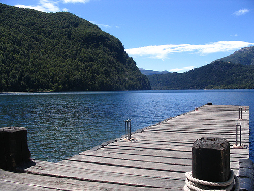
There are numerous rivers, lakes and ponds, waterfalls, and high
altitude glaciers. One of the best known glaciers is the Torrecillas
glacier.
The park has a set of 9 lakes: Futalaufquen, Menéndez,
Rivadavia, Krüger, Verde, Cisne, Stange, Chico and Amutui Quimei. The
latter is a reservoir originated by the Futaleufú dam. These lakes are
connected by various rivers, until they form the Futaleufú River — the
river dammed in the Futaleufú hydroelectric complex — which crosses the
border with Chile and finally flows into the Pacific Ocean through the
Yelcho River.
Close to 4,000 millimeters of annual rainfall make this region one of
the Andean-Patagonian forests richest in vegetation: the Valdivian
forest. In this environment, the laerce or lahuán stands out, a gigantic
conifer that at the beginning of the 20th century was on the verge of
disappearing due to uncontrolled exploitation.
Argentine Patagonia
has the privilege of having one of the oldest and densest forest
formations of this species. On the sides of Lake Menéndez, the majestic
specimens have an estimated age of 4,000 years and reach 75 meters in
height and 3.5 in diameter.
To the east, the transition with the
steppe marks less leafy forests where the maitén and the Andean cypress
grow. The radales, arrayanes, ñires, lengas and maquis also cover the
mountains and make up a landscape colored by rivers and lakes.
The exotic flora, brought by the European settlers, represents in this
national park a serious problem to conserve the native vegetation. Rose
hips, lupines and daisies, among other plants, began to spread unaided
along the edges and clearings of the forest, displacing the original
species.
Likewise, the illegal exploitation of wood and the fires
prevent the recovery of the different tree species that are slow-growing
and take time to cover the slopes, favoring erosion.
The alerce
or lahuán (Fitzroya cupressoides) is the only species of the Fitzroya
genus of the cypress family (Cupresaceae). It was called larch by the
Spanish because of its resemblance to the European larch, but both
conifers are not related. Charles Darwin gave it that name in honor of
Captain Robert FitzRoy, Captain of the ship Beagle, in which Darwin
sailed around the world between the years 1831-36. Due to its height, it
is the largest tree in South America, reaching 70 meters, averaging
40-60; the diameter of its trunk reaches up to 5 meters, although Darwin
recorded one with a trunk of 12.6 meters in diameter. The intensive
exploitation of the timber industry caused it to almost become extinct,
which is why it was necessary to prohibit its felling as of 1977. It has
tiny leaves 3 to 6 mm long by 2 mm wide and tiny cones of about 7 mm in
diameter. and a thick and rough reddish bark that protects it from
fires. They are very long-lived species, the oldest being located in
Puerto Sagrario, Lago Menéndez. It is 57 meters high, 2.2 meters in
diameter and 2,600 years old.
Birds such as the chucao, the Patagonian black woodpecker, the pitío,
the condor, the caburé, the southern parrot, the harrier, the caracara,
the Araucanian pigeon, and the Patagonian thrush nest in this park.
Exotic fish such as salmon and trout abound in its abundant lakes,
rivers and streams.
Los Alerces National Park is a refuge for
many species of mammals, some more common such as the puma or the
tucotuco, but many others in danger, such as the pudú, the huiña cat,
the huillín or Patagonian otter, and mainly the huemul. A natural deer
from Patagonia can be seen on Cerro Riscoso, declared a critical area
for the conservation of the species.
As in other parks in
southern Patagonia, introduced species, such as the red deer, the red
deer, the wild boar and the hare, cause a serious impact on the forests.
For this reason, a system of hunting reserves with limited extraction is
also allowed in this protected area. The mink was introduced between
1945 and 1960 to supply the local fur market, mainly in Cholila, a town
located northwest of the national park. In the 1970s, several were
released and multiplied, dispersing throughout the pre-Andean region of
Chubut and Río Negro. Of carnivorous habits, the mink attacks birds and
offspring of terrestrial or aquatic mammals, threatening the native
fauna. Similarly, the pudú is attacked by wild dogs. Poaching endangers
both the huemul and the puma, both precious specimens for hunters.
More than 3,000 years ago, the first inhabitants to settle in the region were groups of hunter-gatherers who occupied the Desaguadero River valley. With animal bones and stones they made boleadoras, arrowheads, punches for sewing leather and grinding devices. Cave paintings with geometric motifs, labyrinths and schematic human figures are still found on the walls of caves, very similar to those found in northwestern Patagonia. By the 16th century, there were Tehuelche or related groups, who modified several of their attitudes and ways of life after contact with the Spanish. From the 17th century, a greater Mapuche presence is documented. The main transformation in the indigenous way of life was the incorporation of the horse, which produced great transformations, among them the greater mobility of the groups. The Desert Campaign (1879-1883) produced the disarticulation of the indigenous populations. Currently, there are Mapuche families living in the areas surrounding the park.
The tourist city of
Futalaufquen is located within the park, where the administration and
the Information Center and Museum are located, where information can be
obtained and fishing permits can be acquired. The place has a service
station, telephone booths, a restaurant, a grocery store, free, wild and
organized campsites, cabins and inns.
You can get to know the
park through more than twenty pedestrian trails and numerous vehicular
paths.
It should be noted that each point of entry to the
protected area has the necessary institutional presence that provides
visitors with the information they require and also information and
recommendations necessary for entering a protected area. The national
park has a Park Ranger Headquarters with a seat in the Intendancy,
located in Villa Futalaufquen, and 3 zonal headquarters: North, Center
and South, to which a total of 13 sectional ones are added, the majority
located along the corridor formed along route 71. The village of
Futalaufquen is the only urban settlement in the Park, with some 50
homes and 200 inhabitants, most of the population being employees of the
National Parks Administration with their families, police officers,
teachers and school employees.
To access the national park, it can be done through the town of Cholila (entering from National Route No. 40) or through the city of Esquel, Chubut. From there, along National Route No. 259, connecting with Provincial Route No. º 71 that crosses the protected area in a north-south direction. Along this road, you arrive at Villa Futalaufquen, where the administrative center of the national park is located. The route continues to the north of the park, linking the town of Futalaufquen with National Route No. 258 and then National Route No. 40 towards the city of El Bolsón, province of Río Negro. The city of Esquel has an airport (38 km from the national park) and a bus terminal, which provides greater possibilities of access to the protected area.
In March 2015, one of the
worst fires of the decade was recorded inside the park, which devastated
more than 1,500 hectares of native forest in the Situación range.
Fires started on January 24, 2016: it was caused in the area of
the Futaleufú river valley (south of Los Alerces National Park),
almost all indications indicate that they have been intentionally caused
by humans, covering more than 1,700 hectares; the recovery of the
forests will take approximately 30 years.