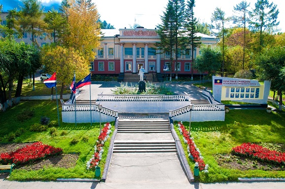
Artyom is a city in the Primorsky Territory. It is located in the
valley of the Knevichanka River, 38 km northeast of the center of
Vladivostok (the border between the cities runs along the bed of the
Peschaniy stream, and the distance between them is, in fact, 0 km).
The administrative center of the Artyomovsk urban district. It is
part of the Vladivostok agglomeration.
Population - 105 675
people. (2020). It is named in honor of Fyodor Andreevich Sergeev, better
known as "Comrade Artyom".
In the past - the largest center
of the Far East for coal mining (the last mine was closed in 2000).
Currently, the city is going through a new stage of industrial
development associated with the opening of transport and logistics
complexes and new industrial production facilities, such as vehicle
assembly (FAW), production of building materials and household
chemicals ("Vostok - Polikor"), woodworking, food production
(sausages, dairy products, canned fish) and others. Farms are also
actively developing in rural areas of the urban district. The
absence of Nadezhdinskaya ASEZ sites in Artyom reduces its
competitiveness.
It stands on the trade routes from Russia
and northeastern China to the APR countries. It is one of the main
transport hubs of the Primorsky Territory. Part of the Free Port of
Vladivostok.
It has access to the Amur and Ussuri bays of the
Sea of Japan. The Primorskoye Koltso tourist and recreational
cluster, the Primorye gambling zone and the Sinyaya Sopka ski center
were created.
Early Discovery and Pre-Founding Period (Pre-1924)
The
foundations of Artyom trace back to the early 20th century with the
discovery of significant coal deposits in the Artyomovsky brown coal
basin. In 1913, lignite (brown coal) reserves were identified near
the 9th verst of the Suchan railway line, a branch of the broader
Trans-Siberian Railway network that was expanding into the Russian
Far East. This area, part of Primorsky Krai (which itself was
annexed from Qing China in 1860 via the Convention of Peking as part
of Outer Manchuria), had seen limited settlement prior to this.
Small-scale mining operations began that same year at the Zybunny
site, but they were rudimentary and operated under private interests
during the late Russian Empire era. The region was sparsely
populated, with indigenous groups like the Udege and Nanai peoples
historically inhabiting parts of Primorye, though Russian
colonization intensified after the 1860 treaties. The coal here was
of relatively high quality for lignite, approaching low-grade
bituminous coal, making it valuable for regional energy needs.
Following the Bolshevik Revolution and the Russian Civil War, the
mines were nationalized in 1923 as part of the Soviet Union's
efforts to consolidate control over resources in the Far East.
During a workers' meeting at the mine that year, the settlement was
renamed "Artyom" in honor of Fyodor Andreyevich Sergeyev
(1883–1921), a prominent Bolshevik revolutionary and the first
chairman of the Central Committee of the All-Russian Union of Mine
Workers. Sergeyev, who used the pseudonym "Artyom," had been a key
figure in organizing miners and was killed during the Civil War; the
name symbolized the Soviet emphasis on proletarian heroes.
Founding and Early Soviet Development (1924–1938)
Artyom was
officially founded in 1924 as a workers' settlement adjacent to the
Zybunny open-pit mine, primarily to house miners and support the
extraction of lignite deposits. This marked the start of organized
industrial activity in an area that had previously seen only
sporadic pre-revolutionary mining. The settlement's growth was
driven by the need for coal to fuel the expanding economy of nearby
Vladivostok, a major port city, and the broader Primorsky Krai
region. By December 13, 1930, Artyom was formally designated as a
workers' settlement under a decree from the Presidium of the Far
Eastern Executive Committee, reflecting its increasing importance
amid Soviet industrialization.
During the 1930s, under Stalin's
five-year plans, mining operations expanded significantly. Open-pit
extraction at Zybunny and nearby sites like Verbluzhye ramped up,
supplying fuel for regional industries and integrating Artyom into
the Soviet economic framework. The city's proximity to Vladivostok
(about 22–35 km northeast) positioned it as a satellite industrial
hub, with coal transport via rail supporting the port's operations.
This period also saw an influx of workers from other parts of the
Soviet Union, contributing to early population growth. However, the
era was not without hardship; Primorsky Krai experienced forced
deportations under Stalin, including over 170,000 ethnic Koreans
from border areas in 1937–1939, though Artyom itself was more
focused on Russian settler labor.
City Status and Soviet
Industrial Peak (1938–1991)
On October 26, 1938, Artyom was
granted city status, acknowledging its population expansion and
economic role in lignite production. This upgrade coincided with the
creation of Primorsky Krai as an administrative entity on October
20, 1938, from the former Far Eastern Krai. During World War II, the
region played a strategic role; Artyom's coal supported wartime
industries, and nearby areas were used for military training.
The
post-war Soviet era marked Artyom's industrial peak. Coal mining
remained the economic backbone, with the Primorskoye Mine
Administration employing thousands. Diversification began with
factories producing building materials, porcelain, pianos,
furniture, and sewing goods. By the 1980s, the city had around 29
industrial enterprises, half private by the late Soviet period, and
joint ventures emerged. Population grew steadily: the 1989 census
recorded 68,887 residents. Infrastructure developed, including rail
junctions handling millions of tons of cargo annually, and the
nearby Vladivostok International Airport (originally a military
airfield in Uglovoye) began civilian operations.
Post-Soviet
Transition and Modern Developments (1991–Present)
The collapse of
the Soviet Union in 1991 brought economic challenges. Coal
production declined sharply due to market disruptions, subsidy cuts,
and global energy shifts; the last mine closed in 2000, leading to
unemployment and economic contraction. The 2002 census showed a dip
to 64,145 residents, reflecting outmigration.
A turning point
came in 2004 with administrative reforms under Primorsky Krai Law
No. 157-UZ. Artyom amalgamated with the nearby urban-type
settlements of Uglovoye, Zavodskoy, and Artyomovsky, boosting its
population to over 100,000 overnight (from around 60,000). This
created the Artyomovsky Urban Okrug, with Artyom as its
administrative center, equal in status to a district. The 2010
census recorded 102,603 people, ranking it 158th among Russian
cities.
Economic diversification focused on transport and
logistics, leveraging Artyom's location. The Vladivostok
International Airport expanded, handling increasing passenger
traffic (e.g., 500,000 in 1994, with growth since). In September
2021, agreements at the Eastern Economic Forum outlined plans for
the Nadezhinskaya Advanced Development Zone, integrating Artyom with
Vladivostok and Nadezhda into a mega-region of over 1 million
people. Construction of the Artyom Transport and Logistics Center (a
"dry port" for container cargo) began in April 2023 and launched in
September 2025 by President Vladimir Putin, enhancing ties to the
Eastern Railway Corridor and Far Eastern trade routes.
Recent
population figures show stability and slight growth: 109,556 in the
2021 census, with a 2025 estimate of 108,274. Today, about half the
workforce is in material production, with promising sectors in
logistics, manufacturing, and tourism. Artyom celebrates City Day on
the last Sunday of August and remains a key node in Russia's Far
East, blending its mining heritage with modern infrastructure.
The city is located in the northern part of the
Muravyov-Amursky Peninsula, 53 km north-east of Vladivostok, in an
intermountain basin. The area of the urban district is 506.4 km².
Geographic latitude - 43 ° 21 ', longitude - 132 ° 11'. The average
height above sea level is 40 meters.
The relief of the city
is a vast intermontane basin surrounded by mid-mountains, with
absolute heights of no more than 700 meters above sea level. There
are three main levels: in the north and north-east - the watershed
level of the low mountains, the heights in which fluctuate between
the marks of 300-700 meters; in the southern regions - hilly-ridged
foothills with relative heights of 100-200 meters; the main area is
river terraces with a maximum height of 54 meters. About 5% of the
territory of Artyom is occupied by the southwestern outskirts of the
Shkotovsky basalt plateau, in places occupied by swamps.
From
the north, the city is surrounded by the Przhevalsky ridge. From the
south - the hills of the Muravyov-Amursky Peninsula. The highest
heights within the city are noted for the Przewalski Mountains. The
highest point is an unnamed height of 700 meters. In the
intermontane basin, the heights do not exceed 30-40 meters,
therefore, the Orlovskaya Sopka with a height of 54 meters stands
out in the general relief.
The urban district
has outlets to the Amur and Ussuri bays. The corner bay (the
northeastern part of the Amur Bay) is distinguished by a low-lying
coast, very gently dropping below sea level. Lagoons with sandy,
clayey bottom and shallow depths are widespread here. The coast of
the bay is heavily indented by the mouths of the small rivers
Peschanka and Saperka; in the distance a narrow rocky and sandy-clay
strip, cut off by rocks, stretches.
The shores of Muravyinaya
Bay (the northern part of the Ussuri Bay) are typically Rias coasts
(arising from the flooding of the coastal segments of river
valleys), rich in bays and islands. A narrow (5-20 meters) rocky and
sandy-pebble beach, interrupted by rocks, stretches along the
seashore. In summer, the water temperature reaches + 22 °, in winter
the bays are covered with ice.
Artyom has a dense river
network. The rivers are flat, with a pronounced flood regime and
rainwater supply. The largest river in the city is the Knevichanka
(Batalyanza), a tributary of the Artyomovka (Maykhe). Its pool
occupies over 80% of the territory of Artyom. The largest
tributaries of the Knevichanka are Bolotnaya, Orlovka, Ivnyanka,
Pushkaryovka, Zybunny Klyuch, Pushkarev Klyuch, Ozernye Klyuchi,
Bezymyanny Klyuch, Soloveytsev Klyuch and others.
Among the
lakes, the largest are: Orlovskoye with an area of 0.8 by 0.6 km
and Krolevetskoye with an area of 1.5 by 1 km. They are
distinguished by swampy shores and a doubling in volume after the
passage of typhoons.
The climate of Artyom is
moderate monsoon, with features of the continental. In winter, the
territory of the city is subject to the influence of the Siberian
anticyclone, which brings cold air from the continent. Due to this,
the winter period is long, dry and frosty, with many clear days.
During the cold period, only 13% of the total annual precipitation
falls. The minimum monthly precipitation occurs in January-February.
A stable snow cover forms at the end of the first decade of December
and completely melts at the beginning of April. Snow lasts an
average of 98 days. Temperatures in winter range from −10 ° С in
December to −12 ° С in February.
In spring, the air
temperature rises sharply, the wind increases. During this period,
preparations are underway to change the winter monsoon to the summer
monsoon, which is directed from the ocean to the mainland. The
average daily temperature ranges from 0 ° C.
Cloudy weather
prevails in early summer with frequent rains. Low temperatures are
combined with high air humidity - 88-95%. From July to September,
the weather is hot and sunny. In the summer period, the influence of
Pacific typhoons increases on Artyom, their number in different
years is not the same and ranges from two to eight. The warmest
month of August has a maximum precipitation of 120 mm. Autumn in the
city is dry and warm.